


@geospatialist.bsky.social
October 6, 2025 at 2:49 PM
2/2
If you plan on producing your own stratovolcano, please be sure your subduction zone creates it in such a way it is legally distinct from my patent, or I may have to sue for IP infringement.
Here a shot of it in the 3D software before I rendered and labeled it.
If you plan on producing your own stratovolcano, please be sure your subduction zone creates it in such a way it is legally distinct from my patent, or I may have to sue for IP infringement.
Here a shot of it in the 3D software before I rendered and labeled it.

October 6, 2025 at 1:23 PM
2/2
If you plan on producing your own stratovolcano, please be sure your subduction zone creates it in such a way it is legally distinct from my patent, or I may have to sue for IP infringement.
Here a shot of it in the 3D software before I rendered and labeled it.
If you plan on producing your own stratovolcano, please be sure your subduction zone creates it in such a way it is legally distinct from my patent, or I may have to sue for IP infringement.
Here a shot of it in the 3D software before I rendered and labeled it.
No. I’ve actually never heard of that website. For USGS maps, I usually go straight to the source.
ngmdb.usgs.gov/topoview/vie...
ngmdb.usgs.gov/topoview/vie...

Get Maps
Explore, interact, and download USGS topographic maps free of charge from topoView.
ngmdb.usgs.gov
September 9, 2025 at 4:29 PM
No. I’ve actually never heard of that website. For USGS maps, I usually go straight to the source.
ngmdb.usgs.gov/topoview/vie...
ngmdb.usgs.gov/topoview/vie...
A few more close ups of Svalbard.


September 8, 2025 at 12:03 PM
A few more close ups of Svalbard.
2/2 Maybe a little too simple, though. I feel like there's too much empty space, but if I do more, I want them all to be square. Now off to see if I can make this a multicolor 3D print.
August 17, 2025 at 9:53 PM
2/2 Maybe a little too simple, though. I feel like there's too much empty space, but if I do more, I want them all to be square. Now off to see if I can make this a multicolor 3D print.
If you look close you can spot Hells Canyon Dam in the shots.
May 30, 2025 at 12:08 AM
If you look close you can spot Hells Canyon Dam in the shots.
Made from NYC LiDAR, processed in ArcGIS Pro and rendered in blender.
May 29, 2025 at 8:54 PM
Made from NYC LiDAR, processed in ArcGIS Pro and rendered in blender.
And one more of Yellowstone without clouds
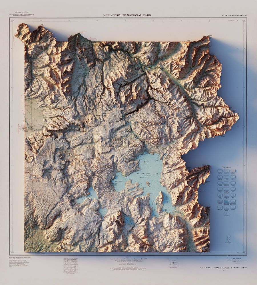
May 1, 2025 at 3:40 PM
And one more of Yellowstone without clouds