


@geospatialist.bsky.social
If you want a higher res version of the Mount St. Helens patent map, you can get it here:
drive.google.com/file/d/1dtHw...
#pnw #mountsthelens #arcgispro #b3d
drive.google.com/file/d/1dtHw...
#pnw #mountsthelens #arcgispro #b3d

October 7, 2025 at 1:55 PM
If you want a higher res version of the Mount St. Helens patent map, you can get it here:
drive.google.com/file/d/1dtHw...
#pnw #mountsthelens #arcgispro #b3d
drive.google.com/file/d/1dtHw...
#pnw #mountsthelens #arcgispro #b3d
2/2
If you plan on producing your own stratovolcano, please be sure your subduction zone creates it in such a way it is legally distinct from my patent, or I may have to sue for IP infringement.
Here a shot of it in the 3D software before I rendered and labeled it.
If you plan on producing your own stratovolcano, please be sure your subduction zone creates it in such a way it is legally distinct from my patent, or I may have to sue for IP infringement.
Here a shot of it in the 3D software before I rendered and labeled it.

October 6, 2025 at 1:23 PM
2/2
If you plan on producing your own stratovolcano, please be sure your subduction zone creates it in such a way it is legally distinct from my patent, or I may have to sue for IP infringement.
Here a shot of it in the 3D software before I rendered and labeled it.
If you plan on producing your own stratovolcano, please be sure your subduction zone creates it in such a way it is legally distinct from my patent, or I may have to sue for IP infringement.
Here a shot of it in the 3D software before I rendered and labeled it.
1/2
I was thinking of using patent application style call-out arrows in a map, when I thought "just make a patent application map".
Patent date is the day Mount St. Helens was made a National Volcanic Monument. I'm sure you can figure out the patent #.
#pnw #mountsainthelens
I was thinking of using patent application style call-out arrows in a map, when I thought "just make a patent application map".
Patent date is the day Mount St. Helens was made a National Volcanic Monument. I'm sure you can figure out the patent #.
#pnw #mountsainthelens


October 6, 2025 at 1:23 PM
1/2
I was thinking of using patent application style call-out arrows in a map, when I thought "just make a patent application map".
Patent date is the day Mount St. Helens was made a National Volcanic Monument. I'm sure you can figure out the patent #.
#pnw #mountsainthelens
I was thinking of using patent application style call-out arrows in a map, when I thought "just make a patent application map".
Patent date is the day Mount St. Helens was made a National Volcanic Monument. I'm sure you can figure out the patent #.
#pnw #mountsainthelens
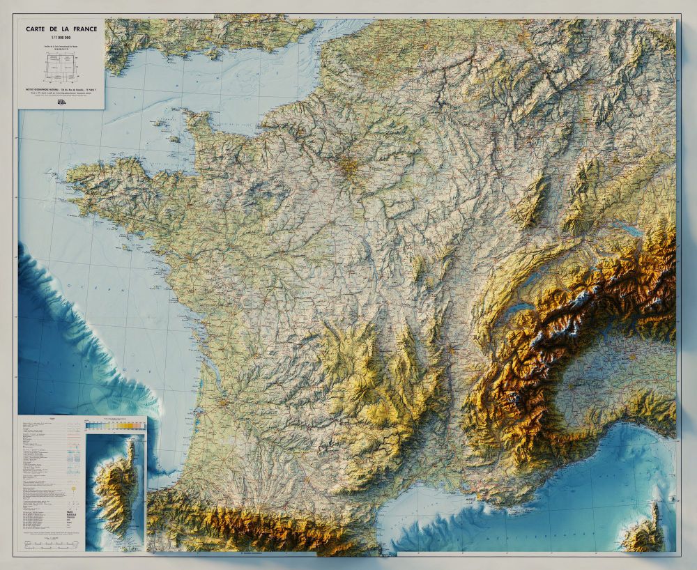
Carte de la France - Institut Géographique National - 1971
3D Render with Bathymetry
#France #ArcGISPro #cartography #b3d
3D Render with Bathymetry
#France #ArcGISPro #cartography #b3d


September 28, 2025 at 6:18 PM
Carte de la France - Institut Géographique National - 1971
3D Render with Bathymetry
#France #ArcGISPro #cartography #b3d
3D Render with Bathymetry
#France #ArcGISPro #cartography #b3d

September 24, 2025 at 11:54 PM
Topographic Map, Acadia National Park and Vicinity, Hancock County Maine - US Geological Survey - 1942
3D Render
#AcadiaNationalPark #Acadia #AcadiaMaine #BarHarborMaine #BarHarbor #ArcGISPro #cartography #b3d
3D Render
#AcadiaNationalPark #Acadia #AcadiaMaine #BarHarborMaine #BarHarbor #ArcGISPro #cartography #b3d


September 24, 2025 at 12:29 PM
Topographic Map, Acadia National Park and Vicinity, Hancock County Maine - US Geological Survey - 1942
3D Render
#AcadiaNationalPark #Acadia #AcadiaMaine #BarHarborMaine #BarHarbor #ArcGISPro #cartography #b3d
3D Render
#AcadiaNationalPark #Acadia #AcadiaMaine #BarHarborMaine #BarHarbor #ArcGISPro #cartography #b3d
Ketchikan, Alaska - 1955 - US Geological Survey - 1955, limited revisions 1976
3D Render
#Alaska #Ketchikan #KetchikanAlaska #ArcGISPro #cartography #b3d
3D Render
#Alaska #Ketchikan #KetchikanAlaska #ArcGISPro #cartography #b3d


September 22, 2025 at 12:05 PM
Ketchikan, Alaska - 1955 - US Geological Survey - 1955, limited revisions 1976
3D Render
#Alaska #Ketchikan #KetchikanAlaska #ArcGISPro #cartography #b3d
3D Render
#Alaska #Ketchikan #KetchikanAlaska #ArcGISPro #cartography #b3d
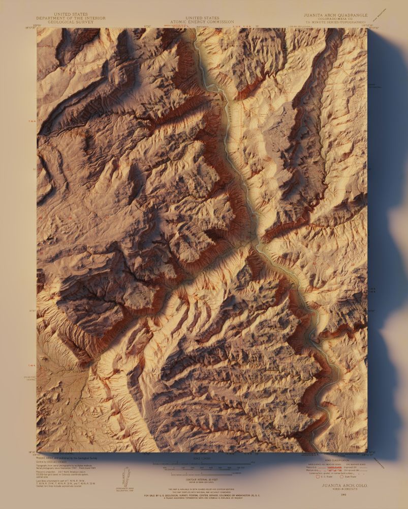
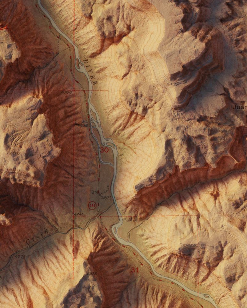
Juanita Arch - Colorado, Mesa Co. - USGS / US Atomic Energy Commission - 1949
3D Render
#colorado #ArcGISPro #cartography #b3d
3D Render
#colorado #ArcGISPro #cartography #b3d


September 15, 2025 at 11:57 AM
Juanita Arch - Colorado, Mesa Co. - USGS / US Atomic Energy Commission - 1949
3D Render
#colorado #ArcGISPro #cartography #b3d
3D Render
#colorado #ArcGISPro #cartography #b3d

September 14, 2025 at 3:27 PM


September 9, 2025 at 12:01 PM
A few more close ups of Svalbard.


September 8, 2025 at 12:03 PM
A few more close ups of Svalbard.
Svalbard, Norway - Norsk Polarinstitutt - 1980
3D Render
#Svalbard #Norway #ArcGISPro #cartography #b3d
3D Render
#Svalbard #Norway #ArcGISPro #cartography #b3d


September 8, 2025 at 12:03 PM
Svalbard, Norway - Norsk Polarinstitutt - 1980
3D Render
#Svalbard #Norway #ArcGISPro #cartography #b3d
3D Render
#Svalbard #Norway #ArcGISPro #cartography #b3d
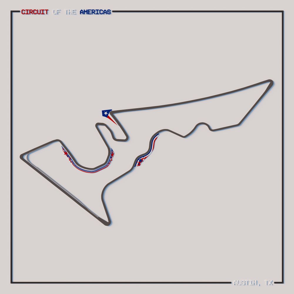
1/2 Most F1 maps seem to be of centerlines of the track, but I wanted to try to get the actual track shape/width in a polygon (along with the pit lane) and the unique decorations at the track.
#F1 #ArcGISPro #Blender #Illustrator #CircuitOfTheAmericas
#F1 #ArcGISPro #Blender #Illustrator #CircuitOfTheAmericas


August 17, 2025 at 9:53 PM
1/2 Most F1 maps seem to be of centerlines of the track, but I wanted to try to get the actual track shape/width in a polygon (along with the pit lane) and the unique decorations at the track.
#F1 #ArcGISPro #Blender #Illustrator #CircuitOfTheAmericas
#F1 #ArcGISPro #Blender #Illustrator #CircuitOfTheAmericas
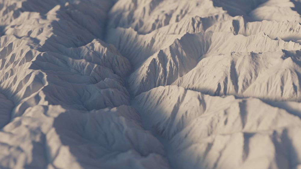
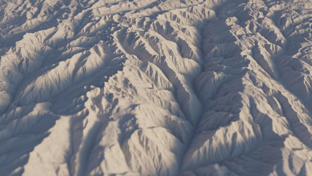
I was reading this @npr.org story and decided to take a look at Hells Canyon (the deepest river gorge in the United States) in 3D.
www.npr.org/2025/05/27/n...
#arcgispro #b3d #hellscanyon #Idaho #Oregon
www.npr.org/2025/05/27/n...
#arcgispro #b3d #hellscanyon #Idaho #Oregon

May 30, 2025 at 12:04 AM
I was reading this @npr.org story and decided to take a look at Hells Canyon (the deepest river gorge in the United States) in 3D.
www.npr.org/2025/05/27/n...
#arcgispro #b3d #hellscanyon #Idaho #Oregon
www.npr.org/2025/05/27/n...
#arcgispro #b3d #hellscanyon #Idaho #Oregon
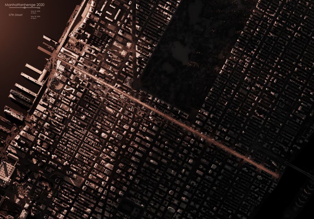
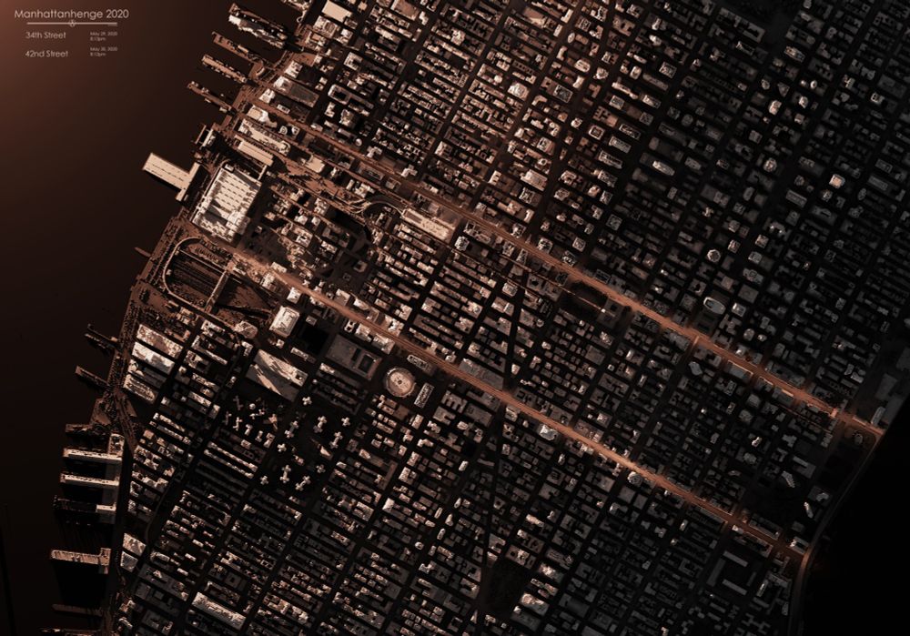
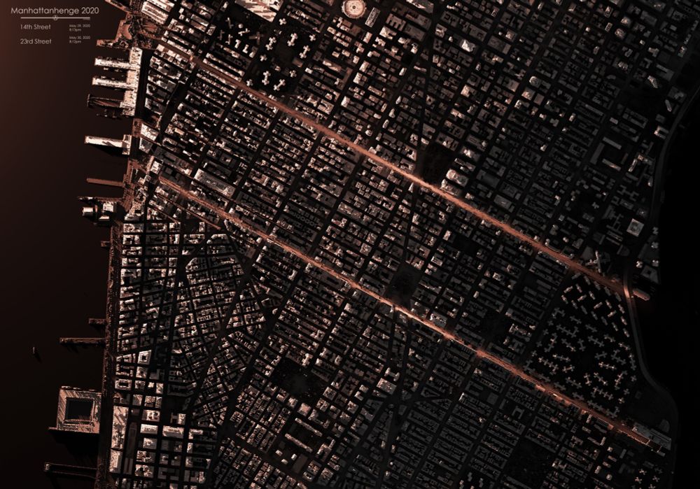
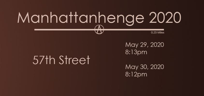
That time of year again - resharing this map of Manhattanhenge from 2020. Same day and time every year.
These maps indicate the 5 best streets with unobstructed views and the best times to experience Manhattanhenge.
#arcgispro #blender #LiDAR #manhattan #NYC #manhattanhenge
These maps indicate the 5 best streets with unobstructed views and the best times to experience Manhattanhenge.
#arcgispro #blender #LiDAR #manhattan #NYC #manhattanhenge
May 29, 2025 at 8:54 PM
That time of year again - resharing this map of Manhattanhenge from 2020. Same day and time every year.
These maps indicate the 5 best streets with unobstructed views and the best times to experience Manhattanhenge.
#arcgispro #blender #LiDAR #manhattan #NYC #manhattanhenge
These maps indicate the 5 best streets with unobstructed views and the best times to experience Manhattanhenge.
#arcgispro #blender #LiDAR #manhattan #NYC #manhattanhenge
Father’s Day sale for the next 3 days only, buy any print and get the second for 50% off when you use code BOGO50.
muir-way.com/collections/...
muir-way.com/collections/...

May 16, 2025 at 5:34 PM
Father’s Day sale for the next 3 days only, buy any print and get the second for 50% off when you use code BOGO50.
muir-way.com/collections/...
muir-way.com/collections/...
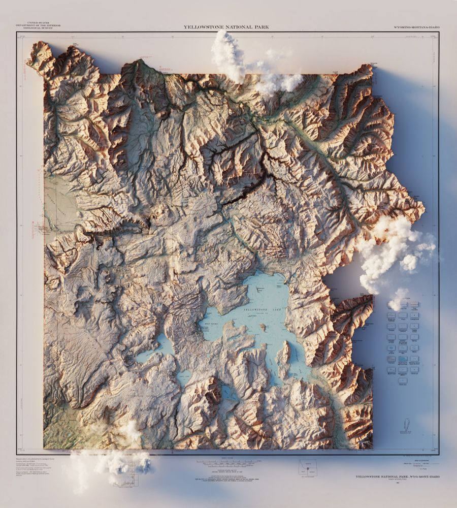
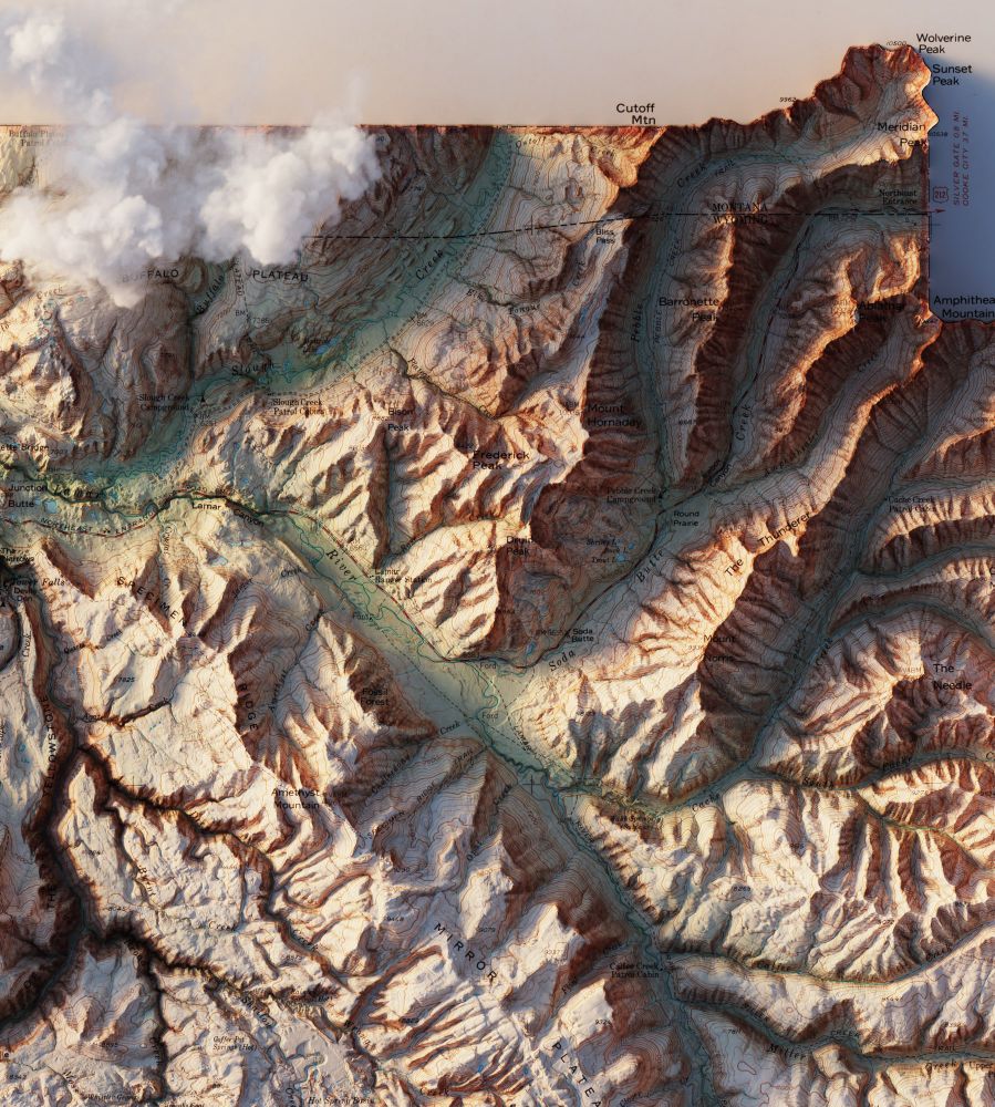
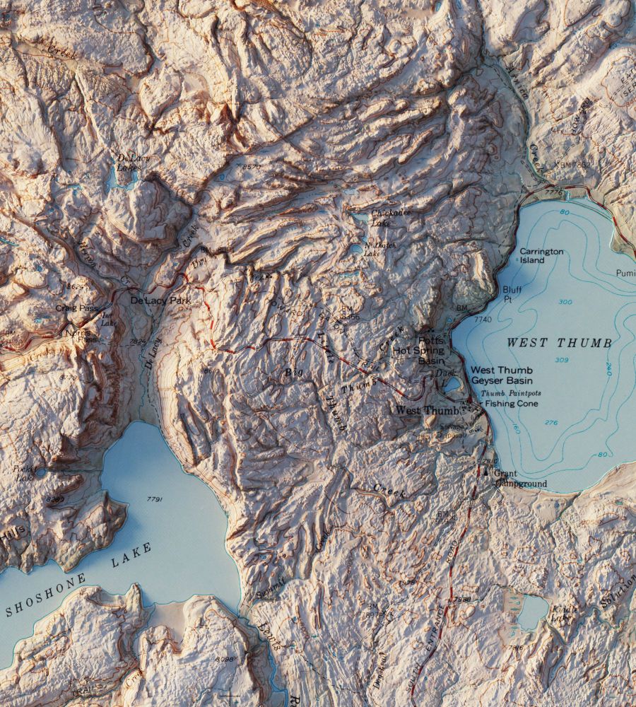
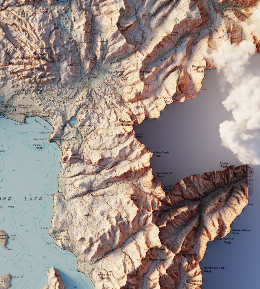
And one more of Yellowstone without clouds
May 1, 2025 at 3:40 PM
And one more of Yellowstone without clouds
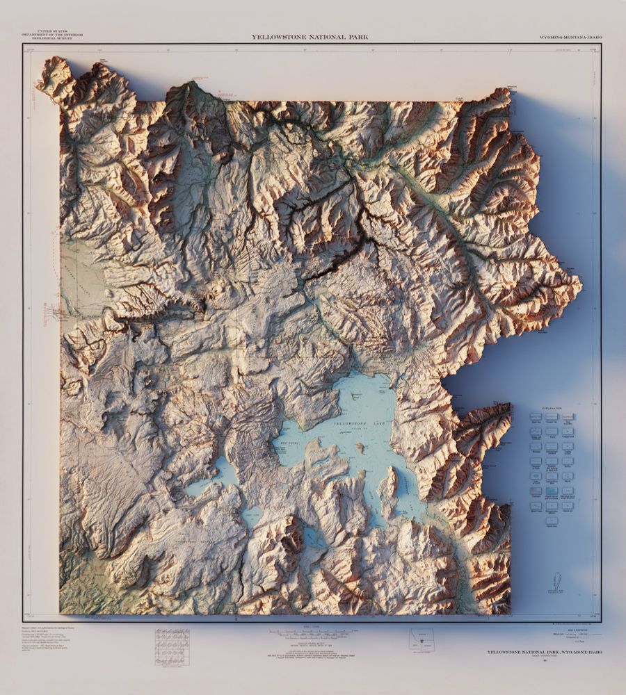
Yellowstone National Park, WY - MT - ID – USGS – 1961
3D Render
#Yellowstone #YellowstoneNationalPark #Wyoming #Montana #Idaho #ArcGISPro #b3d
3D Render
#Yellowstone #YellowstoneNationalPark #Wyoming #Montana #Idaho #ArcGISPro #b3d
May 1, 2025 at 3:40 PM
Yellowstone National Park, WY - MT - ID – USGS – 1961
3D Render
#Yellowstone #YellowstoneNationalPark #Wyoming #Montana #Idaho #ArcGISPro #b3d
3D Render
#Yellowstone #YellowstoneNationalPark #Wyoming #Montana #Idaho #ArcGISPro #b3d
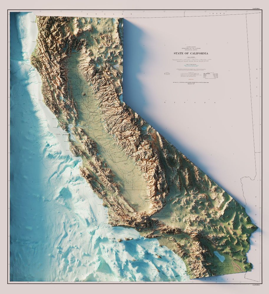
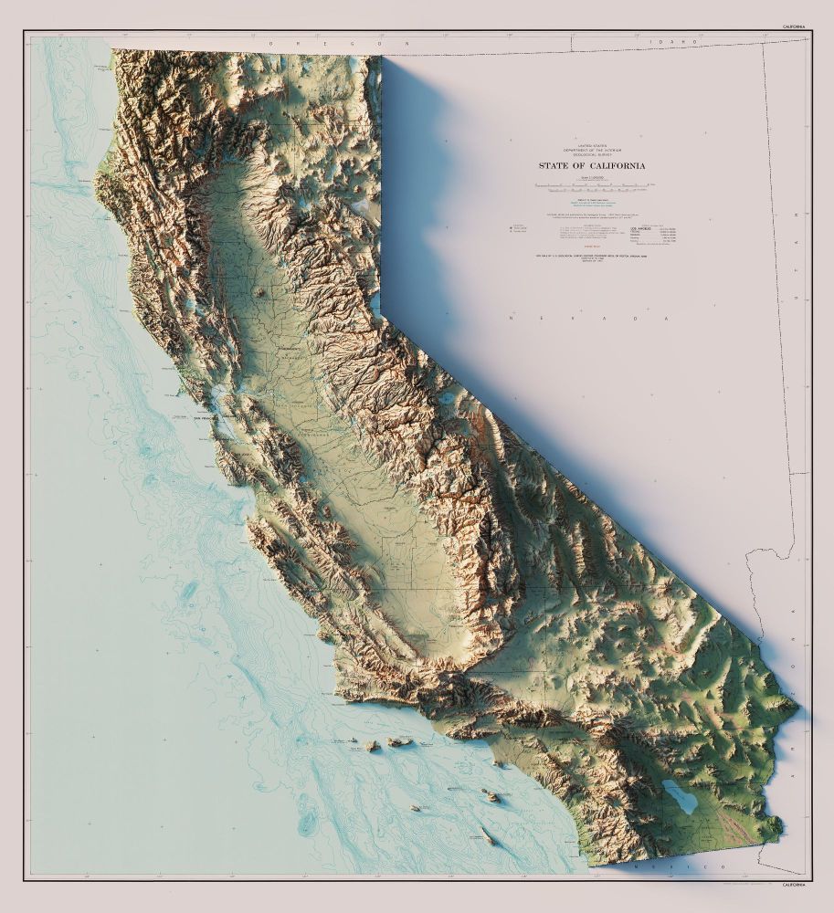
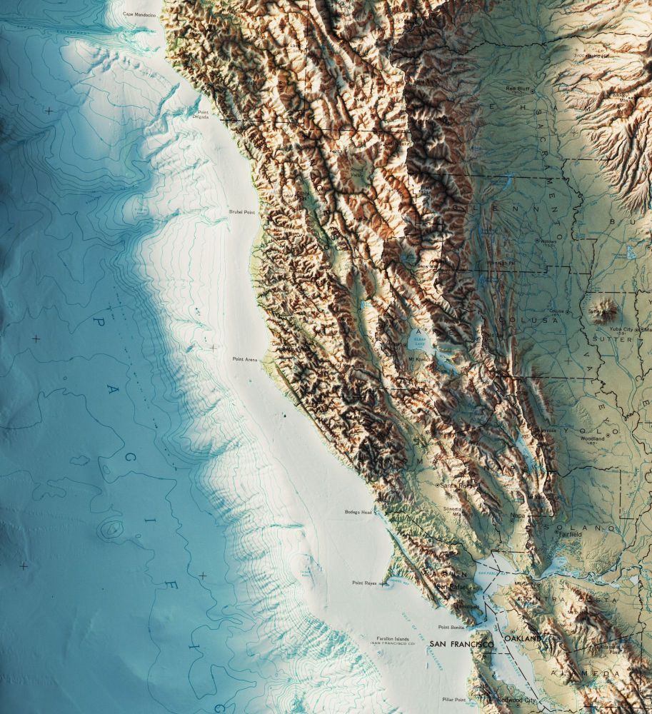
State of California - US Dept. of the Interior - Geological Survey - 1971
3D Render - with and without bathymetry.
#California #arcgispro #geography #b3d
3D Render - with and without bathymetry.
#California #arcgispro #geography #b3d
April 29, 2025 at 4:22 PM
State of California - US Dept. of the Interior - Geological Survey - 1971
3D Render - with and without bathymetry.
#California #arcgispro #geography #b3d
3D Render - with and without bathymetry.
#California #arcgispro #geography #b3d
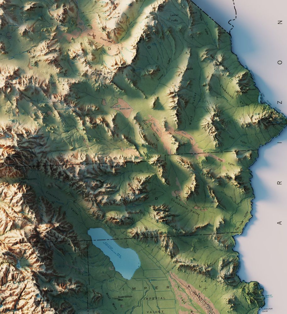
2/2
A few more closeups.
A few more closeups.
April 28, 2025 at 2:35 PM
2/2
A few more closeups.
A few more closeups.
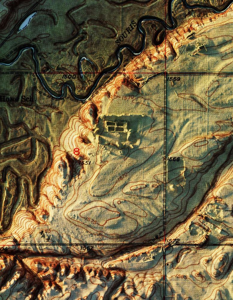
1/2
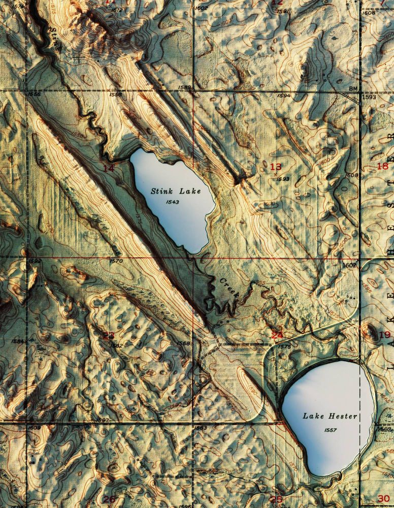
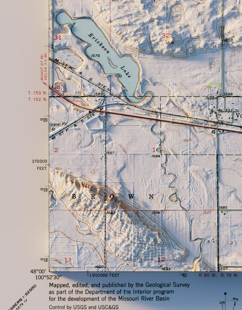
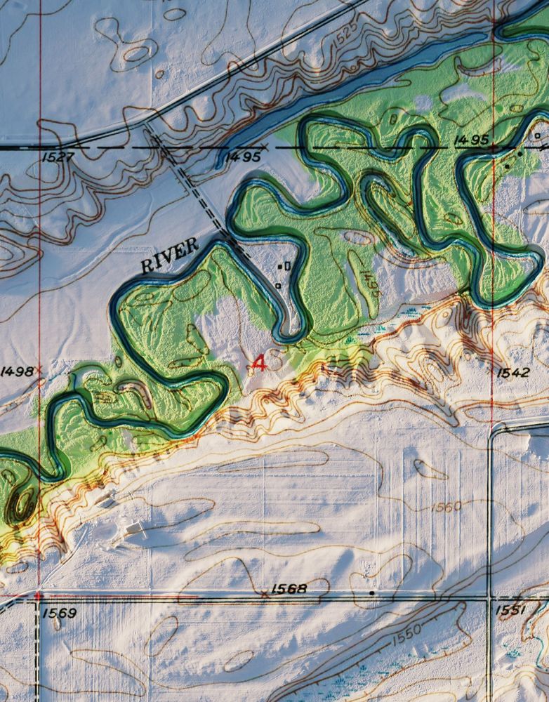
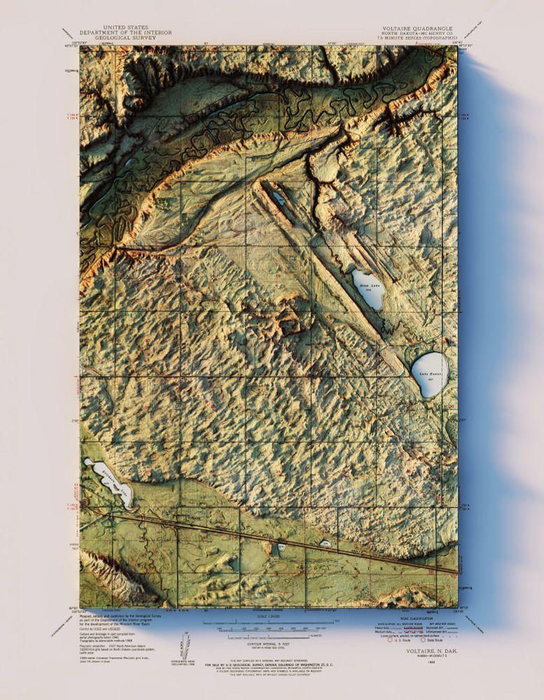
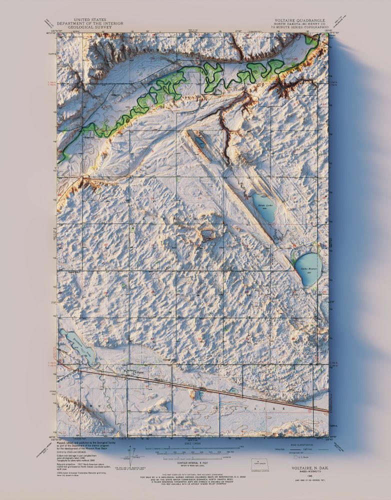
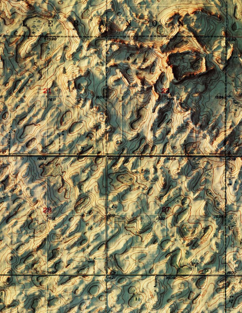
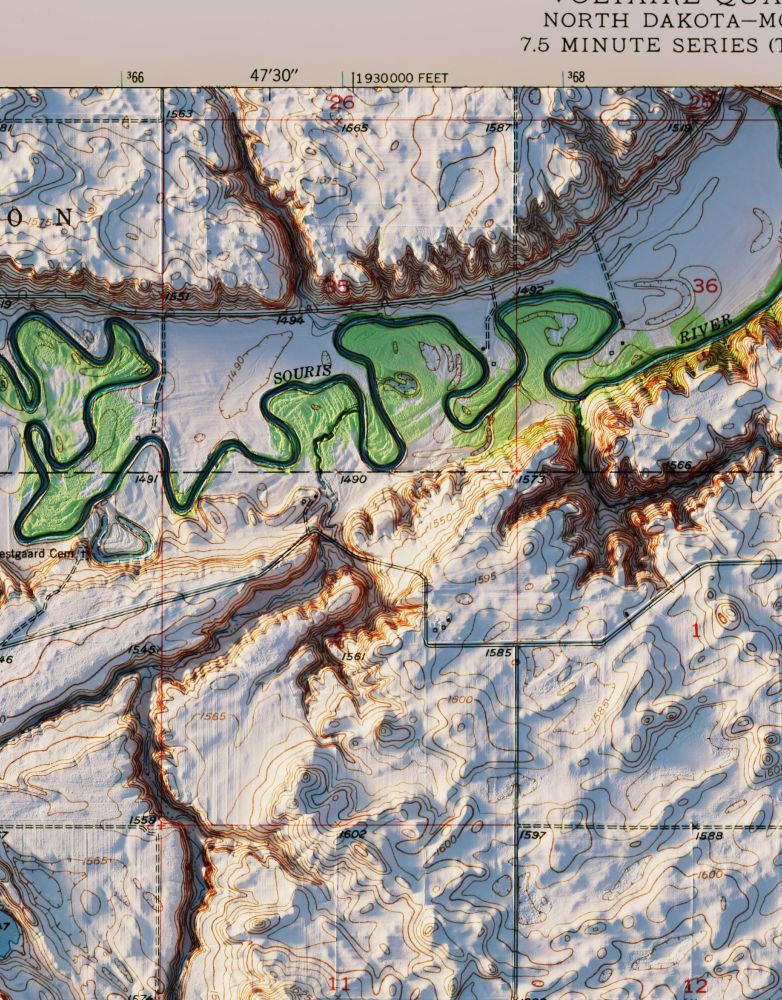
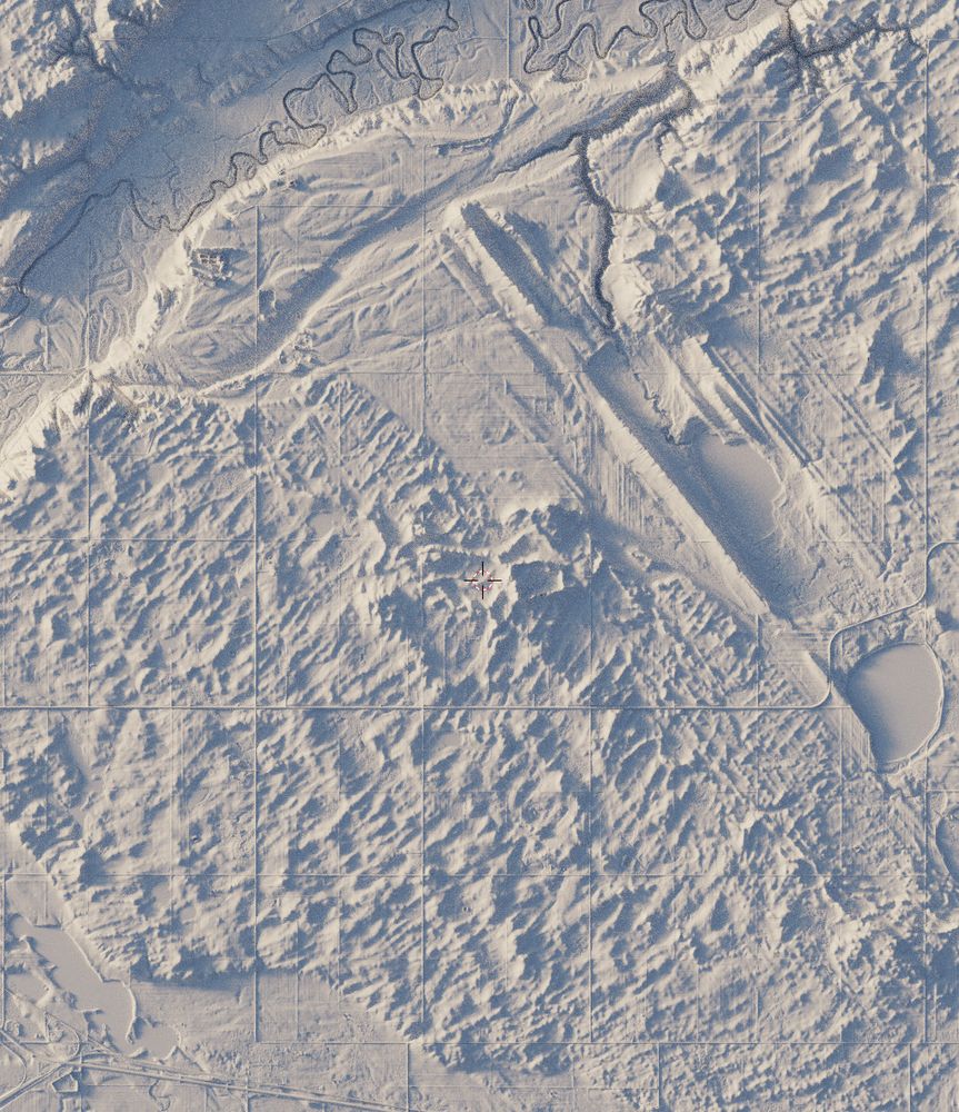
Another two pack of interesting topography. Both a colorized shaded relief and standard topo quads. The elevation data is nice and high res to even see the furrows in the fields.
Voltaire, ND - USGS - 1948
3D Render
#NorthDakota #geography #geology #gis #arcgispro #b3d
Another two pack of interesting topography. Both a colorized shaded relief and standard topo quads. The elevation data is nice and high res to even see the furrows in the fields.
Voltaire, ND - USGS - 1948
3D Render
#NorthDakota #geography #geology #gis #arcgispro #b3d
April 28, 2025 at 2:35 PM
1/2
Another two pack of interesting topography. Both a colorized shaded relief and standard topo quads. The elevation data is nice and high res to even see the furrows in the fields.
Voltaire, ND - USGS - 1948
3D Render
#NorthDakota #geography #geology #gis #arcgispro #b3d
Another two pack of interesting topography. Both a colorized shaded relief and standard topo quads. The elevation data is nice and high res to even see the furrows in the fields.
Voltaire, ND - USGS - 1948
3D Render
#NorthDakota #geography #geology #gis #arcgispro #b3d
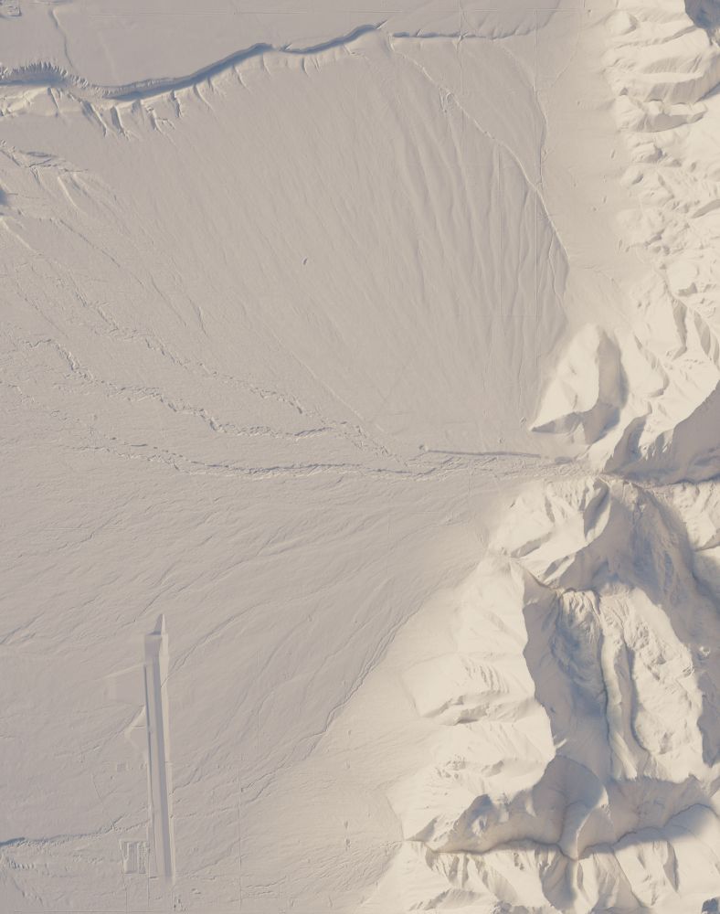
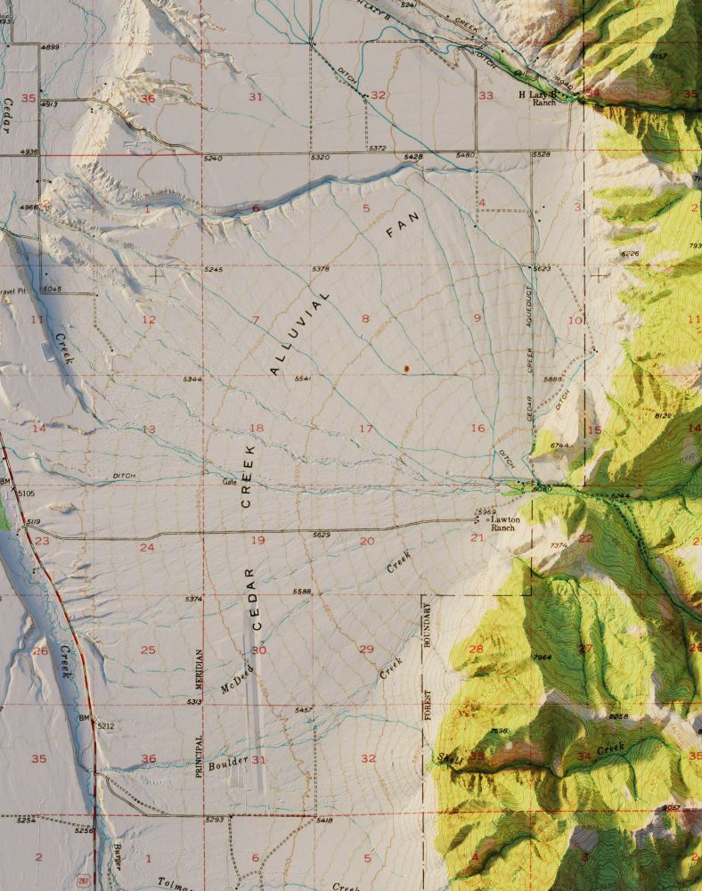
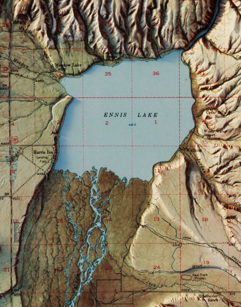
I honestly thought I had some weird tiling issue in the mosaic on this one before I realized it was roads.
April 26, 2025 at 3:58 AM
I honestly thought I had some weird tiling issue in the mosaic on this one before I realized it was roads.
And here's a clay render of Ennis, MT.
You can download the full res clay render here: drive.google.com/file/d/11XjP...
#Montana #geomorphology #sedimentology #arcgispro #b3d
You can download the full res clay render here: drive.google.com/file/d/11XjP...
#Montana #geomorphology #sedimentology #arcgispro #b3d
April 26, 2025 at 12:29 AM
And here's a clay render of Ennis, MT.
You can download the full res clay render here: drive.google.com/file/d/11XjP...
#Montana #geomorphology #sedimentology #arcgispro #b3d
You can download the full res clay render here: drive.google.com/file/d/11XjP...
#Montana #geomorphology #sedimentology #arcgispro #b3d
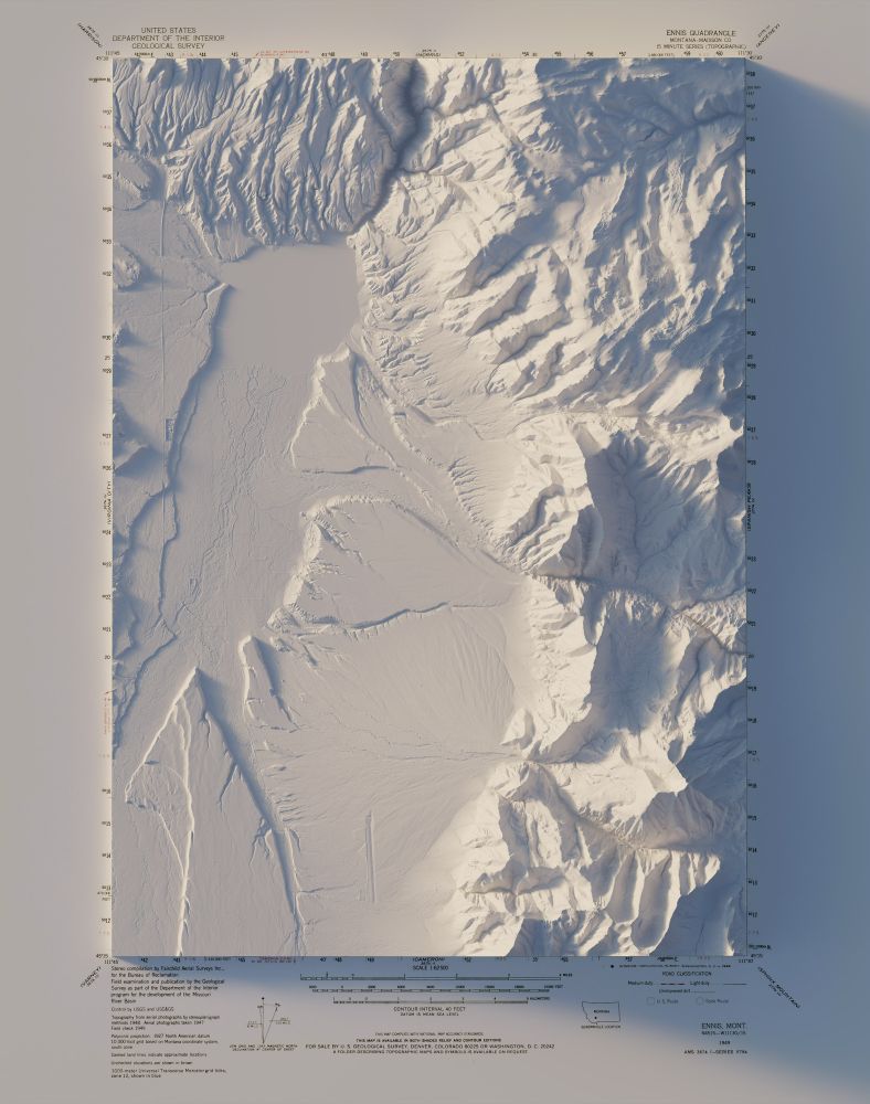
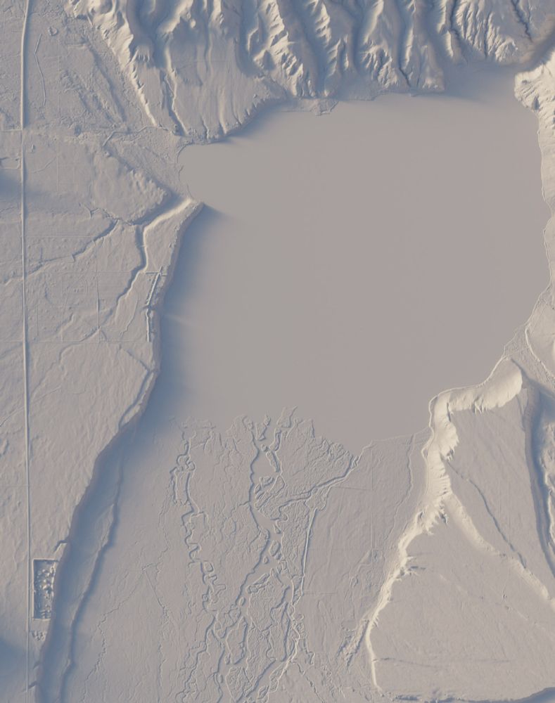
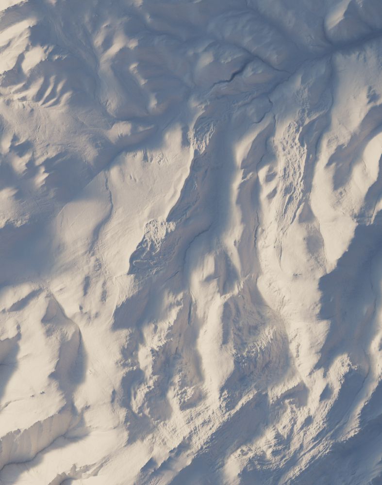
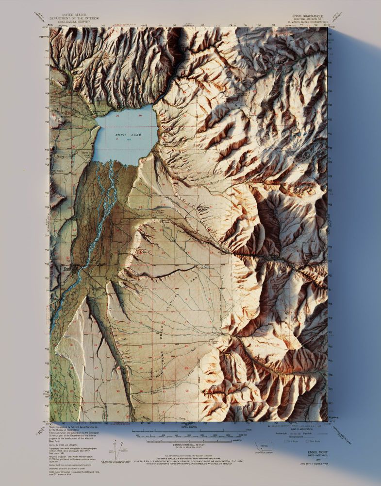
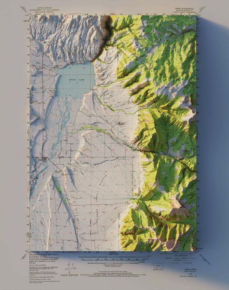
Ennis, MT - USGS - 1949
A literal textbook example of an alluvial fan.
3D render - 2 different maps of the same area. Both from 1949.
#Montana #geomorphology #sedimentology #arcgispro #b3d
A literal textbook example of an alluvial fan.
3D render - 2 different maps of the same area. Both from 1949.
#Montana #geomorphology #sedimentology #arcgispro #b3d
April 26, 2025 at 12:24 AM
Ennis, MT - USGS - 1949
A literal textbook example of an alluvial fan.
3D render - 2 different maps of the same area. Both from 1949.
#Montana #geomorphology #sedimentology #arcgispro #b3d
A literal textbook example of an alluvial fan.
3D render - 2 different maps of the same area. Both from 1949.
#Montana #geomorphology #sedimentology #arcgispro #b3d
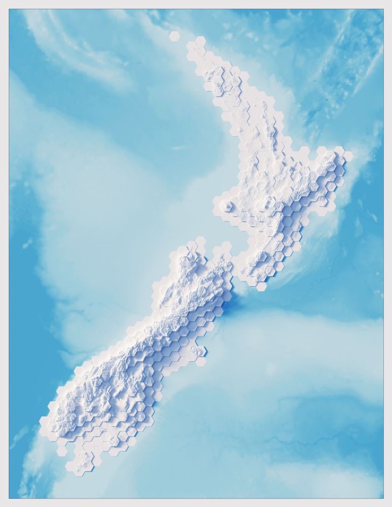
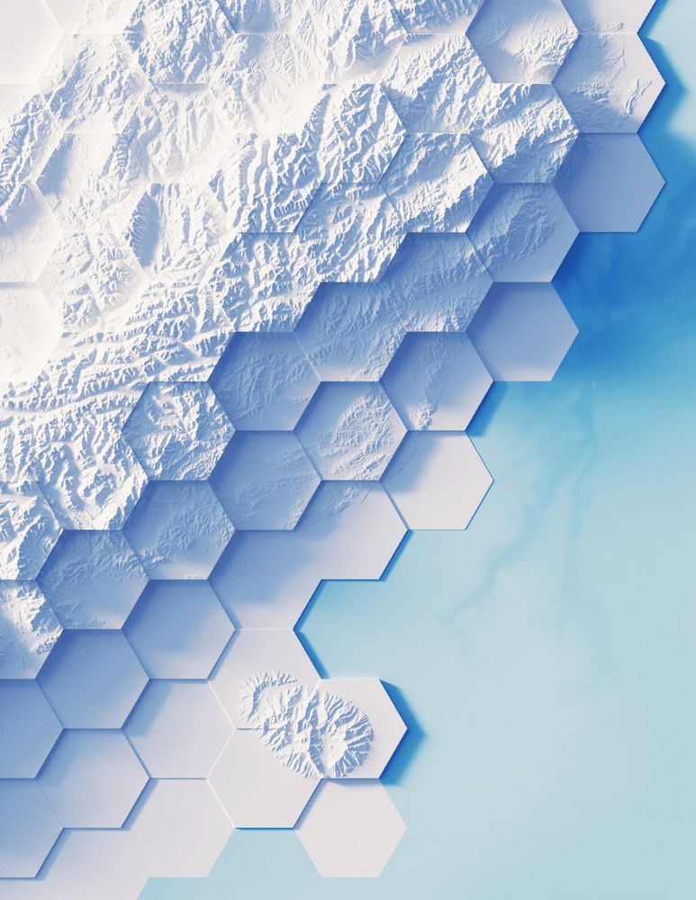
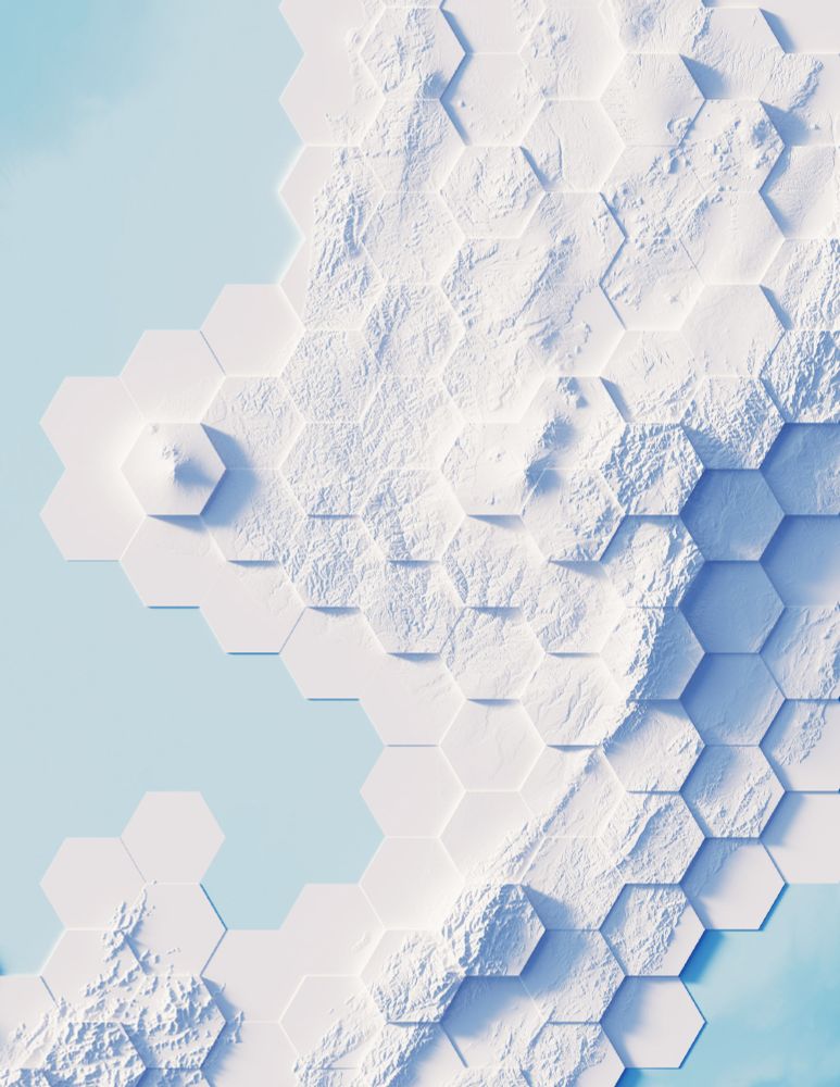
Got a request for New Zealand. Hope you don't mind only having the North and South Islands in and not the smaller ones.
Average elevation for the hexes then the real elevation added back in.
#NewZealand #arcgispro #b3d #hexagonsarebestagons
Average elevation for the hexes then the real elevation added back in.
#NewZealand #arcgispro #b3d #hexagonsarebestagons

April 22, 2025 at 1:19 AM
Got a request for New Zealand. Hope you don't mind only having the North and South Islands in and not the smaller ones.
Average elevation for the hexes then the real elevation added back in.
#NewZealand #arcgispro #b3d #hexagonsarebestagons
Average elevation for the hexes then the real elevation added back in.
#NewZealand #arcgispro #b3d #hexagonsarebestagons