


George H. Allen
@geoallen.bsky.social
Hydrologist and satellite enthusiast. Associate Professor at Virginia Tech
Volcanic island somewhere?
August 27, 2025 at 11:27 AM
Volcanic island somewhere?
Correct! SWOT has a 21-day repeat orbit but most places are observed more frequently because of swath overlap
July 13, 2025 at 12:42 AM
Correct! SWOT has a 21-day repeat orbit but most places are observed more frequently because of swath overlap
Absolutely - we are developing a method to automatically identify and track these flood waves with SWOT. Stay tuned! In the meantime, here's the first paper on the topic if you're interested: agupubs.onlinelibrary.wiley.com/doi/full/10....

SWOT Captures Hydrologic Waves Traveling Down Rivers
Surface Water and Ocean Topography data show downstream changes in river height during a flow wave hydrologic event
By removing the river's long profile, flow wave events are visualized as hydrog...
agupubs.onlinelibrary.wiley.com
July 12, 2025 at 3:51 PM
Absolutely - we are developing a method to automatically identify and track these flood waves with SWOT. Stay tuned! In the meantime, here's the first paper on the topic if you're interested: agupubs.onlinelibrary.wiley.com/doi/full/10....
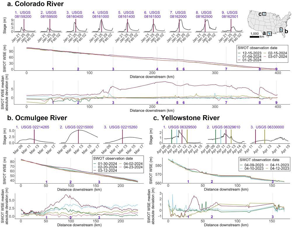
"Seen" meaning retrieved water surface elevation data over rivers while a flood wave is propagating down a river. Here are three examples of flood waves/flow waves traveling down rivers, including one in the Colorado River, TX - near the Guadalupe River:
July 12, 2025 at 3:49 PM
"Seen" meaning retrieved water surface elevation data over rivers while a flood wave is propagating down a river. Here are three examples of flood waves/flow waves traveling down rivers, including one in the Colorado River, TX - near the Guadalupe River:
Hang in there and give yourself a break!
June 25, 2025 at 1:03 AM
Hang in there and give yourself a break!
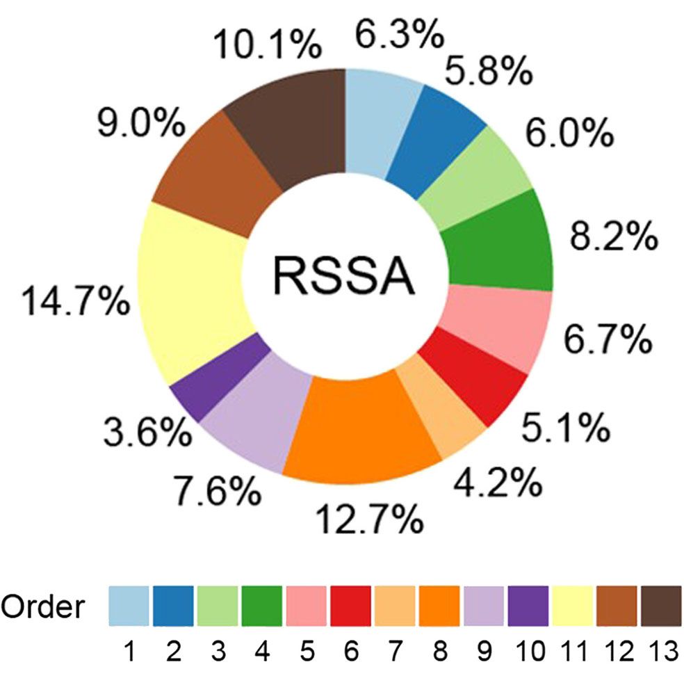
This has implications for how we calculate river and stream surface area (RSSA) at the global scale
June 19, 2025 at 2:10 PM
This has implications for how we calculate river and stream surface area (RSSA) at the global scale
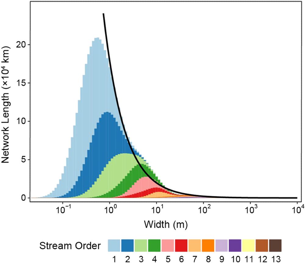
Scaling these widths across the Mississippi basin, we find an emergent fractal distribution of river widths (black line)
June 19, 2025 at 2:10 PM
Scaling these widths across the Mississippi basin, we find an emergent fractal distribution of river widths (black line)
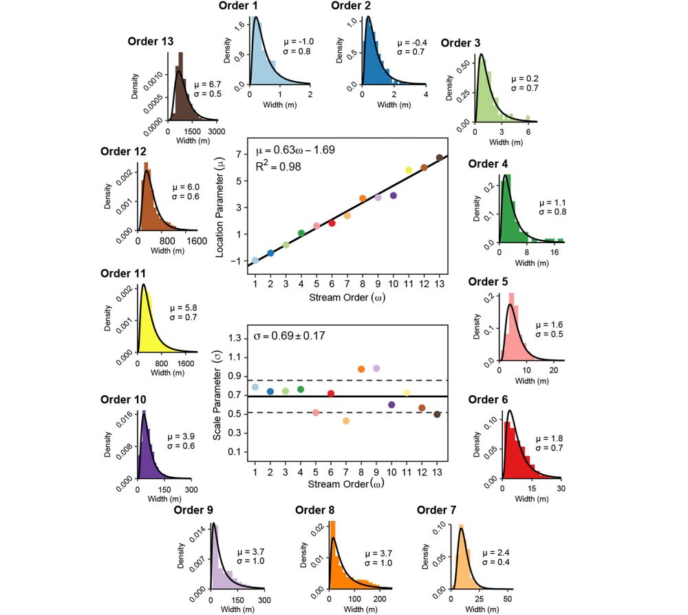
Using multi-scale remote sensing and fieldwork, we found that river widths of each stream order exhibit a very predictable log-normal distribution:
June 16, 2025 at 3:48 PM
Using multi-scale remote sensing and fieldwork, we found that river widths of each stream order exhibit a very predictable log-normal distribution:
The Washington Post also covered our paper! Here's the article with a soft paywall: wapo.st/43UuquB
Satellite measures river flow waves for the first time
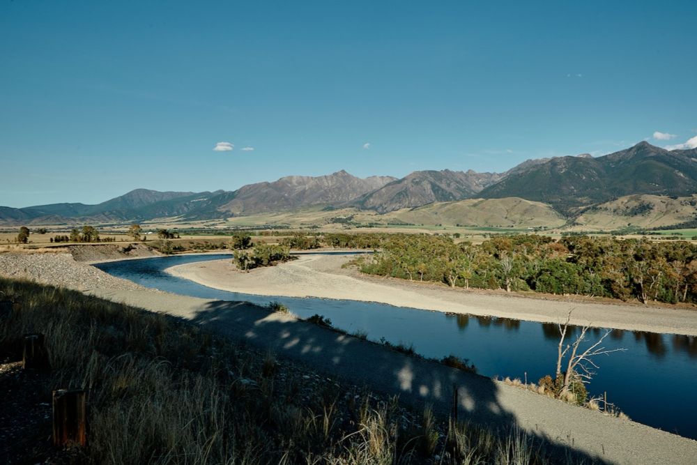
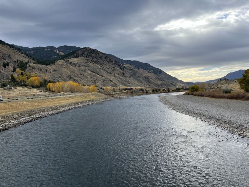
The researchers assessed waves on the Colorado River in Texas, the Ocmulgee River in Georgia and the Yellowstone River in Montana.
wapo.st
June 3, 2025 at 3:55 PM
The Washington Post also covered our paper! Here's the article with a soft paywall: wapo.st/43UuquB
JPL and NASA news article covering the study
NASA-French Satellite Spots Large-Scale River Waves for First Time
The SWOT mission captured the flood waves, which stretched from 47 to 166 miles long, as they traveled down rivers in Montana, Texas, and Georgia.
www.jpl.nasa.gov
May 21, 2025 at 5:27 PM
JPL and NASA news article covering the study