

George H. Allen
@geoallen.bsky.social
Hydrologist and satellite enthusiast. Associate Professor at Virginia Tech
This weekend my research group volunteered at the Claytor Lake Mussel Salvage event near Blacksburg, VA. We surveyed and relocated hundreds of native mussels during the scheduled biennial lake drawdown. #UtProsim
@vtgeosciences.bsky.social @vt-science.bsky.social
@vtgeosciences.bsky.social @vt-science.bsky.social


November 10, 2025 at 6:48 PM
This weekend my research group volunteered at the Claytor Lake Mussel Salvage event near Blacksburg, VA. We surveyed and relocated hundreds of native mussels during the scheduled biennial lake drawdown. #UtProsim
@vtgeosciences.bsky.social @vt-science.bsky.social
@vtgeosciences.bsky.social @vt-science.bsky.social
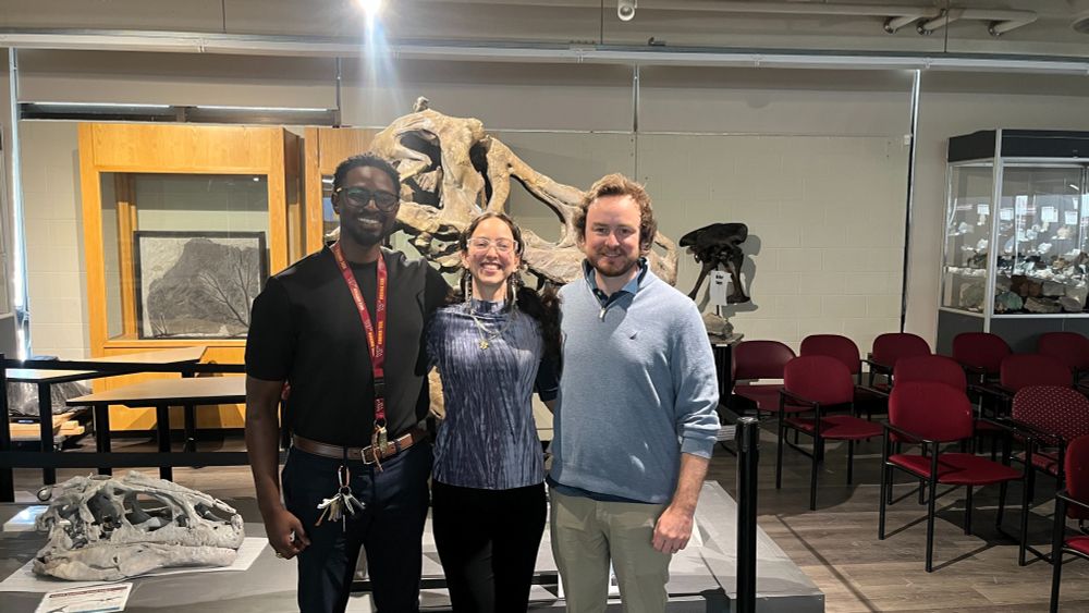
Another SWOT Science Team Meeting for the books!

October 17, 2025 at 4:48 PM
Another SWOT Science Team Meeting for the books!
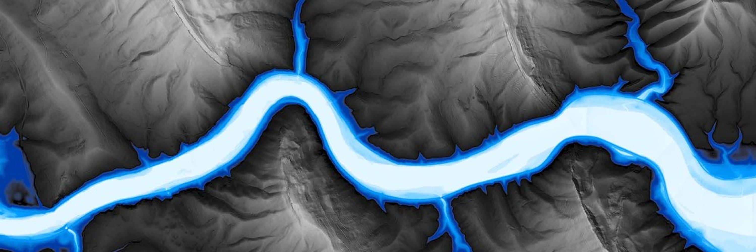
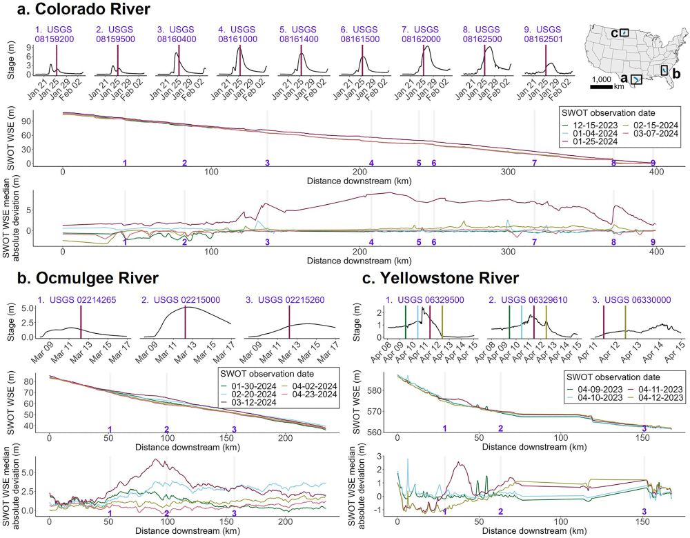
"Seen" meaning retrieved water surface elevation data over rivers while a flood wave is propagating down a river. Here are three examples of flood waves/flow waves traveling down rivers, including one in the Colorado River, TX - near the Guadalupe River:
July 12, 2025 at 3:49 PM
"Seen" meaning retrieved water surface elevation data over rivers while a flood wave is propagating down a river. Here are three examples of flood waves/flow waves traveling down rivers, including one in the Colorado River, TX - near the Guadalupe River:
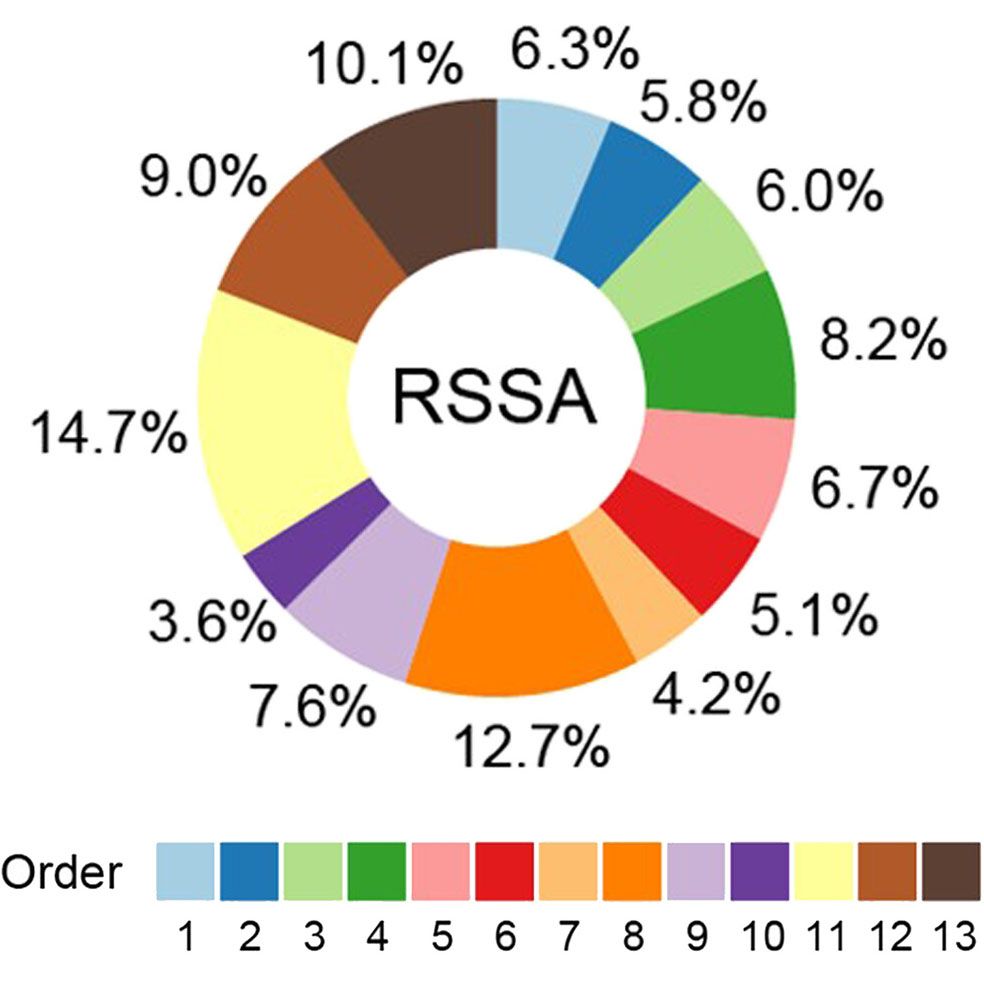
This has implications for how we calculate river and stream surface area (RSSA) at the global scale
June 19, 2025 at 2:10 PM
This has implications for how we calculate river and stream surface area (RSSA) at the global scale
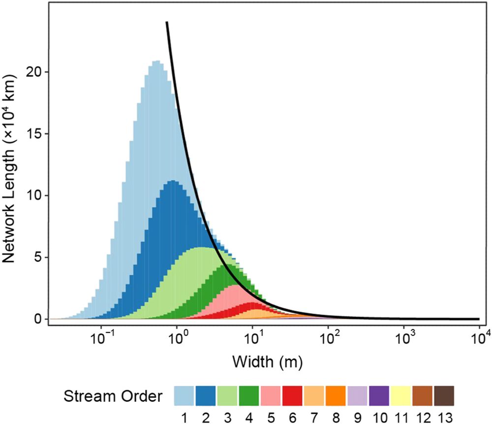
Scaling these widths across the Mississippi basin, we find an emergent fractal distribution of river widths (black line)
June 19, 2025 at 2:10 PM
Scaling these widths across the Mississippi basin, we find an emergent fractal distribution of river widths (black line)
🚨New paper🚨 shows a remarkably clean relationship between river width and stream order across the US
𝑇ℎ𝑒 𝑊𝑖𝑑𝑡ℎ𝑠 𝑜𝑓 𝑅𝑖𝑣𝑒𝑟𝑠 𝑎𝑛𝑑 𝑆𝑡𝑟𝑒𝑎𝑚𝑠 𝐴𝑐𝑟𝑜𝑠𝑠 𝑆𝑝𝑎𝑡𝑖𝑎𝑙 𝑆𝑐𝑎𝑙𝑒𝑠... 🔗 doi.org/10.1029/2025...
#hydrology #geomorphology #rivers #RemoteSensing
𝑇ℎ𝑒 𝑊𝑖𝑑𝑡ℎ𝑠 𝑜𝑓 𝑅𝑖𝑣𝑒𝑟𝑠 𝑎𝑛𝑑 𝑆𝑡𝑟𝑒𝑎𝑚𝑠 𝐴𝑐𝑟𝑜𝑠𝑠 𝑆𝑝𝑎𝑡𝑖𝑎𝑙 𝑆𝑐𝑎𝑙𝑒𝑠... 🔗 doi.org/10.1029/2025...
#hydrology #geomorphology #rivers #RemoteSensing
June 19, 2025 at 2:10 PM
🚨New paper🚨 shows a remarkably clean relationship between river width and stream order across the US
𝑇ℎ𝑒 𝑊𝑖𝑑𝑡ℎ𝑠 𝑜𝑓 𝑅𝑖𝑣𝑒𝑟𝑠 𝑎𝑛𝑑 𝑆𝑡𝑟𝑒𝑎𝑚𝑠 𝐴𝑐𝑟𝑜𝑠𝑠 𝑆𝑝𝑎𝑡𝑖𝑎𝑙 𝑆𝑐𝑎𝑙𝑒𝑠... 🔗 doi.org/10.1029/2025...
#hydrology #geomorphology #rivers #RemoteSensing
𝑇ℎ𝑒 𝑊𝑖𝑑𝑡ℎ𝑠 𝑜𝑓 𝑅𝑖𝑣𝑒𝑟𝑠 𝑎𝑛𝑑 𝑆𝑡𝑟𝑒𝑎𝑚𝑠 𝐴𝑐𝑟𝑜𝑠𝑠 𝑆𝑝𝑎𝑡𝑖𝑎𝑙 𝑆𝑐𝑎𝑙𝑒𝑠... 🔗 doi.org/10.1029/2025...
#hydrology #geomorphology #rivers #RemoteSensing
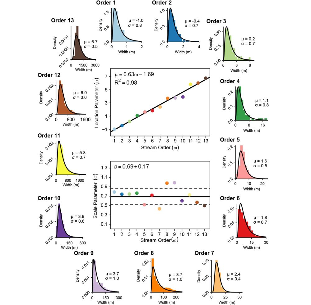
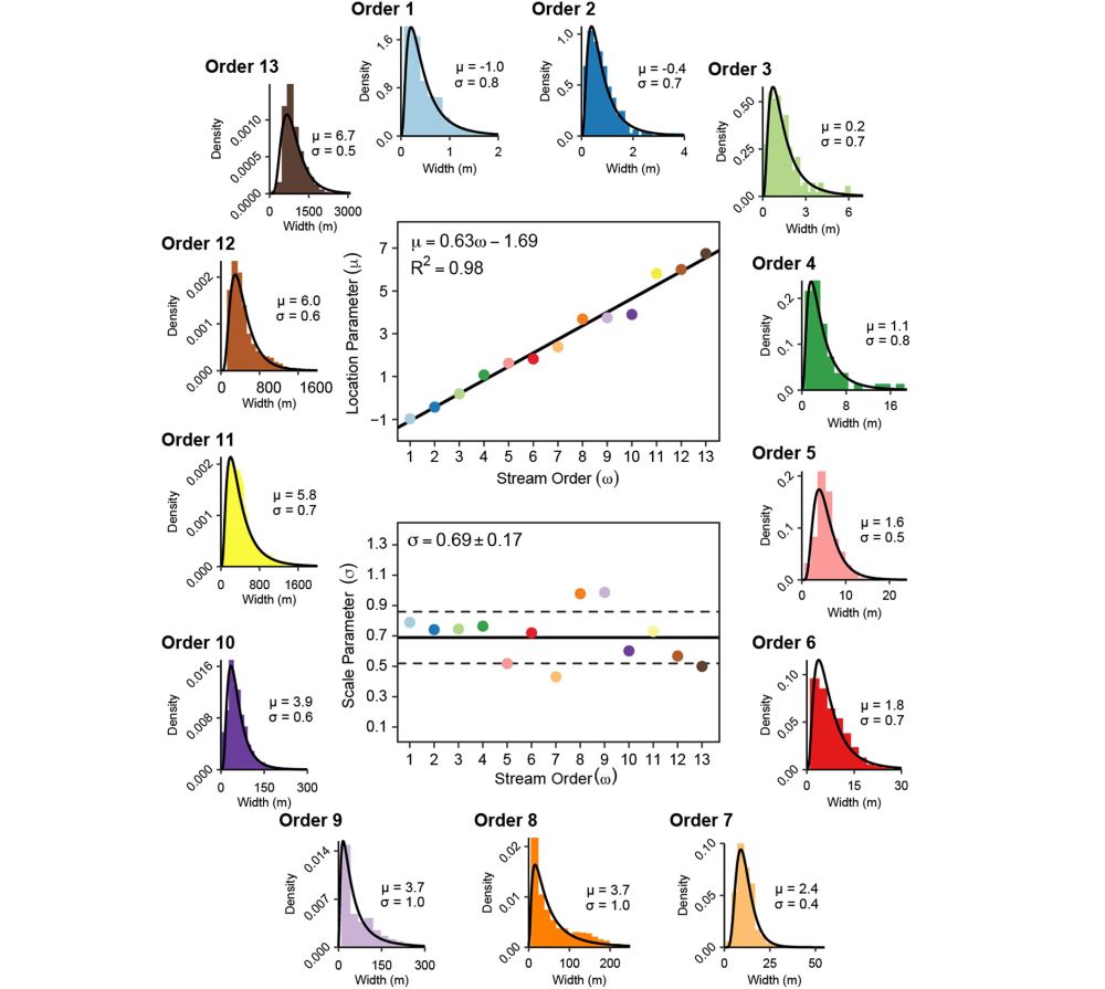
Using multi-scale remote sensing and fieldwork, we found that river widths of each stream order exhibit a very predictable log-normal distribution:
June 16, 2025 at 3:48 PM
Using multi-scale remote sensing and fieldwork, we found that river widths of each stream order exhibit a very predictable log-normal distribution:
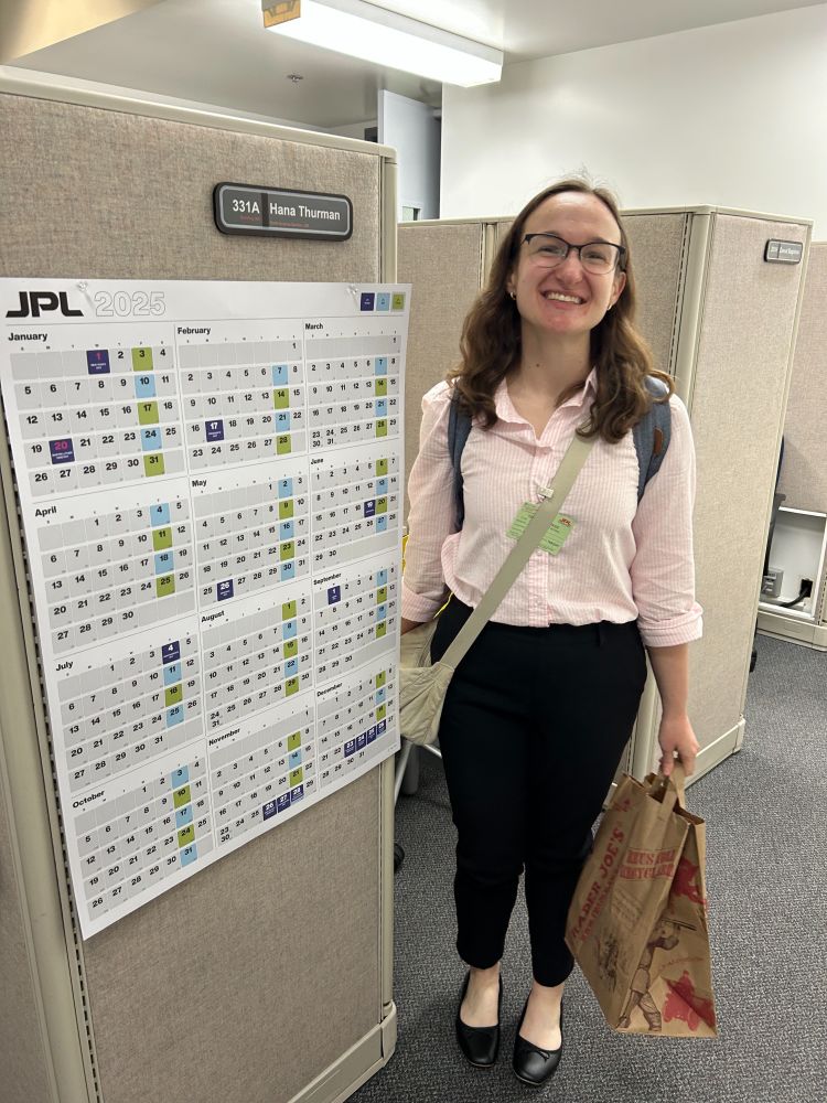
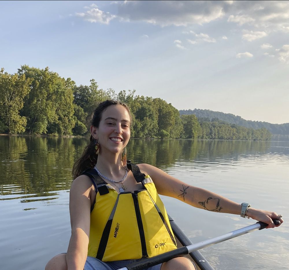
Hana (grad student in my group) will be doing a research internship at JPL this summer. Here she is on her first day on the job. Good luck, Hana!! 🚀🚀🚀
May 27, 2025 at 4:43 PM
Hana (grad student in my group) will be doing a research internship at JPL this summer. Here she is on her first day on the job. Good luck, Hana!! 🚀🚀🚀
Three example flow waves on three rivers:
May 19, 2025 at 6:16 PM
Three example flow waves on three rivers:
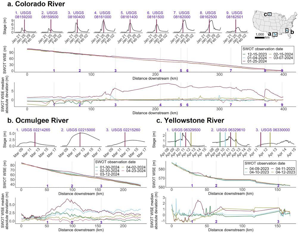
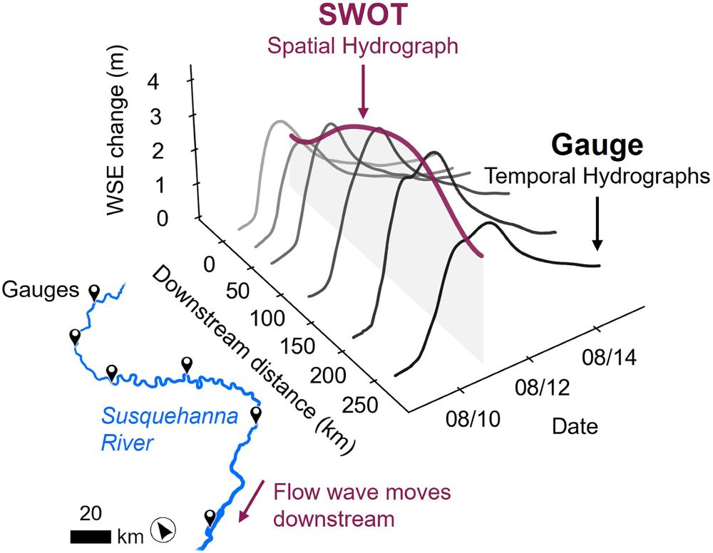
Hydrologists! Ever heard of a Spatial Hydrograph? Our new paper in @agu.org GRL shows that the SWOT satellite can capture spatial flow waves propagating down rivers—something previously only only observable at river gauges: doi.org/10.1029/2024...
#SWOT #hydrology #RemoteSensing #EarthObservation
#SWOT #hydrology #RemoteSensing #EarthObservation
May 19, 2025 at 6:15 PM
Hydrologists! Ever heard of a Spatial Hydrograph? Our new paper in @agu.org GRL shows that the SWOT satellite can capture spatial flow waves propagating down rivers—something previously only only observable at river gauges: doi.org/10.1029/2024...
#SWOT #hydrology #RemoteSensing #EarthObservation
#SWOT #hydrology #RemoteSensing #EarthObservation
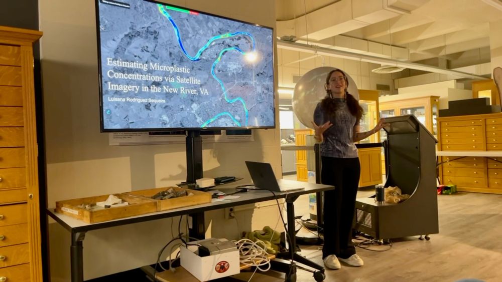
Congrats to Luisana Rodriguez Sequeira, who successfully defended her Master's Thesis on satellite #remotesensing of #microplastics in rivers! I had the pleasure of co-advising with Dr. Austin Gray @austindoug13.bsky.social. She presented to a standing-room-only crowd—well done, Luisana!
May 1, 2025 at 3:31 PM
Congrats to Luisana Rodriguez Sequeira, who successfully defended her Master's Thesis on satellite #remotesensing of #microplastics in rivers! I had the pleasure of co-advising with Dr. Austin Gray @austindoug13.bsky.social. She presented to a standing-room-only crowd—well done, Luisana!
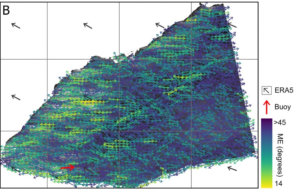
This wind data is useful for estimating lake evaporation rates, lake-air greenhouse gas exchange, and for optimal placement of lake infrastructure. Here's a university press release on the study: news.vt.edu/articles/202...
March 31, 2025 at 9:30 PM
This wind data is useful for estimating lake evaporation rates, lake-air greenhouse gas exchange, and for optimal placement of lake infrastructure. Here's a university press release on the study: news.vt.edu/articles/202...
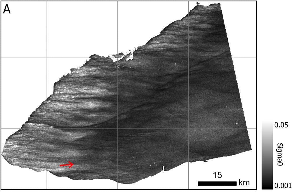
Our new paper maps wind fields over lakes using radar backscatter from SWOT and Sentinel-1 satellites. This technique achieves a much higher spatial resolution than what is available from atmosphere reanalysis products:
agupubs.onlinelibrary.wiley.com/doi/10.1029/...
agupubs.onlinelibrary.wiley.com/doi/10.1029/...
March 31, 2025 at 9:30 PM
Our new paper maps wind fields over lakes using radar backscatter from SWOT and Sentinel-1 satellites. This technique achieves a much higher spatial resolution than what is available from atmosphere reanalysis products:
agupubs.onlinelibrary.wiley.com/doi/10.1029/...
agupubs.onlinelibrary.wiley.com/doi/10.1029/...
A graduate student takes a stream width measurement on Stroubles Creek, Virginia Tech.

March 7, 2025 at 2:50 PM
A graduate student takes a stream width measurement on Stroubles Creek, Virginia Tech.
New paper by Dongmei Feng finds an interesting pattern in global streamflow trends through time: increasing streamflow in upstream river reaches and decreasing flow in downstream reaches: www.science.org/doi/full/10....

December 31, 2024 at 5:15 PM
New paper by Dongmei Feng finds an interesting pattern in global streamflow trends through time: increasing streamflow in upstream river reaches and decreasing flow in downstream reaches: www.science.org/doi/full/10....
Cool paper alert: Yu et al. used SWOT satellite observations of the ocean's surface height to create a global seafloor map at 8-km resolution: about twice the spatial resolution of previous global maps! science.org/doi/full/10....

December 15, 2024 at 5:56 PM
Cool paper alert: Yu et al. used SWOT satellite observations of the ocean's surface height to create a global seafloor map at 8-km resolution: about twice the spatial resolution of previous global maps! science.org/doi/full/10....

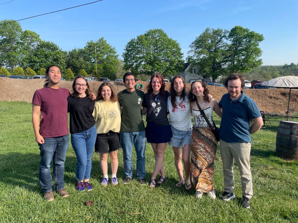
Great day to show our department's incoming graduate students around the Blacksburg area. Thanks @clasticdetritus.bsky.social for letting me tag along!

August 22, 2024 at 3:05 PM
Great day to show our department's incoming graduate students around the Blacksburg area. Thanks @clasticdetritus.bsky.social for letting me tag along!
Looking for an alternative to MDPI Remote Sensing or Remote Sensing of Environment?
Check out the AAAS Science partner journal, Journal of Remote Sensing. Several of us early career folks are guest editing a "Remote Sensing of Hydrology" special issue. Consider submitting your work!
Check out the AAAS Science partner journal, Journal of Remote Sensing. Several of us early career folks are guest editing a "Remote Sensing of Hydrology" special issue. Consider submitting your work!


January 2, 2024 at 6:37 PM
Looking for an alternative to MDPI Remote Sensing or Remote Sensing of Environment?
Check out the AAAS Science partner journal, Journal of Remote Sensing. Several of us early career folks are guest editing a "Remote Sensing of Hydrology" special issue. Consider submitting your work!
Check out the AAAS Science partner journal, Journal of Remote Sensing. Several of us early career folks are guest editing a "Remote Sensing of Hydrology" special issue. Consider submitting your work!
How good are new and future satellites at tracking suspended sediment in rivers? Find out in our new IEEE TGRS paper "Optimizing Satellite Mission Requirements to Measure Total Suspended Solids in Rivers" led by grad student Molly Stroud at Virginia Tech! ieeexplore.ieee.org/abstract/doc...

December 18, 2023 at 10:09 PM
How good are new and future satellites at tracking suspended sediment in rivers? Find out in our new IEEE TGRS paper "Optimizing Satellite Mission Requirements to Measure Total Suspended Solids in Rivers" led by grad student Molly Stroud at Virginia Tech! ieeexplore.ieee.org/abstract/doc...