


Remote Sensing and Geoinformatics - Freie Universität Berlin
@fub-remotesensing.bsky.social
trees – proximal sensing - sensor field – lidar - uav - applied AI - dynamic teaching
Working group for Remote Sensing and Geoinformatics @freieuniversitaet.bsky.social
https://www.geo.fu-berlin.de/en/geog/fachrichtungen/geoinformatik/index.html
Working group for Remote Sensing and Geoinformatics @freieuniversitaet.bsky.social
https://www.geo.fu-berlin.de/en/geog/fachrichtungen/geoinformatik/index.html
Pinned
Remote Sensing and Geoinformatics - Freie Universität Berlin
@fub-remotesensing.bsky.social
· Jun 17
Hello everyone! We’re the Remote Sensing & Geoinformatics Group at FU Berlin. We study trees and ecosystems using tech like LiDAR, satellites & AI. From forests to cities, we’re all about research, learning, teaching and collaboration. Excited to share our journey with you! 🌳📡💥🛸🛰️🤓💻🌍
Reposted by Remote Sensing and Geoinformatics - Freie Universität Berlin
Still want to make cleaning biodiversity data shrimp-ler? 🦐
Good news: We just updated our Cleaning Biodiversity Data in R book, so you still can! We've updated data for 2025, added new content & fixed lots of silly typos 😀
Live the shrimp-le life:
cleaning-data-r.ala.org.au
#rstats #ecology 🧪🌏
Good news: We just updated our Cleaning Biodiversity Data in R book, so you still can! We've updated data for 2025, added new content & fixed lots of silly typos 😀
Live the shrimp-le life:
cleaning-data-r.ala.org.au
#rstats #ecology 🧪🌏

October 15, 2025 at 4:12 AM
Still want to make cleaning biodiversity data shrimp-ler? 🦐
Good news: We just updated our Cleaning Biodiversity Data in R book, so you still can! We've updated data for 2025, added new content & fixed lots of silly typos 😀
Live the shrimp-le life:
cleaning-data-r.ala.org.au
#rstats #ecology 🧪🌏
Good news: We just updated our Cleaning Biodiversity Data in R book, so you still can! We've updated data for 2025, added new content & fixed lots of silly typos 😀
Live the shrimp-le life:
cleaning-data-r.ala.org.au
#rstats #ecology 🧪🌏
Reposted by Remote Sensing and Geoinformatics - Freie Universität Berlin
Conference travel award opportunity:
Foreign Scholar Travel Award to attend the International Association for Landscape Ecology - North America chapter (IALE-NA) conference in April 2026.
www.ialena.org/foreign-scholar-award.html & bit.ly/IALENA-FSTA-....
Apply by Nov. 2, 2025! 🧪🌎
Foreign Scholar Travel Award to attend the International Association for Landscape Ecology - North America chapter (IALE-NA) conference in April 2026.
www.ialena.org/foreign-scholar-award.html & bit.ly/IALENA-FSTA-....
Apply by Nov. 2, 2025! 🧪🌎
October 14, 2025 at 2:43 PM
Conference travel award opportunity:
Foreign Scholar Travel Award to attend the International Association for Landscape Ecology - North America chapter (IALE-NA) conference in April 2026.
www.ialena.org/foreign-scholar-award.html & bit.ly/IALENA-FSTA-....
Apply by Nov. 2, 2025! 🧪🌎
Foreign Scholar Travel Award to attend the International Association for Landscape Ecology - North America chapter (IALE-NA) conference in April 2026.
www.ialena.org/foreign-scholar-award.html & bit.ly/IALENA-FSTA-....
Apply by Nov. 2, 2025! 🧪🌎
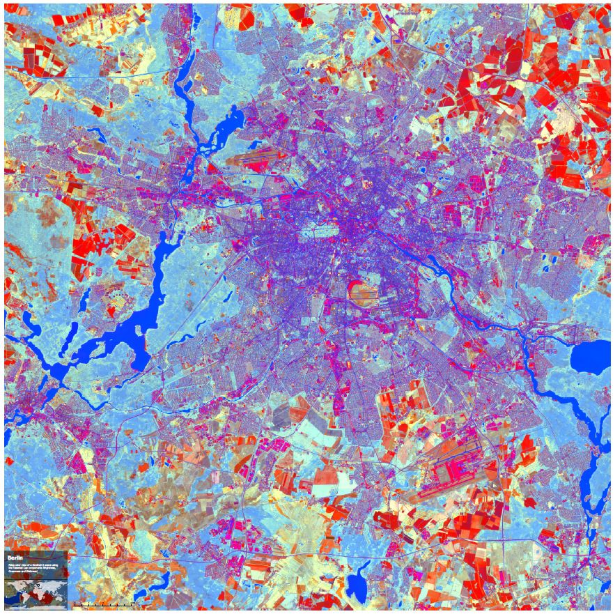
A new semester kicks off this week at Berlin’s universities - back to campus vibes! 🎓✨ Our team is ready for a winter term of teaching GIS & remote sensing at Lankwitz. Wishing students & lecturers alike a semester full of learning, discovery & good energy! 🚀📚🌍 #FreieUniversität #BackToCampus
October 15, 2025 at 7:17 AM
A new semester kicks off this week at Berlin’s universities - back to campus vibes! 🎓✨ Our team is ready for a winter term of teaching GIS & remote sensing at Lankwitz. Wishing students & lecturers alike a semester full of learning, discovery & good energy! 🚀📚🌍 #FreieUniversität #BackToCampus
Reposted by Remote Sensing and Geoinformatics - Freie Universität Berlin
Great to see so many #PlantScience journals, societies, and institutions here. Tag in if we missed one!
Thanks, added! go.bsky.app/Q9QiX9C
October 2, 2025 at 12:08 PM
Great to see so many #PlantScience journals, societies, and institutions here. Tag in if we missed one!
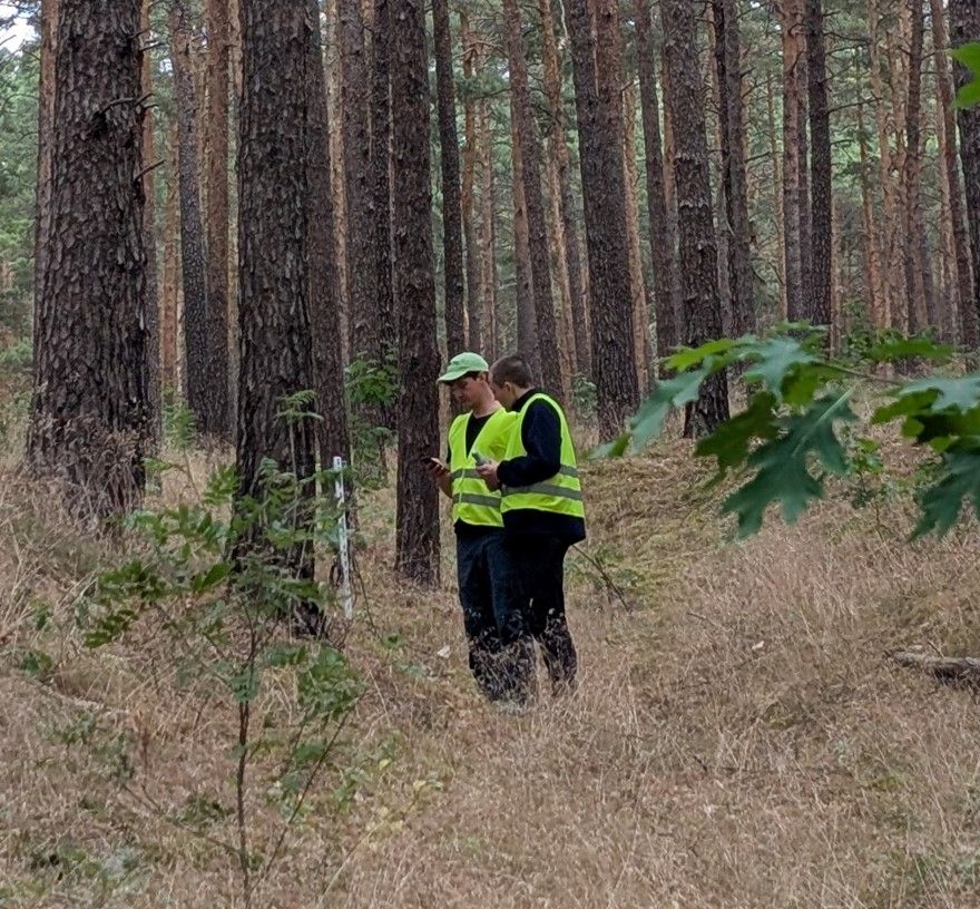
We were delighted to host a research exchange with colleagues from @CzechGlobe 🇨🇿 in Berlin! 🌍
We discussed forestry-focused remote sensing, explored opportunities for future collaboration, and visited study sites like the #sensorfield in Brandenburg. 🌲📡
Thanks for the great visit!
#TeamScience
We discussed forestry-focused remote sensing, explored opportunities for future collaboration, and visited study sites like the #sensorfield in Brandenburg. 🌲📡
Thanks for the great visit!
#TeamScience


September 14, 2025 at 7:23 AM
We were delighted to host a research exchange with colleagues from @CzechGlobe 🇨🇿 in Berlin! 🌍
We discussed forestry-focused remote sensing, explored opportunities for future collaboration, and visited study sites like the #sensorfield in Brandenburg. 🌲📡
Thanks for the great visit!
#TeamScience
We discussed forestry-focused remote sensing, explored opportunities for future collaboration, and visited study sites like the #sensorfield in Brandenburg. 🌲📡
Thanks for the great visit!
#TeamScience
20 plots, hundreds of #Riegl TLS scans, thousands of berries… 🌲🫐 and a million laughs.
Norway field campaign = success! 💪
Now we are back in Berlin and ready to process our data.
Shoutout to our amazing field crew:
Arvin, Asad, Chiara, Ephraim, Johann, Marius & Miriam!
#RonnieRieglOnTour
Norway field campaign = success! 💪
Now we are back in Berlin and ready to process our data.
Shoutout to our amazing field crew:
Arvin, Asad, Chiara, Ephraim, Johann, Marius & Miriam!
#RonnieRieglOnTour


August 30, 2025 at 10:55 AM
20 plots, hundreds of #Riegl TLS scans, thousands of berries… 🌲🫐 and a million laughs.
Norway field campaign = success! 💪
Now we are back in Berlin and ready to process our data.
Shoutout to our amazing field crew:
Arvin, Asad, Chiara, Ephraim, Johann, Marius & Miriam!
#RonnieRieglOnTour
Norway field campaign = success! 💪
Now we are back in Berlin and ready to process our data.
Shoutout to our amazing field crew:
Arvin, Asad, Chiara, Ephraim, Johann, Marius & Miriam!
#RonnieRieglOnTour
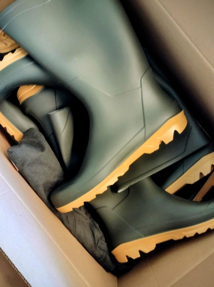
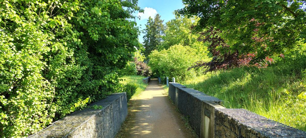
Our fieldwork is in full go – our team is out in the woods every day batteling rain, swamps, sheep and running from cows – the dangers you find in northern Europe 😉 – all with the #Riegl on our shoulders.
But check out these stunning views we get in return! It’s all worth it.
#RonnieRieglOnTour
But check out these stunning views we get in return! It’s all worth it.
#RonnieRieglOnTour


August 22, 2025 at 6:26 PM
Our fieldwork is in full go – our team is out in the woods every day batteling rain, swamps, sheep and running from cows – the dangers you find in northern Europe 😉 – all with the #Riegl on our shoulders.
But check out these stunning views we get in return! It’s all worth it.
#RonnieRieglOnTour
But check out these stunning views we get in return! It’s all worth it.
#RonnieRieglOnTour
We are getting ready to head to Norway! 🌲🌾🌲
Our team will collect terrestrial laser scanning data to on the connection between forest structure and biodiversity – we are looking forward to two weeks in the beautiful boreal forest north of Oslo.
And we are prepared for swampy conditions 😉
Our team will collect terrestrial laser scanning data to on the connection between forest structure and biodiversity – we are looking forward to two weeks in the beautiful boreal forest north of Oslo.
And we are prepared for swampy conditions 😉
August 11, 2025 at 7:25 AM
We are getting ready to head to Norway! 🌲🌾🌲
Our team will collect terrestrial laser scanning data to on the connection between forest structure and biodiversity – we are looking forward to two weeks in the beautiful boreal forest north of Oslo.
And we are prepared for swampy conditions 😉
Our team will collect terrestrial laser scanning data to on the connection between forest structure and biodiversity – we are looking forward to two weeks in the beautiful boreal forest north of Oslo.
And we are prepared for swampy conditions 😉
🛰️ Spending 5 months at the Remote Sensing Lab, Freie Universität, to advance my research on protected area management. Grateful for this opportunity and looking forward to the Norway field trip with this amazing team! – chiaramansi93.bsky.social 🌳 #remotesensing #conservation #Erasmus+ #biodiversity
July 30, 2025 at 12:28 PM
🛰️ Spending 5 months at the Remote Sensing Lab, Freie Universität, to advance my research on protected area management. Grateful for this opportunity and looking forward to the Norway field trip with this amazing team! – chiaramansi93.bsky.social 🌳 #remotesensing #conservation #Erasmus+ #biodiversity
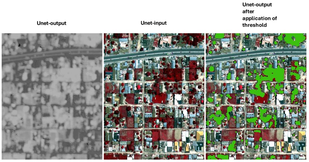
🚀 Getting started with Deep Learning for remote sensing? Check out these beginner tutorials from FU Berlin: 🧠 UNet in PyTorch: bit.ly/3GBWPx1 🛰️ Segment Anything for GeoTIFFs: bit.ly/3GBWRVF 🌍 #DeepLearning #PyTorch #GeospatialAI #UNet #SegmentAnything #EarthObservation #OpenScience
July 22, 2025 at 8:08 AM
🚀 Getting started with Deep Learning for remote sensing? Check out these beginner tutorials from FU Berlin: 🧠 UNet in PyTorch: bit.ly/3GBWPx1 🛰️ Segment Anything for GeoTIFFs: bit.ly/3GBWRVF 🌍 #DeepLearning #PyTorch #GeospatialAI #UNet #SegmentAnything #EarthObservation #OpenScience
On our idyllic GeoCampus Lankwitz, smart sensors track tree growth, soil moisture & light of some of our many trees. TLS scans turn trees like "Rosie" 🌳 the chestnut into stunning 3D models 👓. #TTN #SmartForestry #IoT #TreeGrowth #LoRaWAN #ForestEcology #SensingFUB
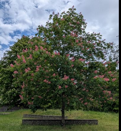
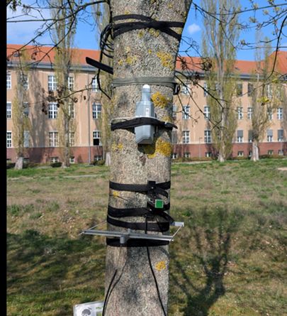
July 14, 2025 at 11:11 AM
On our idyllic GeoCampus Lankwitz, smart sensors track tree growth, soil moisture & light of some of our many trees. TLS scans turn trees like "Rosie" 🌳 the chestnut into stunning 3D models 👓. #TTN #SmartForestry #IoT #TreeGrowth #LoRaWAN #ForestEcology #SensingFUB
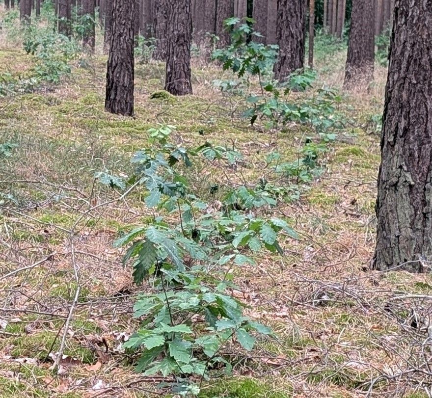
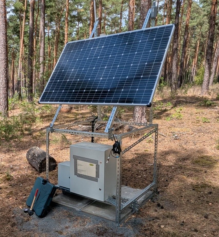
🌳 In Brandenburg, we’ve set up a TTN-connected station to monitor soil moisture & light intensity—exploring how these factors affect young oak seedlings growing under mature pines. Stay tuned for more news from our #sensorfield!
#SmartForestry #IoT #TreeGrowth #LoRaWAN #ForestEcology #SensingFUB
#SmartForestry #IoT #TreeGrowth #LoRaWAN #ForestEcology #SensingFUB

July 9, 2025 at 8:49 AM
🌳 In Brandenburg, we’ve set up a TTN-connected station to monitor soil moisture & light intensity—exploring how these factors affect young oak seedlings growing under mature pines. Stay tuned for more news from our #sensorfield!
#SmartForestry #IoT #TreeGrowth #LoRaWAN #ForestEcology #SensingFUB
#SmartForestry #IoT #TreeGrowth #LoRaWAN #ForestEcology #SensingFUB
🌲 Meet Hua (shorturl.at/3DGFl), one of our PhD researcher! His research focuses on generating high-quality virtual point clouds that realistically include lower vegetation. This helps improve tasks like semantic segmentation and biomass estimation. Smarter, more reliable ecological AI starts here.
Hua Jiang
shorturl.at
July 1, 2025 at 8:19 AM
🌲 Meet Hua (shorturl.at/3DGFl), one of our PhD researcher! His research focuses on generating high-quality virtual point clouds that realistically include lower vegetation. This helps improve tasks like semantic segmentation and biomass estimation. Smarter, more reliable ecological AI starts here.
Reposted by Remote Sensing and Geoinformatics - Freie Universität Berlin
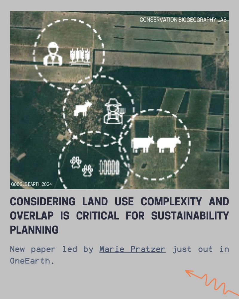
Considering land use complexity and overlap is critical for sustainability planning. New paper led by Marie Pratzer - out in OneEarth:
www.sciencedirect.com/science/arti...
@tkuemmerle.bsky.social @matthiasbaumann.bsky.social @pedrofernandez91.bsky.social @oneearthofficial.bsky.social
www.sciencedirect.com/science/arti...
@tkuemmerle.bsky.social @matthiasbaumann.bsky.social @pedrofernandez91.bsky.social @oneearthofficial.bsky.social
April 7, 2025 at 7:30 AM
Considering land use complexity and overlap is critical for sustainability planning. New paper led by Marie Pratzer - out in OneEarth:
www.sciencedirect.com/science/arti...
@tkuemmerle.bsky.social @matthiasbaumann.bsky.social @pedrofernandez91.bsky.social @oneearthofficial.bsky.social
www.sciencedirect.com/science/arti...
@tkuemmerle.bsky.social @matthiasbaumann.bsky.social @pedrofernandez91.bsky.social @oneearthofficial.bsky.social
Reposted by Remote Sensing and Geoinformatics - Freie Universität Berlin
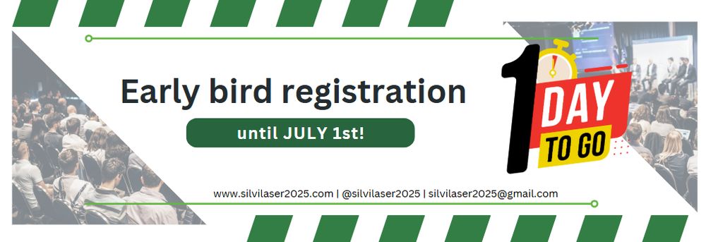
LAST CALL📣 for early bird registration! These rates will NOT be extended 💸 Prices go up July 2!
Students (MSc/PhD): $650 early bird/$750 regular
Standard registration (including PDF): $950 early bird/$1,150 regular
See you in Quebec Sep 29-Oct 3! ⚜️
event.fourwaves.com/silvilaser2025/pages
Students (MSc/PhD): $650 early bird/$750 regular
Standard registration (including PDF): $950 early bird/$1,150 regular
See you in Quebec Sep 29-Oct 3! ⚜️
event.fourwaves.com/silvilaser2025/pages
June 30, 2025 at 9:37 PM
LAST CALL📣 for early bird registration! These rates will NOT be extended 💸 Prices go up July 2!
Students (MSc/PhD): $650 early bird/$750 regular
Standard registration (including PDF): $950 early bird/$1,150 regular
See you in Quebec Sep 29-Oct 3! ⚜️
event.fourwaves.com/silvilaser2025/pages
Students (MSc/PhD): $650 early bird/$750 regular
Standard registration (including PDF): $950 early bird/$1,150 regular
See you in Quebec Sep 29-Oct 3! ⚜️
event.fourwaves.com/silvilaser2025/pages
📣 Just a few days to go!
Join us this Saturday, June 28 at #LNDW2025 in the Theaterhof of the Silberlaube @FUBerlin.
As a special add on we’ll be showcasing a small art project by ZK/U fellows, created in collaboration with us: Visual Cultures of Forest Carbon - www.zku-berlin.org/fellows/754/ 🌳🌲
Join us this Saturday, June 28 at #LNDW2025 in the Theaterhof of the Silberlaube @FUBerlin.
As a special add on we’ll be showcasing a small art project by ZK/U fellows, created in collaboration with us: Visual Cultures of Forest Carbon - www.zku-berlin.org/fellows/754/ 🌳🌲

June 24, 2025 at 8:01 AM
📣 Just a few days to go!
Join us this Saturday, June 28 at #LNDW2025 in the Theaterhof of the Silberlaube @FUBerlin.
As a special add on we’ll be showcasing a small art project by ZK/U fellows, created in collaboration with us: Visual Cultures of Forest Carbon - www.zku-berlin.org/fellows/754/ 🌳🌲
Join us this Saturday, June 28 at #LNDW2025 in the Theaterhof of the Silberlaube @FUBerlin.
As a special add on we’ll be showcasing a small art project by ZK/U fellows, created in collaboration with us: Visual Cultures of Forest Carbon - www.zku-berlin.org/fellows/754/ 🌳🌲
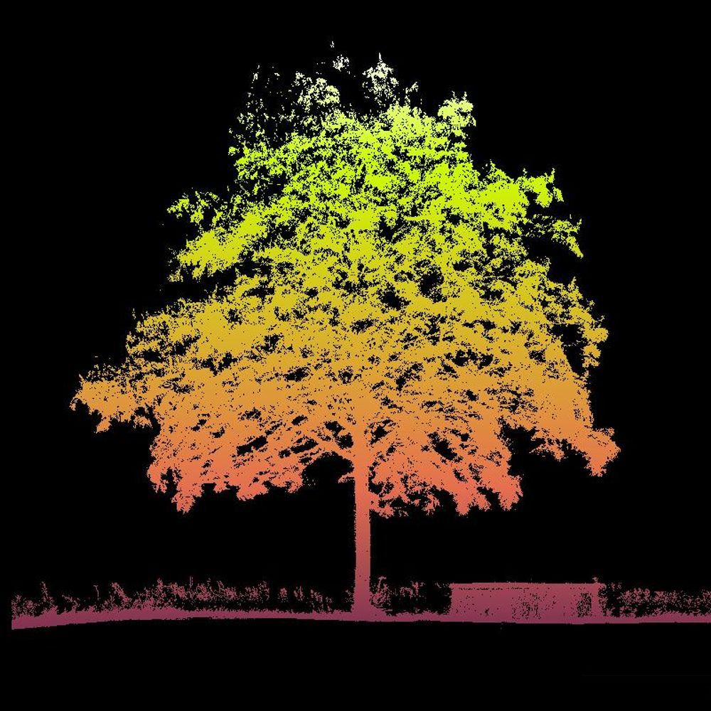
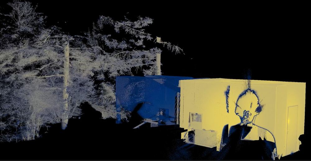
🌲 Curious about what trees do for us—and how we can measure it? Visit us at #LNDW2025 in the Theaterhof of the Silberlaube #FUBerlin on June 28th!
Together we use our new laser scanner to turn trees into 3D models to study their health, structure, & carbon storage. Don’t miss it! 🌳
Together we use our new laser scanner to turn trees into 3D models to study their health, structure, & carbon storage. Don’t miss it! 🌳
June 22, 2025 at 1:29 PM
Reposted by Remote Sensing and Geoinformatics - Freie Universität Berlin

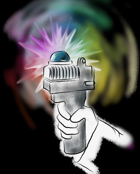
Just picked up my poster! Off to Vienna tomorrow—can’t wait to share my work in the "Advances in Monitoring and Management of Forest Ecosystems" session next Friday. Come say hi if you're around! 🌲🔥🛰️ #LPS25
June 20, 2025 at 8:41 AM
Just picked up my poster! Off to Vienna tomorrow—can’t wait to share my work in the "Advances in Monitoring and Management of Forest Ecosystems" session next Friday. Come say hi if you're around! 🌲🔥🛰️ #LPS25
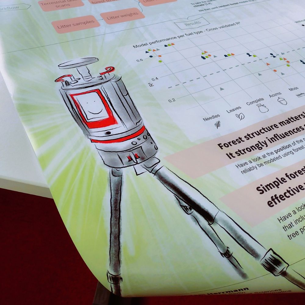
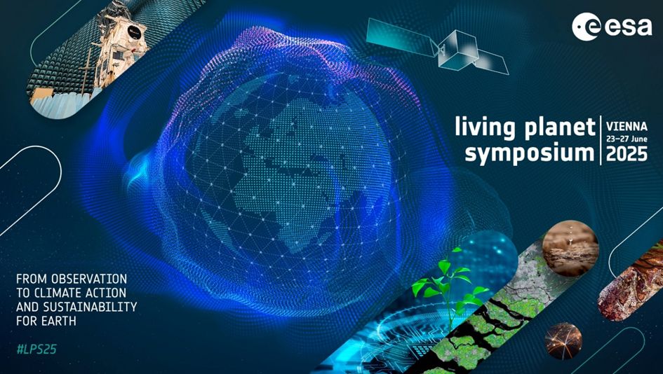
Three of us—@ffassnacht.bsky.social , @miriamher.bsky.social & @HuaJiang—are heading to the Living Planet Symposium in Vienna next week! We will present on forest practitioners' requirements for remote sensing-based products and modeling surface fuels from 3D TLS Data. Hope to see you there!🌍 #LPS25
June 17, 2025 at 2:02 PM
Three of us—@ffassnacht.bsky.social , @miriamher.bsky.social & @HuaJiang—are heading to the Living Planet Symposium in Vienna next week! We will present on forest practitioners' requirements for remote sensing-based products and modeling surface fuels from 3D TLS Data. Hope to see you there!🌍 #LPS25
Hello everyone! We’re the Remote Sensing & Geoinformatics Group at FU Berlin. We study trees and ecosystems using tech like LiDAR, satellites & AI. From forests to cities, we’re all about research, learning, teaching and collaboration. Excited to share our journey with you! 🌳📡💥🛸🛰️🤓💻🌍
June 17, 2025 at 1:49 PM
Hello everyone! We’re the Remote Sensing & Geoinformatics Group at FU Berlin. We study trees and ecosystems using tech like LiDAR, satellites & AI. From forests to cities, we’re all about research, learning, teaching and collaboration. Excited to share our journey with you! 🌳📡💥🛸🛰️🤓💻🌍