


Elena Field
@elenafield.bsky.social
GIS & Web Mapping Specialist at British Antarctic Survey.
Cartographer. Geologist. Bookworm. All views my own.
Cartographer. Geologist. Bookworm. All views my own.
Reposted by Elena Field
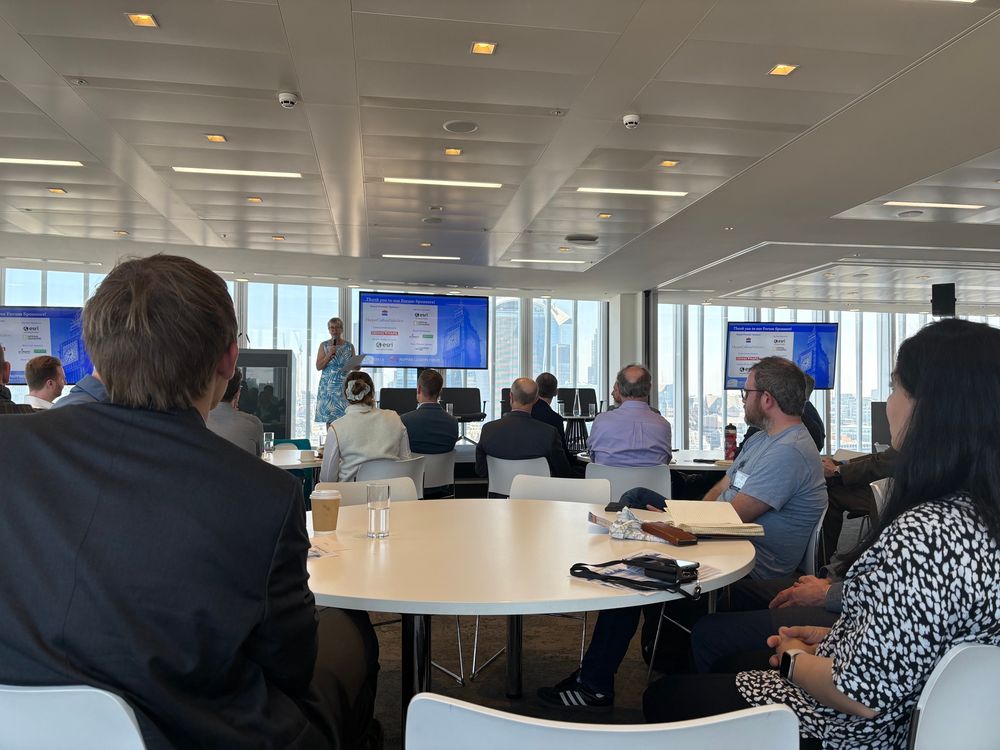
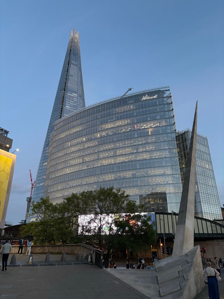
It has been a busy week for conferences this week! One of our GIS Specialists presented at the IMIA Mapping Leaders Forum in London yesterday. It has been a useful few days talking to some world-leading map publishers and printers and we’ve gained lots of ideas on how we can do more with our maps!

May 15, 2025 at 12:48 PM
It has been a busy week for conferences this week! One of our GIS Specialists presented at the IMIA Mapping Leaders Forum in London yesterday. It has been a useful few days talking to some world-leading map publishers and printers and we’ve gained lots of ideas on how we can do more with our maps!
Reposted by Elena Field
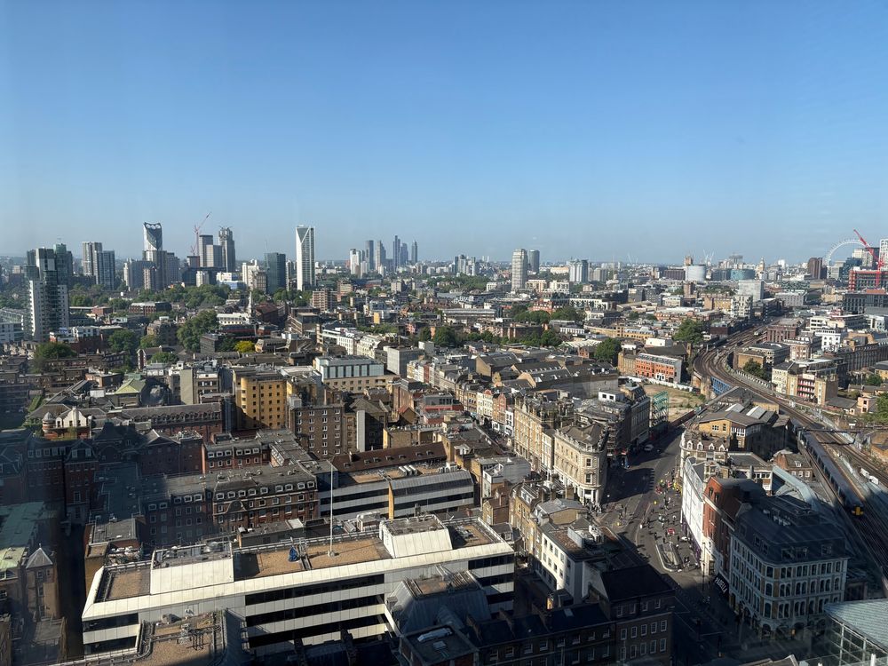
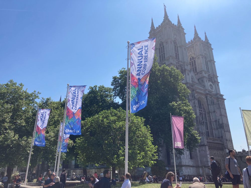
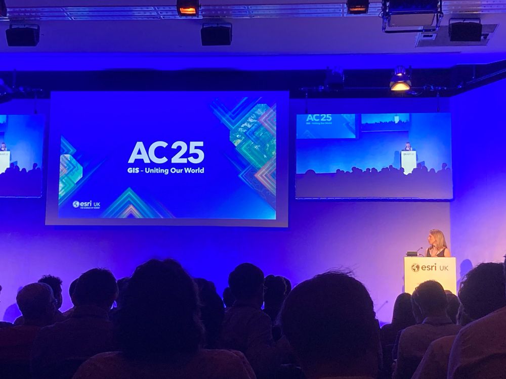
Some of the MAGIC team are at Esri UK Annual Conference today in London. Give us a shout if you want to chat to us 👋
May 13, 2025 at 11:37 AM
Some of the MAGIC team are at Esri UK Annual Conference today in London. Give us a shout if you want to chat to us 👋
Reposted by Elena Field
Did you know that some of our key Antarctic topographic data is in Esri's Living Atlas? We regularly update these services so that your maps will always show the latest authoritative data! livingatlas.arcgis.com/en/browse/?q...
For more info: www.bas.ac.uk/media-post/b...
For more info: www.bas.ac.uk/media-post/b...
ArcGIS Living Atlas of the World
ArcGIS Living Atlas of the World is the foremost collection of geographic information from around the globe. It includes maps, apps, and data layers to support your work.
livingatlas.arcgis.com
March 26, 2025 at 10:31 AM
Did you know that some of our key Antarctic topographic data is in Esri's Living Atlas? We regularly update these services so that your maps will always show the latest authoritative data! livingatlas.arcgis.com/en/browse/?q...
For more info: www.bas.ac.uk/media-post/b...
For more info: www.bas.ac.uk/media-post/b...
Reposted by Elena Field

#throwbacktuesday to when our now BCS President Paul Naylor took a break from our conference in 2023 @bas.ac.uk 🤣

March 11, 2025 at 7:13 PM
#throwbacktuesday to when our now BCS President Paul Naylor took a break from our conference in 2023 @bas.ac.uk 🤣
Reposted by Elena Field
The last Twin Otter aircraft has just left Rothera which marks the end of the field season, and gives us a chance to look back at the support we have provided over the year. We started with fieldwork and air unit maps!
🧵 1/5
🧵 1/5


March 7, 2025 at 3:34 PM
The last Twin Otter aircraft has just left Rothera which marks the end of the field season, and gives us a chance to look back at the support we have provided over the year. We started with fieldwork and air unit maps!
🧵 1/5
🧵 1/5
Place names are vital for safe navigation and ensure that features are clearly identified in research and communication - this is a fantastic chance to be involved!
More details below on how to propose a name in British Antarctic Territory & South Georgia and the South Sandwich Islands 👇
More details below on how to propose a name in British Antarctic Territory & South Georgia and the South Sandwich Islands 👇
Have you noticed a place without a name during the season? Are you referring to “Glacier A, B or C” in your paper?
The Antarctic Place-names Committee are accepting applications for place names - deadline is 17th March. More information about how to apply is here: apc.antarctica.ac.uk
The Antarctic Place-names Committee are accepting applications for place names - deadline is 17th March. More information about how to apply is here: apc.antarctica.ac.uk

February 18, 2025 at 3:43 PM
Place names are vital for safe navigation and ensure that features are clearly identified in research and communication - this is a fantastic chance to be involved!
More details below on how to propose a name in British Antarctic Territory & South Georgia and the South Sandwich Islands 👇
More details below on how to propose a name in British Antarctic Territory & South Georgia and the South Sandwich Islands 👇
Reposted by Elena Field
A new iceberg, ~30x14 km in size, recently calved from the southern end of the George VI Ice Shelf. It's called A84 and is already making quite an impact, bumping into the Stange Ice Shelf over the weekend! These Copernicus Sentinel-1 images from Polar View show the new berg over the last few days.
February 4, 2025 at 3:07 PM
A new iceberg, ~30x14 km in size, recently calved from the southern end of the George VI Ice Shelf. It's called A84 and is already making quite an impact, bumping into the Stange Ice Shelf over the weekend! These Copernicus Sentinel-1 images from Polar View show the new berg over the last few days.
Reposted by Elena Field
Did you know that MAGIC support the BAS Air Unit with mapping, imagery and also 3D visualisations? Check out Rothera runway, made using the latest drone imagery draped over a digital elevation model! Visualising the runway & obstacle surfaces in 3D helps pilots better understand these remote areas ✈️
January 29, 2025 at 7:27 PM
Did you know that MAGIC support the BAS Air Unit with mapping, imagery and also 3D visualisations? Check out Rothera runway, made using the latest drone imagery draped over a digital elevation model! Visualising the runway & obstacle surfaces in 3D helps pilots better understand these remote areas ✈️
Reposted by Elena Field
🔥New paper! 🧪🔥
Glacial geology of Hudson Mountains, nr Pine Island Glacier, Antarctica 🪨❄️
www.sciencedirect.com/science/arti...
With @cosmokeir.bsky.social @radatmines.bsky.social @shelfyice.bsky.social and others.
Fieldwork with @bas.ac.uk
🧵1/n
Glacial geology of Hudson Mountains, nr Pine Island Glacier, Antarctica 🪨❄️
www.sciencedirect.com/science/arti...
With @cosmokeir.bsky.social @radatmines.bsky.social @shelfyice.bsky.social and others.
Fieldwork with @bas.ac.uk
🧵1/n


January 16, 2025 at 4:04 PM
🔥New paper! 🧪🔥
Glacial geology of Hudson Mountains, nr Pine Island Glacier, Antarctica 🪨❄️
www.sciencedirect.com/science/arti...
With @cosmokeir.bsky.social @radatmines.bsky.social @shelfyice.bsky.social and others.
Fieldwork with @bas.ac.uk
🧵1/n
Glacial geology of Hudson Mountains, nr Pine Island Glacier, Antarctica 🪨❄️
www.sciencedirect.com/science/arti...
With @cosmokeir.bsky.social @radatmines.bsky.social @shelfyice.bsky.social and others.
Fieldwork with @bas.ac.uk
🧵1/n
Reposted by Elena Field
🌐 Exciting news! We’re thrilled to announce the release of the new Ice Logistics Portal, providing global sea ice charts from 13 ice & weather services. Explore: www.icelogistics.info
1/3
1/3

Ice Logistics Portal
The Global Ice Charts And Sea Ice Information Portal
www.icelogistics.info
January 14, 2025 at 12:36 PM
🌐 Exciting news! We’re thrilled to announce the release of the new Ice Logistics Portal, providing global sea ice charts from 13 ice & weather services. Explore: www.icelogistics.info
1/3
1/3
Reposted by Elena Field
Work onboard the RRS Sir David Attenborough continues as numerous icebergs drift past to our north. Using a combination of optical and radar satellite imagery, plus regular RPAS flights, we keep watch on any icebergs that might get close enough to interrupt us. Credit Pete Bucktrout & Jamie Oliver.

January 9, 2025 at 7:57 PM
Work onboard the RRS Sir David Attenborough continues as numerous icebergs drift past to our north. Using a combination of optical and radar satellite imagery, plus regular RPAS flights, we keep watch on any icebergs that might get close enough to interrupt us. Credit Pete Bucktrout & Jamie Oliver.
Reposted by Elena Field
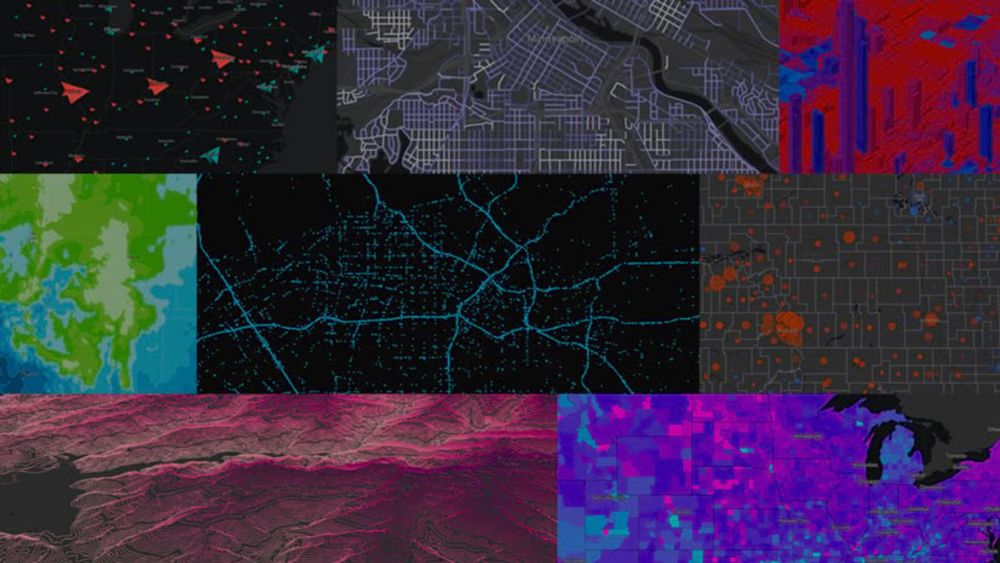
We work with a range of satellite imagery in MAGIC, allowing us to look at some beautiful areas of Antarctica!
Here's a few recent Sentinel and Landsat images (acquired Nov and Dec 2024, courtesy of Copernicus and USGS).
Can anyone name all of the locations or features? 🧊🎄
Here's a few recent Sentinel and Landsat images (acquired Nov and Dec 2024, courtesy of Copernicus and USGS).
Can anyone name all of the locations or features? 🧊🎄


December 23, 2024 at 10:55 AM
We work with a range of satellite imagery in MAGIC, allowing us to look at some beautiful areas of Antarctica!
Here's a few recent Sentinel and Landsat images (acquired Nov and Dec 2024, courtesy of Copernicus and USGS).
Can anyone name all of the locations or features? 🧊🎄
Here's a few recent Sentinel and Landsat images (acquired Nov and Dec 2024, courtesy of Copernicus and USGS).
Can anyone name all of the locations or features? 🧊🎄
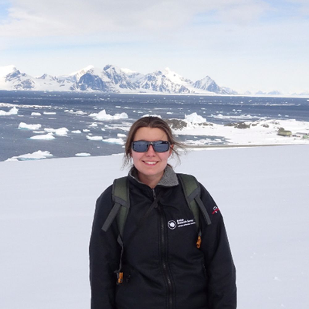
Hello! I'm a GIS and Mapping Specialist at @bas.ac.uk in the Mapping and Geographic Information Centre @magic.bas.ac.uk (or MAGIC for short 🪄)
You can learn more about what we do in this cool intro below 👇
You can learn more about what we do in this cool intro below 👇
Hello 👋
We are the Mapping and Geographic Information Centre (MAGIC) at the British Antarctic Survey.
We produce maps of the polar regions, survey wildlife colonies and our stations, and provide the latest sea ice information through custom platforms.
Here's a quick intro to our work!
1/5
We are the Mapping and Geographic Information Centre (MAGIC) at the British Antarctic Survey.
We produce maps of the polar regions, survey wildlife colonies and our stations, and provide the latest sea ice information through custom platforms.
Here's a quick intro to our work!
1/5

December 12, 2024 at 12:34 PM
Hello! I'm a GIS and Mapping Specialist at @bas.ac.uk in the Mapping and Geographic Information Centre @magic.bas.ac.uk (or MAGIC for short 🪄)
You can learn more about what we do in this cool intro below 👇
You can learn more about what we do in this cool intro below 👇