


Continental Divide Trail - CO
@cdtrail-co.bsky.social
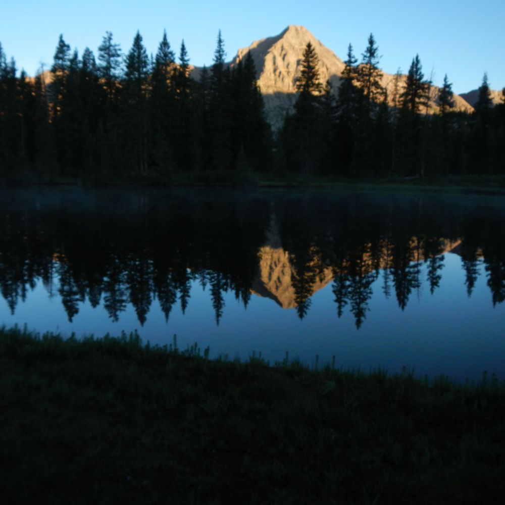
I have hiked the Colorado Trail and the Continental Divide Trail in Colorado. I have lived in Colorado since 1977 and have backpack to many alpine lakes whether there was a trail or not.
Pinned

For the duration of the next 4 years I will share the photos of my hike from Wyoming to New Mexico during the summers of 2012 to 2023. This we be a quiet respite from the day to day madness that I am confident will begin today.
The first picture is of me and my good friend Bill.
Your Welcome, Enjoy
The first picture is of me and my good friend Bill.
Your Welcome, Enjoy
Heading to the saddle just to the right of the post.

December 5, 2025 at 9:10 PM
Heading to the saddle just to the right of the post.
The southwest face of San Luis Peak. It is a gentle giant among 14ers, stuck in the middle of nowhere by itself.

December 4, 2025 at 2:37 PM
The southwest face of San Luis Peak. It is a gentle giant among 14ers, stuck in the middle of nowhere by itself.
As promised, the sliver of snow is crossed. Just strolling along at 12,000'. In the upper right is more forest land devastated by Spruce Beetles. With climate change comes warmer winter temperatures and less moisture, a recipe for Spruce Beetle population explosion.

December 3, 2025 at 4:06 PM
As promised, the sliver of snow is crossed. Just strolling along at 12,000'. In the upper right is more forest land devastated by Spruce Beetles. With climate change comes warmer winter temperatures and less moisture, a recipe for Spruce Beetle population explosion.
The view from the stadium seats. These Hoodoos are an iconic landmark in this section. But hoodoos are scattered around throughout the San Juan Mountains.

December 3, 2025 at 4:23 AM
The view from the stadium seats. These Hoodoos are an iconic landmark in this section. But hoodoos are scattered around throughout the San Juan Mountains.
Traversing at ~12,000' around the bowl clockwise, the trail will cross the sliver of snow and head to the saddle at the upper right. The saddle separates the east and west fingers of Spring Creek which in turn makes up Cebolla (Onion?) Creek then flows into the Gunnison River at Blue Mesa Reservoir.

December 1, 2025 at 4:27 PM
Traversing at ~12,000' around the bowl clockwise, the trail will cross the sliver of snow and head to the saddle at the upper right. The saddle separates the east and west fingers of Spring Creek which in turn makes up Cebolla (Onion?) Creek then flows into the Gunnison River at Blue Mesa Reservoir.
Picking up the trail again at the saddle and continuing into the La Garita Caldera. Looking south at the Divide the trail traverses around the bowl that is the head waters of Spring Creek.

December 1, 2025 at 4:30 AM
Picking up the trail again at the saddle and continuing into the La Garita Caldera. Looking south at the Divide the trail traverses around the bowl that is the head waters of Spring Creek.
A farewell bouquet, Old Man Of The Mountain (Hymenoxys grandiflora) proves that you can bloom where you're planted.

November 29, 2025 at 3:56 PM
A farewell bouquet, Old Man Of The Mountain (Hymenoxys grandiflora) proves that you can bloom where you're planted.
I just couldn't resist leaving my own marker at the top of San Luis Peak.

November 28, 2025 at 5:13 PM
I just couldn't resist leaving my own marker at the top of San Luis Peak.
View #7_ This is the last in the 360 degree views. Looking north west down the Spring Creek Valley.

November 26, 2025 at 4:38 PM
View #7_ This is the last in the 360 degree views. Looking north west down the Spring Creek Valley.
View #6_ Looking north at Stewart Peak (13983') on the right, Baldy Alto (13,698') right of center, Baldy Chato (13,401') left of center and Bondholder Creek Valley on the left. In the foreground are the two hikers heading back down the north ridge.

November 25, 2025 at 5:59 PM
View #6_ Looking north at Stewart Peak (13983') on the right, Baldy Alto (13,698') right of center, Baldy Chato (13,401') left of center and Bondholder Creek Valley on the left. In the foreground are the two hikers heading back down the north ridge.
View #5_ A better look to the east, looking down the Cochetopa Valley. Organ Mountain is on the left. Cochetopa Dome and Caldera are to the right of that. In the far distance is the Sangre De Cristo range. Crestone Peak (14,294') and Kit Carson Mountain (14,164') are seen at upper center.

November 24, 2025 at 4:33 PM
View #5_ A better look to the east, looking down the Cochetopa Valley. Organ Mountain is on the left. Cochetopa Dome and Caldera are to the right of that. In the far distance is the Sangre De Cristo range. Crestone Peak (14,294') and Kit Carson Mountain (14,164') are seen at upper center.
View#4_ Looking to the east at the summit point and the Cochetopa Valley. Two hikers summited coming up the north ridge. Organ Mountain (13,801') is to the left of the hiker wearing red.

November 23, 2025 at 3:30 PM
View#4_ Looking to the east at the summit point and the Cochetopa Valley. Two hikers summited coming up the north ridge. Organ Mountain (13,801') is to the left of the hiker wearing red.
View #3_ Looking south at the ridge line we climbed up. The point knob at the center sits on the Divide. Nelson Mountain (12,090') is in the upper left. The town of Creede is situated to the south of that.

November 22, 2025 at 7:26 PM
View #3_ Looking south at the ridge line we climbed up. The point knob at the center sits on the Divide. Nelson Mountain (12,090') is in the upper left. The town of Creede is situated to the south of that.
View #2_ Looking southwest at our general direction of travel.
It will be a series of traverses an saddle kissing and crosses. As we head to San Luis Pass.
It will be a series of traverses an saddle kissing and crosses. As we head to San Luis Pass.

November 21, 2025 at 4:05 PM
View #2_ Looking southwest at our general direction of travel.
It will be a series of traverses an saddle kissing and crosses. As we head to San Luis Pass.
It will be a series of traverses an saddle kissing and crosses. As we head to San Luis Pass.
View #1_ Looking west, in the far distance is Matterhorn Peak, Wetterhorn Peak, and Uncompahgre Peak. Mid-ground is the western end of the La Garita Wilderness.

November 20, 2025 at 8:50 PM
View #1_ Looking west, in the far distance is Matterhorn Peak, Wetterhorn Peak, and Uncompahgre Peak. Mid-ground is the western end of the La Garita Wilderness.
Made it to the top of San Luis Peak (14,014). Here is the proof. The thing that makes it special is that i sits all alone in the middle of nowhere. The next few posts are a 360 degree panorama from the summit.

November 20, 2025 at 5:23 AM
Made it to the top of San Luis Peak (14,014). Here is the proof. The thing that makes it special is that i sits all alone in the middle of nowhere. The next few posts are a 360 degree panorama from the summit.
50 steps and catch your breath, 50 steps and catch your breath, repeat until you reach the top. This is the last cairn before the summit. 50 steps and catch your breath.

November 18, 2025 at 4:00 PM
50 steps and catch your breath, 50 steps and catch your breath, repeat until you reach the top. This is the last cairn before the summit. 50 steps and catch your breath.
Probably the MOST creative cairn I have ever seen, so far. In the far distance is where we are heading.

November 17, 2025 at 4:02 PM
Probably the MOST creative cairn I have ever seen, so far. In the far distance is where we are heading.
If you are following you'll notice that I just can't pass a well built cairn without taking its photo.

November 16, 2025 at 7:25 PM
If you are following you'll notice that I just can't pass a well built cairn without taking its photo.
Part way up San Luis Peak looking down the Cochetopa Creek valley. The last campsite is down there in the willows someplace. Continental Divide ridge is on the right. East ridge line of San Luis Peak on the left.

November 15, 2025 at 6:18 PM
Part way up San Luis Peak looking down the Cochetopa Creek valley. The last campsite is down there in the willows someplace. Continental Divide ridge is on the right. East ridge line of San Luis Peak on the left.
Let's take a right turn and go up there.

November 14, 2025 at 8:27 PM
Let's take a right turn and go up there.
View to the west from the saddle. There is going the be a side excursion from here. I dropped the pack and headed up the south side of San Luis Peak

November 13, 2025 at 4:03 PM
View to the west from the saddle. There is going the be a side excursion from here. I dropped the pack and headed up the south side of San Luis Peak
Saddle up, on a bluebird sky day!!!

November 12, 2025 at 7:22 PM
Saddle up, on a bluebird sky day!!!
Just in case you were wondering what the headwaters of Cochetopa creek looked and sounded like. Enjoy!!
November 11, 2025 at 7:46 PM
Just in case you were wondering what the headwaters of Cochetopa creek looked and sounded like. Enjoy!!
More flowers please! Dusky Beardtongue (Penstemon whippleanus)

November 10, 2025 at 3:47 PM
More flowers please! Dusky Beardtongue (Penstemon whippleanus)