


Brian LaMarre
@blamarre.bsky.social
Chief Meteorologist | Founder of Inspire Weather, LLC. | National Weather Service (Retired) | Former Meteorologist-in-Charge, NWS Tampa, Florida.
InspireWeather.com
BDL ➡️ CRP ➡️ DCA ➡️ LBB ➡️ TPA
InspireWeather.com
BDL ➡️ CRP ➡️ DCA ➡️ LBB ➡️ TPA
📡🥶 Unusually cold air for November is on the way for much of Florida tonight into Tuesday morning.
It is always fascinating to see strong cold fronts push over the Gulf with stable, cold air overspreading the warmer, unstable air above the water.
It is always fascinating to see strong cold fronts push over the Gulf with stable, cold air overspreading the warmer, unstable air above the water.


November 10, 2025 at 6:27 PM
📡🥶 Unusually cold air for November is on the way for much of Florida tonight into Tuesday morning.
It is always fascinating to see strong cold fronts push over the Gulf with stable, cold air overspreading the warmer, unstable air above the water.
It is always fascinating to see strong cold fronts push over the Gulf with stable, cold air overspreading the warmer, unstable air above the water.
Innovative work by a team at the University of South Florida:
“A year after Helene and Milton, USF app is leading the way in flood tracking technology.”
📡🌀 📸
Video resource:
youtu.be/h4fjGbI-ZqI?...
Article:
www.stpetersburg.usf.edu/news/2025/a-...
“A year after Helene and Milton, USF app is leading the way in flood tracking technology.”
📡🌀 📸
Video resource:
youtu.be/h4fjGbI-ZqI?...
Article:
www.stpetersburg.usf.edu/news/2025/a-...


November 6, 2025 at 11:30 PM
Innovative work by a team at the University of South Florida:
“A year after Helene and Milton, USF app is leading the way in flood tracking technology.”
📡🌀 📸
Video resource:
youtu.be/h4fjGbI-ZqI?...
Article:
www.stpetersburg.usf.edu/news/2025/a-...
“A year after Helene and Milton, USF app is leading the way in flood tracking technology.”
📡🌀 📸
Video resource:
youtu.be/h4fjGbI-ZqI?...
Article:
www.stpetersburg.usf.edu/news/2025/a-...
West Central Florida Chapter of the American Meteorological Society (AMS) for our Fall meeting and dinner this evening. 📡⚡️🌀🌪️
It was awesome catching up with friends and colleagues and students interested in meteorology and broadening the understanding of the social impacts of weather and climate.
It was awesome catching up with friends and colleagues and students interested in meteorology and broadening the understanding of the social impacts of weather and climate.


November 6, 2025 at 3:10 AM
West Central Florida Chapter of the American Meteorological Society (AMS) for our Fall meeting and dinner this evening. 📡⚡️🌀🌪️
It was awesome catching up with friends and colleagues and students interested in meteorology and broadening the understanding of the social impacts of weather and climate.
It was awesome catching up with friends and colleagues and students interested in meteorology and broadening the understanding of the social impacts of weather and climate.
Impressive view of #hurricane #Melissa at landfall on #Jamaica today around 1 PM ET 28 October 2025, as viewed from the Sentinel-2 satellite. This polar orbiting satellite is operated by the European Space Agency with imagery taken from about 488 miles above Earth.
🛰️ 🌀
🛰️ 🌀


October 28, 2025 at 9:47 PM
Impressive view of #hurricane #Melissa at landfall on #Jamaica today around 1 PM ET 28 October 2025, as viewed from the Sentinel-2 satellite. This polar orbiting satellite is operated by the European Space Agency with imagery taken from about 488 miles above Earth.
🛰️ 🌀
🛰️ 🌀


When the sunrise reveals a category 5 #hurricane #Melissa located 135 miles southwest of #Kingston #Jamaica early this morning. Conditions will continue to severely worsen today with a devastating landfall tomorrow morning on Tuesday.
October 27, 2025 at 12:20 PM
When the sunrise reveals a category 5 #hurricane #Melissa located 135 miles southwest of #Kingston #Jamaica early this morning. Conditions will continue to severely worsen today with a devastating landfall tomorrow morning on Tuesday.


One year ago today on October 9, 2024, Hurricane Milton impacted Florida with storm surge, tornadoes, intense wind, inland flooding and widespread damage. These impacts came a couple of weeks after the extreme impacts from Hurricane Helene.
Detailed StoryMap:
storymaps.arcgis.com/stories/ca76...
Detailed StoryMap:
storymaps.arcgis.com/stories/ca76...
October 9, 2025 at 9:21 PM
One year ago today on October 9, 2024, Hurricane Milton impacted Florida with storm surge, tornadoes, intense wind, inland flooding and widespread damage. These impacts came a couple of weeks after the extreme impacts from Hurricane Helene.
Detailed StoryMap:
storymaps.arcgis.com/stories/ca76...
Detailed StoryMap:
storymaps.arcgis.com/stories/ca76...
Thanks to @hannahnatanson.bsky.social with @washingtonpost.com for the important story about the people of the National Weather Service and its public safety mission.
#weather #science
Article:
tinyurl.com/4tzt5xz4
#weather #science
Article:
tinyurl.com/4tzt5xz4


September 27, 2025 at 1:32 PM
Thanks to @hannahnatanson.bsky.social with @washingtonpost.com for the important story about the people of the National Weather Service and its public safety mission.
#weather #science
Article:
tinyurl.com/4tzt5xz4
#weather #science
Article:
tinyurl.com/4tzt5xz4
Gorgeous weather in Tampa this afternoon!


September 13, 2025 at 6:02 PM
Gorgeous weather in Tampa this afternoon!
Thanks to meteorologist Ian Oliver with @foxweather.bsky.social for interviewing with me about the current lull in hurricane activity in the Atlantic Basin and the potential for development in the tropics in the latter half of #hurricane season.
www.foxweather.com/watch/fmc-5f...
www.foxweather.com/watch/fmc-5f...


September 11, 2025 at 9:04 PM
Thanks to meteorologist Ian Oliver with @foxweather.bsky.social for interviewing with me about the current lull in hurricane activity in the Atlantic Basin and the potential for development in the tropics in the latter half of #hurricane season.
www.foxweather.com/watch/fmc-5f...
www.foxweather.com/watch/fmc-5f...
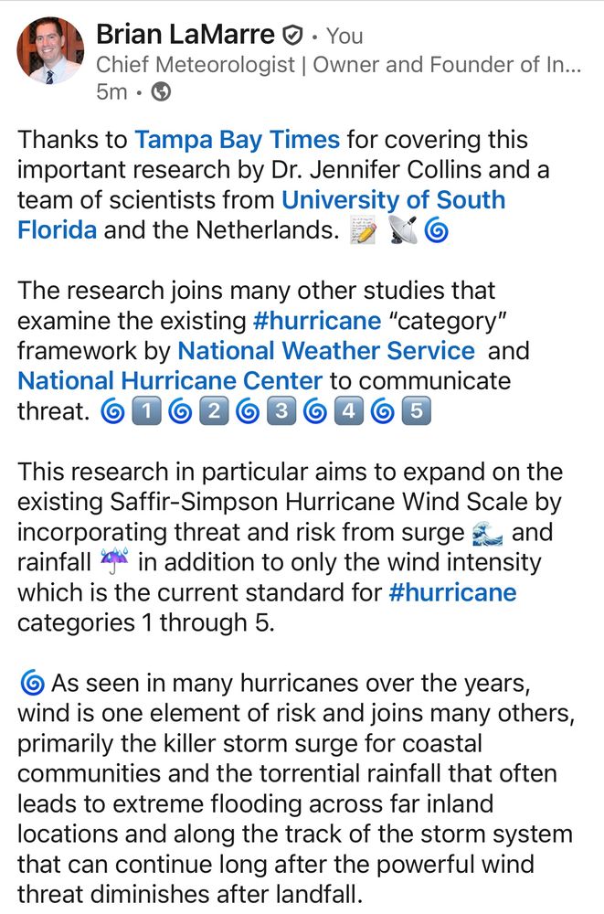
Thanks to Tampa Bay Times for covering this important research from the University of South Florida and the Netherlands. 📝 📡🌀
🌀The full, peer-reviewed scientific research study is also linked in the Tampa Bay Times article.
Article:
www.tampabay.com/hurricane/20...
🌀The full, peer-reviewed scientific research study is also linked in the Tampa Bay Times article.
Article:
www.tampabay.com/hurricane/20...


September 2, 2025 at 5:29 PM
Thanks to Tampa Bay Times for covering this important research from the University of South Florida and the Netherlands. 📝 📡🌀
🌀The full, peer-reviewed scientific research study is also linked in the Tampa Bay Times article.
Article:
www.tampabay.com/hurricane/20...
🌀The full, peer-reviewed scientific research study is also linked in the Tampa Bay Times article.
Article:
www.tampabay.com/hurricane/20...
Morning surface analyses 📝 from the NWS depict the surface low and the NWS NAM computer model output for the next 60 hours illustrates the lingering front and surface low pressure through Wednesday.
Is this how you start your Labor Day morning? 😎
#Science
#Weather
#Technology
#STEM
Is this how you start your Labor Day morning? 😎
#Science
#Weather
#Technology
#STEM


September 1, 2025 at 1:08 PM
Morning surface analyses 📝 from the NWS depict the surface low and the NWS NAM computer model output for the next 60 hours illustrates the lingering front and surface low pressure through Wednesday.
Is this how you start your Labor Day morning? 😎
#Science
#Weather
#Technology
#STEM
Is this how you start your Labor Day morning? 😎
#Science
#Weather
#Technology
#STEM
Similarly, the counterclockwise low pressure trough axis was seen forming in radar data from the NWS Tampa office on Sunday. 📡 🔄


September 1, 2025 at 1:08 PM
Similarly, the counterclockwise low pressure trough axis was seen forming in radar data from the NWS Tampa office on Sunday. 📡 🔄
A low pressure wave formed along this meandering front later Sunday just east of Orlando near Cape Canaveral 🚀, as evident in radar data from National Weather Service (NWS) Melbourne Weather Forecast Office.


September 1, 2025 at 1:08 PM
A low pressure wave formed along this meandering front later Sunday just east of Orlando near Cape Canaveral 🚀, as evident in radar data from National Weather Service (NWS) Melbourne Weather Forecast Office.
Interesting weather across Florida on this #LaborDay2025 📡⛈️🔄
A weak and nearly stationary front lingering over Florida for the last few days has provided beneficial rain ☔️ across the area.
A weak and nearly stationary front lingering over Florida for the last few days has provided beneficial rain ☔️ across the area.

September 1, 2025 at 1:08 PM
Interesting weather across Florida on this #LaborDay2025 📡⛈️🔄
A weak and nearly stationary front lingering over Florida for the last few days has provided beneficial rain ☔️ across the area.
A weak and nearly stationary front lingering over Florida for the last few days has provided beneficial rain ☔️ across the area.
2️⃣ Note the expansive area of vessel traffic avoiding hazards and steering around the powerful waves and wind from Erin. 🛳️🌀 #MarineTraffic #PublicSafety #science

August 22, 2025 at 5:18 PM
2️⃣ Note the expansive area of vessel traffic avoiding hazards and steering around the powerful waves and wind from Erin. 🛳️🌀 #MarineTraffic #PublicSafety #science
1️⃣ Noted on the static satellite image are two moisture channels ↗️ ↗️ being funneled into Erin as it transitions from a warm core hurricane to a colder core cyclone. 🌀⚡️


August 22, 2025 at 5:18 PM
1️⃣ Noted on the static satellite image are two moisture channels ↗️ ↗️ being funneled into Erin as it transitions from a warm core hurricane to a colder core cyclone. 🌀⚡️
A rainy day across Florida, as pulses of energy pass over the state within a deep, moist southwest flow across the Gulf and into the western Atlantic. This flow is feeding into the massive circulation of #HurricaneErin, as seen in satellite 🛰️ water vapor imagery and radar data from NWS Tampa. 📡⛈️

August 22, 2025 at 5:18 PM
A rainy day across Florida, as pulses of energy pass over the state within a deep, moist southwest flow across the Gulf and into the western Atlantic. This flow is feeding into the massive circulation of #HurricaneErin, as seen in satellite 🛰️ water vapor imagery and radar data from NWS Tampa. 📡⛈️
Impressive to see the void of vessel traffic tonight in the vicinity of #HurricaneErin - thanks to the pre-planning and coordination between the weather and marine navigation experts. #MarineSafety #HurricaneSeason #science #technology
August 18, 2025 at 12:34 AM
Impressive to see the void of vessel traffic tonight in the vicinity of #HurricaneErin - thanks to the pre-planning and coordination between the weather and marine navigation experts. #MarineSafety #HurricaneSeason #science #technology
Thanks to the USAToday for the interview about #HurricaneErin and the important collaboration between weather and ocean experts to keep mariners safe in navigating open oceans to steer clear from the hazards produced by tropical cyclones.
Story: www.usatoday.com/story/news/n...
Story: www.usatoday.com/story/news/n...


August 17, 2025 at 9:44 PM
Thanks to the USAToday for the interview about #HurricaneErin and the important collaboration between weather and ocean experts to keep mariners safe in navigating open oceans to steer clear from the hazards produced by tropical cyclones.
Story: www.usatoday.com/story/news/n...
Story: www.usatoday.com/story/news/n...
📡🌀 🛰️
#HurricaneErin undergoing an eyewall replacement cycle (ERC). Radar animation from around 3:20 AM ET to 8:20 AM ET from the vantage point of National Weather Service San Juan Forecast Office this Sunday morning, 17 August 2025. I placed the ⚫️ at the eyeball center at the start of the loop.
#HurricaneErin undergoing an eyewall replacement cycle (ERC). Radar animation from around 3:20 AM ET to 8:20 AM ET from the vantage point of National Weather Service San Juan Forecast Office this Sunday morning, 17 August 2025. I placed the ⚫️ at the eyeball center at the start of the loop.


August 17, 2025 at 12:56 PM
📡🌀 🛰️
#HurricaneErin undergoing an eyewall replacement cycle (ERC). Radar animation from around 3:20 AM ET to 8:20 AM ET from the vantage point of National Weather Service San Juan Forecast Office this Sunday morning, 17 August 2025. I placed the ⚫️ at the eyeball center at the start of the loop.
#HurricaneErin undergoing an eyewall replacement cycle (ERC). Radar animation from around 3:20 AM ET to 8:20 AM ET from the vantage point of National Weather Service San Juan Forecast Office this Sunday morning, 17 August 2025. I placed the ⚫️ at the eyeball center at the start of the loop.
📡🌀After an early morning jog to the west and southwest, #HurricaneErin is now back on a west and northwest track. I placed the line on the northern eyewall around 9:15 AM ET and the loop ends around 1:15 PM ET from the NWS San Juan radar.

August 16, 2025 at 5:28 PM
📡🌀After an early morning jog to the west and southwest, #HurricaneErin is now back on a west and northwest track. I placed the line on the northern eyewall around 9:15 AM ET and the loop ends around 1:15 PM ET from the NWS San Juan radar.
Science and Education: 📡🌪️⛈️⚡️
Part 1: A first look at the next generation of weather radar:
abc13.com/post/new-rad...
Part 2: How history shaped the next generation weather radar:
abc13.com/post/13-how-...
Part 3: The timeline and future of phased array radar technology.
abc13.com/post/13-time...
Part 1: A first look at the next generation of weather radar:
abc13.com/post/new-rad...
Part 2: How history shaped the next generation weather radar:
abc13.com/post/13-how-...
Part 3: The timeline and future of phased array radar technology.
abc13.com/post/13-time...


August 9, 2025 at 1:58 PM
Science and Education: 📡🌪️⛈️⚡️
Part 1: A first look at the next generation of weather radar:
abc13.com/post/new-rad...
Part 2: How history shaped the next generation weather radar:
abc13.com/post/13-how-...
Part 3: The timeline and future of phased array radar technology.
abc13.com/post/13-time...
Part 1: A first look at the next generation of weather radar:
abc13.com/post/new-rad...
Part 2: How history shaped the next generation weather radar:
abc13.com/post/13-how-...
Part 3: The timeline and future of phased array radar technology.
abc13.com/post/13-time...