


Brooks Groves
@bdgroves.bsky.social
🏠 GIS @ Zillow | Advancing real estate geospatial mapping.
🌍 Enthusiast of spatial sciences and their applications in:
#GIS | #Cartography | #Meteorology | #Hydrology | #Ecology | #Nature🔬 Exploring the intersections of geospatial analysis, environment
🌍 Enthusiast of spatial sciences and their applications in:
#GIS | #Cartography | #Meteorology | #Hydrology | #Ecology | #Nature🔬 Exploring the intersections of geospatial analysis, environment
Just setting up my first OSF Project. #Desert EcoStats. Plan to make this my work area for sharing my learnings with geospatial ecology statistics, etc., with a desert ecosystems vibe. Think I have it structured well. Take a look: osf.io/q8zkd/ #Science #rstats
#Biogeography #EnvSci #GISchat
#Biogeography #EnvSci #GISchat

Desert EcoStats
Welcome! This project is a learning lab and code collection for applying ecological statistics and spatial analysis to desert ecosystems. It includes small, focused projects using R, Python, QGIS, and...
osf.io
May 7, 2025 at 7:39 PM
Just setting up my first OSF Project. #Desert EcoStats. Plan to make this my work area for sharing my learnings with geospatial ecology statistics, etc., with a desert ecosystems vibe. Think I have it structured well. Take a look: osf.io/q8zkd/ #Science #rstats
#Biogeography #EnvSci #GISchat
#Biogeography #EnvSci #GISchat
More great projects to get into. Thanks for sharing @milos-makes-maps.bsky.social #GISchat

🗺️ 5 GIS Project Ideas You Must Try in 2025 🗺️
Looking to level up your GIS skills and tackle real-world challenges? I’ve got you covered in my new video 👇🏻
youtu.be/1CKzDxEievg
Here’s what’s covered: 👇🏻 (1/7)
Looking to level up your GIS skills and tackle real-world challenges? I’ve got you covered in my new video 👇🏻
youtu.be/1CKzDxEievg
Here’s what’s covered: 👇🏻 (1/7)

5 Amazing GIS Project Ideas You Must Try in 2025!
YouTube video by Milos Makes Maps
youtu.be
January 6, 2025 at 5:15 PM
More great projects to get into. Thanks for sharing @milos-makes-maps.bsky.social #GISchat
Reposted by Brooks Groves

Welcome to my cartographic tour of France, with #LiDAR #mapping ! It starts from Paris here:
➡️ jgaffuri.github.io/CartoHD_webm...
#cartography #gis #gischat #map #maps #dataviz #datavis
➡️ jgaffuri.github.io/CartoHD_webm...
#cartography #gis #gischat #map #maps #dataviz #datavis
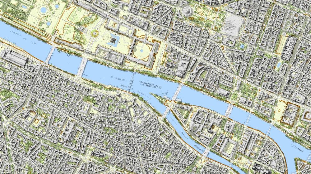
January 5, 2025 at 8:09 PM
Welcome to my cartographic tour of France, with #LiDAR #mapping ! It starts from Paris here:
➡️ jgaffuri.github.io/CartoHD_webm...
#cartography #gis #gischat #map #maps #dataviz #datavis
➡️ jgaffuri.github.io/CartoHD_webm...
#cartography #gis #gischat #map #maps #dataviz #datavis
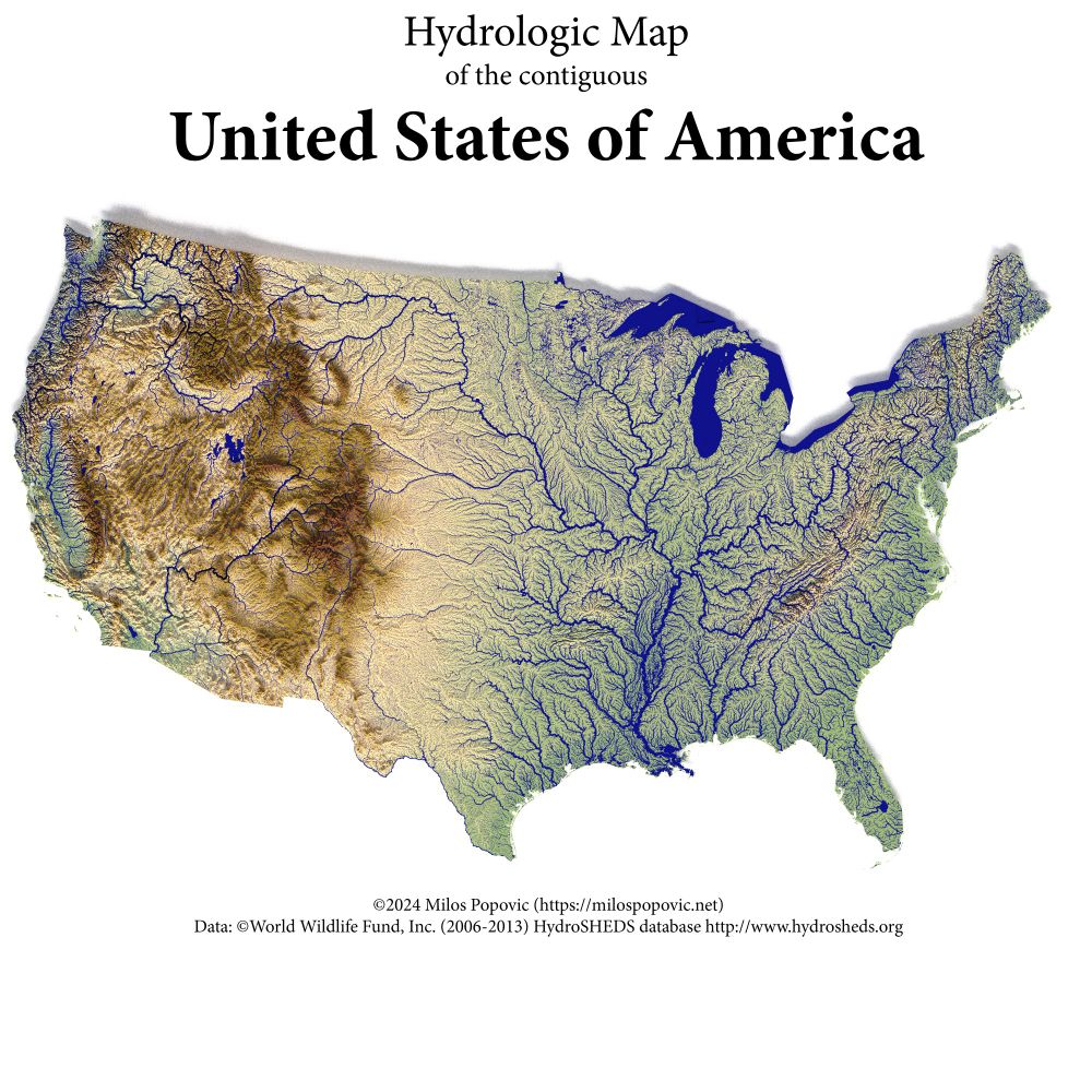
Great tutorials to make some awesome maps!!
🌍 10 Ways to Bring Your Data to Life with 3D Maps
Maps are no longer just flat visuals. With the right tools & data, you can create 3D maps that turn complex datasets into captivating stories.
Here are 10 types of 3D maps you can create, the data sources you'll need, and tutorials to get started ⬇️
Maps are no longer just flat visuals. With the right tools & data, you can create 3D maps that turn complex datasets into captivating stories.
Here are 10 types of 3D maps you can create, the data sources you'll need, and tutorials to get started ⬇️
December 22, 2024 at 4:44 PM
Great tutorials to make some awesome maps!!
Wow, I had been listining to this program more or less since then … seems like only yesterday!! on.soundcloud.com/eHMzKkCdQAR4...

The First Episode of Afropop Worldwide!
Afropop's first visit to South Africa, just a year after Graceland won the Grammy Award, was eye-opening. Groups like Mahlathini and the Mahotella Queens, Lucky Dube, and Ladysmith Black Mambazo were
on.soundcloud.com
December 22, 2024 at 4:41 PM
Wow, I had been listining to this program more or less since then … seems like only yesterday!! on.soundcloud.com/eHMzKkCdQAR4...
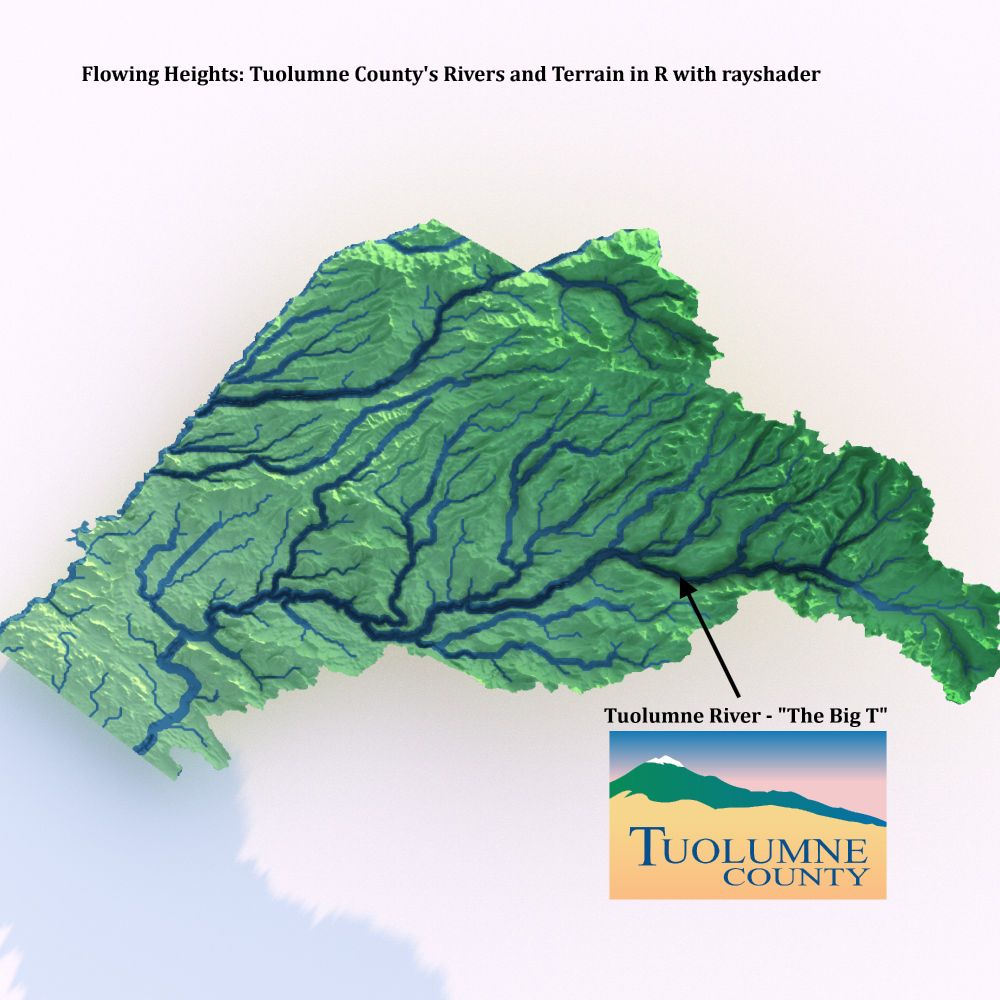
Flowing Heights: Tuolumne County's Rivers and Terrain in R with rayshader 🌊⛰️
Huge thanks to @milos-makes-maps.bsky.social for the tutorial that made this visualization possible! Proud to showcase the natural beauty of @VisitTuolumneCo. #Rayshader #DataViz #TuolumneCounty #CaliforniaNature
Huge thanks to @milos-makes-maps.bsky.social for the tutorial that made this visualization possible! Proud to showcase the natural beauty of @VisitTuolumneCo. #Rayshader #DataViz #TuolumneCounty #CaliforniaNature
December 13, 2024 at 11:23 PM
Flowing Heights: Tuolumne County's Rivers and Terrain in R with rayshader 🌊⛰️
Huge thanks to @milos-makes-maps.bsky.social for the tutorial that made this visualization possible! Proud to showcase the natural beauty of @VisitTuolumneCo. #Rayshader #DataViz #TuolumneCounty #CaliforniaNature
Huge thanks to @milos-makes-maps.bsky.social for the tutorial that made this visualization possible! Proud to showcase the natural beauty of @VisitTuolumneCo. #Rayshader #DataViz #TuolumneCounty #CaliforniaNature
Thrilled to share my review of A Draught of the South Land by Paul Moon in Cartographic Perspectives #105 (coming soon)! A fascinating look at historical cartography & exploration. 🌍🗺️
GIS & map enthusiasts, stay tuned! #GISchat #GIS #NZ
🔗 tinyurl.com/2zc4xxty
GIS & map enthusiasts, stay tuned! #GISchat #GIS #NZ
🔗 tinyurl.com/2zc4xxty
View of Review of A Draught of the South Land: Mapping New Zealand from Tasman to Cook
tinyurl.com
December 11, 2024 at 5:07 PM
Thrilled to share my review of A Draught of the South Land by Paul Moon in Cartographic Perspectives #105 (coming soon)! A fascinating look at historical cartography & exploration. 🌍🗺️
GIS & map enthusiasts, stay tuned! #GISchat #GIS #NZ
🔗 tinyurl.com/2zc4xxty
GIS & map enthusiasts, stay tuned! #GISchat #GIS #NZ
🔗 tinyurl.com/2zc4xxty
Reposted by Brooks Groves

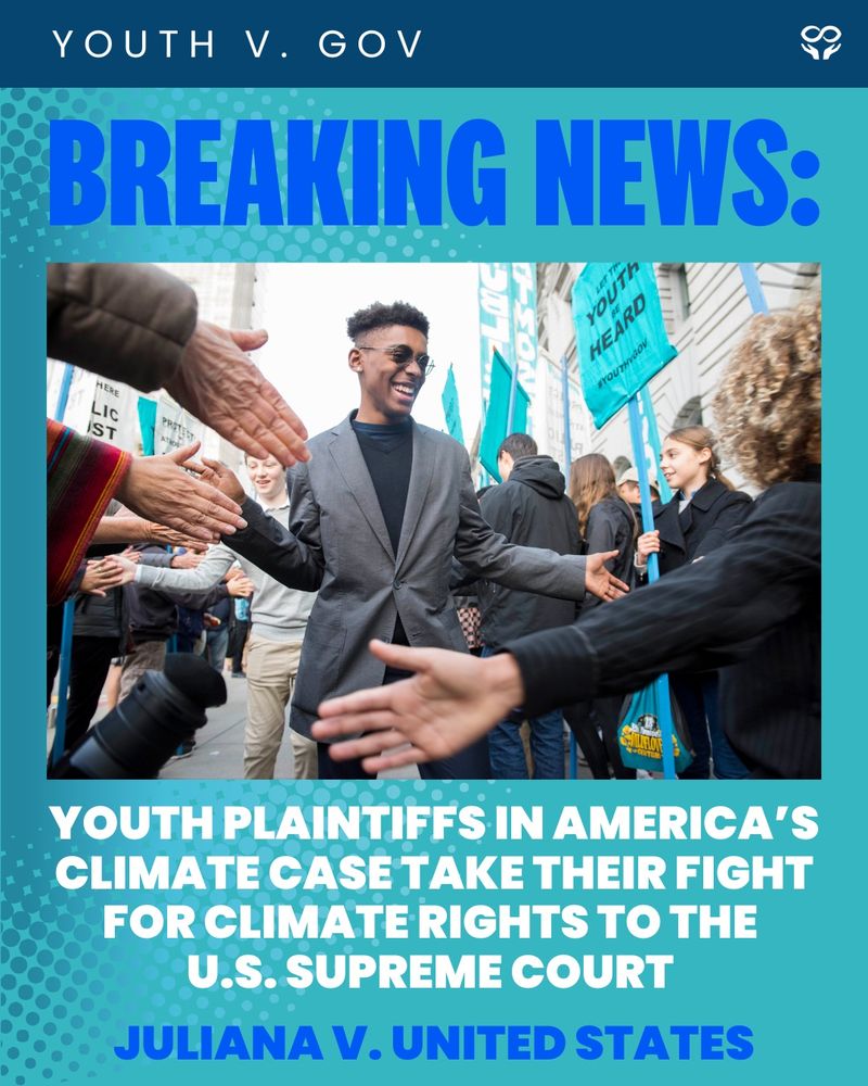
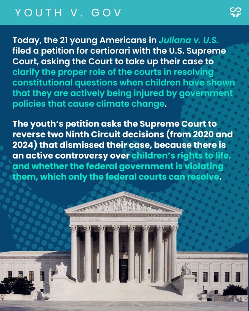
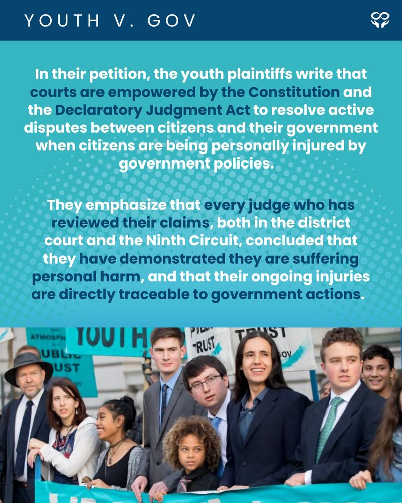
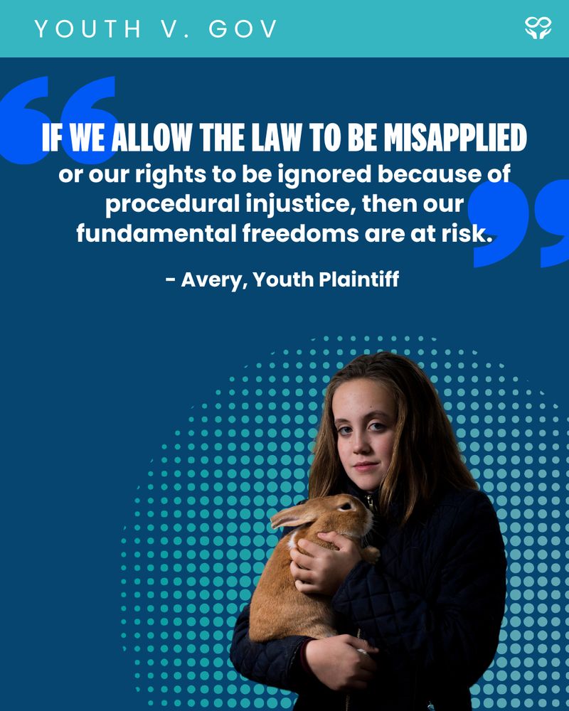
The Juliana 21 have fought their own government long enough. It’s time for SCOTUS to clarify the role of the courts and LET THE YOUTH BE HEARD! #YouthvGov #SaveJuliana
December 9, 2024 at 10:43 PM
The Juliana 21 have fought their own government long enough. It’s time for SCOTUS to clarify the role of the courts and LET THE YOUTH BE HEARD! #YouthvGov #SaveJuliana
Nice blog on using R and {tidycensus} to Map water insecurity. waterdata.usgs.gov/blog/acs-maps/
Mapping water insecurity in R with tidycensus
Using the `tidycensus` package to access and visualize American Community Survey (ACS) data.
waterdata.usgs.gov
December 9, 2024 at 8:55 PM
Nice blog on using R and {tidycensus} to Map water insecurity. waterdata.usgs.gov/blog/acs-maps/
@geo-coe.bsky.social work is always so inspiring!!
New #lidar images of the #Enchantments for the Washington Geological Survey. #PNW #Maps #CascadeRange

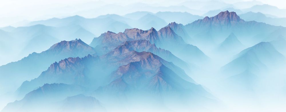
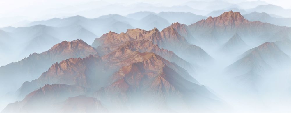
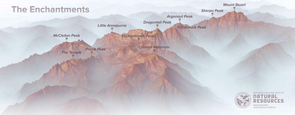
December 8, 2024 at 9:16 PM
@geo-coe.bsky.social work is always so inspiring!!
Day 30: The Final Map! 🐍 Rattlesnake venom lectin (1muq), a galactose-specific C-type lectin, visualized in 3D. Went deep into micromapping, and it paid off! Big thanks to
& the {raymolecule} R package. #30DayMapChallenge #Micromapping 🧬✨
& the {raymolecule} R package. #30DayMapChallenge #Micromapping 🧬✨
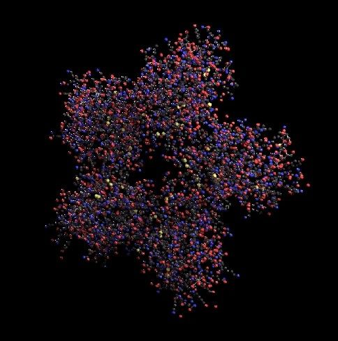
December 7, 2024 at 12:27 AM
Day 30: The Final Map! 🐍 Rattlesnake venom lectin (1muq), a galactose-specific C-type lectin, visualized in 3D. Went deep into micromapping, and it paid off! Big thanks to
& the {raymolecule} R package. #30DayMapChallenge #Micromapping 🧬✨
& the {raymolecule} R package. #30DayMapChallenge #Micromapping 🧬✨
My home county! Tuolumne County, California! Made this with R, to show the elevation ... all the way up to the High Sierra! #rstats, #GIS, #California
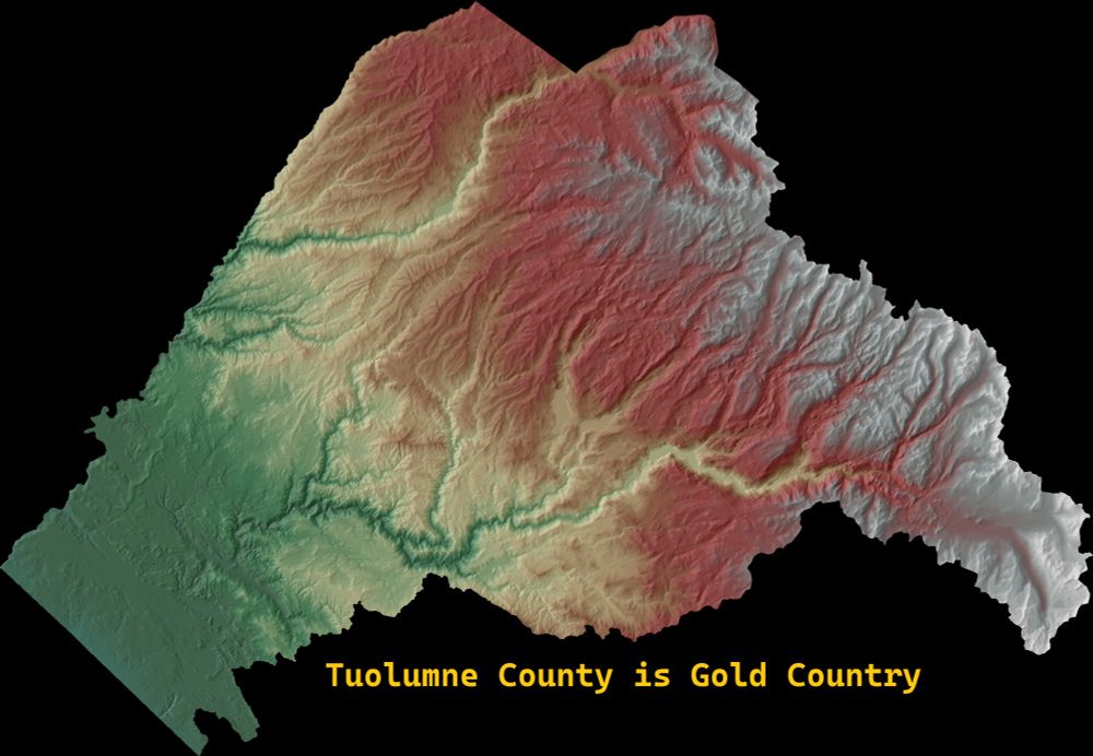
December 7, 2024 at 12:10 AM
My home county! Tuolumne County, California! Made this with R, to show the elevation ... all the way up to the High Sierra! #rstats, #GIS, #California