


Urban Headwaters
@urbanheadwaters.com
Urban Headwaters is dedicated to exploring the urban rivers and creeks of the Greater Toronto Area & attempting to walk from the headwaters to the lakeshore. Come along on our journey!
www.youtube.com/@urbanheadwaters
www.youtube.com/@urbanheadwaters
Today I continued my exploration of the East Don, this between Lawrence and Eglinton. The good news is that there is trail all the way, although the south part is pretty basic. www.strava.com/activities/1...

East Don River from Lawrence to Eglinton | Strava
View Scott W's walk on November 8, 2025 | Strava
www.strava.com
November 9, 2025 at 12:47 AM
Today I continued my exploration of the East Don, this between Lawrence and Eglinton. The good news is that there is trail all the way, although the south part is pretty basic. www.strava.com/activities/1...
Walking south from Charles Sauriol Park


November 8, 2025 at 8:43 PM
Walking south from Charles Sauriol Park


Glen Sheilds and Dufferin. 12.5 km. Done for the day.
November 2, 2025 at 6:14 PM
Glen Sheilds and Dufferin. 12.5 km. Done for the day.
Highway 407 bridge over the West Don:

November 2, 2025 at 5:49 PM
Highway 407 bridge over the West Don:
I lied. That was not Rivermede. NOW I am at Rivermede and 7.
9.96 kms from Mackenzie Glen.
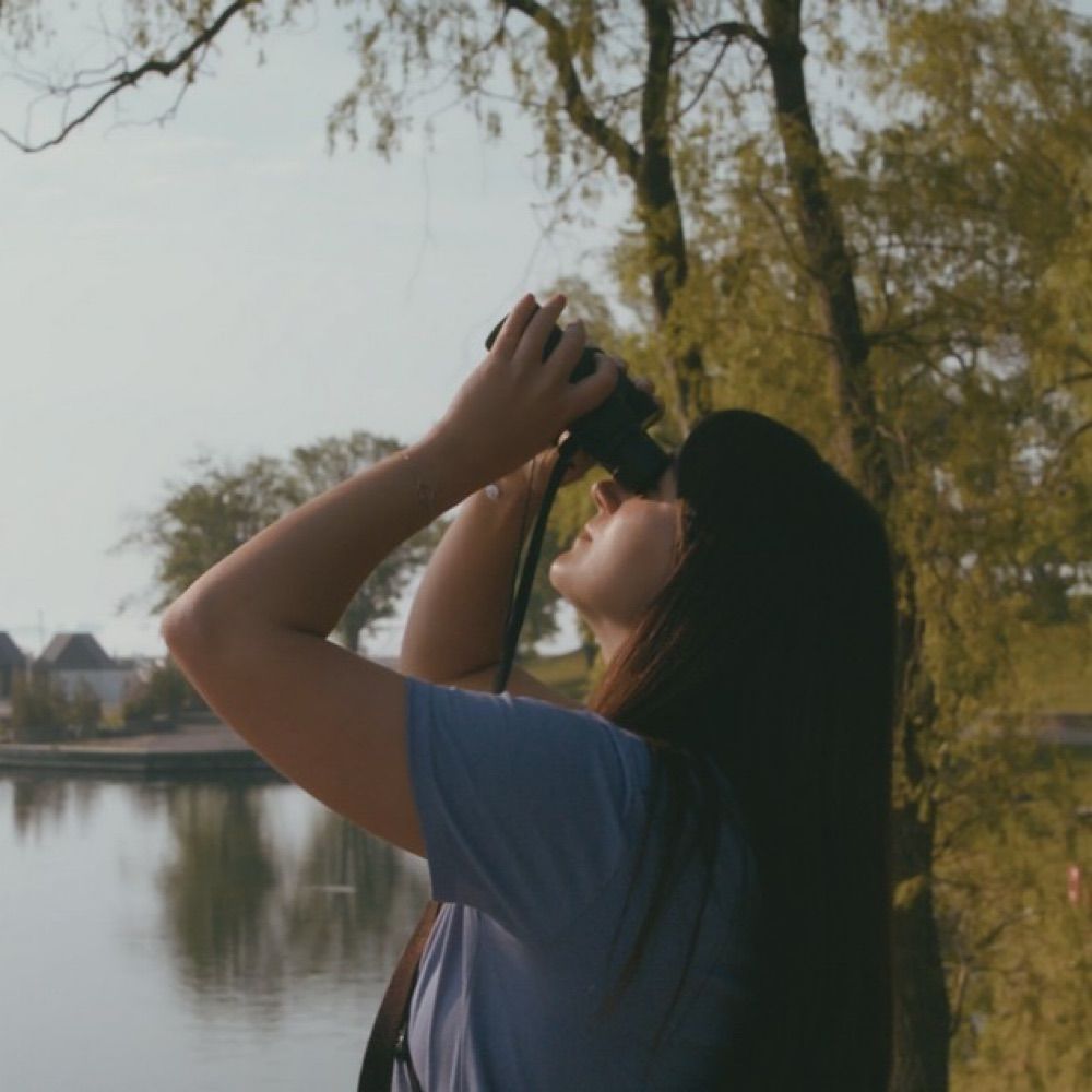
Here’s a pretty pic to make up for it.
9.96 kms from Mackenzie Glen.
Here’s a pretty pic to make up for it.

November 2, 2025 at 5:38 PM
I lied. That was not Rivermede. NOW I am at Rivermede and 7.
9.96 kms from Mackenzie Glen.
Here’s a pretty pic to make up for it.
9.96 kms from Mackenzie Glen.
Here’s a pretty pic to make up for it.
At Highway 7 & North Rivermede. End of Leg 1. Exactly 9.0 kms from Mackenzie Glen Park. Pressing on.
November 2, 2025 at 5:20 PM
At Highway 7 & North Rivermede. End of Leg 1. Exactly 9.0 kms from Mackenzie Glen Park. Pressing on.
Urban explorers must be prepared to forage for food when the opportunity presents!

November 2, 2025 at 3:57 PM
Urban explorers must be prepared to forage for food when the opportunity presents!
Ok, it’s a beautiful day, and I’m walking the West Don. Started at Mackenzie Glen park. At Rutherford now.
November 2, 2025 at 3:40 PM
Ok, it’s a beautiful day, and I’m walking the West Don. Started at Mackenzie Glen park. At Rutherford now.
East Don River Valley, south of Don Mills.

November 2, 2025 at 1:42 AM
East Don River Valley, south of Don Mills.
Looking south over the East Don River on Donalda Golf Course.

November 2, 2025 at 1:21 AM
Looking south over the East Don River on Donalda Golf Course.
I can definitely state that there is a pathway between Charles Sauriol Park and the south end of the Donalda Golf Course. strava.app.link/7OGCgdkUWXb
strava.app.link
November 1, 2025 at 8:04 PM
I can definitely state that there is a pathway between Charles Sauriol Park and the south end of the Donalda Golf Course. strava.app.link/7OGCgdkUWXb
Looking for paths south from Don Mills, and I spotted these two boys up on the roof of a public school, retrieving their ball. I guessed that any boys who would climb up on a school roof would know about secret trails, and they did!

November 1, 2025 at 7:59 PM
Looking for paths south from Don Mills, and I spotted these two boys up on the roof of a public school, retrieving their ball. I guessed that any boys who would climb up on a school roof would know about secret trails, and they did!
Out exploring the next leg of the East Don. Will have lots of updates tonight but here I am at the DVP and Lawrence. This is looking west.

November 1, 2025 at 7:04 PM
Out exploring the next leg of the East Don. Will have lots of updates tonight but here I am at the DVP and Lawrence. This is looking west.
OK THIS IS CRAZY COOL!
I have been doing some experiments with my #insta360 camera and Google Maps, and I can announce that I have just successfully published a set of Google TrailView images! On the real Google Maps!
Go to www.google.com/maps/@43.860... , drag and drop the Streetview guy and...
I have been doing some experiments with my #insta360 camera and Google Maps, and I can announce that I have just successfully published a set of Google TrailView images! On the real Google Maps!
Go to www.google.com/maps/@43.860... , drag and drop the Streetview guy and...

www.google.com
October 31, 2025 at 1:42 AM
OK THIS IS CRAZY COOL!
I have been doing some experiments with my #insta360 camera and Google Maps, and I can announce that I have just successfully published a set of Google TrailView images! On the real Google Maps!
Go to www.google.com/maps/@43.860... , drag and drop the Streetview guy and...
I have been doing some experiments with my #insta360 camera and Google Maps, and I can announce that I have just successfully published a set of Google TrailView images! On the real Google Maps!
Go to www.google.com/maps/@43.860... , drag and drop the Streetview guy and...
Hey peeps -- looking for advice on the next phase of my East Don walk, going south from Sheppard and Leslie. Somebody (maybe @torontoboris.bsky.social ?) mentioned that the 401 underpass was closed, can anyone confirm?
And after that, what is the closest I can stay to the river?
And after that, what is the closest I can stay to the river?

October 29, 2025 at 10:15 PM
Hey peeps -- looking for advice on the next phase of my East Don walk, going south from Sheppard and Leslie. Somebody (maybe @torontoboris.bsky.social ?) mentioned that the 401 underpass was closed, can anyone confirm?
And after that, what is the closest I can stay to the river?
And after that, what is the closest I can stay to the river?
Working on the East Don Leg 2, from Rutherford to Yonge. This is about 200 metres south of the 407.


October 26, 2025 at 3:12 PM
Working on the East Don Leg 2, from Rutherford to Yonge. This is about 200 metres south of the 407.
I went out today and explored the East Don route between Major Mackenzie Drive and Thornhill (Yonge south of Highway 7). So far it's looking promising, the next step is to walk it. Hopefully the weather will be good tomorrow. youtu.be/FC-evOZy4ZE

2025-10-25 East Don Leg 2
YouTube video by urbanheadwaters
youtu.be
October 26, 2025 at 3:33 AM
I went out today and explored the East Don route between Major Mackenzie Drive and Thornhill (Yonge south of Highway 7). So far it's looking promising, the next step is to walk it. Hopefully the weather will be good tomorrow. youtu.be/FC-evOZy4ZE
Having fun with my new-to-me iPhone14 (tell me I’m not the only one who gets my kid’s castoffs?)

October 25, 2025 at 6:53 PM
Having fun with my new-to-me iPhone14 (tell me I’m not the only one who gets my kid’s castoffs?)
Beautiful fall morning in the West Don headwaters.


October 25, 2025 at 3:49 PM
Beautiful fall morning in the West Don headwaters.
On Sunday, I did the first leg of the East Don. Check it out: www.youtube.com/watch?v=_17D...

East Don Leg 1 Stroll
YouTube video by urbanheadwaters
www.youtube.com
October 22, 2025 at 12:40 AM
On Sunday, I did the first leg of the East Don. Check it out: www.youtube.com/watch?v=_17D...
Today, for a change, I went poking around the headwaters of the East Don river. Amazingly, the East Don headwaters are only about a km from the West Don. Looks like there is a pretty good route down to Rutherford. www.youtube.com/watch?v=fSMo...

2025-10-18 East Don Leg 1 Explorations
YouTube video by urbanheadwaters
www.youtube.com
October 18, 2025 at 10:36 PM
Today, for a change, I went poking around the headwaters of the East Don river. Amazingly, the East Don headwaters are only about a km from the West Don. Looks like there is a pretty good route down to Rutherford. www.youtube.com/watch?v=fSMo...
Also @metroscapes.ca I am doing some experimentation with an Insta360 camera, and potentially even publishing the trail walks as user-generated content on Google Maps. If you have any other ideas on how best to document trails I would be all ears.
October 17, 2025 at 7:13 PM
Also @metroscapes.ca I am doing some experimentation with an Insta360 camera, and potentially even publishing the trail walks as user-generated content on Google Maps. If you have any other ideas on how best to document trails I would be all ears.
Hey @metroscapes.ca may I ask what application you were using for route planning? I love that it shows property lines, which are missing from Strava and AllTrails.

October 17, 2025 at 7:11 PM
Hey @metroscapes.ca may I ask what application you were using for route planning? I love that it shows property lines, which are missing from Strava and AllTrails.
This is a bit of a random rabbit hole, but as I have been exploring Toronto rivers I’ve been thinking of how to document what I find.
I’m sort of thinking that in a perfect world, I could generate something like Google Street View, but for trails. Stay tuned!
I’m sort of thinking that in a perfect world, I could generate something like Google Street View, but for trails. Stay tuned!
October 14, 2025 at 5:59 PM
This is a bit of a random rabbit hole, but as I have been exploring Toronto rivers I’ve been thinking of how to document what I find.
I’m sort of thinking that in a perfect world, I could generate something like Google Street View, but for trails. Stay tuned!
I’m sort of thinking that in a perfect world, I could generate something like Google Street View, but for trails. Stay tuned!