


Transit 4 Detroit
@transit4detroit.bsky.social
Metro Detroit Map Maker
www.instagram.com/transit4detroit
www.instagram.com/transit4detroit
Historical Etymology of Michigan’s Counties

October 10, 2025 at 9:01 PM
Historical Etymology of Michigan’s Counties
What US built car brand is local to you?
Voronoi cell diagrams showing the closest auto plants to any point in the lower 48
Voronoi cell diagrams showing the closest auto plants to any point in the lower 48


October 5, 2025 at 7:50 PM
What US built car brand is local to you?
Voronoi cell diagrams showing the closest auto plants to any point in the lower 48
Voronoi cell diagrams showing the closest auto plants to any point in the lower 48
Voronoi cell diagrams showing the closest schools in Rochester Community School District. 4th image is a sidewalk and trails walkability map for each elementary school


October 4, 2025 at 5:19 PM
Voronoi cell diagrams showing the closest schools in Rochester Community School District. 4th image is a sidewalk and trails walkability map for each elementary school
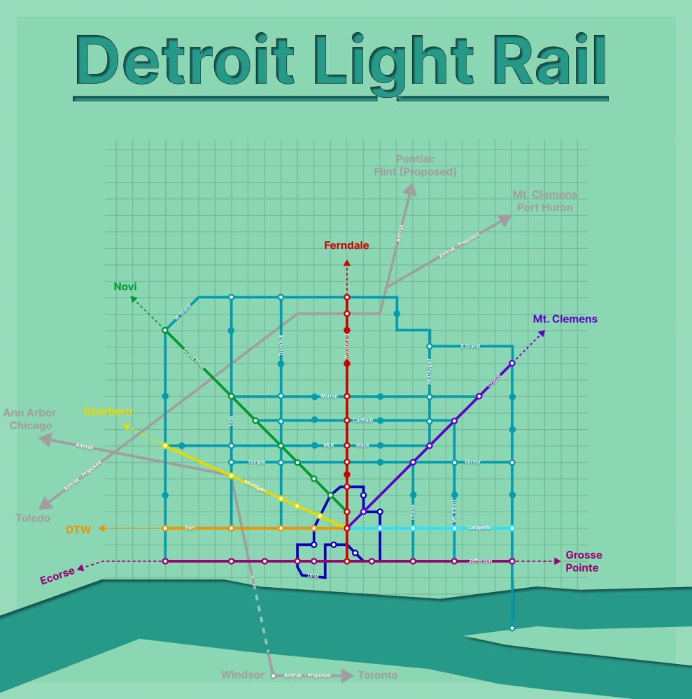
Detroit Light Rail System Concept
October 1, 2025 at 9:35 PM
Detroit Light Rail System Concept
What if Detroit and New York City traded parks?


September 30, 2025 at 2:39 PM
What if Detroit and New York City traded parks?
Metro Detroit’s “_ Mile” Roads

December 4, 2024 at 9:49 PM
Metro Detroit’s “_ Mile” Roads