


Sarah Bell
@sarahbell.bsky.social
Cartography. Geo-visualization. Geo-Scientist. @Esri.
Keynote speaker and Rock climber 🧗
Previous: National Park Service
Keynote speaker and Rock climber 🧗
Previous: National Park Service
Rather than take this torn bicep tendon injury as a sign that I should quit climbing, I’m going to let it inspire me to set MUCH higher climbing goals… after 6-8 weeks of recovery 💪
November 8, 2025 at 1:46 AM
Rather than take this torn bicep tendon injury as a sign that I should quit climbing, I’m going to let it inspire me to set MUCH higher climbing goals… after 6-8 weeks of recovery 💪
#30daymapchallenge Day 4. My Data
One year ago today we said goodbye to Jasperdog. I drew this hillshade of Goat Mtn in memory of a special hike w/my pup. I plan to complete the map soon. The other photo is the actual hike. One year and still missing him so much 🐾
One year ago today we said goodbye to Jasperdog. I drew this hillshade of Goat Mtn in memory of a special hike w/my pup. I plan to complete the map soon. The other photo is the actual hike. One year and still missing him so much 🐾


November 4, 2025 at 5:28 PM
#30daymapchallenge Day 4. My Data
One year ago today we said goodbye to Jasperdog. I drew this hillshade of Goat Mtn in memory of a special hike w/my pup. I plan to complete the map soon. The other photo is the actual hike. One year and still missing him so much 🐾
One year ago today we said goodbye to Jasperdog. I drew this hillshade of Goat Mtn in memory of a special hike w/my pup. I plan to complete the map soon. The other photo is the actual hike. One year and still missing him so much 🐾
#30DayMapChallenge Day 3: Polygons
Not a lot of time for this one today. Mexico and surrounding geography with an early mid-century modern twist. 🌎
Not a lot of time for this one today. Mexico and surrounding geography with an early mid-century modern twist. 🌎

November 3, 2025 at 2:58 PM
#30DayMapChallenge Day 3: Polygons
Not a lot of time for this one today. Mexico and surrounding geography with an early mid-century modern twist. 🌎
Not a lot of time for this one today. Mexico and surrounding geography with an early mid-century modern twist. 🌎
Serendipitously, I flew from east coast time zone to the pacific on the eve of setting our clocks back. I landed at 3:00am body clock time. That extra hour of sleep was wonderful. Kentucky was fantastic! Cartography conference, climbing, hanging w friends & working. Glad to be back in the PNW 🌲


November 2, 2025 at 9:19 PM
Serendipitously, I flew from east coast time zone to the pacific on the eve of setting our clocks back. I landed at 3:00am body clock time. That extra hour of sleep was wonderful. Kentucky was fantastic! Cartography conference, climbing, hanging w friends & working. Glad to be back in the PNW 🌲
#30DayMapChallenge “Points”
I chose to map this pene-exclave using a modified antique style. Point Roberts is a small community only accessible via the water or by driving through Canada (twice if you’re coming from the US!) I enjoy that our little exclave is nestled by our 🇨🇦 neighbors.
I chose to map this pene-exclave using a modified antique style. Point Roberts is a small community only accessible via the water or by driving through Canada (twice if you’re coming from the US!) I enjoy that our little exclave is nestled by our 🇨🇦 neighbors.

November 1, 2025 at 6:33 PM
#30DayMapChallenge “Points”
I chose to map this pene-exclave using a modified antique style. Point Roberts is a small community only accessible via the water or by driving through Canada (twice if you’re coming from the US!) I enjoy that our little exclave is nestled by our 🇨🇦 neighbors.
I chose to map this pene-exclave using a modified antique style. Point Roberts is a small community only accessible via the water or by driving through Canada (twice if you’re coming from the US!) I enjoy that our little exclave is nestled by our 🇨🇦 neighbors.
I’m considering a blog post that nobody will read: A list of reasons that cartograms for US Elections are not my thing. I understand why some folks like them, but nevertheless, I intentionally avoid them.
October 24, 2025 at 4:36 PM
I’m considering a blog post that nobody will read: A list of reasons that cartograms for US Elections are not my thing. I understand why some folks like them, but nevertheless, I intentionally avoid them.
Portland, Oregon is beautiful.
September 28, 2025 at 3:56 PM
Portland, Oregon is beautiful.
Tonight’s sunset over Bellingham Bay from the front porch. It’s setting so far south now as the days get increasingly shorter.

September 18, 2025 at 2:09 AM
Tonight’s sunset over Bellingham Bay from the front porch. It’s setting so far south now as the days get increasingly shorter.
It sounds cliche, but it is true. Every time I mentor a budding geo-spatial person, I walk away inspired and hopeful for our future.
September 16, 2025 at 1:04 AM
It sounds cliche, but it is true. Every time I mentor a budding geo-spatial person, I walk away inspired and hopeful for our future.
I’m dog sitting Pip this week, and it would be rude not to share this cute face 🥹

September 9, 2025 at 11:16 PM
I’m dog sitting Pip this week, and it would be rude not to share this cute face 🥹
Went rock climbing in the North Cascades National Park this weekend and caught this shot 📸 of Joe on a beautiful 5.13a that I’m quite happy with.

September 2, 2025 at 3:29 PM
Went rock climbing in the North Cascades National Park this weekend and caught this shot 📸 of Joe on a beautiful 5.13a that I’m quite happy with.
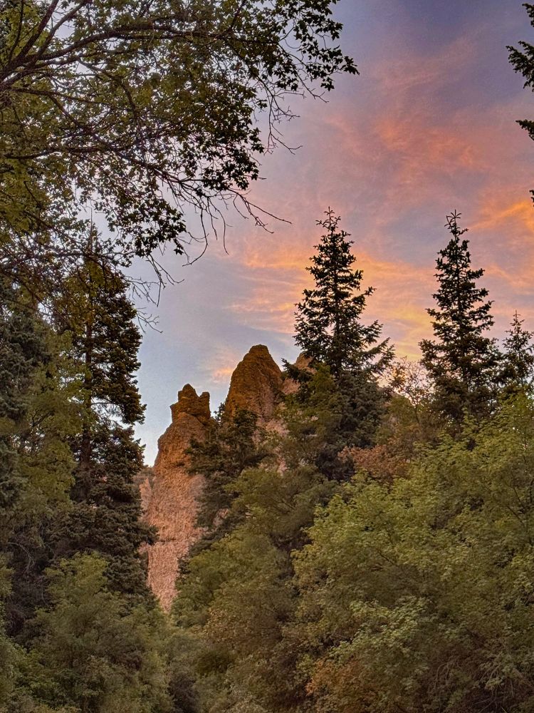
This time, rock climbing brings me to Utah. Momentary WiFi allows me to share this stunning sunset. Back into the wilderness again tomorrow where I’m grateful for the lack of cell service. 🧗
August 16, 2025 at 11:36 PM
This time, rock climbing brings me to Utah. Momentary WiFi allows me to share this stunning sunset. Back into the wilderness again tomorrow where I’m grateful for the lack of cell service. 🧗
Sturgeon Moon tonight. Spectacular.
August 10, 2025 at 3:41 AM
Sturgeon Moon tonight. Spectacular.
My BellTopo Sans font in the wild (Reuters). I love that it’s for a piece on public lands protections. Thanks for the heads-up @moriartymaps.com
This is a stunning scrollymap.
You can download the font for free at sarahbellmaps.com
This is a stunning scrollymap.
You can download the font for free at sarahbellmaps.com
July 28, 2025 at 6:06 PM
My BellTopo Sans font in the wild (Reuters). I love that it’s for a piece on public lands protections. Thanks for the heads-up @moriartymaps.com
This is a stunning scrollymap.
You can download the font for free at sarahbellmaps.com
This is a stunning scrollymap.
You can download the font for free at sarahbellmaps.com
In my world, map is a verb.
June 25, 2025 at 6:45 PM
In my world, map is a verb.
Reposted by Sarah Bell

I'm off to #Canada 🍁 and I'm looking for #jobs!
I'm looking for roles in BC/AB in or around #Vancouver / #Calgary / Canadian #Rockies / remote.
Open to anything #GIS & #cartography.
11+ years experience across ArcGIS, QGIS, FME, Adobe, Blender…
Please get in touch if you have any leads!
#gischat
I'm looking for roles in BC/AB in or around #Vancouver / #Calgary / Canadian #Rockies / remote.
Open to anything #GIS & #cartography.
11+ years experience across ArcGIS, QGIS, FME, Adobe, Blender…
Please get in touch if you have any leads!
#gischat

June 10, 2025 at 2:47 AM
I'm off to #Canada 🍁 and I'm looking for #jobs!
I'm looking for roles in BC/AB in or around #Vancouver / #Calgary / Canadian #Rockies / remote.
Open to anything #GIS & #cartography.
11+ years experience across ArcGIS, QGIS, FME, Adobe, Blender…
Please get in touch if you have any leads!
#gischat
I'm looking for roles in BC/AB in or around #Vancouver / #Calgary / Canadian #Rockies / remote.
Open to anything #GIS & #cartography.
11+ years experience across ArcGIS, QGIS, FME, Adobe, Blender…
Please get in touch if you have any leads!
#gischat
I rarely do animated maps in phases, because I let the flow state consume me (it’s quite enjoyable). This time however, I’m executing a phased vision for an animated map. This is a small section of the base of phase one.

June 6, 2025 at 3:22 PM
I rarely do animated maps in phases, because I let the flow state consume me (it’s quite enjoyable). This time however, I’m executing a phased vision for an animated map. This is a small section of the base of phase one.
More wildlife updates. Cougar track on top of another cougar track, both from the same cat. This creature walked all around the muddy trail we hiked yesterday. It’s a joy knowing the local ecosystem sustains these beautiful megafauna 🐱 it also left a territorial remnant (not pictured)


June 2, 2025 at 9:24 PM
More wildlife updates. Cougar track on top of another cougar track, both from the same cat. This creature walked all around the muddy trail we hiked yesterday. It’s a joy knowing the local ecosystem sustains these beautiful megafauna 🐱 it also left a territorial remnant (not pictured)
Bear sightings are the best. Came across this healthy gorgeous black bear in Skagit County, Washington state.
May 31, 2025 at 8:35 PM
Bear sightings are the best. Came across this healthy gorgeous black bear in Skagit County, Washington state.
Reposted by Sarah Bell
Fine but it’s still a word to me

May 29, 2025 at 4:56 PM
Fine but it’s still a word to me
Reposted by Sarah Bell

New on the blog: "Planetfall," in which I go into great detail about making a fun map based upon a 1999 computer game. One of the most technically demanding projects of my career, for a very niche audience.
somethingaboutmaps.wordpress.com/2025/05/20/p...
#SMAC
somethingaboutmaps.wordpress.com/2025/05/20/p...
#SMAC


May 21, 2025 at 2:20 AM
New on the blog: "Planetfall," in which I go into great detail about making a fun map based upon a 1999 computer game. One of the most technically demanding projects of my career, for a very niche audience.
somethingaboutmaps.wordpress.com/2025/05/20/p...
#SMAC
somethingaboutmaps.wordpress.com/2025/05/20/p...
#SMAC
Gosh dataviz is fun! Definitely my favorite bar chart I've gotten to make in a while. I'll certainly be reusing these colors.
Each state ranked by voter turnout & change (+/-) in turnout from 2024-2024.
sarahbellmaps.com/2025/2024-vo...
#datavisualization
Each state ranked by voter turnout & change (+/-) in turnout from 2024-2024.
sarahbellmaps.com/2025/2024-vo...
#datavisualization
May 14, 2025 at 10:33 PM
Gosh dataviz is fun! Definitely my favorite bar chart I've gotten to make in a while. I'll certainly be reusing these colors.
Each state ranked by voter turnout & change (+/-) in turnout from 2024-2024.
sarahbellmaps.com/2025/2024-vo...
#datavisualization
Each state ranked by voter turnout & change (+/-) in turnout from 2024-2024.
sarahbellmaps.com/2025/2024-vo...
#datavisualization
Obviously an honor to have Daniel Huffman use my font, but seriously excited to see the finished map 😍
Just the labels of this #map that I'm working on. Type is set in BellTopo Sans, by @sarahbell.bsky.social.

May 6, 2025 at 12:38 AM
Obviously an honor to have Daniel Huffman use my font, but seriously excited to see the finished map 😍
As @vickyjohnsondahl.bsky.social says, pick the window seat. Especially when flying into SeaTac. Mount Rainier peaking above low clouds on my flight home.

May 4, 2025 at 4:59 PM
As @vickyjohnsondahl.bsky.social says, pick the window seat. Especially when flying into SeaTac. Mount Rainier peaking above low clouds on my flight home.
I’m heading home after an eventful and rewarding week at Esri headquarters with my fantastic team.
🛫 🌎
🛫 🌎
May 2, 2025 at 7:01 PM
I’m heading home after an eventful and rewarding week at Esri headquarters with my fantastic team.
🛫 🌎
🛫 🌎