


Qiusheng Wu
@giswqs.bsky.social
Associate Professor @UTKnoxville | Amazon Scholar | Creator of #geemap & #leafmap | Talk about #Geospatial #GeoPython #DataViz #GIS #FOSS #EarthEngine
Pinned
Qiusheng Wu
@giswqs.bsky.social
· Jun 28
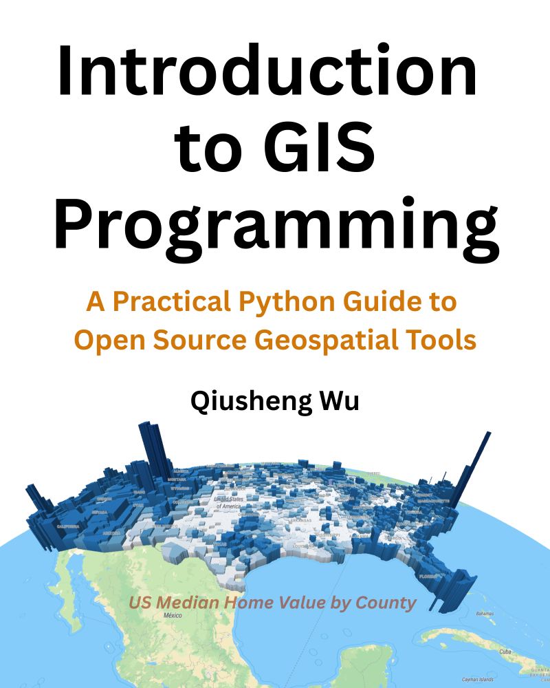
📣 Exciting News! The full-color print edition of my book “Introduction to GIS Programming: A Practical Python Guide to Open Source Geospatial Tools” is now available on Amazon!
📘 Grab your copy: amazon.com/dp/B0FFW34LL3
Prefer digital? The PDF version is available on Leanpub: leanpub.com/gispro
📘 Grab your copy: amazon.com/dp/B0FFW34LL3
Prefer digital? The PDF version is available on Leanpub: leanpub.com/gispro
Plugin page: plugins.qgis.org/plugins/nasa...
GitHub: github.com/opengeos/qgi...
Step-by-step video tutorial: youtu.be/H78l-3nbPfk
#QGIS #NASA #satelliteimagery #opensource
GitHub: github.com/opengeos/qgi...
Step-by-step video tutorial: youtu.be/H78l-3nbPfk
#QGIS #NASA #satelliteimagery #opensource
NASA Earthdata - Search, visualize, and download NASA Earthdata products in QGIS. Supports COG visualization and data footprint display.
plugins.qgis.org
January 7, 2026 at 4:01 PM
Plugin page: plugins.qgis.org/plugins/nasa...
GitHub: github.com/opengeos/qgi...
Step-by-step video tutorial: youtu.be/H78l-3nbPfk
#QGIS #NASA #satelliteimagery #opensource
GitHub: github.com/opengeos/qgi...
Step-by-step video tutorial: youtu.be/H78l-3nbPfk
#QGIS #NASA #satelliteimagery #opensource
NASA Earthdata QGIS Plugin v0.2.0 has been released!
It now supports highlighting selected footprints and clearing search results without resetting other settings.
Use the plugin update checker to update the plugin to the latest verion with a simple click.
It now supports highlighting selected footprints and clearing search results without resetting other settings.
Use the plugin update checker to update the plugin to the latest verion with a simple click.

January 7, 2026 at 4:01 PM
NASA Earthdata QGIS Plugin v0.2.0 has been released!
It now supports highlighting selected footprints and clearing search results without resetting other settings.
Use the plugin update checker to update the plugin to the latest verion with a simple click.
It now supports highlighting selected footprints and clearing search results without resetting other settings.
Use the plugin update checker to update the plugin to the latest verion with a simple click.
Plugin page: plugins.qgis.org/plugins/nasa...
GitHub: github.com/opengeos/qgi...
Step-by-step video tutorial: youtu.be/H78l-3nbPfk
#QGIS #NASA #satelliteimagery #opensource
GitHub: github.com/opengeos/qgi...
Step-by-step video tutorial: youtu.be/H78l-3nbPfk
#QGIS #NASA #satelliteimagery #opensource
January 6, 2026 at 4:36 PM
Plugin page: plugins.qgis.org/plugins/nasa...
GitHub: github.com/opengeos/qgi...
Step-by-step video tutorial: youtu.be/H78l-3nbPfk
#QGIS #NASA #satelliteimagery #opensource
GitHub: github.com/opengeos/qgi...
Step-by-step video tutorial: youtu.be/H78l-3nbPfk
#QGIS #NASA #satelliteimagery #opensource
Introducing the NASA Earthdata Plugin for QGIS!
With the NASA Earthdata plugin, you can search, filter, preview, and download NASA datasets directly inside QGIS, no programming needed. It’s designed for anyone who wants fast, seamless access to NASA data within their existing GIS workflow.
With the NASA Earthdata plugin, you can search, filter, preview, and download NASA datasets directly inside QGIS, no programming needed. It’s designed for anyone who wants fast, seamless access to NASA data within their existing GIS workflow.
January 6, 2026 at 4:36 PM
Introducing the NASA Earthdata Plugin for QGIS!
With the NASA Earthdata plugin, you can search, filter, preview, and download NASA datasets directly inside QGIS, no programming needed. It’s designed for anyone who wants fast, seamless access to NASA data within their existing GIS workflow.
With the NASA Earthdata plugin, you can search, filter, preview, and download NASA datasets directly inside QGIS, no programming needed. It’s designed for anyone who wants fast, seamless access to NASA data within their existing GIS workflow.
👉 Download the plugin and follow the full step-by-step video tutorial to get started today:
QGIS Plugin Page: plugins.qgis.org/plugins/gee_...
GitHub Repository: github.com/opengeos/qgi...
Video Tutorial: youtu.be/nZ3D6wLKJQw
QGIS Plugin Page: plugins.qgis.org/plugins/gee_...
GitHub Repository: github.com/opengeos/qgi...
Video Tutorial: youtu.be/nZ3D6wLKJQw
Earth Engine Data Catalogs - Browse, search, and load Google Earth Engine data catalogs directly in QGIS.
plugins.qgis.org
January 3, 2026 at 3:42 PM
👉 Download the plugin and follow the full step-by-step video tutorial to get started today:
QGIS Plugin Page: plugins.qgis.org/plugins/gee_...
GitHub Repository: github.com/opengeos/qgi...
Video Tutorial: youtu.be/nZ3D6wLKJQw
QGIS Plugin Page: plugins.qgis.org/plugins/gee_...
GitHub Repository: github.com/opengeos/qgi...
Video Tutorial: youtu.be/nZ3D6wLKJQw
🎁 A New Year’s gift to the geospatial community: a brand-new QGIS plugin that unlocks access to 80+ petabytes of satellite imagery and geospatial datasets with zero coding required.
January 3, 2026 at 3:42 PM
🎁 A New Year’s gift to the geospatial community: a brand-new QGIS plugin that unlocks access to 80+ petabytes of satellite imagery and geospatial datasets with zero coding required.
Exciting News to Wrap Up 2025!
I’m thrilled to announce the release of the QGIS Geemap Plugin, which allows you to run Google Earth Engine and Jupyter Notebooks directly within QGIS!
GitHub Repo: github.com/opengeos/qgi...
Video Tutorial: youtu.be/QHFp0v579Hc
I’m thrilled to announce the release of the QGIS Geemap Plugin, which allows you to run Google Earth Engine and Jupyter Notebooks directly within QGIS!
GitHub Repo: github.com/opengeos/qgi...
Video Tutorial: youtu.be/QHFp0v579Hc
December 31, 2025 at 1:56 PM
Exciting News to Wrap Up 2025!
I’m thrilled to announce the release of the QGIS Geemap Plugin, which allows you to run Google Earth Engine and Jupyter Notebooks directly within QGIS!
GitHub Repo: github.com/opengeos/qgi...
Video Tutorial: youtu.be/QHFp0v579Hc
I’m thrilled to announce the release of the QGIS Geemap Plugin, which allows you to run Google Earth Engine and Jupyter Notebooks directly within QGIS!
GitHub Repo: github.com/opengeos/qgi...
Video Tutorial: youtu.be/QHFp0v579Hc
GitHub repo: github.com/opengeos/qgi...
Video tutorial: youtu.be/glBgnyS8IDY
#QGIS #geospatial #opensource #datascience
Video tutorial: youtu.be/glBgnyS8IDY
#QGIS #geospatial #opensource #datascience

GitHub - opengeos/qgis-leafmap-plugin: A QGIS plugin for leafmap
A QGIS plugin for leafmap. Contribute to opengeos/qgis-leafmap-plugin development by creating an account on GitHub.
github.com
December 30, 2025 at 2:24 PM
GitHub repo: github.com/opengeos/qgi...
Video tutorial: youtu.be/glBgnyS8IDY
#QGIS #geospatial #opensource #datascience
Video tutorial: youtu.be/glBgnyS8IDY
#QGIS #geospatial #opensource #datascience
Compare Layers Visually in QGIS — New Leafmap Plugin Demo!
Whether you're working with raster or vector data, this tool brings interactive transparency controls and a layer swipe feature right into your QGIS environment.
Whether you're working with raster or vector data, this tool brings interactive transparency controls and a layer swipe feature right into your QGIS environment.
December 30, 2025 at 2:24 PM
Compare Layers Visually in QGIS — New Leafmap Plugin Demo!
Whether you're working with raster or vector data, this tool brings interactive transparency controls and a layer swipe feature right into your QGIS environment.
Whether you're working with raster or vector data, this tool brings interactive transparency controls and a layer swipe feature right into your QGIS environment.
Notebook plugin:
QGIS: plugins.qgis.org/plugins/qgis...
GitHub: github.com/opengeos/qgi...
If you find them useful, please give them a thumps up ⭐️ in the QGIS plugin page to show you support! Thank you!
#QGIS #geospatial #EarthEngine #opensource
QGIS: plugins.qgis.org/plugins/qgis...
GitHub: github.com/opengeos/qgi...
If you find them useful, please give them a thumps up ⭐️ in the QGIS plugin page to show you support! Thank you!
#QGIS #geospatial #EarthEngine #opensource
Notebook - Render and run Jupyter notebooks within QGIS in a dockable panel.
plugins.qgis.org
December 30, 2025 at 2:04 PM
Notebook plugin:
QGIS: plugins.qgis.org/plugins/qgis...
GitHub: github.com/opengeos/qgi...
If you find them useful, please give them a thumps up ⭐️ in the QGIS plugin page to show you support! Thank you!
#QGIS #geospatial #EarthEngine #opensource
QGIS: plugins.qgis.org/plugins/qgis...
GitHub: github.com/opengeos/qgi...
If you find them useful, please give them a thumps up ⭐️ in the QGIS plugin page to show you support! Thank you!
#QGIS #geospatial #EarthEngine #opensource
Both the Timelapse and Notebook plugins are now available in the official QGIS plugin repository! You can install them easily by searching them in the QGIS Plugin Manager.
Timelapse plugin:
QGIS: plugins.qgis.org/plugins/time...
GitHub: github.com/opengeos/qgi...
Timelapse plugin:
QGIS: plugins.qgis.org/plugins/time...
GitHub: github.com/opengeos/qgi...
December 30, 2025 at 2:04 PM
Both the Timelapse and Notebook plugins are now available in the official QGIS plugin repository! You can install them easily by searching them in the QGIS Plugin Manager.
Timelapse plugin:
QGIS: plugins.qgis.org/plugins/time...
GitHub: github.com/opengeos/qgi...
Timelapse plugin:
QGIS: plugins.qgis.org/plugins/time...
GitHub: github.com/opengeos/qgi...
Update easily using the plugin update checker to enjoy these enhancements!
GitHub: github.com/opengeos/qgi...
Video tutorial: youtu.be/Nr2QEZq2Q_Q
#QGIS #geospatial #Python #Jupyter
GitHub: github.com/opengeos/qgi...
Video tutorial: youtu.be/Nr2QEZq2Q_Q
#QGIS #geospatial #Python #Jupyter

GitHub - opengeos/qgis-notebook-plugin: A QGIS plugin for running Jupyter Notebook within QGIS
A QGIS plugin for running Jupyter Notebook within QGIS - opengeos/qgis-notebook-plugin
github.com
December 29, 2025 at 3:17 PM
Update easily using the plugin update checker to enjoy these enhancements!
GitHub: github.com/opengeos/qgi...
Video tutorial: youtu.be/Nr2QEZq2Q_Q
#QGIS #geospatial #Python #Jupyter
GitHub: github.com/opengeos/qgi...
Video tutorial: youtu.be/Nr2QEZq2Q_Q
#QGIS #geospatial #Python #Jupyter
The QGIS Notebook Plugin v0.2.0 is now available! 🎉
New features:
🌟 Light theme for a fresh look
✂️ Clear outputs for selected cells
➕ Insert code snippets directly into your notebooks
New features:
🌟 Light theme for a fresh look
✂️ Clear outputs for selected cells
➕ Insert code snippets directly into your notebooks

December 29, 2025 at 3:17 PM
The QGIS Notebook Plugin v0.2.0 is now available! 🎉
New features:
🌟 Light theme for a fresh look
✂️ Clear outputs for selected cells
➕ Insert code snippets directly into your notebooks
New features:
🌟 Light theme for a fresh look
✂️ Clear outputs for selected cells
➕ Insert code snippets directly into your notebooks
Reposted by Qiusheng Wu

Giving
@giswqs.bsky.social new timelapse plugin a go. This is much faster than the code I had been working through for each project. Try it out: Plugin page:
qgis.gishub.orggithub:
github.com/opengeos/qgi... tutorial: youtu.be/D_nkIL1JVU8 #QGIS #geospatial #python #EarthEngine
@giswqs.bsky.social new timelapse plugin a go. This is much faster than the code I had been working through for each project. Try it out: Plugin page:
qgis.gishub.orggithub:
github.com/opengeos/qgi... tutorial: youtu.be/D_nkIL1JVU8 #QGIS #geospatial #python #EarthEngine
December 28, 2025 at 9:41 PM
Giving
@giswqs.bsky.social new timelapse plugin a go. This is much faster than the code I had been working through for each project. Try it out: Plugin page:
qgis.gishub.orggithub:
github.com/opengeos/qgi... tutorial: youtu.be/D_nkIL1JVU8 #QGIS #geospatial #python #EarthEngine
@giswqs.bsky.social new timelapse plugin a go. This is much faster than the code I had been working through for each project. Try it out: Plugin page:
qgis.gishub.orggithub:
github.com/opengeos/qgi... tutorial: youtu.be/D_nkIL1JVU8 #QGIS #geospatial #python #EarthEngine
Plugin repository: qgis.gishub.org
GitHub: github.com/opengeos/qgi...
Video tutorial: youtu.be/D_nkIL1JVU8
#QGIS #geospatial #EarthEngine #Opensource
GitHub: github.com/opengeos/qgi...
Video tutorial: youtu.be/D_nkIL1JVU8
#QGIS #geospatial #EarthEngine #Opensource
QGIS Plugin Repository | GeoAI Tools
qgis.gishub.org
December 28, 2025 at 3:25 PM
Plugin repository: qgis.gishub.org
GitHub: github.com/opengeos/qgi...
Video tutorial: youtu.be/D_nkIL1JVU8
#QGIS #geospatial #EarthEngine #Opensource
GitHub: github.com/opengeos/qgi...
Video tutorial: youtu.be/D_nkIL1JVU8
#QGIS #geospatial #EarthEngine #Opensource
🚀 The QGIS Timelapse Plugin v0.2.0 has been released! 🎉 You can now overlay vector datasets (like administrative boundaries and roads) on your satellite imagery. 🌍✨
December 28, 2025 at 3:25 PM
🚀 The QGIS Timelapse Plugin v0.2.0 has been released! 🎉 You can now overlay vector datasets (like administrative boundaries and roads) on your satellite imagery. 🌍✨
Geostationary Operational Environmental Satellite (GOES) showing hurricane dynamics
December 27, 2025 at 6:29 PM
Geostationary Operational Environmental Satellite (GOES) showing hurricane dynamics
Normalized Difference Vegetation Index (NDVI)
December 27, 2025 at 6:27 PM
Normalized Difference Vegetation Index (NDVI)
Create a timelpase animation for any location around the globe in second. Try it out:
Plugin page: qgis.gishub.org
GitHub: github.com/opengeos/qgi...
Video tutorial: youtu.be/D_nkIL1JVU8
#QGIS #geospatial #python #EarthEngine
Plugin page: qgis.gishub.org
GitHub: github.com/opengeos/qgi...
Video tutorial: youtu.be/D_nkIL1JVU8
#QGIS #geospatial #python #EarthEngine
QGIS Plugin Repository | GeoAI Tools
qgis.gishub.org
December 27, 2025 at 6:25 PM
Create a timelpase animation for any location around the globe in second. Try it out:
Plugin page: qgis.gishub.org
GitHub: github.com/opengeos/qgi...
Video tutorial: youtu.be/D_nkIL1JVU8
#QGIS #geospatial #python #EarthEngine
Plugin page: qgis.gishub.org
GitHub: github.com/opengeos/qgi...
Video tutorial: youtu.be/D_nkIL1JVU8
#QGIS #geospatial #python #EarthEngine
🚀 Watch the Earth Change: New QGIS Plugin Creates Satellite Timelapse Animations in Seconds 🌍
A QGIS plugin for creating timelapse animations from satellite and aerial imagery using Google Earth Engine. Supports NAIP, Landsat, Sentinel-2, Sentinel-1, MODIS NDVI, and GOES weather satellite imagery.
A QGIS plugin for creating timelapse animations from satellite and aerial imagery using Google Earth Engine. Supports NAIP, Landsat, Sentinel-2, Sentinel-1, MODIS NDVI, and GOES weather satellite imagery.
December 27, 2025 at 6:25 PM
🚀 Watch the Earth Change: New QGIS Plugin Creates Satellite Timelapse Animations in Seconds 🌍
A QGIS plugin for creating timelapse animations from satellite and aerial imagery using Google Earth Engine. Supports NAIP, Landsat, Sentinel-2, Sentinel-1, MODIS NDVI, and GOES weather satellite imagery.
A QGIS plugin for creating timelapse animations from satellite and aerial imagery using Google Earth Engine. Supports NAIP, Landsat, Sentinel-2, Sentinel-1, MODIS NDVI, and GOES weather satellite imagery.
📂 Resources & Links:
👉 Plugin & Example Notebooks: github.com/opengeos/qgi...
👉 PyQGIS Cookbook: github.com/opengeos/pyq...
💡 Whether you're teaching Python + GIS or building repeatable workflows, this plugin is a game-changer.
#qgis #geospatial #python #jupyter #opensource
👉 Plugin & Example Notebooks: github.com/opengeos/qgi...
👉 PyQGIS Cookbook: github.com/opengeos/pyq...
💡 Whether you're teaching Python + GIS or building repeatable workflows, this plugin is a game-changer.
#qgis #geospatial #python #jupyter #opensource

GitHub - opengeos/qgis-notebook-plugin: A QGIS plugin for running Jupyter Notebook within QGIS
A QGIS plugin for running Jupyter Notebook within QGIS - opengeos/qgis-notebook-plugin
github.com
December 26, 2025 at 3:39 PM
📂 Resources & Links:
👉 Plugin & Example Notebooks: github.com/opengeos/qgi...
👉 PyQGIS Cookbook: github.com/opengeos/pyq...
💡 Whether you're teaching Python + GIS or building repeatable workflows, this plugin is a game-changer.
#qgis #geospatial #python #jupyter #opensource
👉 Plugin & Example Notebooks: github.com/opengeos/qgi...
👉 PyQGIS Cookbook: github.com/opengeos/pyq...
💡 Whether you're teaching Python + GIS or building repeatable workflows, this plugin is a game-changer.
#qgis #geospatial #python #jupyter #opensource
🚀 Run Jupyter Notebooks Directly Inside QGIS! | QGIS Notebook Plugin Tutorial
Want to combine the power of QGIS with the flexibility of Jupyter Notebooks? In this step-by-step tutorial, you'll learn how to install and use the QGIS Notebook Plugin to run Jupyter Notebooks inside the QGIS interface.
Want to combine the power of QGIS with the flexibility of Jupyter Notebooks? In this step-by-step tutorial, you'll learn how to install and use the QGIS Notebook Plugin to run Jupyter Notebooks inside the QGIS interface.

December 26, 2025 at 3:39 PM
🚀 Run Jupyter Notebooks Directly Inside QGIS! | QGIS Notebook Plugin Tutorial
Want to combine the power of QGIS with the flexibility of Jupyter Notebooks? In this step-by-step tutorial, you'll learn how to install and use the QGIS Notebook Plugin to run Jupyter Notebooks inside the QGIS interface.
Want to combine the power of QGIS with the flexibility of Jupyter Notebooks? In this step-by-step tutorial, you'll learn how to install and use the QGIS Notebook Plugin to run Jupyter Notebooks inside the QGIS interface.
Reposted by Qiusheng Wu

🎥 Just released a new video exploring the #QGIS #GeoAI plugin, a powerful way to bring #AI into everyday mapping workflows. Watch here: youtu.be/PMEZaW71YSA
Thanks to @giswqs.bsky.social for his brilliant work and clear documentation!
Thanks to @giswqs.bsky.social for his brilliant work and clear documentation!

Review of the QGIS GeoAI plugin
YouTube video by Hans van der Kwast
youtu.be
December 21, 2025 at 4:41 PM
🎥 Just released a new video exploring the #QGIS #GeoAI plugin, a powerful way to bring #AI into everyday mapping workflows. Watch here: youtu.be/PMEZaW71YSA
Thanks to @giswqs.bsky.social for his brilliant work and clear documentation!
Thanks to @giswqs.bsky.social for his brilliant work and clear documentation!
🚀 Installing the GeoAI QGIS Plugin—Easiest Method
📺 Video tutorial: youtu.be/TJmZQXJK-IU
🔗 Plugin Page: plugins.qgis.org/plugins/geoai
📖 Installation Guide: opengeoai.org/qgis_plugin
If you find the plugin useful, please consider giving it a 👍 on the official QGIS plugin page.
📺 Video tutorial: youtu.be/TJmZQXJK-IU
🔗 Plugin Page: plugins.qgis.org/plugins/geoai
📖 Installation Guide: opengeoai.org/qgis_plugin
If you find the plugin useful, please consider giving it a 👍 on the official QGIS plugin page.

December 20, 2025 at 3:13 PM
🚀 Installing the GeoAI QGIS Plugin—Easiest Method
📺 Video tutorial: youtu.be/TJmZQXJK-IU
🔗 Plugin Page: plugins.qgis.org/plugins/geoai
📖 Installation Guide: opengeoai.org/qgis_plugin
If you find the plugin useful, please consider giving it a 👍 on the official QGIS plugin page.
📺 Video tutorial: youtu.be/TJmZQXJK-IU
🔗 Plugin Page: plugins.qgis.org/plugins/geoai
📖 Installation Guide: opengeoai.org/qgis_plugin
If you find the plugin useful, please consider giving it a 👍 on the official QGIS plugin page.
The recording of the GeoAI workshop at the #AGU25 is now available.
Notebook: agu2025.workshops.geojupyter.org/modules/inte...
Video: youtu.be/OW26XShiqeI
#geospatial #GeoAI #Python #Jupyter
Notebook: agu2025.workshops.geojupyter.org/modules/inte...
Video: youtu.be/OW26XShiqeI
#geospatial #GeoAI #Python #Jupyter

December 19, 2025 at 1:51 PM
The recording of the GeoAI workshop at the #AGU25 is now available.
Notebook: agu2025.workshops.geojupyter.org/modules/inte...
Video: youtu.be/OW26XShiqeI
#geospatial #GeoAI #Python #Jupyter
Notebook: agu2025.workshops.geojupyter.org/modules/inte...
Video: youtu.be/OW26XShiqeI
#geospatial #GeoAI #Python #Jupyter