Andy Bokanev
banner
bokanev.bsky.social
Andy Bokanev
@bokanev.bsky.social
Probably talking about airplanes. Or the weather.
Worked better than an alarm clock.
December 18, 2024 at 2:35 PM
Space Needle panocam never disappoints on a foggy day. #wawx www.spaceneedle.com/webcam
November 28, 2024 at 5:51 PM
Five spice sweet potato tian is the new traditional contribution to the big family table. 4 years running.
November 28, 2024 at 4:35 PM
Reposted by Andy Bokanev
WPC analysis shows the #BombCyclone bottomed out at 942 mb at 03z (19 PT). This ties the record set in October 2021.

#weather #BCstorm #WAwx #ORwx
November 20, 2024 at 7:57 PM
Memorable evening for #wawx
November 20, 2024 at 7:05 AM
Reposted by Andy Bokanev
Cross-sections from the 4/3 km UW-WRF show tonight's downslope windstorm nicely. These run from L-->R from the Pacific Coast - Seattle - Spokane. 4/7/10 PM pictured.

You can see things really go nuts starting around 7 PM with 60+ kt (70+ mph) wind potentially reaching the surface east of Seattle.
November 19, 2024 at 9:23 PM
Reposted by Andy Bokanev
Real-time mesoscale analysis shows peak sustained winds in the #BombCyclone around 126 km/h, which is the same strength as a category 1 hurricane.

#WAwx #ORwx #BCstorm #weather
November 19, 2024 at 9:42 PM
And here's the first TAF for tomorrow afternoon/evening.

Going to have some good crosswinds landing on the 16s at Sea-Tac #wawx
November 19, 2024 at 6:33 AM
Going to be a windy one for folks in the Hobart-Maple Valley-Black Diamond area tomorrow evening with possible gusts up to 60 mph... Peaking around 8-10PM #wawx
November 19, 2024 at 6:30 AM
A bit of graupel from this solo cell to start the morning.
November 18, 2024 at 3:27 PM
Volcanic Ash Advisory issued for Mount Katmai, a volcano that last erupted in 1912 and over two and half days expelled thirty times as much as as the 1980 eruption of Mount St. Helens.
November 18, 2024 at 8:06 AM
Big one coming on Tuesday.
A baroclinic wave in the North Pacific embedded in a strong jet streak interacting with a potent short-wavelength trough will result in explosive cyclogenesis in the NE Pacific on Tuesday.

With models showing MSLP in the 940s hPa, this may challenge for the deepest cyclone on record in the region.
November 17, 2024 at 4:29 PM
Did not realize the Concorde used its own NAT tracks.

www.heritageconcorde.com/air-traffic-...
November 15, 2024 at 6:17 PM
That’s weird. It feels like a valid handle.
November 15, 2024 at 12:39 AM
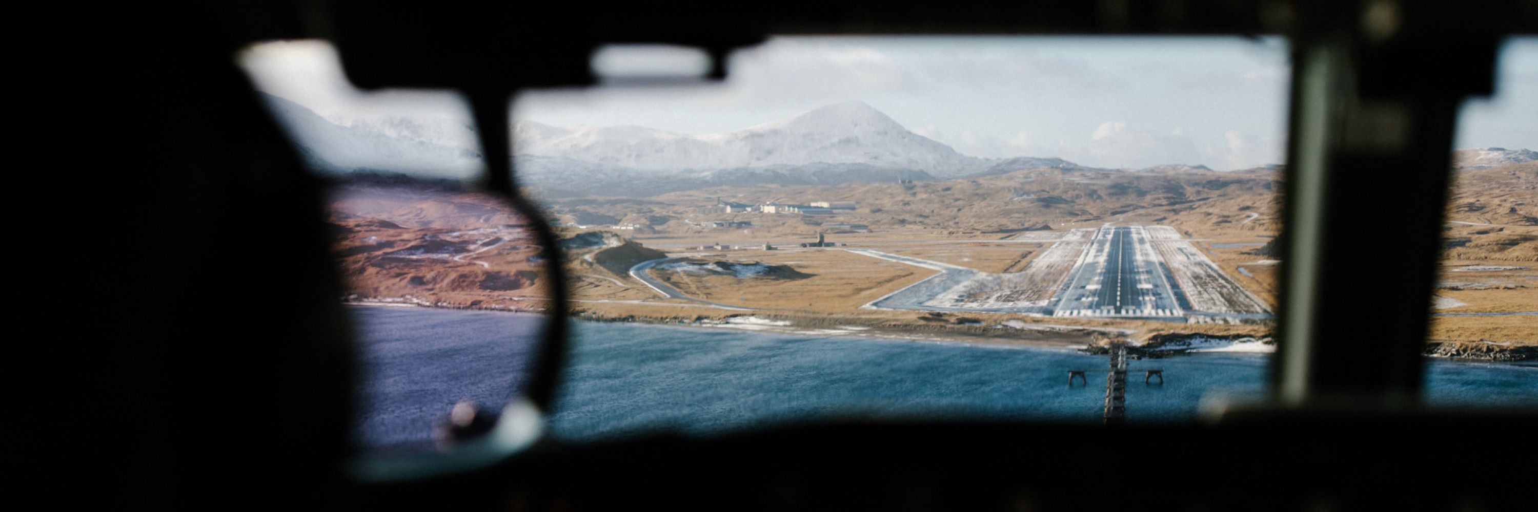
One of the coolest experiences so far at Alaska was a quick trip to Adak Island last year. Lucky to experience it on a sunny and (relatively) calm day for December.
November 14, 2024 at 11:53 PM
TIL about Hurricane Huron, a cyclone that formed over the Great Lakes in September 1996 and peaked at 992mb with 75 mph winds. en.m.wikipedia.org/wiki/1996_La...
November 14, 2024 at 7:36 PM
One of my favorite times of the year for dramatic light and contrast.
November 12, 2024 at 4:16 PM
We like to keep it interesting in the Fall here in PNW.
November 12, 2024 at 3:26 PM
Happy #WingFriday to those who celebrate
November 8, 2024 at 11:50 PM
Rafael vs. a wall of dry air.
November 8, 2024 at 11:30 PM
Reposted by Andy Bokanev
In a welcome change of pace from earlier this fall, a major hurricane in the Gulf of Mexico is not making landfall in the US - or anywhere, for that matter.

Hurricane Rafael is weakening due to wind shear & dry air, and will dissipate over the central Gulf of Mexico:
November 8, 2024 at 11:24 PM
Well, let’s start here: a photo from a great backpacking trip this past August.
November 8, 2024 at 8:16 AM