


Aleksander Berg
@alekberg.bsky.social
Geography PhD Student University of Colorado Boulder
I am a geographer that uses big data at fine grained scales to answer questions about natural hazards, health, and population dynamics to better inform decision making in and for those communities.
I am a geographer that uses big data at fine grained scales to answer questions about natural hazards, health, and population dynamics to better inform decision making in and for those communities.
Pinned
Aleksander Berg
@alekberg.bsky.social
· Apr 30

Remapping California's wildland urban interface: A property-level time-space framework, 2000–2020
Wildland fire poses a significant risk to property and people, and these risks tend to be highest in places where flammable, wildland vegetation abuts…
www.sciencedirect.com
New paper! How much development has occurred in California’s #wildfire prone areas over the past 20yrs? With ~10 million @zillow property records @Dylligent, @pjkedron, @amyefrazier, & I remap California's wildland urban interface (WUI) 2000-2020
www.sciencedirect.com/science/arti...
🧵 1/8
www.sciencedirect.com/science/arti...
🧵 1/8
A little bit of good news today. Our paper “Who gets left behind by left behind places?” Just won the Annual Editors’ Choice Award at the CJRES!
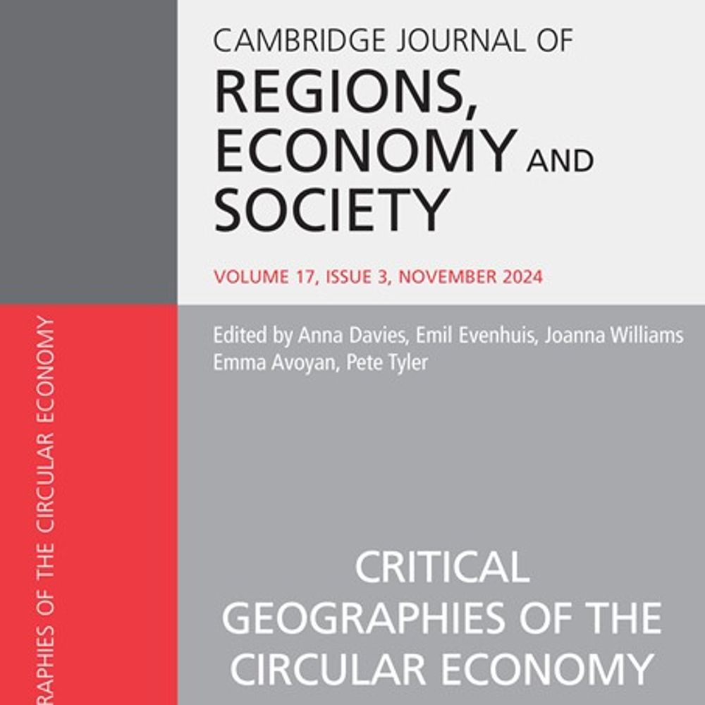
The 2024 Editors' Choice award has been made to Dylan Connor, Aleksander Berg, Tom Kemeny and Peter Kedron for their paper "Who gets left behind by left behind places?"
doi.org/10.1093/cjre...
doi.org/10.1093/cjre...

July 22, 2025 at 6:16 PM
A little bit of good news today. Our paper “Who gets left behind by left behind places?” Just won the Annual Editors’ Choice Award at the CJRES!
I had the privilege of teaching an impressive group of early career scholars at @mpidr.bsky.social this week. What an amazing time to be in Rostock! Happy I could open up the big-tent of geography to a few more researchers

June 21, 2025 at 10:55 AM
I had the privilege of teaching an impressive group of early career scholars at @mpidr.bsky.social this week. What an amazing time to be in Rostock! Happy I could open up the big-tent of geography to a few more researchers
Reposted by Aleksander Berg
🎙️ New #GLaDpodcast episode! @darribas.bsky.social, @levijohnwolf.bsky.social and I are joined by the amazing @geoffboeing.com (@priceschool.usc.edu) to talk streets, disasters, urban form & open source software. It's a pretty good one, if I do say so myself. #geosky
open.spotify.com/episode/4H6K...
open.spotify.com/episode/4H6K...

Episode 20: Street Smart — A Conversation with Geoff Boeing
The GLaD Podcast · Episode
open.spotify.com
February 3, 2025 at 3:14 PM
🎙️ New #GLaDpodcast episode! @darribas.bsky.social, @levijohnwolf.bsky.social and I are joined by the amazing @geoffboeing.com (@priceschool.usc.edu) to talk streets, disasters, urban form & open source software. It's a pretty good one, if I do say so myself. #geosky
open.spotify.com/episode/4H6K...
open.spotify.com/episode/4H6K...
Reposted by Aleksander Berg
I often use Watch Duty as an example of truly needed tech solutions for wildfire. Drones and AI are never going to prevent wildfires or put them out. But communications before, during, and after fire is a massive gap that tech can absolutely help solve.
Pretty amazing that nonprofit Watch Duty -- which says it has 150 volunteers working around the clock to track wildfires -- has become the most trusted source of information on LA fires. Operated by retired/volunteer firefighters, dispatchers, and reporters. Real people.
www.watchduty.org
www.watchduty.org
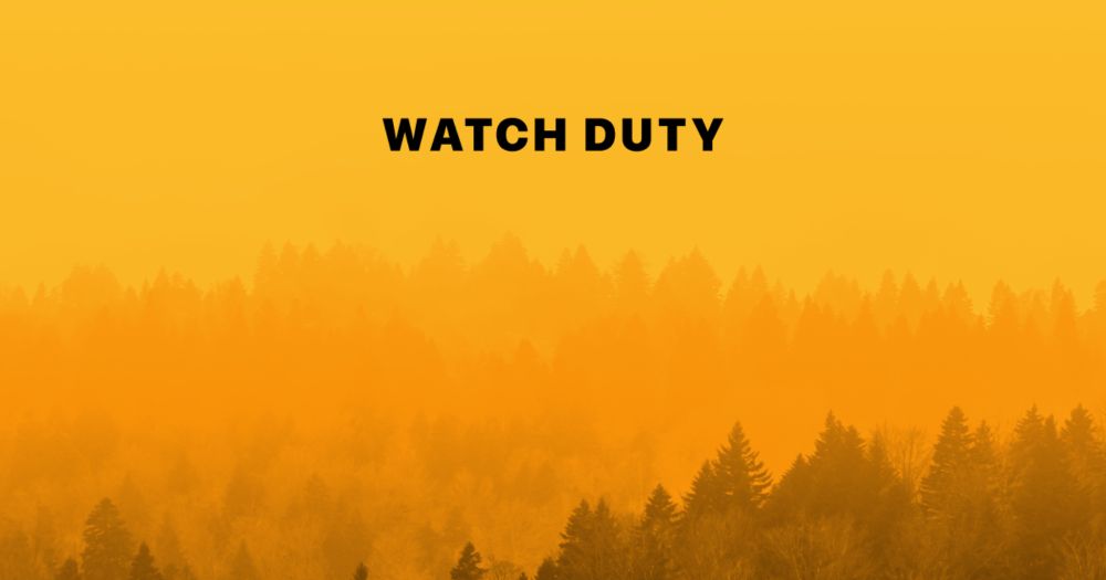
Watch Duty - Wildfire Maps & Alerts
Watch Duty, a 501(c)(3) nonprofit, alerts you of nearby wildfires and firefighting efforts in real-time.
www.watchduty.org
January 10, 2025 at 12:40 AM
I often use Watch Duty as an example of truly needed tech solutions for wildfire. Drones and AI are never going to prevent wildfires or put them out. But communications before, during, and after fire is a massive gap that tech can absolutely help solve.
Reposted by Aleksander Berg
A disaster is a function of three things: the hazard itself, people's vulnerability to the hazard, and their exposure. @rebeccasolnit.bsky.social explains eloquently how the LA fires are a perfect storm of all three. Read more:
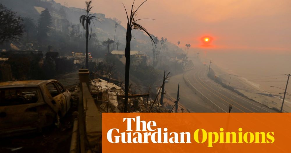
The chronicle of a fire foretold | Rebecca Solnit
The current fires in Los Angeles are reminders of the costs of forgetting
www.theguardian.com
January 10, 2025 at 12:18 AM
A disaster is a function of three things: the hazard itself, people's vulnerability to the hazard, and their exposure. @rebeccasolnit.bsky.social explains eloquently how the LA fires are a perfect storm of all three. Read more:
Reposted by Aleksander Berg

Is there a link between #ClimateChange & increasing risk/severity of #wildfire in California--including the still-unfolding disaster? Yes. Is climate change the only factor at play? No, of course not. So what's really going on? [Thread] #CAfire #CAwx #LAfires iopscience.iop.org/a...
January 9, 2025 at 10:05 PM
Is there a link between #ClimateChange & increasing risk/severity of #wildfire in California--including the still-unfolding disaster? Yes. Is climate change the only factor at play? No, of course not. So what's really going on? [Thread] #CAfire #CAwx #LAfires iopscience.iop.org/a...
Reposted by Aleksander Berg
Devastating photos of Pacific Palisades today. #PalisadesFire


January 9, 2025 at 10:06 PM
Devastating photos of Pacific Palisades today. #PalisadesFire
Reposted by Aleksander Berg

Harrowing scenes from across Los Angeles as multiple fires ravage the county and displace over 100,000 people.
📷 Ethan Swope/AP Photo & Josh Edelson/Getty Images
📷 Ethan Swope/AP Photo & Josh Edelson/Getty Images


January 9, 2025 at 10:25 PM
Harrowing scenes from across Los Angeles as multiple fires ravage the county and displace over 100,000 people.
📷 Ethan Swope/AP Photo & Josh Edelson/Getty Images
📷 Ethan Swope/AP Photo & Josh Edelson/Getty Images
Reposted by Aleksander Berg
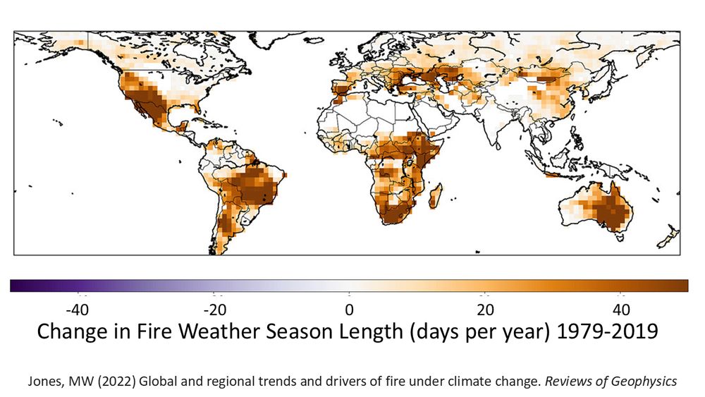
Southern California now sees longer fire weather seasons, like many other places worldwide
Human-caused climate change means hot, dry, windy conditions happen more often, priming landscapes to burn more easily if ignition occurs
Matt Jones et al 2022 agupubs.onlinelibrary.wiley.com/doi/10.1029/...
Human-caused climate change means hot, dry, windy conditions happen more often, priming landscapes to burn more easily if ignition occurs
Matt Jones et al 2022 agupubs.onlinelibrary.wiley.com/doi/10.1029/...
January 9, 2025 at 8:01 PM
Southern California now sees longer fire weather seasons, like many other places worldwide
Human-caused climate change means hot, dry, windy conditions happen more often, priming landscapes to burn more easily if ignition occurs
Matt Jones et al 2022 agupubs.onlinelibrary.wiley.com/doi/10.1029/...
Human-caused climate change means hot, dry, windy conditions happen more often, priming landscapes to burn more easily if ignition occurs
Matt Jones et al 2022 agupubs.onlinelibrary.wiley.com/doi/10.1029/...
Reposted by Aleksander Berg
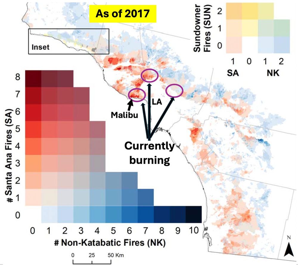
Here's the reality about the #LAFires this week: this isn't the first time ANY of these places have burned. Not even close. In 2018, we mapped CA fire history to look at fire frequency across SoCal. Santa Monica Mtns area burns more than anywhere else -- up to once per decade in a given spot. 🧵
January 9, 2025 at 5:33 PM
Here's the reality about the #LAFires this week: this isn't the first time ANY of these places have burned. Not even close. In 2018, we mapped CA fire history to look at fire frequency across SoCal. Santa Monica Mtns area burns more than anywhere else -- up to once per decade in a given spot. 🧵
New paper! How much development has occurred in California’s #wildfire prone areas over the past 20yrs? With ~10 million @zillow property records @Dylligent, @pjkedron, @amyefrazier, & I remap California's wildland urban interface (WUI) 2000-2020
www.sciencedirect.com/science/arti...
🧵 1/8
www.sciencedirect.com/science/arti...
🧵 1/8
Remapping California's wildland urban interface: A property-level time-space framework, 2000–2020
Wildland fire poses a significant risk to property and people, and these risks tend to be highest in places where flammable, wildland vegetation abuts…
www.sciencedirect.com
April 30, 2024 at 4:26 PM
New paper! How much development has occurred in California’s #wildfire prone areas over the past 20yrs? With ~10 million @zillow property records @Dylligent, @pjkedron, @amyefrazier, & I remap California's wildland urban interface (WUI) 2000-2020
www.sciencedirect.com/science/arti...
🧵 1/8
www.sciencedirect.com/science/arti...
🧵 1/8
Hot off the press! Our paper "Who gets left behind by left behind places?" (Connor, Berg, Kemeny, & Kedron) from a forthcoming special issue on left behind places.
We examine the economic trajectory of left behind places and the children who grow up in them. #geo
academic.oup.com/cjres/advanc...
We examine the economic trajectory of left behind places and the children who grow up in them. #geo
academic.oup.com/cjres/advanc...

Who gets left behind by left behind places?
Abstract. We document that children growing up in places left behind by today’s economy experience lower levels of social mobility as adults. Using a longitudin
academic.oup.com
October 5, 2023 at 7:00 PM
Hot off the press! Our paper "Who gets left behind by left behind places?" (Connor, Berg, Kemeny, & Kedron) from a forthcoming special issue on left behind places.
We examine the economic trajectory of left behind places and the children who grow up in them. #geo
academic.oup.com/cjres/advanc...
We examine the economic trajectory of left behind places and the children who grow up in them. #geo
academic.oup.com/cjres/advanc...