


Kevin Scharfenberg
@wxkev.bsky.social
Meteorologist, but this account is my personal views only and not those of my employer. Also hiking and photography content.
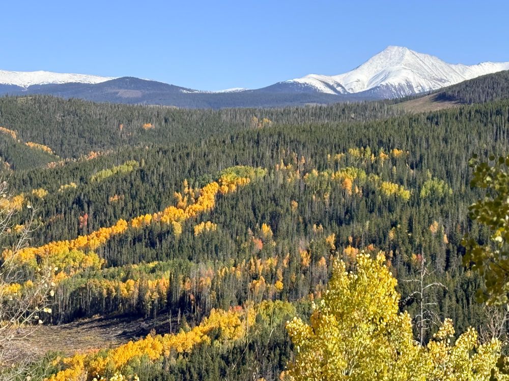
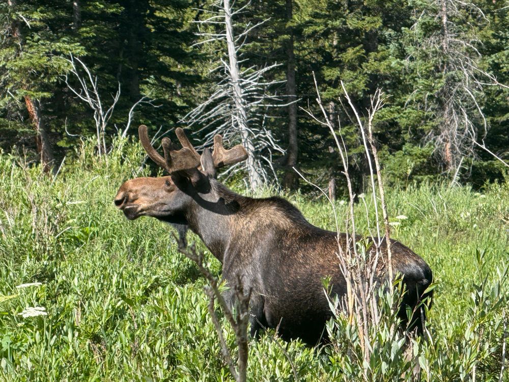
Not too shabby in the central Colorado mountains today.


September 24, 2025 at 9:51 PM
Not too shabby in the central Colorado mountains today.
Air quality really varies across the Denver area this evening as some smoke trapped in the foothills escaped downhill into Boulder/Louisville, while very clean air persists over downtown Denver.

September 9, 2025 at 2:28 AM
Air quality really varies across the Denver area this evening as some smoke trapped in the foothills escaped downhill into Boulder/Louisville, while very clean air persists over downtown Denver.
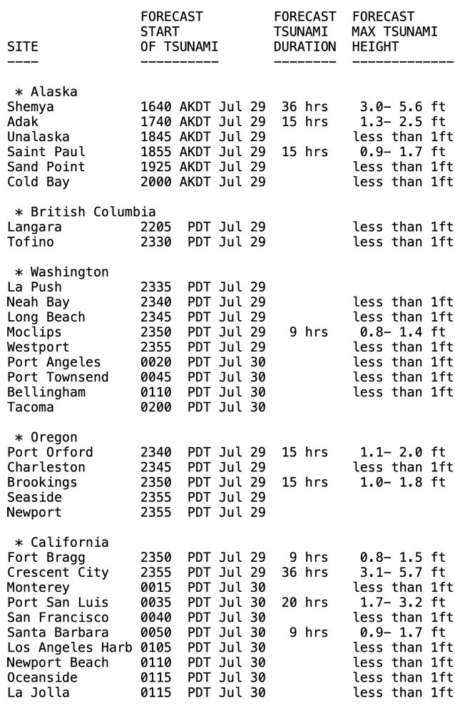
Tsunami WARNING for Hawaii, take immediate action to evacuate tsunami threat zones. Tsunami ADVISORY issued for parts of Alaska, BC, California, Oregon, and Washington means stay away from beaches and marinas. Here are the arrival times and expected tsunami heights.
July 30, 2025 at 1:36 AM
Tsunami WARNING for Hawaii, take immediate action to evacuate tsunami threat zones. Tsunami ADVISORY issued for parts of Alaska, BC, California, Oregon, and Washington means stay away from beaches and marinas. Here are the arrival times and expected tsunami heights.
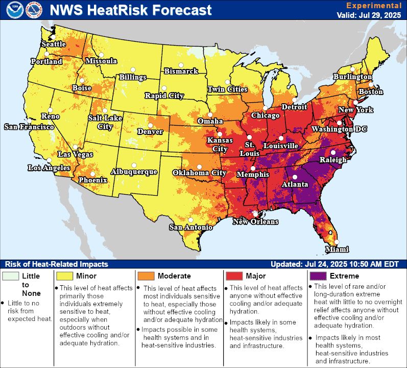
The NWS HeatRisk product is really highlighting a large part of the central and southeast part of the country late this weekend into early next week with major to extreme threat. This will be a multi day heatwave so people should prepare and make sure vulnerable friends and family will be okay.
July 24, 2025 at 6:30 PM
The NWS HeatRisk product is really highlighting a large part of the central and southeast part of the country late this weekend into early next week with major to extreme threat. This will be a multi day heatwave so people should prepare and make sure vulnerable friends and family will be okay.
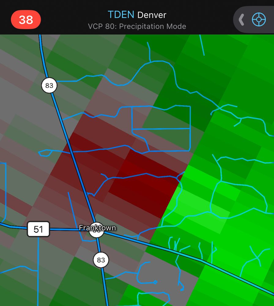
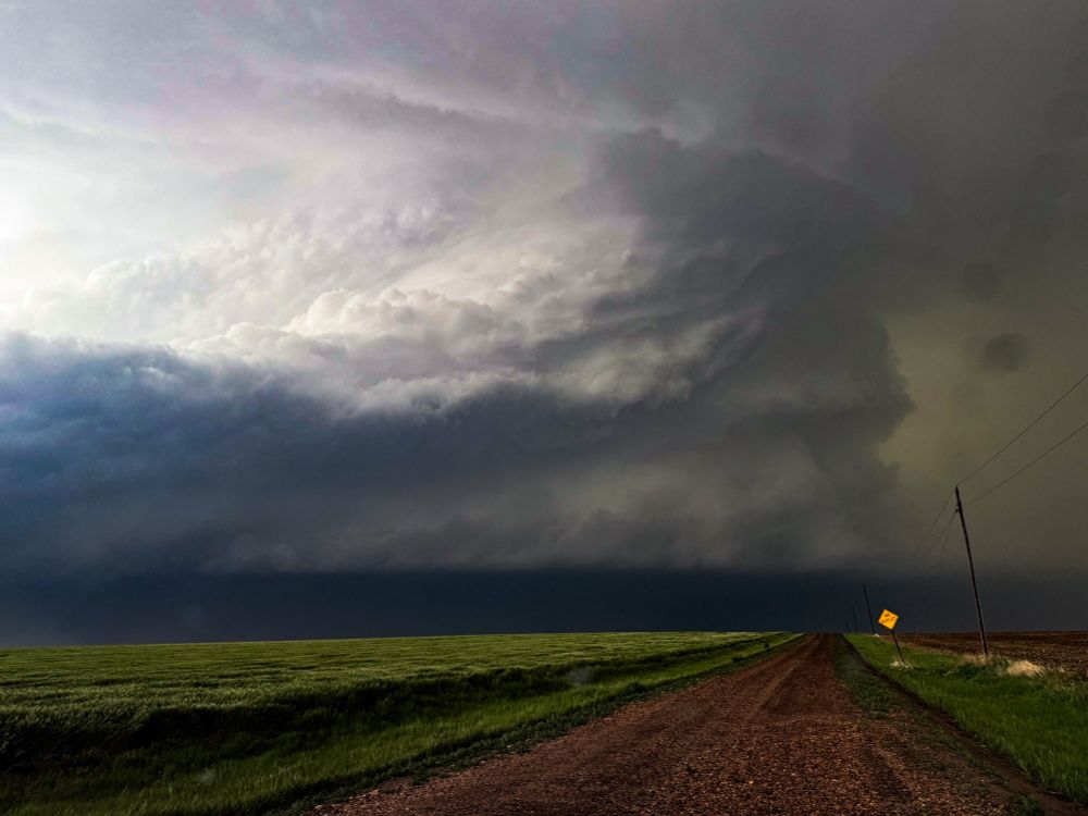
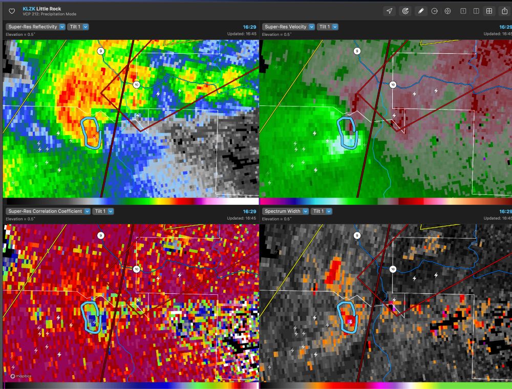
Also a gate-to-gate couplet went right over Franktown with report of a roof blown off.
July 14, 2025 at 8:57 PM
Also a gate-to-gate couplet went right over Franktown with report of a roof blown off.
Channeling @climatologist49.bsky.social on my hike today
July 13, 2025 at 9:18 PM
Channeling @climatologist49.bsky.social on my hike today
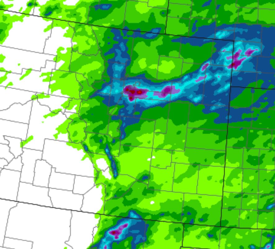
HREF Local Probability Matched Mean precip bullseye of 2-3" right over metro Denver this afternoon/evening. Probably some local flooding if this happens.
May 25, 2025 at 5:56 PM
HREF Local Probability Matched Mean precip bullseye of 2-3" right over metro Denver this afternoon/evening. Probably some local flooding if this happens.
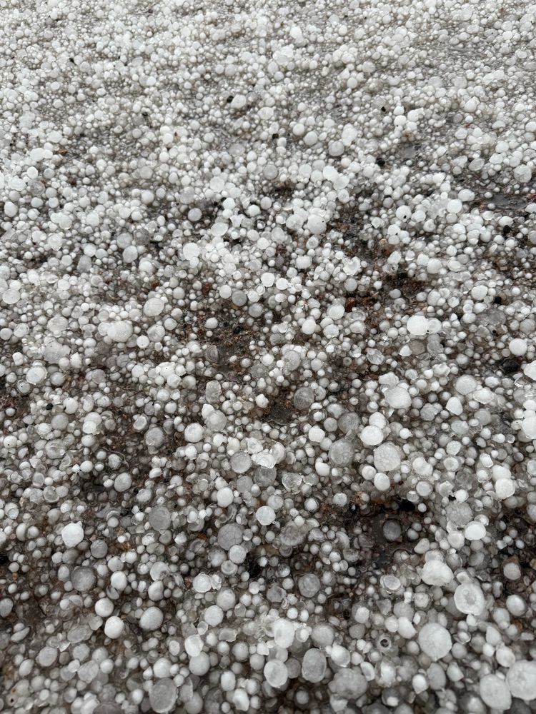
This was just south of Meridian and Evans road just after the core passed over. Tons of pea to quarter size hail covering the road and fields. Definitely a few quarters
May 25, 2025 at 1:39 AM
This was just south of Meridian and Evans road just after the core passed over. Tons of pea to quarter size hail covering the road and fields. Definitely a few quarters
Hayes Center, Nebraska — May 18, 2025
May 20, 2025 at 3:04 PM
Hayes Center, Nebraska — May 18, 2025
You had to be within eyeshot of us.

May 19, 2025 at 10:49 PM
You had to be within eyeshot of us.


And a very real and serious TDS
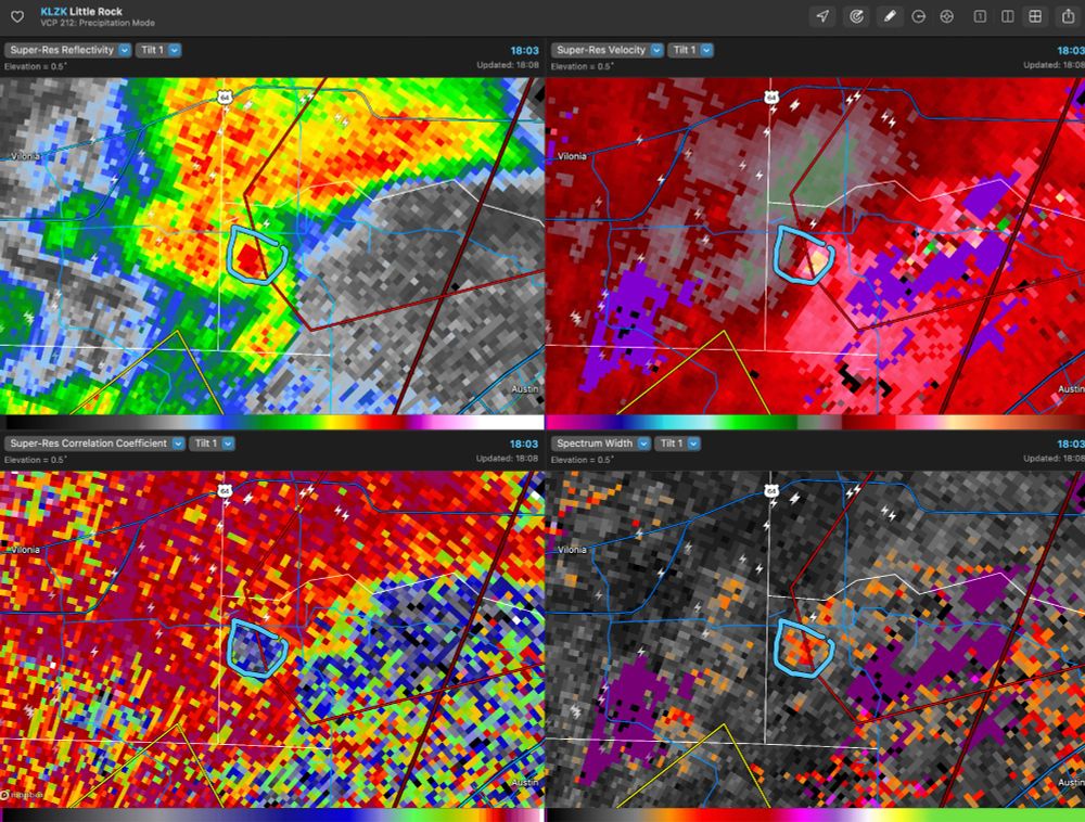
April 21, 2025 at 12:09 AM
And a very real and serious TDS
Good example of a fake TDS (left) vs. a real TDS (right) from the LZK 88D this afternoon.

April 20, 2025 at 10:46 PM
Good example of a fake TDS (left) vs. a real TDS (right) from the LZK 88D this afternoon.
WPC ringing the bell this morning!

April 5, 2025 at 1:46 PM
WPC ringing the bell this morning!
Tornado almost just hit the Paducah radar.
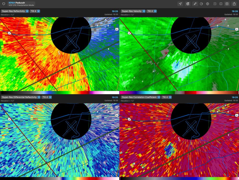
April 3, 2025 at 1:34 AM
Tornado almost just hit the Paducah radar.


A lot of deserved attention on the severe storm potential, but also a day 5 MDT risk (THU) from WPC for excessive rainfall over the lower OH valley. It looks like the front will stall from NE Texas to Ohio, with deep moisture and repeating rounds of convection. Potentially high end flooding WED-SUN.
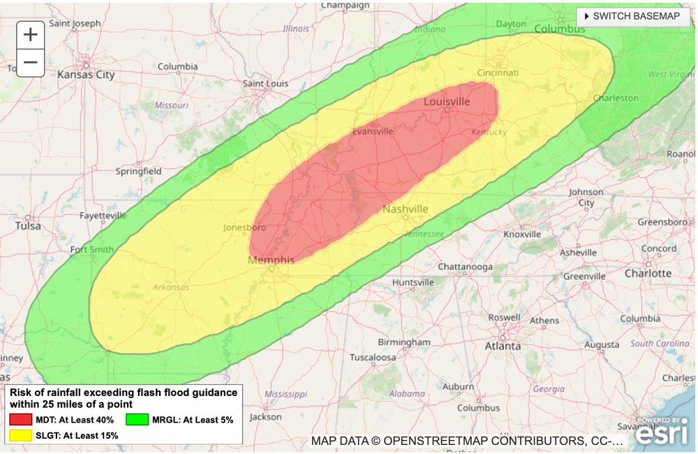
March 30, 2025 at 3:06 PM
A lot of deserved attention on the severe storm potential, but also a day 5 MDT risk (THU) from WPC for excessive rainfall over the lower OH valley. It looks like the front will stall from NE Texas to Ohio, with deep moisture and repeating rounds of convection. Potentially high end flooding WED-SUN.
The synoptically-evident outbreak setup aside, at one point years ago I looked at F4/EF4+ tornadoes just from the perspective of regional inflow-side surface obs, and many of them clustered around 77/70 with strong background wind speeds (>15 kts sustained).

March 15, 2025 at 3:31 PM
The synoptically-evident outbreak setup aside, at one point years ago I looked at F4/EF4+ tornadoes just from the perspective of regional inflow-side surface obs, and many of them clustered around 77/70 with strong background wind speeds (>15 kts sustained).
When you see this on radar approaching a major city, be glad there is still a functioning public warning system. For now

March 15, 2025 at 2:35 AM
When you see this on radar approaching a major city, be glad there is still a functioning public warning system. For now
When you see a radar signature like this put on shoes and a helmet, go to the basement under a piece of heavy furniture, and drink a glass of bourbon or whiskey. 4 fingers

March 15, 2025 at 1:54 AM
When you see a radar signature like this put on shoes and a helmet, go to the basement under a piece of heavy furniture, and drink a glass of bourbon or whiskey. 4 fingers
This particular thingie on radar means you should just go ahead and call your insurance agent now to get in the front of the line
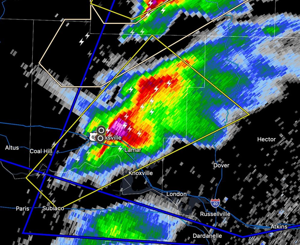
March 15, 2025 at 1:00 AM
This particular thingie on radar means you should just go ahead and call your insurance agent now to get in the front of the line
Wild wind gradients out there right now
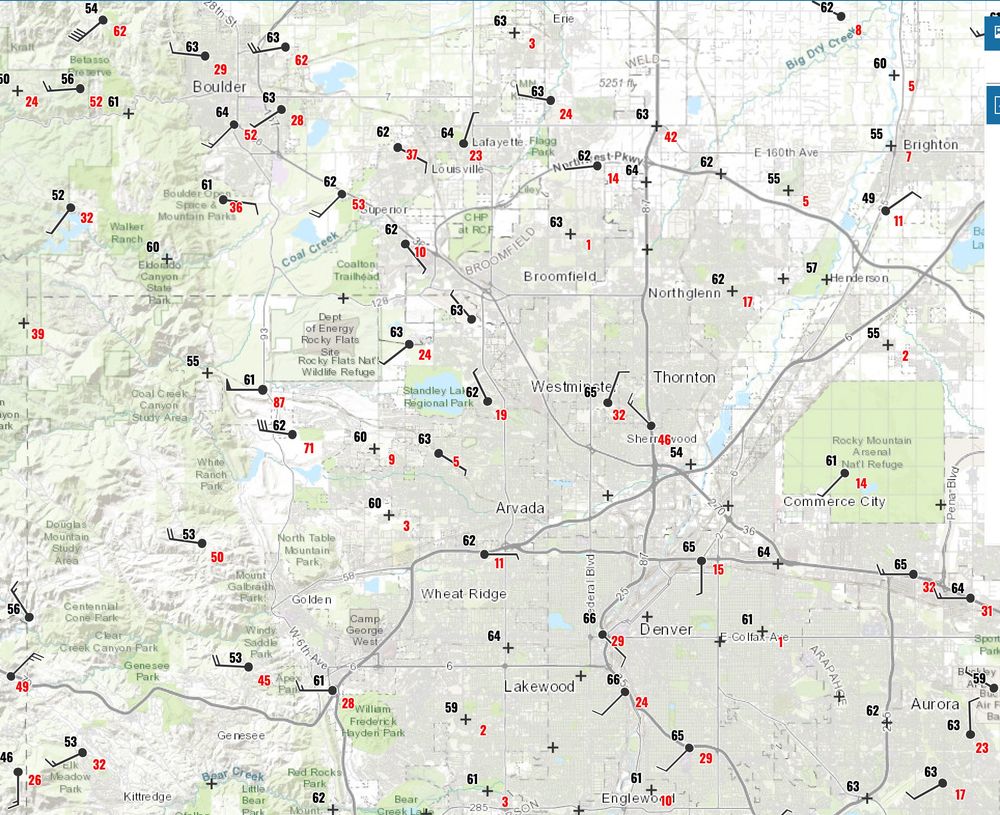
February 3, 2025 at 3:55 AM
Wild wind gradients out there right now


Nice lenticular cloud display over Denver this afternoon.


December 22, 2024 at 11:38 PM
Nice lenticular cloud display over Denver this afternoon.