


Utah Daily Snow
@wasatchsnow.bsky.social
Utah Forecaster for OpenSnow
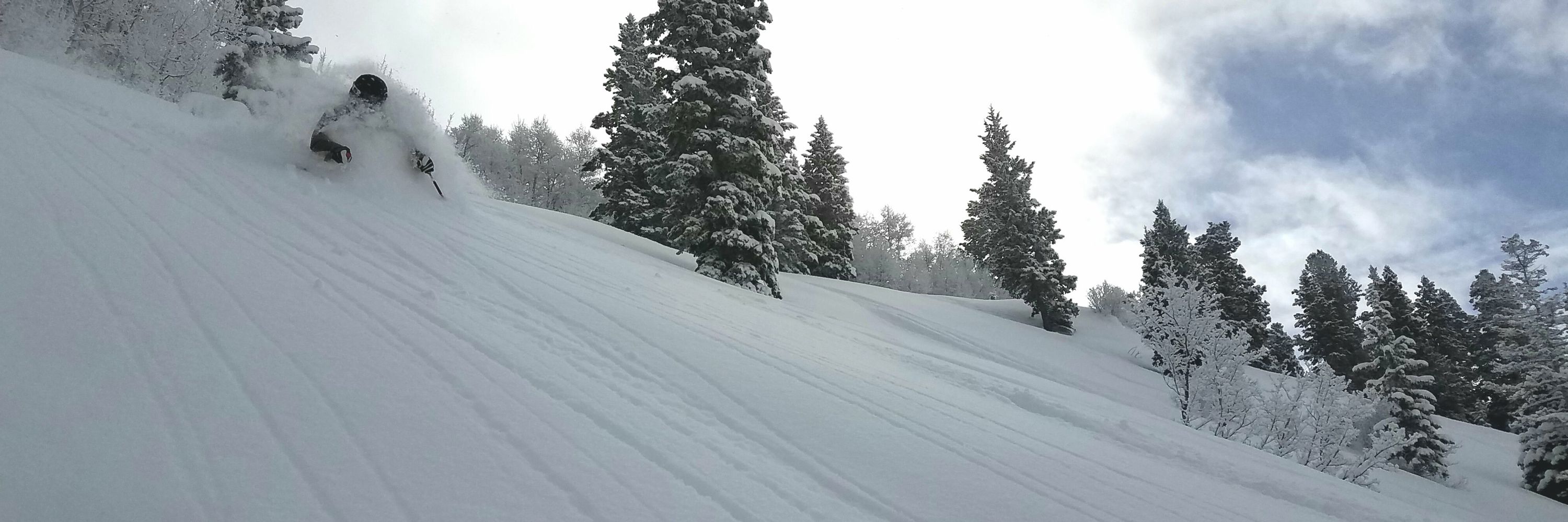
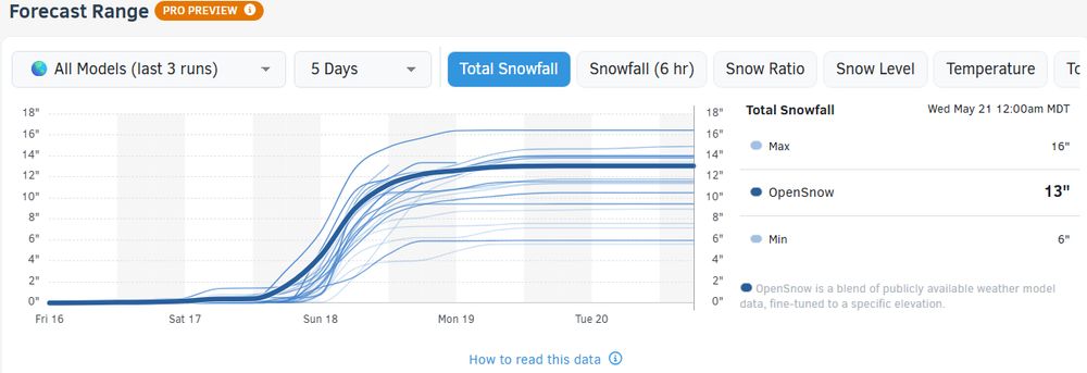
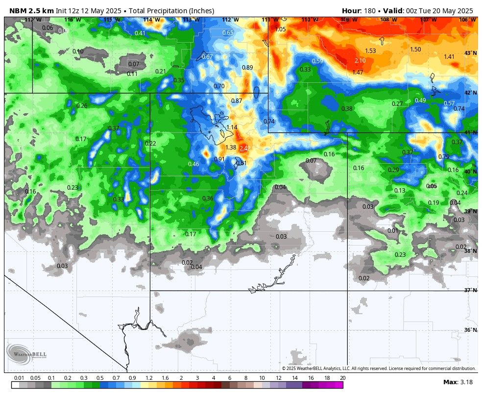
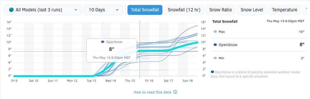
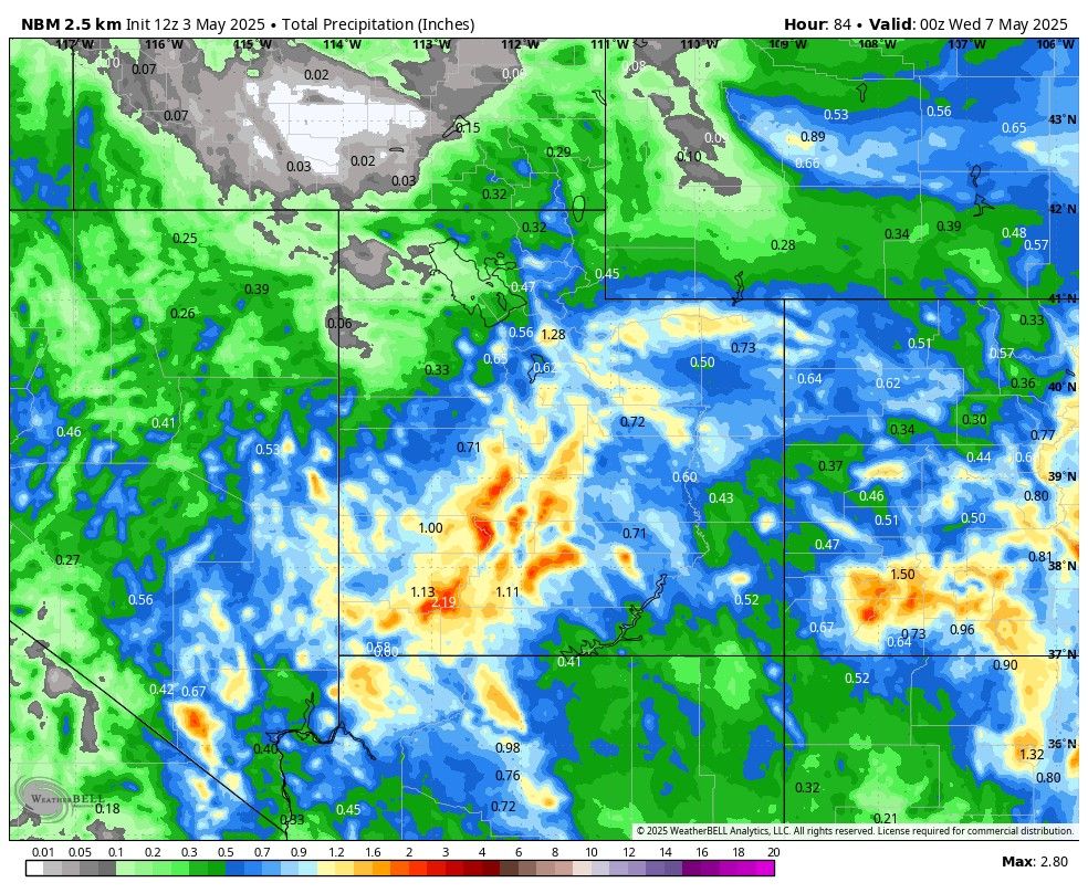
Another decent late-spring storm is moving in this weekend. Sunday looks to be the most likely day for "powder" and there's a chance amounts could be in the significant-for-this-time-of-year range.
May 16, 2025 at 1:53 PM
Another decent late-spring storm is moving in this weekend. Sunday looks to be the most likely day for "powder" and there's a chance amounts could be in the significant-for-this-time-of-year range.
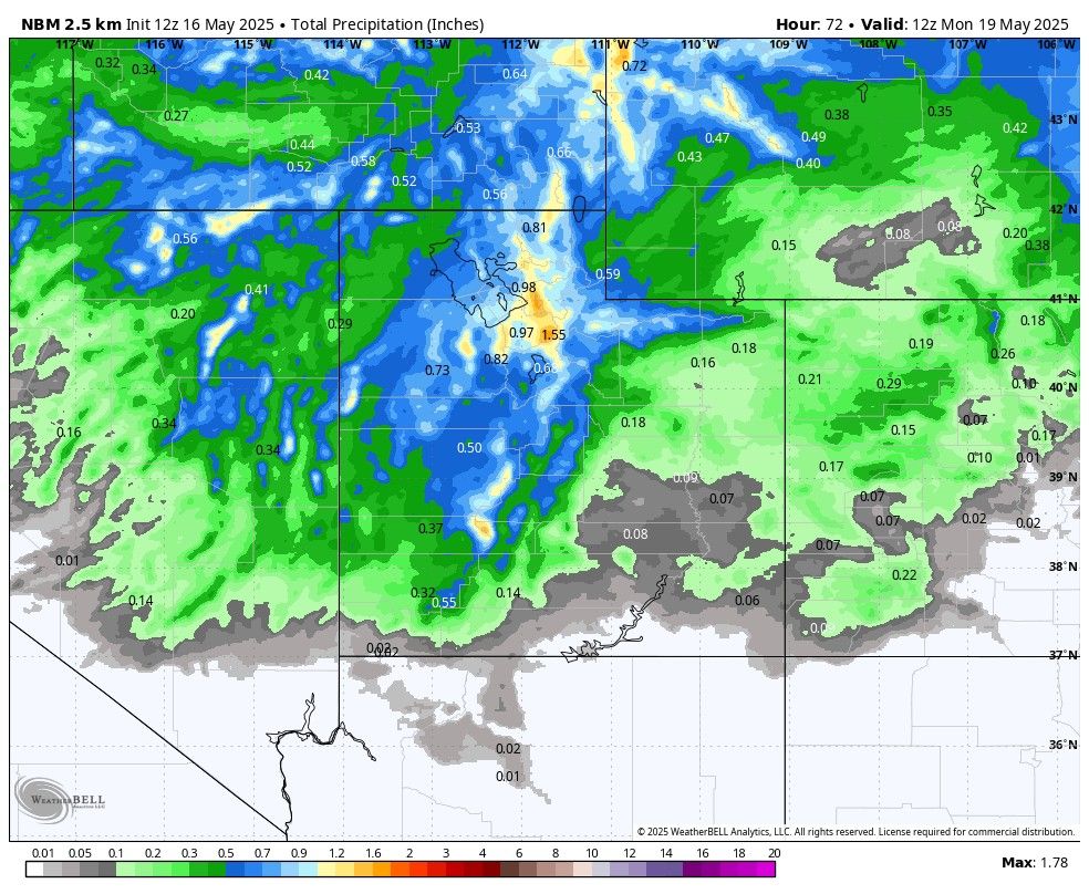
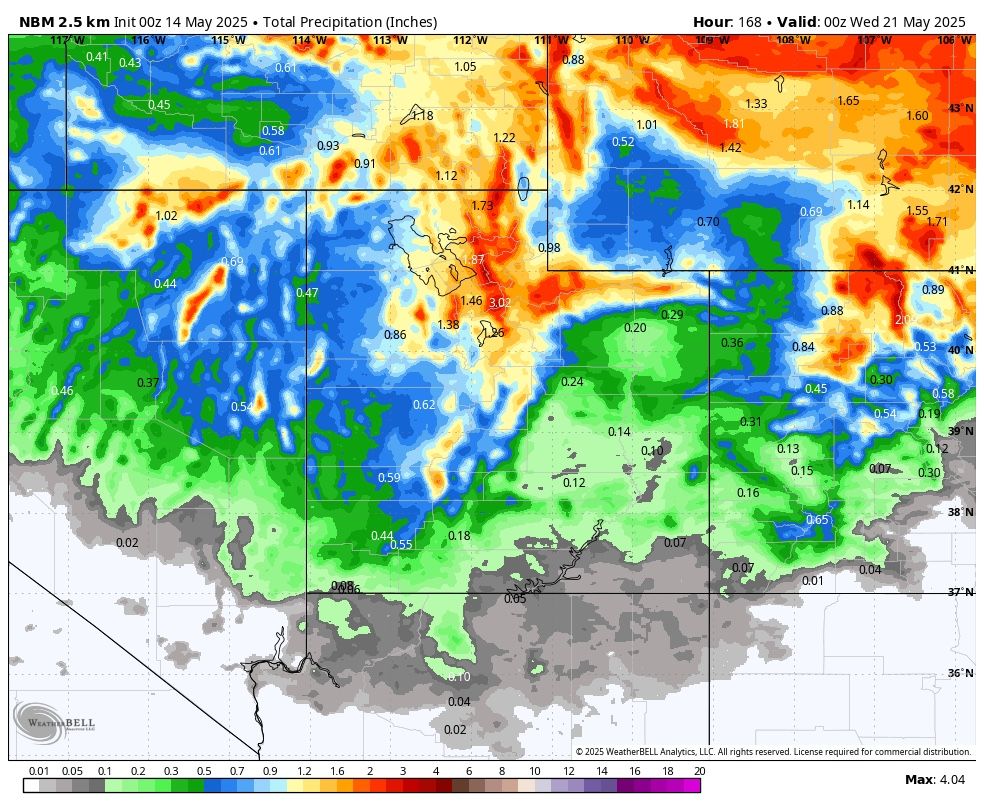
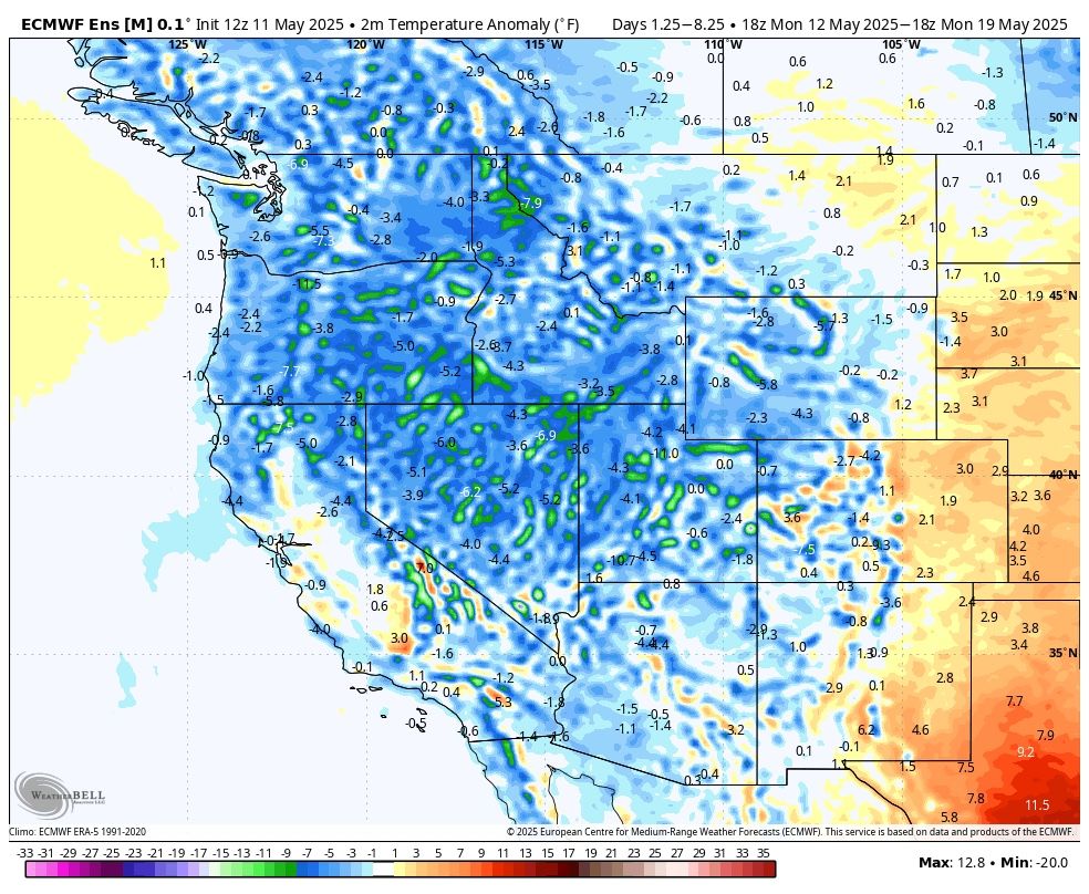
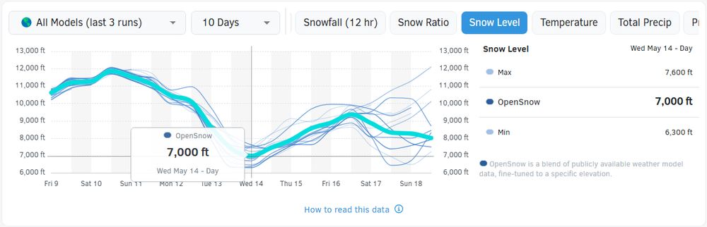
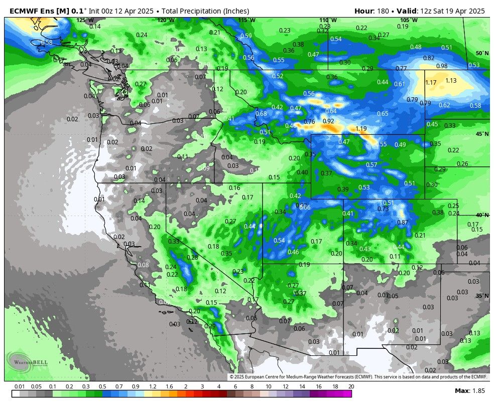
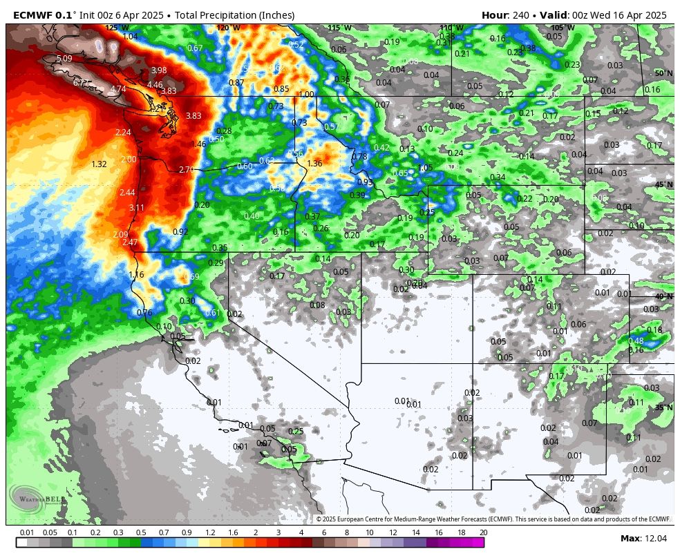
This is the next 7 days… Models are generating quite a bit of precip for Northern Utah. Very beneficial. Also, highly likely we see some decent snowfall accumulation in the highest elevations.
May 14, 2025 at 3:12 AM
This is the next 7 days… Models are generating quite a bit of precip for Northern Utah. Very beneficial. Also, highly likely we see some decent snowfall accumulation in the highest elevations.
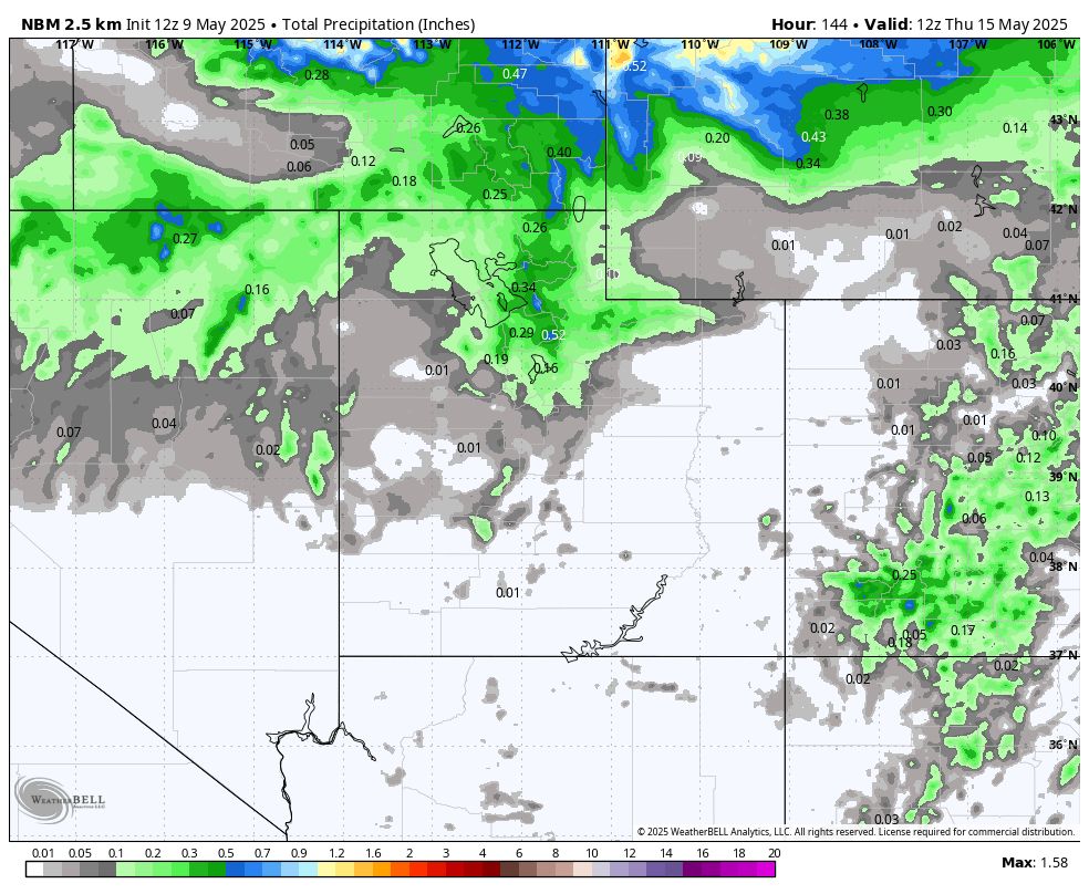
A storm brings more showers (and high elevation snow showers) Tuesday afternoon through Wednesday. We have the potential for a stronger storm system this weekend into early next week. Could we get one (or two) more "powder" days?
May 12, 2025 at 2:16 PM
A storm brings more showers (and high elevation snow showers) Tuesday afternoon through Wednesday. We have the potential for a stronger storm system this weekend into early next week. Could we get one (or two) more "powder" days?
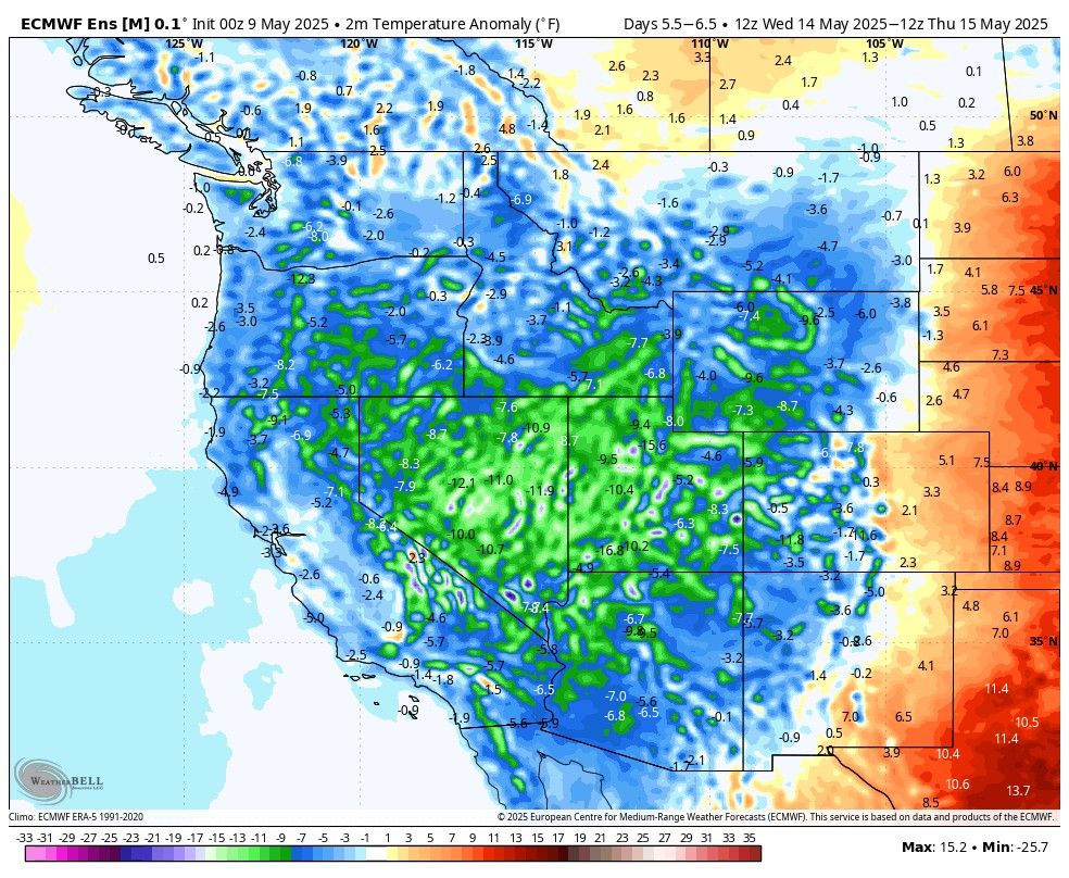
A cooler-than-average pattern will prevail for the next week or more throughout most of the western US. This will include chances for high elevation snow in Utah midweek and again next weekend.
May 11, 2025 at 10:33 PM
A cooler-than-average pattern will prevail for the next week or more throughout most of the western US. This will include chances for high elevation snow in Utah midweek and again next weekend.
Another cool late-spring storm will bring the threat of mountain snowfall to northern Utah late Tuesday into Wednesday of next week. Another chance for freshies?
May 9, 2025 at 2:47 PM
Another cool late-spring storm will bring the threat of mountain snowfall to northern Utah late Tuesday into Wednesday of next week. Another chance for freshies?
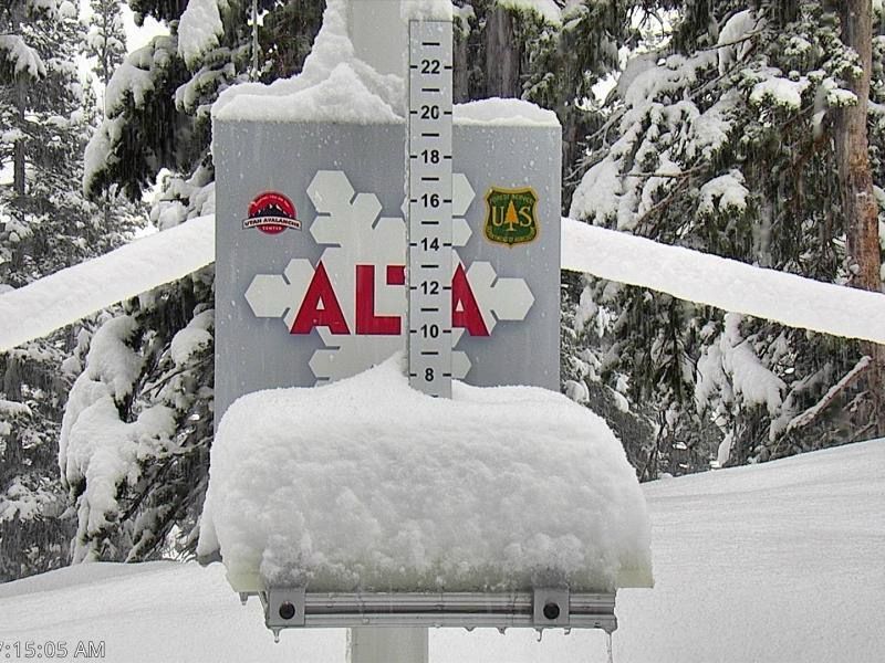
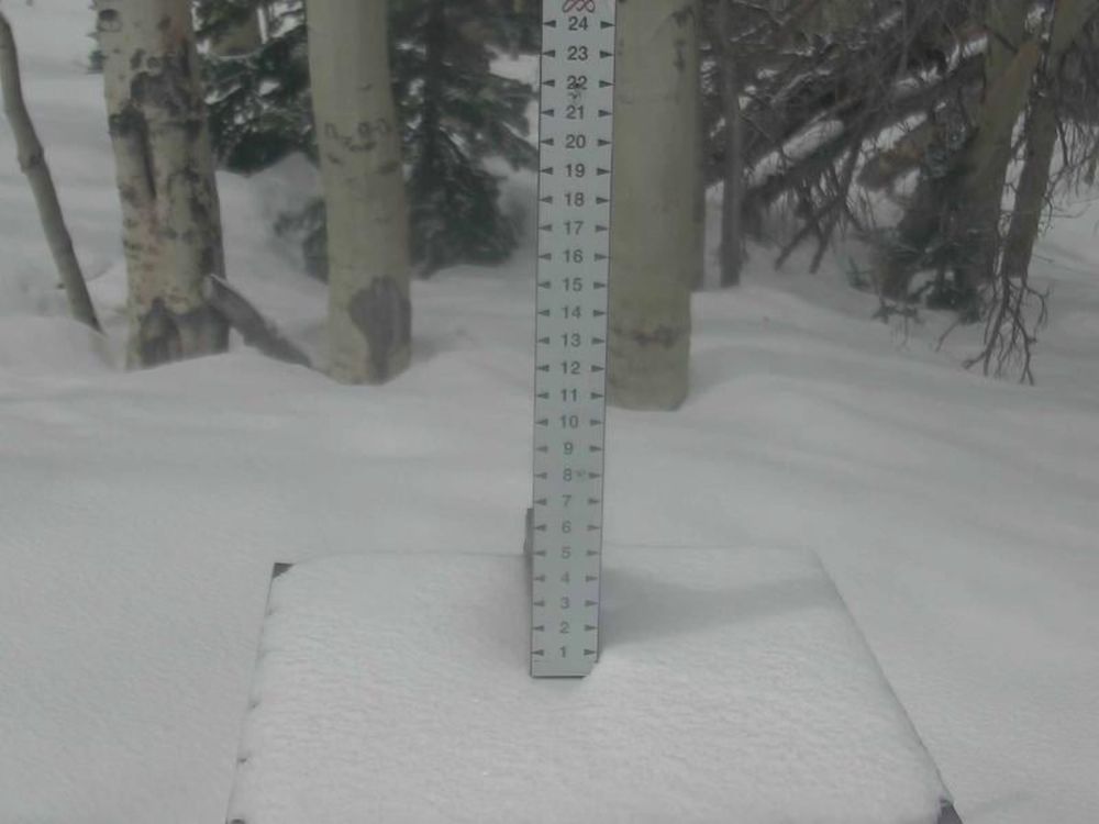
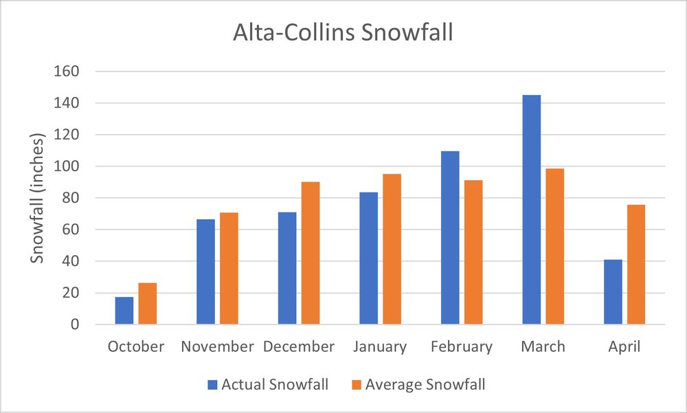
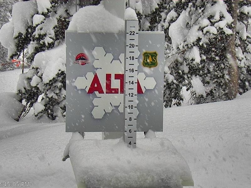
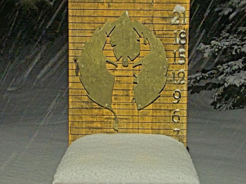
Alta-Collins has 8” of snow from 1.00” of SWE. Definitely dense, but it is May. We will take it.
May 6, 2025 at 1:32 PM
Alta-Collins has 8” of snow from 1.00” of SWE. Definitely dense, but it is May. We will take it.
So it is snowing, but it was 35°F at 9600’ at 4pm. What’s falling is, as expected, thick and creamy. Slightly cooler air will filter in, but only slightly.
May 5, 2025 at 10:44 PM
So it is snowing, but it was 35°F at 9600’ at 4pm. What’s falling is, as expected, thick and creamy. Slightly cooler air will filter in, but only slightly.
We have a decent storm that will bring precip to the state Sunday thru Tuesday. Our struggle, from a snow perspective, is getting cold enough air into the region for this storm. We are probably looking at only very high elevation snow that will be very dense where it does fall.
May 3, 2025 at 3:38 PM
We have a decent storm that will bring precip to the state Sunday thru Tuesday. Our struggle, from a snow perspective, is getting cold enough air into the region for this storm. We are probably looking at only very high elevation snow that will be very dense where it does fall.
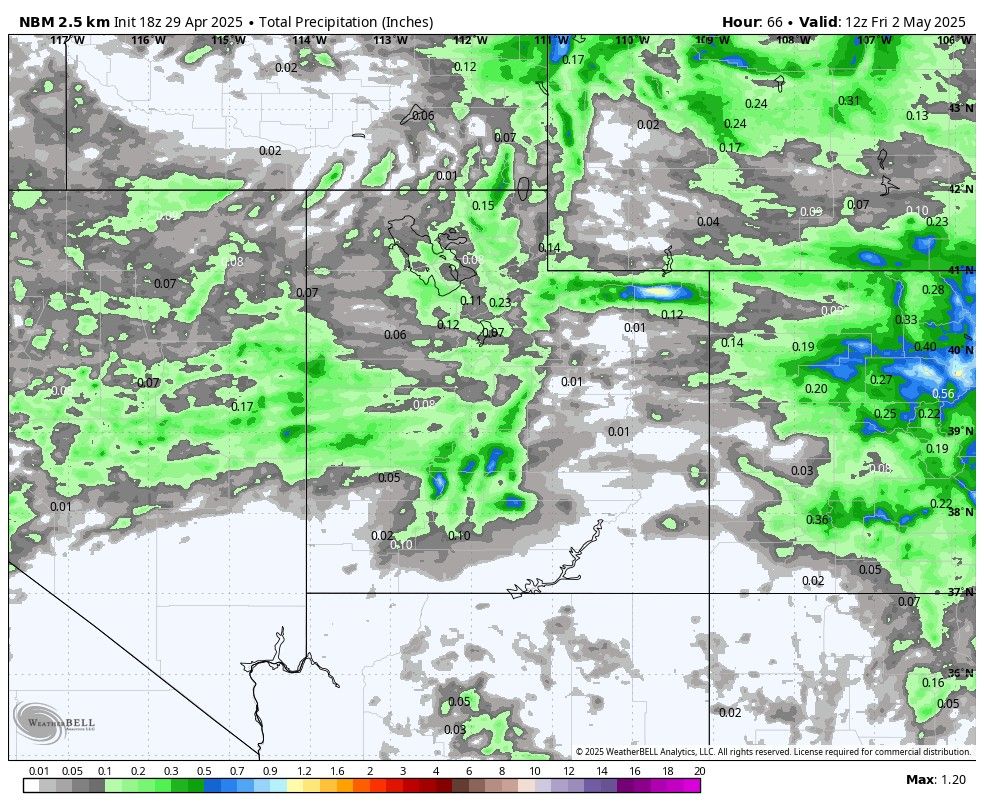
Another weak storm will bring some precip to Utah tomorrow. Amounts are fairly meager, and temps aren't particularly cold, but we could manage an inch or two of fresh snow in the high elevations.
April 29, 2025 at 7:46 PM
Another weak storm will bring some precip to Utah tomorrow. Amounts are fairly meager, and temps aren't particularly cold, but we could manage an inch or two of fresh snow in the high elevations.
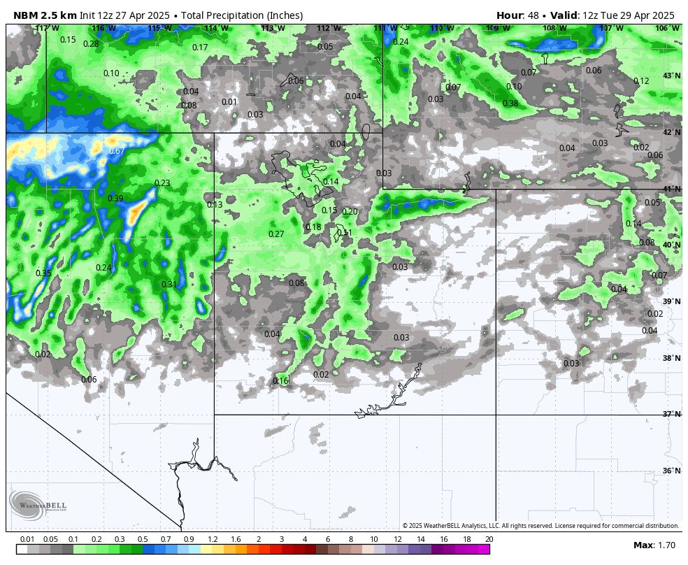
A weakening cutoff low will track across Utah, bringing the threat of high-elevation snow showers later today through Monday. Accumulations look to be on the light side (1-3"), but we could see pockets of higher. Additional chances for snow Wednesday and again next weekend.
April 27, 2025 at 3:03 PM
A weakening cutoff low will track across Utah, bringing the threat of high-elevation snow showers later today through Monday. Accumulations look to be on the light side (1-3"), but we could see pockets of higher. Additional chances for snow Wednesday and again next weekend.
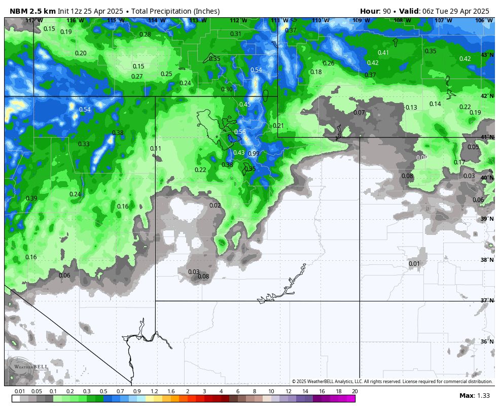
A cutoff low spins its way into Utah by Sunday afternoon with cooler temps and snow continuing into Monday. This time of year, storms are always a wildcard, but perhaps we can get some real powder out of this... *fingers crossed*
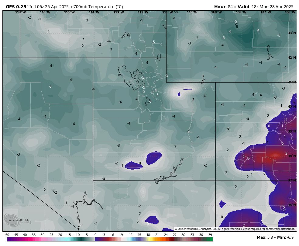
April 25, 2025 at 3:36 PM
A cutoff low spins its way into Utah by Sunday afternoon with cooler temps and snow continuing into Monday. This time of year, storms are always a wildcard, but perhaps we can get some real powder out of this... *fingers crossed*
We had a quick convective storm roll through with snow/graupel in the central Wasatch. Scattered showers and high elevation snow will be possible through the afternoon. Can’t rule out a quick coating of snow from these storms.
April 24, 2025 at 6:23 PM
We had a quick convective storm roll through with snow/graupel in the central Wasatch. Scattered showers and high elevation snow will be possible through the afternoon. Can’t rule out a quick coating of snow from these storms.
Final Post of the Season is now up!
We still have chances for snow, especially next Monday, so I will update here and the "Forecast" section of my end-of-season post. But... You can read the post-season analysis now if you so choose.
We still have chances for snow, especially next Monday, so I will update here and the "Forecast" section of my end-of-season post. But... You can read the post-season analysis now if you so choose.
April 23, 2025 at 3:24 PM
Final Post of the Season is now up!
We still have chances for snow, especially next Monday, so I will update here and the "Forecast" section of my end-of-season post. But... You can read the post-season analysis now if you so choose.
We still have chances for snow, especially next Monday, so I will update here and the "Forecast" section of my end-of-season post. But... You can read the post-season analysis now if you so choose.
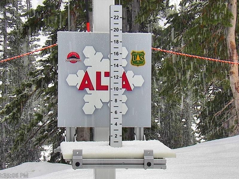
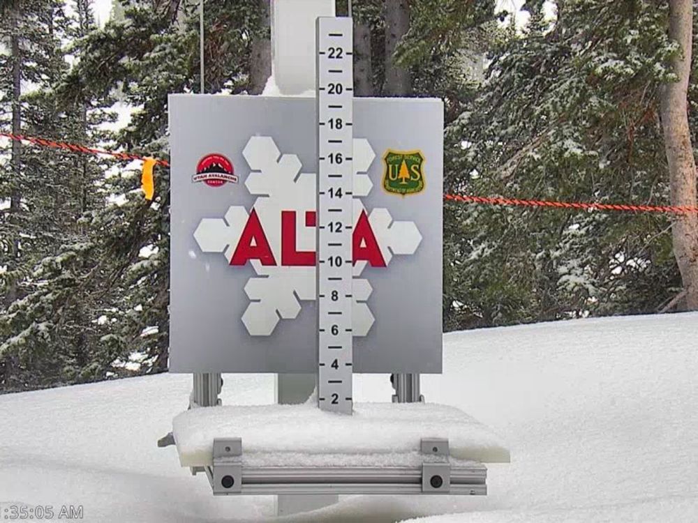
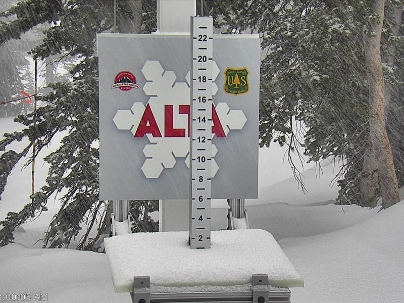
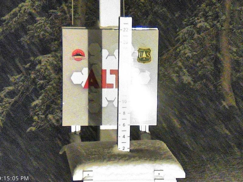
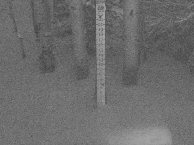
2" of snow from 0.23" SWE at Alta-Collins as of 8am. Snowing hard and temperatures are starting to fall as the front moves through. Looks like generally 1-3" so far across northern Utah mountains. 4-8" likely by noon when the front sags south. Snow showers return tonight/Fri AM.
April 17, 2025 at 2:41 PM
2" of snow from 0.23" SWE at Alta-Collins as of 8am. Snowing hard and temperatures are starting to fall as the front moves through. Looks like generally 1-3" so far across northern Utah mountains. 4-8" likely by noon when the front sags south. Snow showers return tonight/Fri AM.
Weak "storm" tonight with a stronger system possible for later in the week. Some indications of an unsettled second half of April. I could really use one more powder day...
April 12, 2025 at 12:55 PM
Weak "storm" tonight with a stronger system possible for later in the week. Some indications of an unsettled second half of April. I could really use one more powder day...
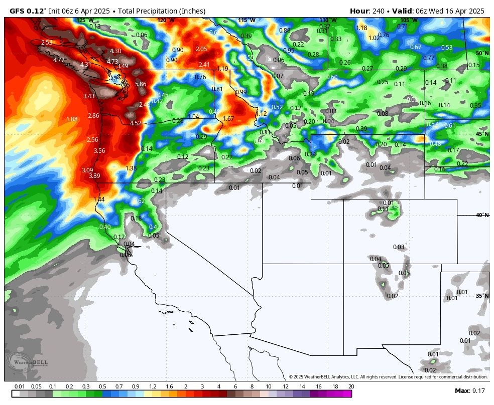
Next ten days per the GFS and Euro… mostly dry with the majority of action to our north and west.
April 6, 2025 at 1:42 PM
Next ten days per the GFS and Euro… mostly dry with the majority of action to our north and west.
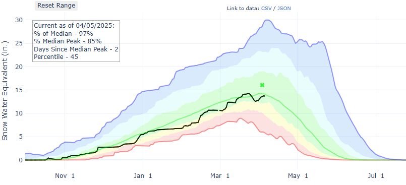
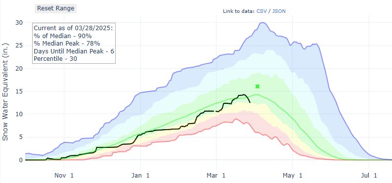
I've seen a lot of downward graphs lately. Our snowpack is about to follow suit. This is likely the peak. The spring melt-off resumes as high pressure takes control for the next week or more.
April 5, 2025 at 2:53 PM
I've seen a lot of downward graphs lately. Our snowpack is about to follow suit. This is likely the peak. The spring melt-off resumes as high pressure takes control for the next week or more.
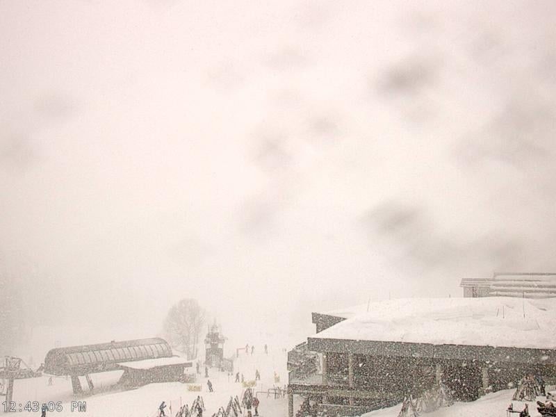
Almost stationary snow showers over parts of the central Wasatch. Snowing very hard in LCC right now! Who’s up there?
April 3, 2025 at 7:06 PM
Almost stationary snow showers over parts of the central Wasatch. Snowing very hard in LCC right now! Who’s up there?
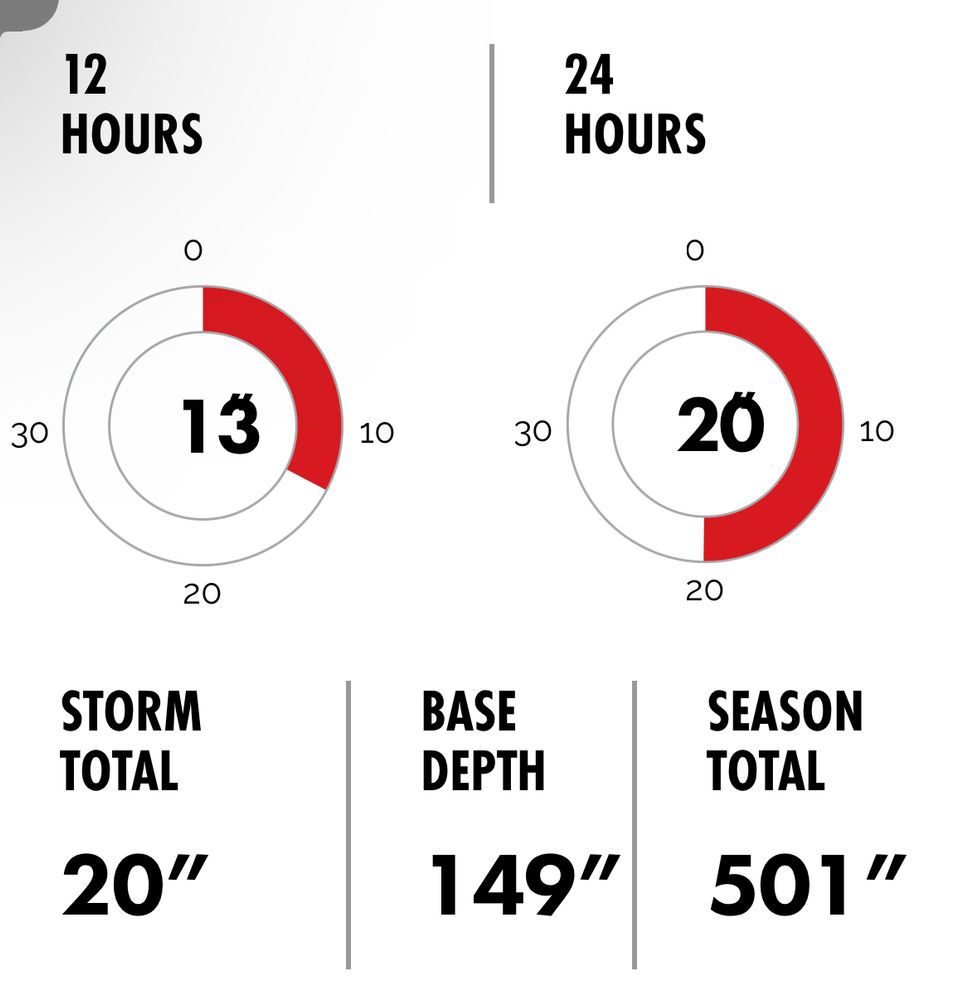
Happy 500” to those who celebrate 🎉
April 1, 2025 at 6:48 PM
Happy 500” to those who celebrate 🎉
Sweet dreams. May the night bring us plentiful bounty.
April 1, 2025 at 3:35 AM
Sweet dreams. May the night bring us plentiful bounty.
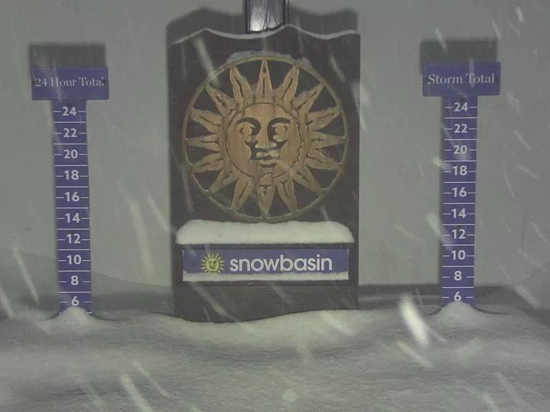
Graupel now. Fluff and stuff arrives this evening and continues through tomorrow. Promising storm to start April!
March 31, 2025 at 8:44 PM
Graupel now. Fluff and stuff arrives this evening and continues through tomorrow. Promising storm to start April!
womp womp woooomp
March 28, 2025 at 6:43 PM
womp womp woooomp
We haven't even gotten to the warm part of this "heatwave" and we are already seeing the statewide average snowpack lose snow. Good news is that most of this snow loss is going to occur on low and mid-elevation sites. High elevation sites, where you ski/ride, are more resilient.

March 25, 2025 at 2:12 PM
We haven't even gotten to the warm part of this "heatwave" and we are already seeing the statewide average snowpack lose snow. Good news is that most of this snow loss is going to occur on low and mid-elevation sites. High elevation sites, where you ski/ride, are more resilient.
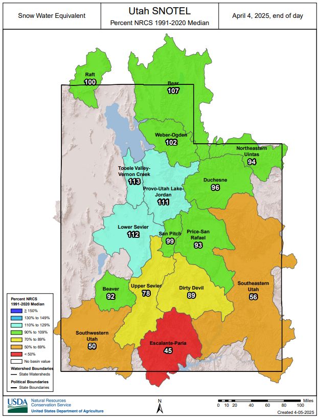
Temperatures could reach 80F this week along the Wasatch Front. We are probably going to lose some low and mid-elevation snowpack, so we may want to mentally frame this. Our statewide snowpack has made remarkable climb to 105% of median after starting the month around 85%.

March 23, 2025 at 2:34 PM
Temperatures could reach 80F this week along the Wasatch Front. We are probably going to lose some low and mid-elevation snowpack, so we may want to mentally frame this. Our statewide snowpack has made remarkable climb to 105% of median after starting the month around 85%.


