


Former PV_Anomaly/Baroclinic Instability
@tropofold.bsky.social
AK Weather
Happy to see we were highlighted up here. I just had a webinar with someone I am working with on a project and he stated his office (I won’t name it) is going to lose 4 to VERA which was just approved by DOC. They will have…gasp…two leads and two Mets. That’s it. With upcoming severe season.
March 23, 2025 at 1:54 PM
Happy to see we were highlighted up here. I just had a webinar with someone I am working with on a project and he stated his office (I won’t name it) is going to lose 4 to VERA which was just approved by DOC. They will have…gasp…two leads and two Mets. That’s it. With upcoming severe season.
Reposted by Former PV_Anomaly/Baroclinic Instability

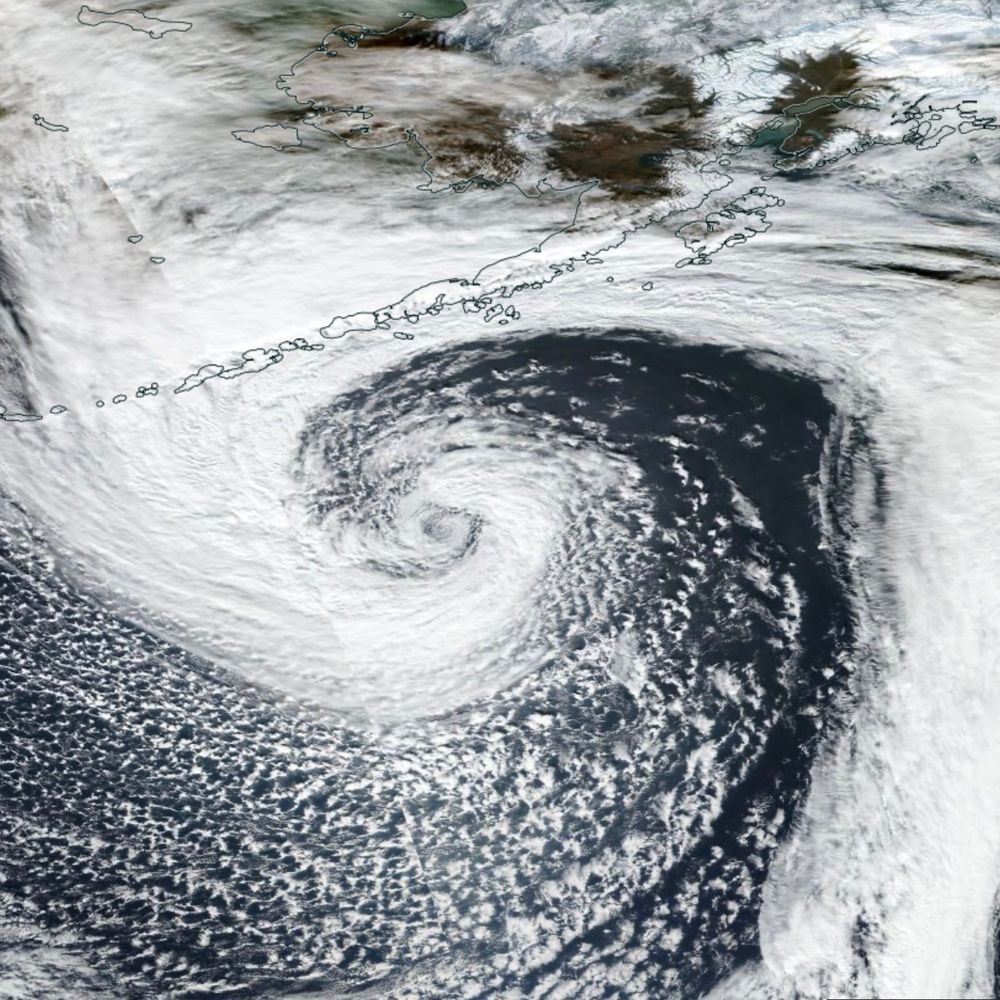
Here's an animation of #GOESWest True Color RGB images -- it appears that the von Kármán vortex street was created by northerly winds interacting with the sharp western tip of Nelson Island? Full res: cimss.ssec.wisc.edu/satellite-bl... #AKwx
March 21, 2025 at 10:53 PM
Here's an animation of #GOESWest True Color RGB images -- it appears that the von Kármán vortex street was created by northerly winds interacting with the sharp western tip of Nelson Island? Full res: cimss.ssec.wisc.edu/satellite-bl... #AKwx
That looks to be the cause. What an amazing view!
March 22, 2025 at 8:03 AM
That looks to be the cause. What an amazing view!
Absolutely good sir. Also, it still says hi, because it is still sitting there an hour later 😊

March 15, 2025 at 4:49 PM
Absolutely good sir. Also, it still says hi, because it is still sitting there an hour later 😊
Very much reminiscent of April 14 2011. Dust swirling into the cyclone, fires burning over the plains feeding smoke into the center.

March 15, 2025 at 4:36 PM
Very much reminiscent of April 14 2011. Dust swirling into the cyclone, fires burning over the plains feeding smoke into the center.
Someone’s Christmas lights, ha. It is North Pole, AK 😄
March 15, 2025 at 4:19 PM
Someone’s Christmas lights, ha. It is North Pole, AK 😄
I am still proud to say I experienced the worst snow season of all-time in 2014-15. I remember chinook after chinook, rainstorm after rainstorm. I learned about studded tires that I still utilize to this day, thanks to those meager years in the mid 2010s.
March 14, 2025 at 4:43 PM
I am still proud to say I experienced the worst snow season of all-time in 2014-15. I remember chinook after chinook, rainstorm after rainstorm. I learned about studded tires that I still utilize to this day, thanks to those meager years in the mid 2010s.
How r things in cali? Hope you r well man.
March 14, 2025 at 6:54 AM
How r things in cali? Hope you r well man.
We used to call them, #convective bombs.
March 13, 2025 at 1:41 PM
We used to call them, #convective bombs.
Also credit to the often mocked Canadian Regional. It’s nonhydroststic physics can come in handy sometimes.

March 13, 2025 at 1:34 PM
Also credit to the often mocked Canadian Regional. It’s nonhydroststic physics can come in handy sometimes.
Interestingly enough, the course res ECMWF ensemble did the “best”. At least showed the potential.

March 13, 2025 at 1:30 PM
Interestingly enough, the course res ECMWF ensemble did the “best”. At least showed the potential.
The HRRR doesn’t even have it right now 😂 Yeah I agree, these are the hardest events for models. Weak convergence coupled with local ocean driven instability, with lifting along a mesoscale front in PWS, and lifting by huge but highly complex terrain. It’s a model problem that isn’t going away.
March 13, 2025 at 1:28 PM
The HRRR doesn’t even have it right now 😂 Yeah I agree, these are the hardest events for models. Weak convergence coupled with local ocean driven instability, with lifting along a mesoscale front in PWS, and lifting by huge but highly complex terrain. It’s a model problem that isn’t going away.
Turnagain Arm convergence can pay dividends in bad snow years. Also, warmer ocean temps presumably can result in more convective banding. Reminds of the tough snow forecasts of the 2010s.
March 13, 2025 at 1:20 PM
Turnagain Arm convergence can pay dividends in bad snow years. Also, warmer ocean temps presumably can result in more convective banding. Reminds of the tough snow forecasts of the 2010s.
Your tabby has similar color patterns to mine.

March 11, 2025 at 12:28 PM
Your tabby has similar color patterns to mine.
I would also have to think that played a role in why Kaktovik just blew 50+ mph from the east over the last three days with hardly any blowing snow restrictions.
March 9, 2025 at 3:25 AM
I would also have to think that played a role in why Kaktovik just blew 50+ mph from the east over the last three days with hardly any blowing snow restrictions.