SRHelicity
@srhelicity.bsky.social
Meteorologist (B.S., M.S., Ph.D.).
All views my own
All views my own
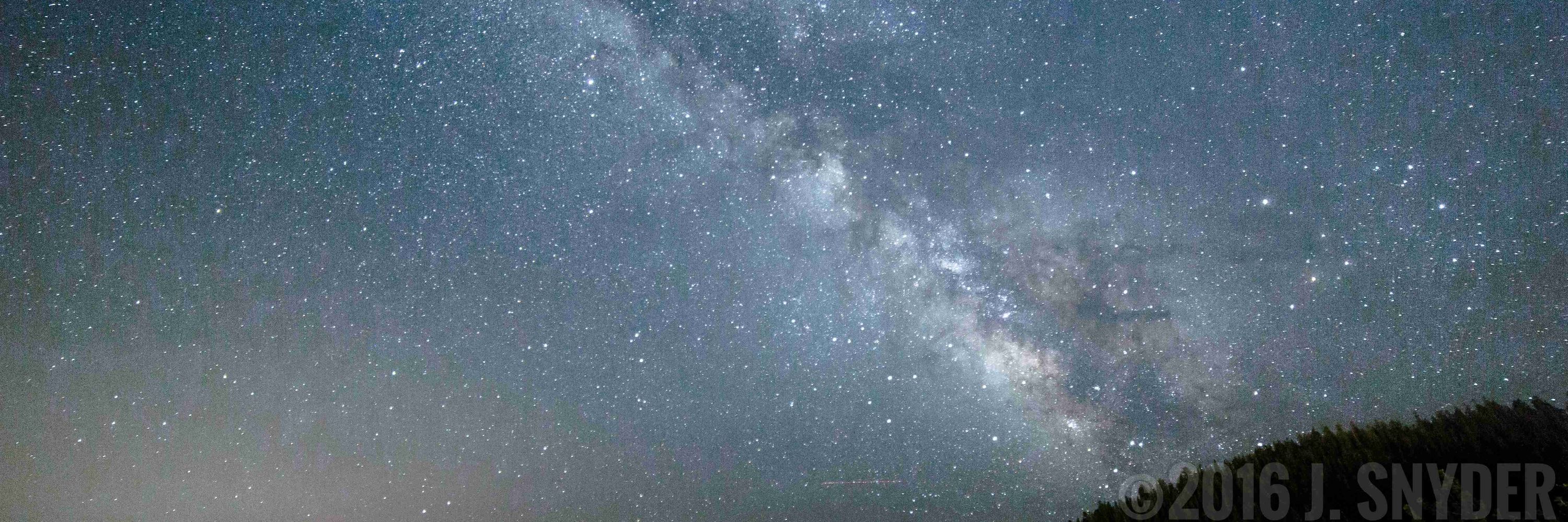
Aurora visible in the Oklahoma City metro now. Think those are some lingering clouds blocking some of it

November 12, 2025 at 1:43 AM
Aurora visible in the Oklahoma City metro now. Think those are some lingering clouds blocking some of it
Been there, done that, unfortunately... 👎 Mine was a trim nail (missed the stud) through a pex line that went undetected until the nail rusted enough for the water leak to saturate the adjacent carpet and pad, which took about 7 years.


September 9, 2025 at 10:39 PM
Been there, done that, unfortunately... 👎 Mine was a trim nail (missed the stud) through a pex line that went undetected until the nail rusted enough for the water leak to saturate the adjacent carpet and pad, which took about 7 years.

An absolutely A+ weather day here in Oklahoma! Temps near 70, dewpoints in the low 50s, light winds, under partly cloudy skies... Considering we are still in early September (!!), I don't think the weather can get much more pleasant than we are seeing today!

September 6, 2025 at 6:46 PM
An absolutely A+ weather day here in Oklahoma! Temps near 70, dewpoints in the low 50s, light winds, under partly cloudy skies... Considering we are still in early September (!!), I don't think the weather can get much more pleasant than we are seeing today!
<BoomingBaritoneRadioVoice>The man. The myth. The legend. </voice>

August 26, 2025 at 9:12 PM
<BoomingBaritoneRadioVoice>The man. The myth. The legend. </voice>
A bumblebee kind of morning in my backyard...


August 24, 2025 at 4:16 PM
A bumblebee kind of morning in my backyard...

July 29, 2025 at 11:31 PM
The headline here neglects to mention today also sets a new all-time high temperature at Tampa, but it's noted in the second paragraph.

July 27, 2025 at 8:21 PM
The headline here neglects to mention today also sets a new all-time high temperature at Tampa, but it's noted in the second paragraph.
An 80 deg dewpoint in my yard this afternoon with a temp in the mid-90s makes for gross conditions. I live in a ~40 yr old neighborhood w/ many mature trees (lots of vegetation & less mixing), so the daytime Td tends to be several deg higher than nearby mesonet sites with more open exposure. Yuck.

July 21, 2025 at 9:38 PM
An 80 deg dewpoint in my yard this afternoon with a temp in the mid-90s makes for gross conditions. I live in a ~40 yr old neighborhood w/ many mature trees (lots of vegetation & less mixing), so the daytime Td tends to be several deg higher than nearby mesonet sites with more open exposure. Yuck.
My tipping gauge is at 3.50" now, while my Climalytic CoCoRaHS gauge is ~3.95". Radar estimate at my place is very near 3.75", which is a good match with my gauges. Other areas of the N and W metro have seen >5". (In attached radar image, magenta starts near 4.25" and purple/blue near 5.5"!) #okwx


July 12, 2025 at 10:34 PM
My tipping gauge is at 3.50" now, while my Climalytic CoCoRaHS gauge is ~3.95". Radar estimate at my place is very near 3.75", which is a good match with my gauges. Other areas of the N and W metro have seen >5". (In attached radar image, magenta starts near 4.25" and purple/blue near 5.5"!) #okwx
Very heavy rain across the northern and western OKC metro. Peak rainrate at my house has been above 3"/hr. I've gotten nearly 2" (reasonably close to radar estimate), and the rainrate is still >2"/hr here.


July 12, 2025 at 8:23 PM
Very heavy rain across the northern and western OKC metro. Peak rainrate at my house has been above 3"/hr. I've gotten nearly 2" (reasonably close to radar estimate), and the rainrate is still >2"/hr here.
NSSL and GSL are in the Weather Laboratories section, which also gets zeroed out.

June 30, 2025 at 5:20 PM
NSSL and GSL are in the Weather Laboratories section, which also gets zeroed out.
I think it's important that people realize that line items like "Tornado Severe Storm Research / Phased Array Radar" (6 FTEs) and "US Weather Research Program" are very small (17 FTEs). The vast, *vast* majority of tornado, severe storm, radar, & weather research occurs at the labs and CIs.

June 30, 2025 at 5:05 PM
I think it's important that people realize that line items like "Tornado Severe Storm Research / Phased Array Radar" (6 FTEs) and "US Weather Research Program" are very small (17 FTEs). The vast, *vast* majority of tornado, severe storm, radar, & weather research occurs at the labs and CIs.
NOAA's FY26 Congressional Justification is out. Screenshot is from Page 190 (OAR-10). A small number of positions from OAR are transferred to NWS, but otherwise there are a lot of zeroes, consistent w/ previous news. Congress ultimately is responsible for budgets, so we'll see what they do.
June 30, 2025 at 4:55 PM
NOAA's FY26 Congressional Justification is out. Screenshot is from Page 190 (OAR-10). A small number of positions from OAR are transferred to NWS, but otherwise there are a lot of zeroes, consistent w/ previous news. Congress ultimately is responsible for budgets, so we'll see what they do.
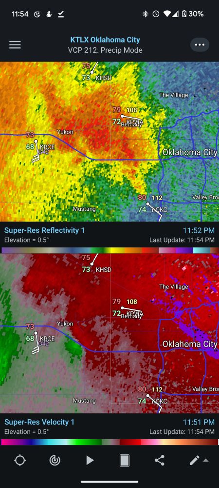
Then don't look at this cyclonic convergence signature on this closer supercell that's along i40 in Yukon ...
June 7, 2025 at 4:55 AM
Then don't look at this cyclonic convergence signature on this closer supercell that's along i40 in Yukon ...
Looks like a weak, pseudo-warm front cuts through the metro as well. SE winds and mid 70 dewpoints to the S; Erly winds with ~70 dewpoints to the N of it. 👎

June 7, 2025 at 4:36 AM
Looks like a weak, pseudo-warm front cuts through the metro as well. SE winds and mid 70 dewpoints to the S; Erly winds with ~70 dewpoints to the N of it. 👎

Growing TDS west of Huntsville

May 20, 2025 at 11:20 PM
Growing TDS west of Huntsville


I should have mentioned that the CC and Z *could* be biological (tho typically see more azmthl varblty in CC and ZDR in bio), but velocity (everywhere closer to 0, much less than the wind) & SW (also v low, indicating little variability in velocities in radar volumes) hints at ground/sea clutter


May 15, 2025 at 4:14 AM
I should have mentioned that the CC and Z *could* be biological (tho typically see more azmthl varblty in CC and ZDR in bio), but velocity (everywhere closer to 0, much less than the wind) & SW (also v low, indicating little variability in velocities in radar volumes) hints at ground/sea clutter
Just to be clear (heh!), here's the current visible satellite imagery showing just some cirrus and maybe some altocumulus over the northwestern Gulf. Our standard dual-pol products (e.g., correlation coefficient) show that these are all non-meteorological echoes as well.

May 14, 2025 at 1:51 PM
Just to be clear (heh!), here's the current visible satellite imagery showing just some cirrus and maybe some altocumulus over the northwestern Gulf. Our standard dual-pol products (e.g., correlation coefficient) show that these are all non-meteorological echoes as well.
Can see the tremendous inversion on the CRP and, to a little less extent, LCH soundings this morning. I wonder if the additional "rings" farther out are 2nd & 3rd hit of the ocean after EM forward scatters off ocean sfc once, then gets bent and hits sfc again a 2nd time. Prop path like (Radar)/\x/\x

May 14, 2025 at 1:37 PM
Can see the tremendous inversion on the CRP and, to a little less extent, LCH soundings this morning. I wonder if the additional "rings" farther out are 2nd & 3rd hit of the ocean after EM forward scatters off ocean sfc once, then gets bent and hits sfc again a 2nd time. Prop path like (Radar)/\x/\x