


Ricky Reusser
@rreusser.bsky.social
Math, graphics, maps, trail running. he/him
https://rreusser.github.io/
https://rreusser.github.io/
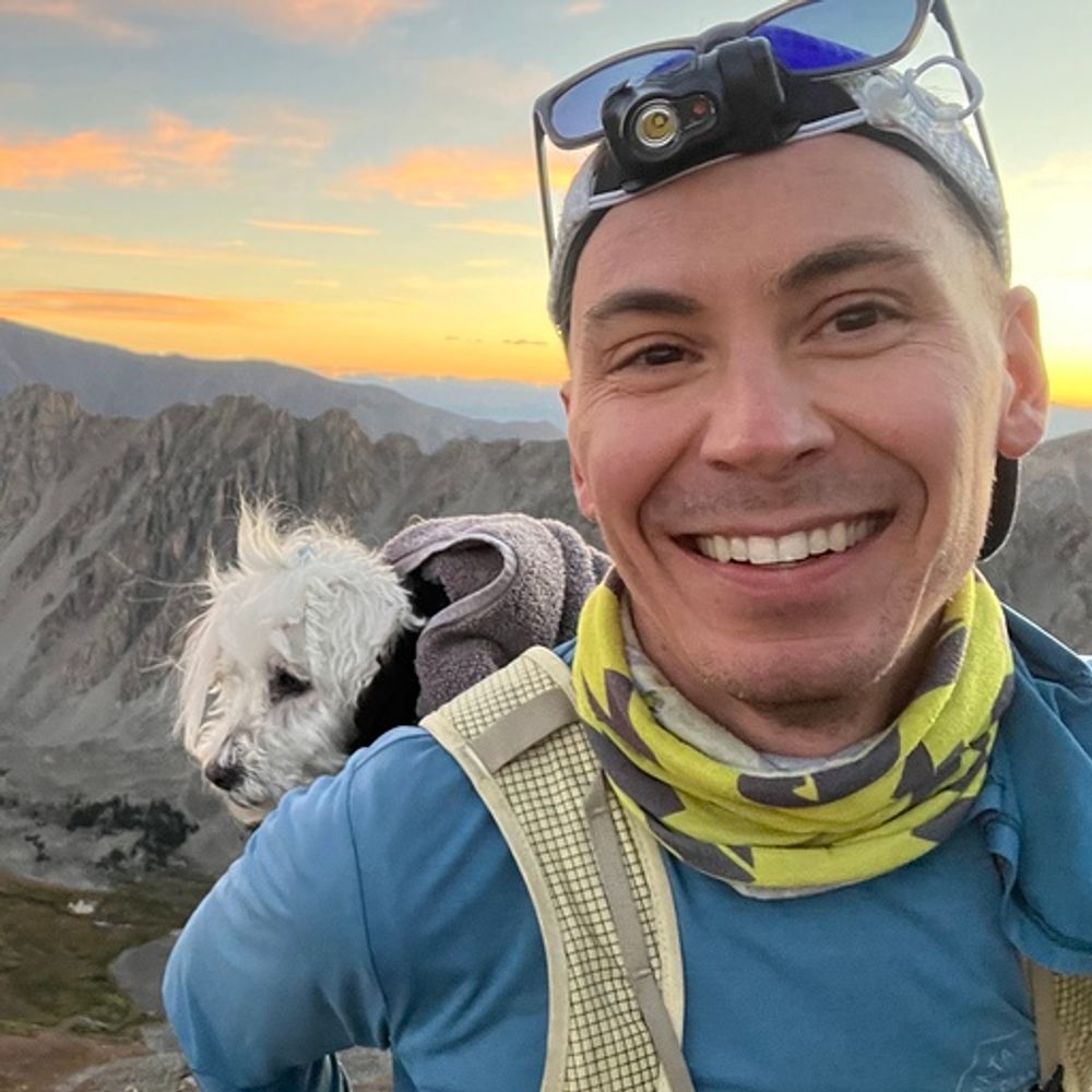
Phew, altitude PR and probably the most incredible view I’ve seen from a mountain. 🌋🦙 #cotopaxi #volcano #ecuador #mountaineering
November 15, 2025 at 11:13 PM
Phew, altitude PR and probably the most incredible view I’ve seen from a mountain. 🌋🦙 #cotopaxi #volcano #ecuador #mountaineering
Expanded it to work across an array of satellite tiles and added soft shadows. Softening shadows around the azimuth is easy because you just average samples (here, 16), and along the altitude is even easier because the horizon algorithm gives enough information to simply do a smooth fade.
July 5, 2025 at 6:15 AM
Expanded it to work across an array of satellite tiles and added soft shadows. Softening shadows around the azimuth is easy because you just average samples (here, 16), and along the altitude is even easier because the horizon algorithm gives enough information to simply do a smooth fade.
A 24-hour loop of summer solstice sun rising over Mount Adams, Washington, USA. Not terribly user-friendly, but you can select a region and encode a loop here: observablehq.com/@rreusser/li...
July 3, 2025 at 7:15 AM
A 24-hour loop of summer solstice sun rising over Mount Adams, Washington, USA. Not terribly user-friendly, but you can select a region and encode a loop here: observablehq.com/@rreusser/li...
I mean I sure thought so, but……
April 11, 2025 at 7:08 AM
I mean I sure thought so, but……
Alright, fixed the ad hoc lighting computation for my terrain shading, I think. Always tricky to balance good appearance and good controllability. Try it live here: observablehq.com/@rreusser/li...
April 9, 2025 at 6:04 PM
Alright, fixed the ad hoc lighting computation for my terrain shading, I think. Always tricky to balance good appearance and good controllability. Try it live here: observablehq.com/@rreusser/li...
The sun rising over Thor Peak, Auyuittuq National Park, Canada. It's using line sweep horizon tracking to compute ambient occlusion and physically accurate shadows together with relief shading, all packed into an RGBA texture. Pretty happy with the scanline algorithm, but the shading needs work.
April 9, 2025 at 8:48 AM
The sun rising over Thor Peak, Auyuittuq National Park, Canada. It's using line sweep horizon tracking to compute ambient occlusion and physically accurate shadows together with relief shading, all packed into an RGBA texture. Pretty happy with the scanline algorithm, but the shading needs work.