Payton Malone
paytonmalonewx.bsky.social
Payton Malone
@paytonmalonewx.bsky.social
Morning Meteorologist in New Orleans, Catch me on WWL-TV, CBS Monday - Friday 4:30 am - 9 am.
Cold weather preps! Make sure to cover your plants and protect your pet by putting them in a turtleneck.
November 10, 2025 at 8:03 PM
The weather may change, but your support never does. Thank you for making me your #1! Gambit Weekly
September 21, 2025 at 7:55 PM
Every year around this time, I celebrate my anniversary in New Orleans and my time at WWL.

This city has a way of getting under your skin in the best way. The music, the food, the history, the people, it all wraps around you until you cannot imagine being anywhere else. I am so grateful.
September 18, 2025 at 9:58 PM
Behind Erin there is a new spot to watch in thr Atlantic. It doesn’t look like much for a big part of this upcoming week. We will watch closely by next weekend! No threat from this anytime soon, but we’ll monitor. Hopefully it goes out to sea too, but we don’t really know yet.
August 17, 2025 at 1:13 PM
BREAKING: just unbelievable. Erin becomes a powerful Category 5 hurricane. the storm went from a Tropical Storm Friday morning to a Cat 5 Saturday morning. The current track still keeps it away from land. It will produce giant waves and rough seas along the East Coast next week.
August 16, 2025 at 3:46 PM
Finally! After a blistering hot day, rain is moving in this evening! More passing showers will keep the heat less intense through the rest of the week. Thank the tropical disturbance moving through the Gulf.
July 23, 2025 at 11:47 PM
High-res models are still showing a flood threat for Tuesday night. A large area of slow moving rain moves in Tuesday evening and lasts into the night. Models show totals between 2-5 inches with isolated amounts over 6-12 inches. Flood Watch in effect from Tuesday night until Thursday evening.
May 5, 2025 at 7:57 PM
Not done! More rain forming and moving in. Expect heavy showers and thunderstorms through the noon hour. Watch for street flooding.
March 24, 2025 at 3:04 PM
Heads up! Scattered thunderstorms are expected Monday morning. A few may slow down the morning drive. The threats of severe weather and flooding are low, but there is a marginal risk.
March 24, 2025 at 12:17 AM
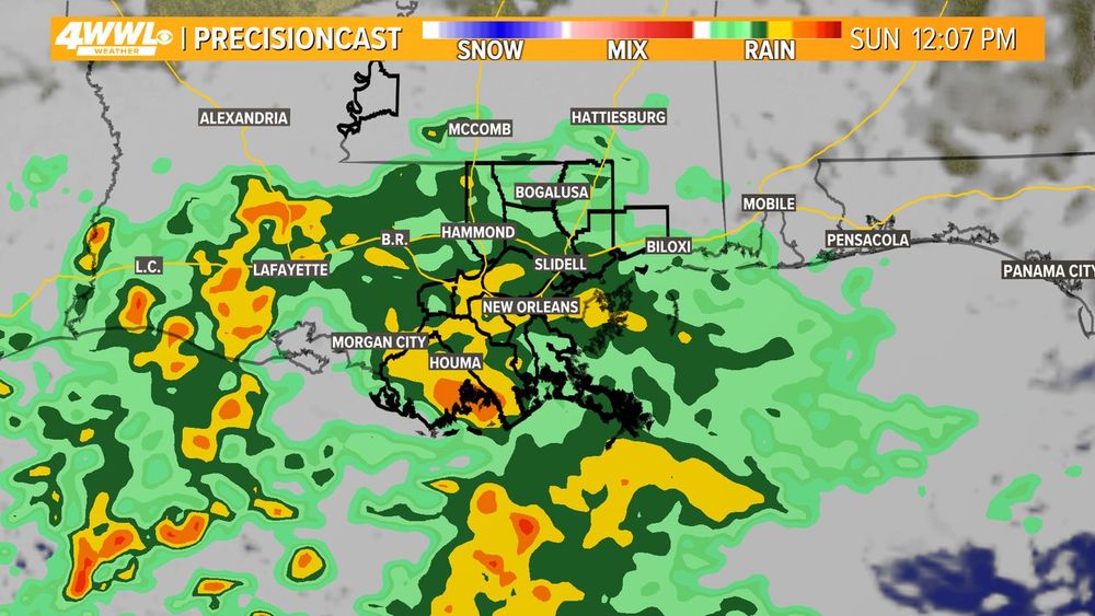
WET SUNDAY: Hate to report this, but Sunday looks wet and chilly. The latest data still shows high chance for rain Sunday morning, afternoon and evening. At times rain will be steady. Temps will be mostly in the 40s.
February 21, 2025 at 1:09 PM
HEAVY RAIN: Before the cold air arrives there will be heavy rain Tuesday evening into early Wednesday. Expect 1-3 inches of rain. The risk for severe weather is low but slightly elevated the closer to the coast. Freeze for most by Wednesday night!
February 18, 2025 at 4:58 PM
SEVERE WEATHER: Heads up for Saturday night. A line of severe storms will roll in between 10pm-1 am. There could be a few isolated storms around for the parades but the main line of storms will hold off until closer to the midnight hour. Risk for damaging winds and tornadoes.
February 15, 2025 at 2:59 PM
BREAKING: Tornado Watch until 8 pm for the area.
February 12, 2025 at 6:18 PM
UPGRADE: We now have an enhanced risk for a few strong tornadoes for areas north of the lake. Timing: a few severe storms this afternoon lasting into this evening. Stay weather aware!
February 12, 2025 at 1:13 PM
We aren’t done with the cold weather just yet! Expect the chill to return Sunday amd last into ealry next week. There is a light freeze potential north of I-10 (and I-12) Monday morning.
February 11, 2025 at 8:29 PM
WEATHER IMPACT ALERT: Severe storms are possible Wednesday afternoon/evening. Storms could produce gusty winds, isolated tornadoes and heavy rain. Another round of storms is expected later Saturday.
February 11, 2025 at 5:45 PM
1895->2025. Took 130 years to see a big snow in New Orleans
January 23, 2025 at 1:56 AM
Yesterday was insane. As a snow lover, I'm not complaining, but we'll be back to normal soon. Make the most of these snow days. Who knows when we'll get another chance! Thanks for following along the past few days as this historic event unfolded.
January 22, 2025 at 7:24 PM
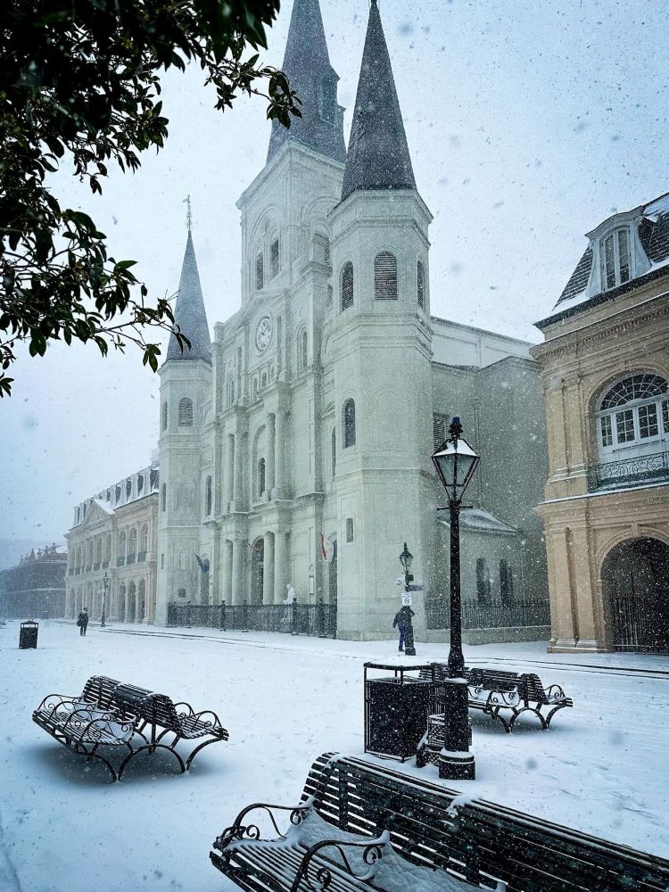
I’m framing this. A once in a lifetime moment in the French Quarter.
January 22, 2025 at 5:09 PM
Glad to see New Orleanians don’t rush to get milk during a winter storm but all the andouille sausage was gone 😂😂
January 20, 2025 at 1:34 AM
Still looks like this could be a once in a lifetime event for some. Adjusting snow totals based on snowier. Went a little higher for southshore. A few spots could overperform in heavy snow bands. That's where 10" isn't impossible just hard to say for sure where that would happen. Dangerous travel
January 19, 2025 at 4:45 PM
Here is my first take on snow/sleet accumulation. These numbers could easily change. If air is cold enough and most falls as snow then you can increase these numbers. Event starts late Monday nigh and ends Tuesday night. Icy roads Tue morning - Wednesday morning.
January 18, 2025 at 11:46 PM
WINTER STORM WATCH: There is an increasing chance for significant impacts from sleet,snow and maybe ice next Tuesday for areas in blue. Timing could be as early as Monday night with the biggest accumulation potential on Tuesday. Impacts to roads would likely be an issue Wednesday morning as well.
January 18, 2025 at 2:18 PM
Data continues to show an impactful winter storm next Tuesday across the Gulf Coast. It's too early to talk specifics like accumulation, but confidence is growing we see snow/sleet. Travel could be quite a mess Tuesday/Wednesday. Here are initial thoughts. Changes likely!
January 17, 2025 at 5:14 PM
Look it's hard to not get excited if you're a snow lover. A lot of data shows snow next Tuesday, but use caution. Yes the chance has increased for a winter storm, but the storm system is still days away and models will likely adjust some. There is a fine line between snow, ice,rain.
January 17, 2025 at 12:15 PM