


Alerts from NWS Norman OK (UNOFFICIAL)
@oun.nws-bot.us
Unofficial bot sharing alerts from NWS Norman OK.
This account is not monitored. Contact @wandrme.paxex.aero if needed.
This account is not monitored. Contact @wandrme.paxex.aero if needed.
OUN issues Area Forecast Discussion (AFD) at Nov 24, 9:33 AM CST ...New UPDATE... via IEMbot
Additional Details Here.
Additional Details Here.
November 24, 2025 at 3:48 PM
OUN issues Area Forecast Discussion (AFD) at Nov 24, 9:33 AM CST ...New UPDATE... via IEMbot
Additional Details Here.
Additional Details Here.
OUN issues Area Forecast Discussion (AFD) at Nov 24, 5:09 AM CST ...New AVIATION... via IEMbot
Additional Details Here.
Additional Details Here.
November 24, 2025 at 11:28 AM
OUN issues Area Forecast Discussion (AFD) at Nov 24, 5:09 AM CST ...New AVIATION... via IEMbot
Additional Details Here.
Additional Details Here.
Weather Prediction Center issues Mesoscale Precipitation Discussion #1244 concerning HEAVY RAINFALL...FLASH FLOODING LIKELY
at Mon, 24 Nov 2025 10:14:31 +0000 via IEMbot
Additional Details Here.
at Mon, 24 Nov 2025 10:14:31 +0000 via IEMbot
Additional Details Here.
November 24, 2025 at 10:28 AM
Weather Prediction Center issues Mesoscale Precipitation Discussion #1244 concerning HEAVY RAINFALL...FLASH FLOODING LIKELY
at Mon, 24 Nov 2025 10:14:31 +0000 via IEMbot
Additional Details Here.
at Mon, 24 Nov 2025 10:14:31 +0000 via IEMbot
Additional Details Here.
WICHITA FALLS Nov 23
Climate Report:
High: 71
Low: 39
Precip: 0.76"
Snow: 0.0"
at Mon, 24 Nov 2025 07:30:05 +0000 via IEMbot
Additional Details Here.
Climate Report:
High: 71
Low: 39
Precip: 0.76"
Snow: 0.0"
at Mon, 24 Nov 2025 07:30:05 +0000 via IEMbot
Additional Details Here.
November 24, 2025 at 7:48 AM
WICHITA FALLS Nov 23
Climate Report:
High: 71
Low: 39
Precip: 0.76"
Snow: 0.0"
at Mon, 24 Nov 2025 07:30:05 +0000 via IEMbot
Additional Details Here.
Climate Report:
High: 71
Low: 39
Precip: 0.76"
Snow: 0.0"
at Mon, 24 Nov 2025 07:30:05 +0000 via IEMbot
Additional Details Here.
Weather Prediction Center issues Mesoscale Precipitation Discussion #1243 concerning HEAVY RAINFALL...FLASH FLOODING LIKELY
at Mon, 24 Nov 2025 05:52:56 +0000 via IEMbot
Additional Details Here.
at Mon, 24 Nov 2025 05:52:56 +0000 via IEMbot
Additional Details Here.
November 24, 2025 at 6:08 AM
Weather Prediction Center issues Mesoscale Precipitation Discussion #1243 concerning HEAVY RAINFALL...FLASH FLOODING LIKELY
at Mon, 24 Nov 2025 05:52:56 +0000 via IEMbot
Additional Details Here.
at Mon, 24 Nov 2025 05:52:56 +0000 via IEMbot
Additional Details Here.
OUN issues Area Forecast Discussion (AFD) at Nov 23, 10:37 PM CST ...New AVIATION... via IEMbot
Additional Details Here.
Additional Details Here.
November 24, 2025 at 4:48 AM
OUN issues Area Forecast Discussion (AFD) at Nov 23, 10:37 PM CST ...New AVIATION... via IEMbot
Additional Details Here.
Additional Details Here.
Special Weather Statement issued November 23 at 9:13PM CST by NWS Norman OK
Additional Details Here.
Additional Details Here.

November 24, 2025 at 3:30 AM
Special Weather Statement issued November 23 at 9:13PM CST by NWS Norman OK
Additional Details Here.
Additional Details Here.
OUN issues A strong thunderstorm will impact portions of southeastern Atoka County through 945 PM CST [wind: <30 MPH, hail: 0.75 IN]
at Mon, 24 Nov 2025 03:13:51 +0000 via IEMbot
Additional Details Here.
at Mon, 24 Nov 2025 03:13:51 +0000 via IEMbot
Additional Details Here.
November 24, 2025 at 3:28 AM
OUN issues A strong thunderstorm will impact portions of southeastern Atoka County through 945 PM CST [wind: <30 MPH, hail: 0.75 IN]
at Mon, 24 Nov 2025 03:13:51 +0000 via IEMbot
Additional Details Here.
at Mon, 24 Nov 2025 03:13:51 +0000 via IEMbot
Additional Details Here.
Storm Prediction Center issues Mesoscale Discussion #2220 concerning SEVERE THUNDERSTORM WATCH 637 [Most Prob: Hail: 1.00-1.75 IN, Gust: UP TO 60 MPH]
at Mon, 24 Nov 2025 02:35:49 +0000 via IEMbot
Additional Details Here.
at Mon, 24 Nov 2025 02:35:49 +0000 via IEMbot
Additional Details Here.
November 24, 2025 at 2:48 AM
Storm Prediction Center issues Mesoscale Discussion #2220 concerning SEVERE THUNDERSTORM WATCH 637 [Most Prob: Hail: 1.00-1.75 IN, Gust: UP TO 60 MPH]
at Mon, 24 Nov 2025 02:35:49 +0000 via IEMbot
Additional Details Here.
at Mon, 24 Nov 2025 02:35:49 +0000 via IEMbot
Additional Details Here.
Special Weather Statement issued November 23 at 8:06PM CST by NWS Norman OK
Additional Details Here.
Additional Details Here.
November 24, 2025 at 2:15 AM
Special Weather Statement issued November 23 at 8:06PM CST by NWS Norman OK
Additional Details Here.
Additional Details Here.
OUN issues Special Weather Statement [wind: <30 MPH, hail: 0.75 IN] for Carter, Johnston, Love, Marshall [OK] till 8:30 PM CST
at Mon, 24 Nov 2025 02:06:08 +0000 via IEMbot
Additional Details Here.
at Mon, 24 Nov 2025 02:06:08 +0000 via IEMbot
Additional Details Here.
November 24, 2025 at 2:08 AM
OUN issues Special Weather Statement [wind: <30 MPH, hail: 0.75 IN] for Carter, Johnston, Love, Marshall [OK] till 8:30 PM CST
at Mon, 24 Nov 2025 02:06:08 +0000 via IEMbot
Additional Details Here.
at Mon, 24 Nov 2025 02:06:08 +0000 via IEMbot
Additional Details Here.
The Storm Prediction Center issues Day 1 Marginal Convective Risk at Nov 24, 0:57z for portions of OUN
at Mon, 24 Nov 2025 00:59:20 +0000 via IEMbot
Additional Details Here.
at Mon, 24 Nov 2025 00:59:20 +0000 via IEMbot
Additional Details Here.
November 24, 2025 at 1:08 AM
The Storm Prediction Center issues Day 1 Marginal Convective Risk at Nov 24, 0:57z for portions of OUN
at Mon, 24 Nov 2025 00:59:20 +0000 via IEMbot
Additional Details Here.
at Mon, 24 Nov 2025 00:59:20 +0000 via IEMbot
Additional Details Here.
OUN issues Area Forecast Discussion (AFD) at Nov 23, 6:02 PM CST ...New AVIATION... via IEMbot
Additional Details Here.
Additional Details Here.
November 24, 2025 at 12:08 AM
OUN issues Area Forecast Discussion (AFD) at Nov 23, 6:02 PM CST ...New AVIATION... via IEMbot
Additional Details Here.
Additional Details Here.
OKLAHOMA CITY Nov 23
Climate Report:
High: 62
Low: 36
Precip: 0.0"
Snow: 0.0"
at Sun, 23 Nov 2025 23:17:43 +0000 via IEMbot
Additional Details Here.
Climate Report:
High: 62
Low: 36
Precip: 0.0"
Snow: 0.0"
at Sun, 23 Nov 2025 23:17:43 +0000 via IEMbot
Additional Details Here.
November 23, 2025 at 11:28 PM
OKLAHOMA CITY Nov 23
Climate Report:
High: 62
Low: 36
Precip: 0.0"
Snow: 0.0"
at Sun, 23 Nov 2025 23:17:43 +0000 via IEMbot
Additional Details Here.
Climate Report:
High: 62
Low: 36
Precip: 0.0"
Snow: 0.0"
at Sun, 23 Nov 2025 23:17:43 +0000 via IEMbot
Additional Details Here.
WICHITA FALLS Nov 23
Climate Report:
High: 71
Low: 39
Precip: 0.07"
Snow: 0.0"
at Sun, 23 Nov 2025 23:17:43 +0000 via IEMbot
Additional Details Here.
Climate Report:
High: 71
Low: 39
Precip: 0.07"
Snow: 0.0"
at Sun, 23 Nov 2025 23:17:43 +0000 via IEMbot
Additional Details Here.
November 23, 2025 at 11:28 PM
WICHITA FALLS Nov 23
Climate Report:
High: 71
Low: 39
Precip: 0.07"
Snow: 0.0"
at Sun, 23 Nov 2025 23:17:43 +0000 via IEMbot
Additional Details Here.
Climate Report:
High: 71
Low: 39
Precip: 0.07"
Snow: 0.0"
at Sun, 23 Nov 2025 23:17:43 +0000 via IEMbot
Additional Details Here.
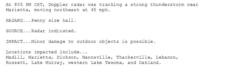
Special Weather Statement issued November 23 at 5:02PM CST by NWS Norman OK
Additional Details Here.
Additional Details Here.

November 23, 2025 at 11:15 PM
Special Weather Statement issued November 23 at 5:02PM CST by NWS Norman OK
Additional Details Here.
Additional Details Here.
OUN issues Special Weather Statement [wind: <30 MPH, hail: 0.75 IN] for Garvin, Grady, McClain, Stephens [OK] till 5:30 PM CST
at Sun, 23 Nov 2025 23:02:46 +0000 via IEMbot
Additional Details Here.
at Sun, 23 Nov 2025 23:02:46 +0000 via IEMbot
Additional Details Here.
November 23, 2025 at 11:08 PM
OUN issues Special Weather Statement [wind: <30 MPH, hail: 0.75 IN] for Garvin, Grady, McClain, Stephens [OK] till 5:30 PM CST
at Sun, 23 Nov 2025 23:02:46 +0000 via IEMbot
Additional Details Here.
at Sun, 23 Nov 2025 23:02:46 +0000 via IEMbot
Additional Details Here.
OUN issues A strong thunderstorm will impact portions of northeastern Comanche, southwestern Grady and northwestern Stephens Counties through 500 PM CST [wind: 30 MPH, hail: 0.50 I... at Sun, 23 Nov 2025 22:32:48 +0000 via IEMbot
Additional Details Here.
Additional Details Here.
November 23, 2025 at 10:48 PM
OUN issues A strong thunderstorm will impact portions of northeastern Comanche, southwestern Grady and northwestern Stephens Counties through 500 PM CST [wind: 30 MPH, hail: 0.50 I... at Sun, 23 Nov 2025 22:32:48 +0000 via IEMbot
Additional Details Here.
Additional Details Here.
OUN issues Special Weather Statement [wind: <30 MPH, hail: 0.88 IN] for Cotton [OK] and Archer, Clay, Wichita [TX] till 5:15 PM CST
at Sun, 23 Nov 2025 22:42:33 +0000 via IEMbot
Additional Details Here.
at Sun, 23 Nov 2025 22:42:33 +0000 via IEMbot
Additional Details Here.
November 23, 2025 at 10:48 PM
OUN issues Special Weather Statement [wind: <30 MPH, hail: 0.88 IN] for Cotton [OK] and Archer, Clay, Wichita [TX] till 5:15 PM CST
at Sun, 23 Nov 2025 22:42:33 +0000 via IEMbot
Additional Details Here.
at Sun, 23 Nov 2025 22:42:33 +0000 via IEMbot
Additional Details Here.
Special Weather Statement issued November 23 at 4:42PM CST by NWS Norman OK
Additional Details Here.
Additional Details Here.

November 23, 2025 at 10:45 PM
Special Weather Statement issued November 23 at 4:42PM CST by NWS Norman OK
Additional Details Here.
Additional Details Here.
Special Weather Statement issued November 23 at 4:32PM CST by NWS Norman OK
Additional Details Here.
Additional Details Here.

November 23, 2025 at 10:45 PM
Special Weather Statement issued November 23 at 4:32PM CST by NWS Norman OK
Additional Details Here.
Additional Details Here.
🚨 Severe Thunderstorm Warning issued November 23 at 4:24PM CST until November 23 at 4:45PM CST by NWS Norman OK 🚨
Additional Details Here.
Additional Details Here.

November 23, 2025 at 10:30 PM
🚨 Severe Thunderstorm Warning issued November 23 at 4:24PM CST until November 23 at 4:45PM CST by NWS Norman OK 🚨
Additional Details Here.
Additional Details Here.
OKLAHOMA CITY Nov 23
Climate Report:
High: 62
Low: 36
Precip: 0.0"
Snow: Missing
at Sun, 23 Nov 2025 22:12:42 +0000 via IEMbot
Additional Details Here.
Climate Report:
High: 62
Low: 36
Precip: 0.0"
Snow: Missing
at Sun, 23 Nov 2025 22:12:42 +0000 via IEMbot
Additional Details Here.
November 23, 2025 at 10:28 PM
OKLAHOMA CITY Nov 23
Climate Report:
High: 62
Low: 36
Precip: 0.0"
Snow: Missing
at Sun, 23 Nov 2025 22:12:42 +0000 via IEMbot
Additional Details Here.
Climate Report:
High: 62
Low: 36
Precip: 0.0"
Snow: Missing
at Sun, 23 Nov 2025 22:12:42 +0000 via IEMbot
Additional Details Here.
OUN continues Severe Thunderstorm Warning [wind: 60 MPH (RADAR INDICATED), hail: 1.50 IN (RADAR INDICATED)] for Archer, Clay, Wichita [TX] till 4:45 PM CST
at Sun, 23 Nov 2025 22:24:46 +0000 via IEMbot
Additional Details Here.
at Sun, 23 Nov 2025 22:24:46 +0000 via IEMbot
Additional Details Here.
November 23, 2025 at 10:28 PM
OUN continues Severe Thunderstorm Warning [wind: 60 MPH (RADAR INDICATED), hail: 1.50 IN (RADAR INDICATED)] for Archer, Clay, Wichita [TX] till 4:45 PM CST
at Sun, 23 Nov 2025 22:24:46 +0000 via IEMbot
Additional Details Here.
at Sun, 23 Nov 2025 22:24:46 +0000 via IEMbot
Additional Details Here.
Special Weather Statement issued November 23 at 4:07PM CST by NWS Norman OK
Additional Details Here.
Additional Details Here.

November 23, 2025 at 10:15 PM
Special Weather Statement issued November 23 at 4:07PM CST by NWS Norman OK
Additional Details Here.
Additional Details Here.