


On a Map
@onamap.bsky.social
Browse incredible maps and easily making your own 🗺️. Add layers from iNaturalist or GBIF, Google or Tom Tom, Strava, etc. 😎 Free and easy to use.
A country on the edge of war, with USA and Israel desperately wanting to invade it. Iran.
When you see this, are you curious about the country, its cities and historic locations?
This is our first in a series of interactive maps. Let us know what you think so far 😄
onamap.org/map/iran
When you see this, are you curious about the country, its cities and historic locations?
This is our first in a series of interactive maps. Let us know what you think so far 😄
onamap.org/map/iran

February 3, 2026 at 10:43 AM
A country on the edge of war, with USA and Israel desperately wanting to invade it. Iran.
When you see this, are you curious about the country, its cities and historic locations?
This is our first in a series of interactive maps. Let us know what you think so far 😄
onamap.org/map/iran
When you see this, are you curious about the country, its cities and historic locations?
This is our first in a series of interactive maps. Let us know what you think so far 😄
onamap.org/map/iran
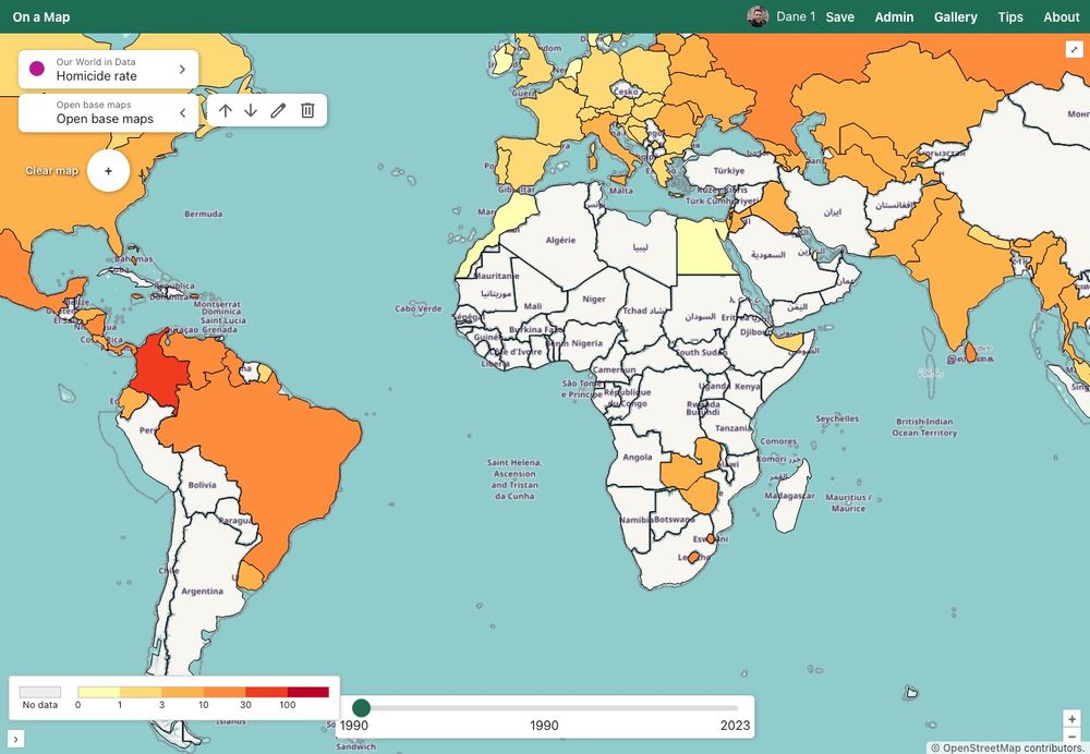
New regions plugin in On a Map! And sample data! Including countries 🗺, timezones ⌚️, EEZs 🛡, major cities 🏙 and airports ✈️, reefs 🏄♀, and mountain peaks 🏔


September 16, 2025 at 8:16 AM
New regions plugin in On a Map! And sample data! Including countries 🗺, timezones ⌚️, EEZs 🛡, major cities 🏙 and airports ✈️, reefs 🏄♀, and mountain peaks 🏔
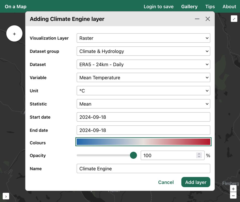
Climate Engine will probably be the second complete plugin (after iNaturalist). It's incredible! 🥳
Precipitation (rainfall), temperature, cloud cover, satellite photography, historical data, predictions; you name it, this plugin will has it 😀
@climateengineorg.bsky.social @inaturalist.bsky.social
Precipitation (rainfall), temperature, cloud cover, satellite photography, historical data, predictions; you name it, this plugin will has it 😀
@climateengineorg.bsky.social @inaturalist.bsky.social
December 29, 2024 at 5:31 PM
Climate Engine will probably be the second complete plugin (after iNaturalist). It's incredible! 🥳
Precipitation (rainfall), temperature, cloud cover, satellite photography, historical data, predictions; you name it, this plugin will has it 😀
@climateengineorg.bsky.social @inaturalist.bsky.social
Precipitation (rainfall), temperature, cloud cover, satellite photography, historical data, predictions; you name it, this plugin will has it 😀
@climateengineorg.bsky.social @inaturalist.bsky.social


December 18, 2024 at 10:40 PM
Hey Bluesky! I'm building On a Map; an app to see layers from loads of other apps / organisations 😀
Plants & animals from iNaturalist or GBIF, attractions from Google Maps or Tom Tom, cycling from Strava or running from Runkeeper. That sort of thing 😎
How would you use it? → onamap.org ←
Plants & animals from iNaturalist or GBIF, attractions from Google Maps or Tom Tom, cycling from Strava or running from Runkeeper. That sort of thing 😎
How would you use it? → onamap.org ←

December 17, 2024 at 7:36 AM
Hey Bluesky! I'm building On a Map; an app to see layers from loads of other apps / organisations 😀
Plants & animals from iNaturalist or GBIF, attractions from Google Maps or Tom Tom, cycling from Strava or running from Runkeeper. That sort of thing 😎
How would you use it? → onamap.org ←
Plants & animals from iNaturalist or GBIF, attractions from Google Maps or Tom Tom, cycling from Strava or running from Runkeeper. That sort of thing 😎
How would you use it? → onamap.org ←