


we prefer to call them infographics instead bsky.app/profile/obre...
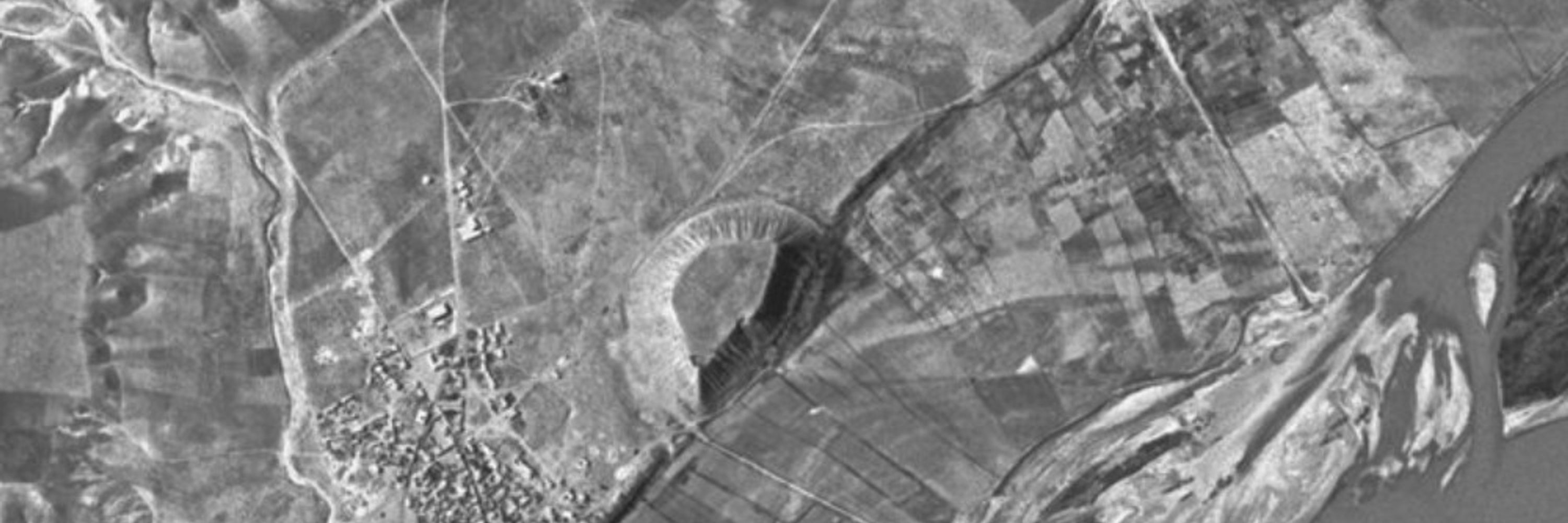
IDF infographics vs actual places targeted by the airstrikes in southern Syria last Monday (geolocated from Sentinel-2 and Planet satellite images)


October 9, 2025 at 6:19 PM
we prefer to call them infographics instead bsky.app/profile/obre...
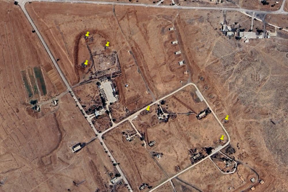
similar to the "Al Maliha" chemical weapons production facility (allegedly used to produce ricin) which was destroyed and "all debris removed" on 7 Jun 2018 google.com/maps?ll=33.4...


September 26, 2025 at 4:38 PM
similar to the "Al Maliha" chemical weapons production facility (allegedly used to produce ricin) which was destroyed and "all debris removed" on 7 Jun 2018 google.com/maps?ll=33.4...
it is the only building which was "razed to ground level and all debris removed" in the area of Tell Kurdi that day
September 26, 2025 at 4:38 PM
it is the only building which was "razed to ground level and all debris removed" in the area of Tell Kurdi that day
hard to keep track since the OPCW reported in August that "nine of these locations have already been visited by the DAT, during the deployments in March and April 2025" but "in March and in April 2025, the DAT visited four declared locations and five suspected locations" in the 142nd report in July
September 25, 2025 at 2:03 PM
hard to keep track since the OPCW reported in August that "nine of these locations have already been visited by the DAT, during the deployments in March and April 2025" but "in March and in April 2025, the DAT visited four declared locations and five suspected locations" in the 142nd report in July
at least 19 of these airstrikes were focused on destroying some ancient field artillery guns on military bases near Deir Ali google.com/maps?ll=33.2...
July 20, 2025 at 10:54 PM
at least 19 of these airstrikes were focused on destroying some ancient field artillery guns on military bases near Deir Ali google.com/maps?ll=33.2...