


Neil Southall
@neilcfd.bsky.social
Naval Architect turned Data Scientist
Hi - you can use the lidR package in R to go directly from a bunch of .laz files to an elevation matrix:
# load lidar elevation data
ctg <- lidR::readLAScatalog("/path/to/your/laz_data/")
las <- lidR::readLAS(ctg, select = "xyz")
dem <- lidR::grid_canopy(las, res = 1, p2r())
# load lidar elevation data
ctg <- lidR::readLAScatalog("/path/to/your/laz_data/")
las <- lidR::readLAS(ctg, select = "xyz")
dem <- lidR::grid_canopy(las, res = 1, p2r())
January 3, 2025 at 2:24 PM
Hi - you can use the lidR package in R to go directly from a bunch of .laz files to an elevation matrix:
# load lidar elevation data
ctg <- lidR::readLAScatalog("/path/to/your/laz_data/")
las <- lidR::readLAS(ctg, select = "xyz")
dem <- lidR::grid_canopy(las, res = 1, p2r())
# load lidar elevation data
ctg <- lidR::readLAScatalog("/path/to/your/laz_data/")
las <- lidR::readLAS(ctg, select = "xyz")
dem <- lidR::grid_canopy(las, res = 1, p2r())
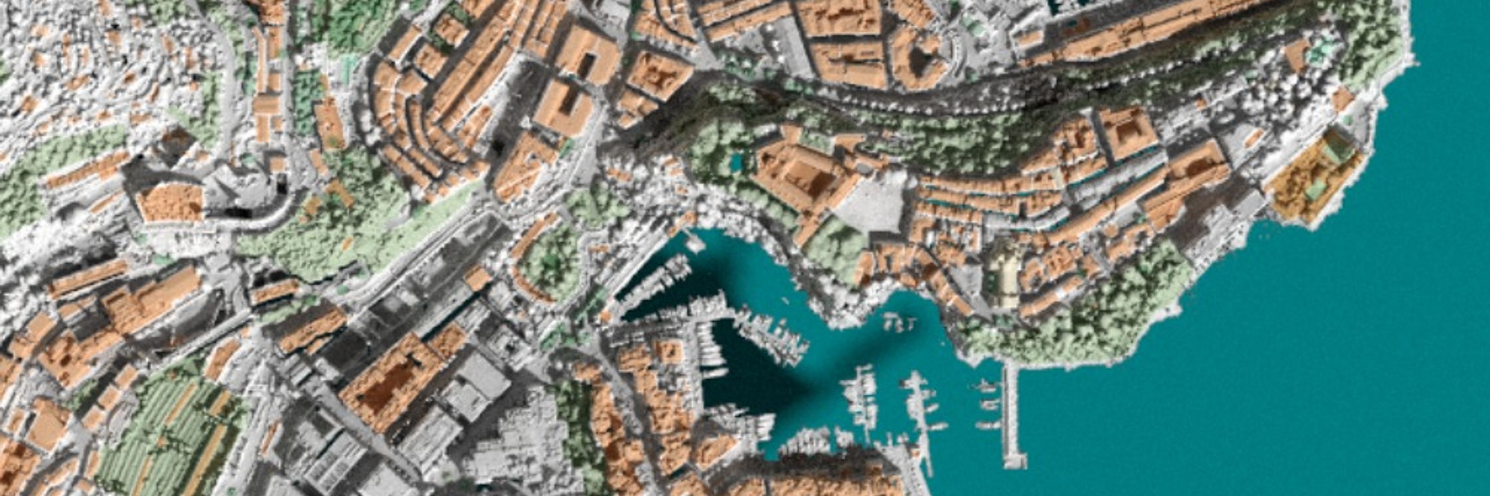
yep, using the rayshader package in R by @tylermorganwall.bsky.social
November 30, 2024 at 7:15 PM
yep, using the rayshader package in R by @tylermorganwall.bsky.social
Just encountered this too, that 50MB limit is a little annoying!
November 30, 2024 at 1:46 PM
Just encountered this too, that 50MB limit is a little annoying!
Lucky you, I'd love to see the race village and the start!
November 20, 2024 at 4:47 PM
Lucky you, I'd love to see the race village and the start!
That is wonderful, Julian
November 19, 2024 at 3:12 PM
That is wonderful, Julian
Thank you! I've made a few of these lighthouse maps over the years, I'll post them over the next couple of weeks
November 19, 2024 at 8:55 AM
Thank you! I've made a few of these lighthouse maps over the years, I'll post them over the next couple of weeks
Thank you, it's nice to be back, looking forward to making some new work!
November 19, 2024 at 8:53 AM
Thank you, it's nice to be back, looking forward to making some new work!
Thanks, Terence, not sure I would have embarked upon it if I'd known how much work would be involved 😂
November 19, 2024 at 8:52 AM
Thanks, Terence, not sure I would have embarked upon it if I'd known how much work would be involved 😂