


Michigan Storm Chasers
@mistormchasers.bsky.social
Michigan's #1 Storm Chasing & Live Coverage Team. Providing the Great Lake State with accurate forecasts, live chasing, weather education, and disaster relief.
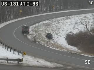
Roads could be deceivingly slick this afternoon across the state as surface temperatures are just below freezing as of 3:22pm. A couple slide offs are being reported.
February 2, 2025 at 8:24 PM
Roads could be deceivingly slick this afternoon across the state as surface temperatures are just below freezing as of 3:22pm. A couple slide offs are being reported.
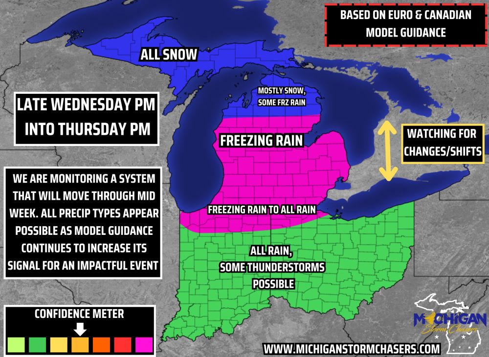
Confidence is increasing that an impactful system will move through beginning Wednesday evening and continue into Thursday morning. This system will likely bring all modes of precipitation with it, from rain, freezing rain, snow, and perhaps sleet as well.
February 2, 2025 at 7:45 PM
Confidence is increasing that an impactful system will move through beginning Wednesday evening and continue into Thursday morning. This system will likely bring all modes of precipitation with it, from rain, freezing rain, snow, and perhaps sleet as well.
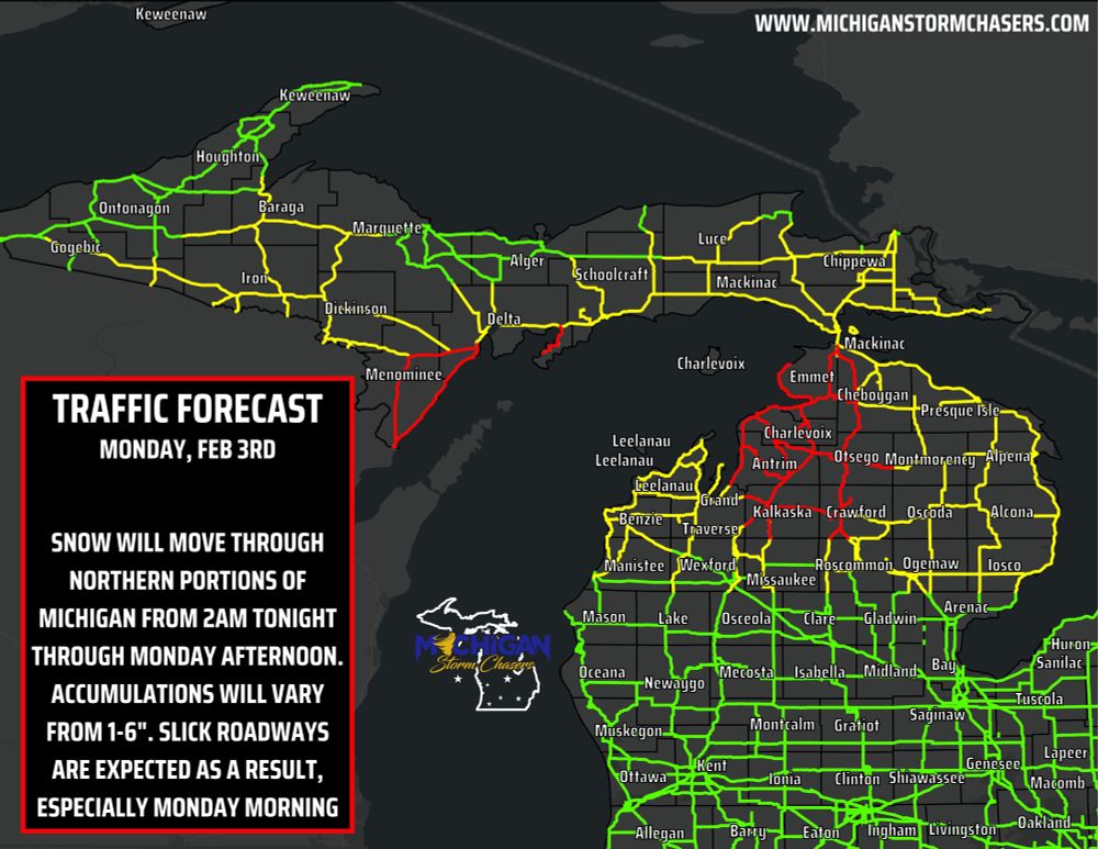
Travel/Traffic FORECAST based on expected snowfall for Northern Lower/Upper Peninsula of Michigan.
Valid: Monday, February 3rd, from 2am to 6pm.
🟥 Red: Major impacts, expect low visibility throughout the morning, as well as the worst road conditions in the state.
Valid: Monday, February 3rd, from 2am to 6pm.
🟥 Red: Major impacts, expect low visibility throughout the morning, as well as the worst road conditions in the state.
February 2, 2025 at 5:03 PM
Travel/Traffic FORECAST based on expected snowfall for Northern Lower/Upper Peninsula of Michigan.
Valid: Monday, February 3rd, from 2am to 6pm.
🟥 Red: Major impacts, expect low visibility throughout the morning, as well as the worst road conditions in the state.
Valid: Monday, February 3rd, from 2am to 6pm.
🟥 Red: Major impacts, expect low visibility throughout the morning, as well as the worst road conditions in the state.
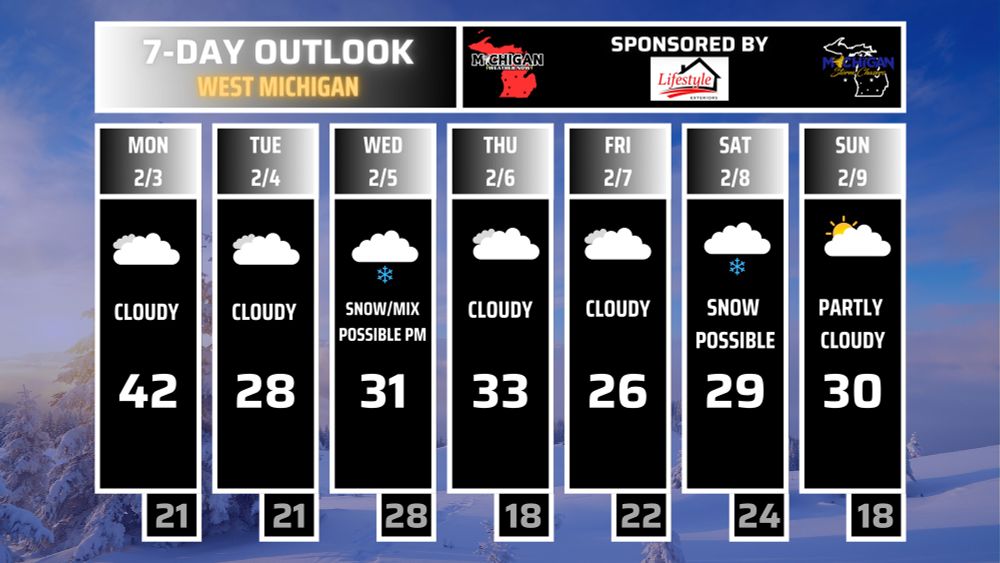
Here’s your 7 day outlooks. Click the link to read the full write up.
www.facebook.com/share/p/1Fci...
www.facebook.com/share/p/1Fci...
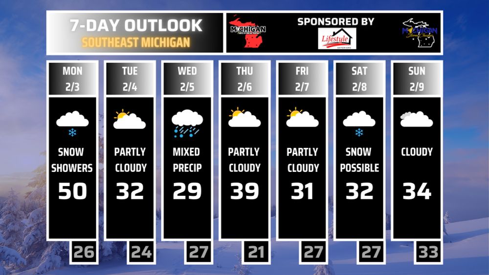
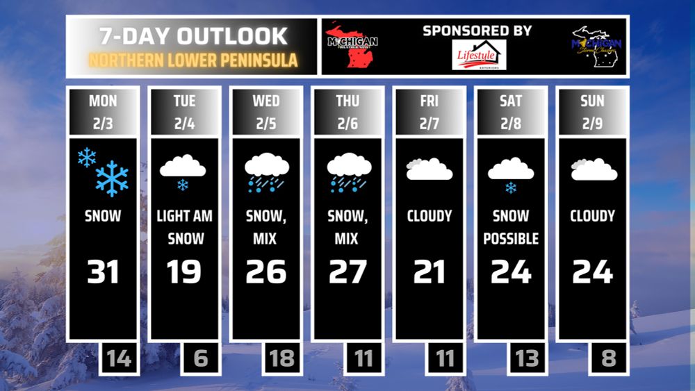
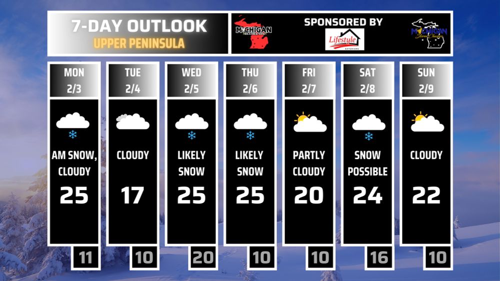
February 2, 2025 at 4:54 PM
Here’s your 7 day outlooks. Click the link to read the full write up.
www.facebook.com/share/p/1Fci...
www.facebook.com/share/p/1Fci...
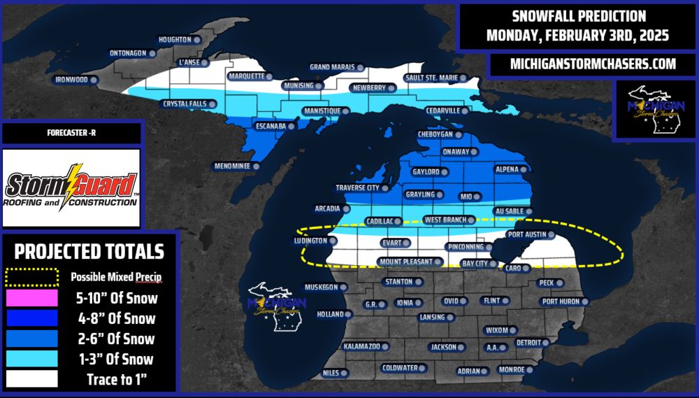
Additional snowfall is expected to begin late tonight / early Monday morning, beginning around 2-4am and continuing into Monday afternoon around 2-4pm.
Accumulations will be heaviest centered northern lower Michigan where 2-6” may fall. 1-3” will surround the heaviest swath,
Accumulations will be heaviest centered northern lower Michigan where 2-6” may fall. 1-3” will surround the heaviest swath,
February 2, 2025 at 3:55 PM
Additional snowfall is expected to begin late tonight / early Monday morning, beginning around 2-4am and continuing into Monday afternoon around 2-4pm.
Accumulations will be heaviest centered northern lower Michigan where 2-6” may fall. 1-3” will surround the heaviest swath,
Accumulations will be heaviest centered northern lower Michigan where 2-6” may fall. 1-3” will surround the heaviest swath,
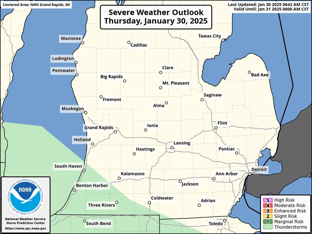
Per the Storm Prediction Center, a couple of thunderstorms / rumble of thunder will be possible in far southwest Michigan later tonight / early Friday morning.
No severe weather is expected.
No severe weather is expected.
January 30, 2025 at 3:05 PM
Per the Storm Prediction Center, a couple of thunderstorms / rumble of thunder will be possible in far southwest Michigan later tonight / early Friday morning.
No severe weather is expected.
No severe weather is expected.
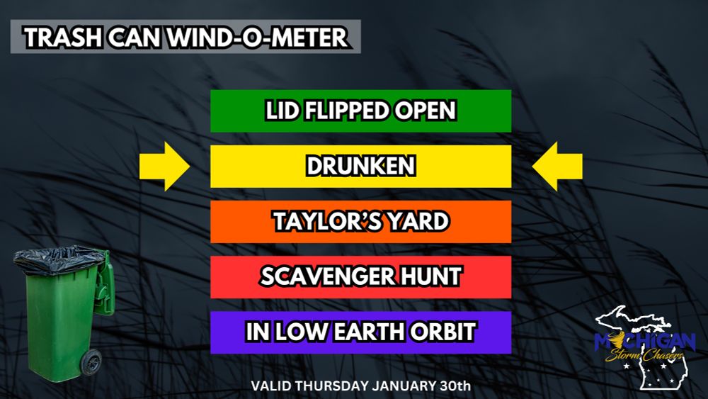
The return of the Trash Can Wind-O-Meter
Gusty winds today will be centered from late morning to mid afternoon across much of the state. Luckily we’re not looking at anything too concerning, with gusts between 20-30mph expected. This could cause your beloved trash can to stumble & fall over.
Gusty winds today will be centered from late morning to mid afternoon across much of the state. Luckily we’re not looking at anything too concerning, with gusts between 20-30mph expected. This could cause your beloved trash can to stumble & fall over.
January 30, 2025 at 2:22 PM
The return of the Trash Can Wind-O-Meter
Gusty winds today will be centered from late morning to mid afternoon across much of the state. Luckily we’re not looking at anything too concerning, with gusts between 20-30mph expected. This could cause your beloved trash can to stumble & fall over.
Gusty winds today will be centered from late morning to mid afternoon across much of the state. Luckily we’re not looking at anything too concerning, with gusts between 20-30mph expected. This could cause your beloved trash can to stumble & fall over.
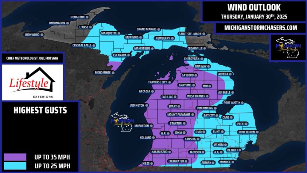
MSC Wind Outlook for Thursday, January 30th, 2025
The main story for tomorrow besides the rather abundant sunshine and warmer temperatures will be the wind. Seems like we can't have a nice weather day without an annoyance mixed in.
The main story for tomorrow besides the rather abundant sunshine and warmer temperatures will be the wind. Seems like we can't have a nice weather day without an annoyance mixed in.
January 29, 2025 at 10:08 PM
MSC Wind Outlook for Thursday, January 30th, 2025
The main story for tomorrow besides the rather abundant sunshine and warmer temperatures will be the wind. Seems like we can't have a nice weather day without an annoyance mixed in.
The main story for tomorrow besides the rather abundant sunshine and warmer temperatures will be the wind. Seems like we can't have a nice weather day without an annoyance mixed in.
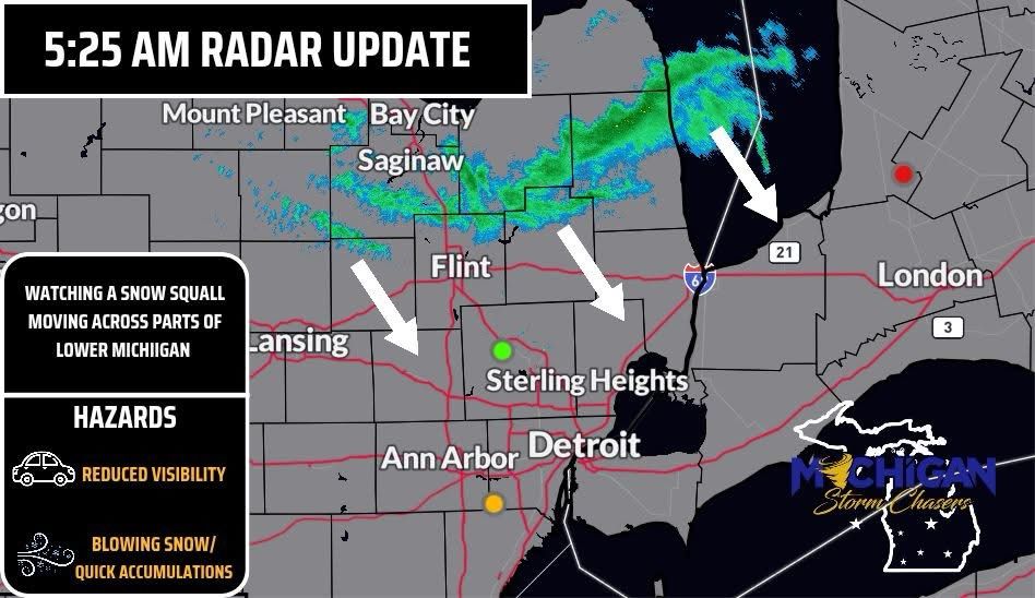
5:25am radar update!
We are currently monitoring a snow squall moving across parts of lower Michigan, especially over the thumb. This band of snow is associated with the cold front and will continue moving SE this morning.
We are currently monitoring a snow squall moving across parts of lower Michigan, especially over the thumb. This band of snow is associated with the cold front and will continue moving SE this morning.
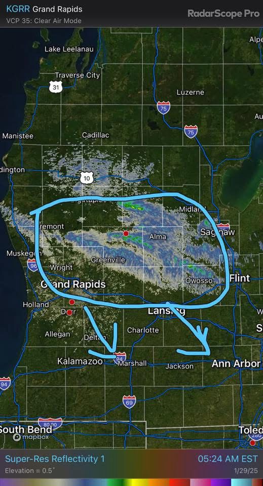
January 29, 2025 at 10:33 AM
5:25am radar update!
We are currently monitoring a snow squall moving across parts of lower Michigan, especially over the thumb. This band of snow is associated with the cold front and will continue moving SE this morning.
We are currently monitoring a snow squall moving across parts of lower Michigan, especially over the thumb. This band of snow is associated with the cold front and will continue moving SE this morning.
Updated Snow Squall Timing Map for Wednesday Morning, January 29th, 2025
Our earlier map this evening was based on guidance that had the snow squall moving through rather quickly without much impact to travel. Now, in recent updates, our squall appears to have slowed down.
Our earlier map this evening was based on guidance that had the snow squall moving through rather quickly without much impact to travel. Now, in recent updates, our squall appears to have slowed down.
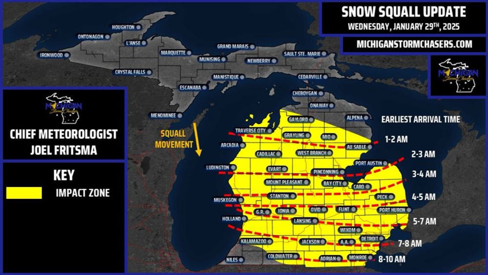
January 29, 2025 at 4:48 AM
Updated Snow Squall Timing Map for Wednesday Morning, January 29th, 2025
Our earlier map this evening was based on guidance that had the snow squall moving through rather quickly without much impact to travel. Now, in recent updates, our squall appears to have slowed down.
Our earlier map this evening was based on guidance that had the snow squall moving through rather quickly without much impact to travel. Now, in recent updates, our squall appears to have slowed down.
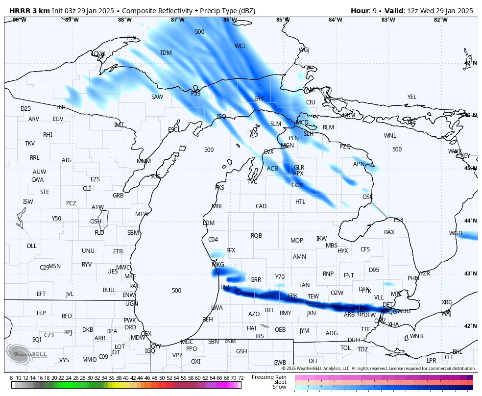
⚠️Attention is on overnight tonight into early tomorrow morning. A potent snow squall is currently modeled to move across most all of lower Michigan bringing gusty winds, whiteout conditions, deteriorating road conditions, and rapid snow accumulations.
Timing map to come
Timing map to come
January 29, 2025 at 4:46 AM
⚠️Attention is on overnight tonight into early tomorrow morning. A potent snow squall is currently modeled to move across most all of lower Michigan bringing gusty winds, whiteout conditions, deteriorating road conditions, and rapid snow accumulations.
Timing map to come
Timing map to come
Tonight’s sunset was an absolute STUNNER.
Thank you to Samantha for sending this into us!
Thank you to Samantha for sending this into us!

January 29, 2025 at 12:39 AM
Tonight’s sunset was an absolute STUNNER.
Thank you to Samantha for sending this into us!
Thank you to Samantha for sending this into us!
- Friday System -
As mentioned, we are watching a system that will move up from south/west. It arrives in Michigan early Friday morning with rain as the likely precipitation mode.
As mentioned, we are watching a system that will move up from south/west. It arrives in Michigan early Friday morning with rain as the likely precipitation mode.

January 29, 2025 at 12:14 AM
- Friday System -
As mentioned, we are watching a system that will move up from south/west. It arrives in Michigan early Friday morning with rain as the likely precipitation mode.
As mentioned, we are watching a system that will move up from south/west. It arrives in Michigan early Friday morning with rain as the likely precipitation mode.
We will see a brief “burst” of wind across much of the lower peninsula centered around this afternoon. It won’t be as gusty as yesterday by any means, but still we could see highest gusts in the mid 40mph range across much of lower Michigan.
This should be over by late tonight.

January 28, 2025 at 5:40 PM
We will see a brief “burst” of wind across much of the lower peninsula centered around this afternoon. It won’t be as gusty as yesterday by any means, but still we could see highest gusts in the mid 40mph range across much of lower Michigan.
This should be over by late tonight.
Check it out! Rare “Snow Rollers” have made an appearance once again in west Michigan. These occur when gusty winds and/or a hill helps roll snow into a circular formation. Essentially, it’s Mother Nature’s way of trying to make a snowman!
Taken in Kent County
Taken in Kent County
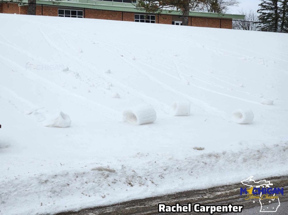
January 28, 2025 at 4:57 PM
Check it out! Rare “Snow Rollers” have made an appearance once again in west Michigan. These occur when gusty winds and/or a hill helps roll snow into a circular formation. Essentially, it’s Mother Nature’s way of trying to make a snowman!
Taken in Kent County
Taken in Kent County
With ongoing & expected snow in the forecast, here’s your traffic forecast for today. The eastern UP, and far northern lower Michigan will feel the highest impacts/heaviest snow accumulations, while other areas will see lighter accumulations with more moderate impacts.


January 28, 2025 at 2:23 PM
With ongoing & expected snow in the forecast, here’s your traffic forecast for today. The eastern UP, and far northern lower Michigan will feel the highest impacts/heaviest snow accumulations, while other areas will see lighter accumulations with more moderate impacts.
Well well well… Aurora has made an appearance in the UP! While very faint/weak, on camera sightings would certainly be possible in the northern half of the upper peninsula. We do not expect any sightings further south at this time. - 11:23pm

January 28, 2025 at 4:25 AM
Well well well… Aurora has made an appearance in the UP! While very faint/weak, on camera sightings would certainly be possible in the northern half of the upper peninsula. We do not expect any sightings further south at this time. - 11:23pm
Not a great day for trash cans across the state…
Be sure to secure loose objects in your yard! Winds will continue to gust up to 40-50mph across ALL of Michigan through late tonight.
Thank you to Ryan & Harrison for sending these into us!
Be sure to secure loose objects in your yard! Winds will continue to gust up to 40-50mph across ALL of Michigan through late tonight.
Thank you to Ryan & Harrison for sending these into us!


January 27, 2025 at 9:09 PM
Not a great day for trash cans across the state…
Be sure to secure loose objects in your yard! Winds will continue to gust up to 40-50mph across ALL of Michigan through late tonight.
Thank you to Ryan & Harrison for sending these into us!
Be sure to secure loose objects in your yard! Winds will continue to gust up to 40-50mph across ALL of Michigan through late tonight.
Thank you to Ryan & Harrison for sending these into us!
Strong winds at Mackinac have closed the bridge to traffic with exception to passenger cars/vans & unloaded pickup trucks. Blowing snow is also causing an eerie scene on the north side of the bridge. -10:00am

January 27, 2025 at 3:01 PM
Strong winds at Mackinac have closed the bridge to traffic with exception to passenger cars/vans & unloaded pickup trucks. Blowing snow is also causing an eerie scene on the north side of the bridge. -10:00am