


MiraMon
@miramon.cat
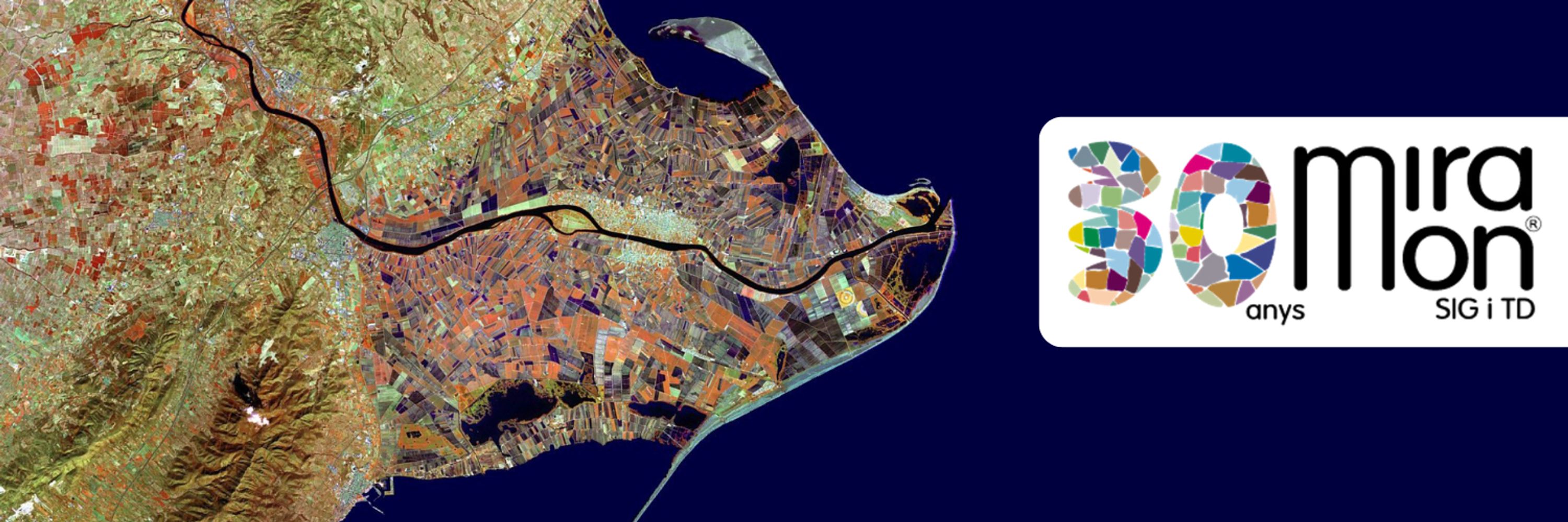
🗺️🛰️ El MiraMon és un programari de teledetecció i SIG des de 1994.
MiraMon is a Remote Sensing and GIS software since 1994
⌨️ Developed by @grumets.cat
MiraMon is a Remote Sensing and GIS software since 1994
⌨️ Developed by @grumets.cat
Reposted by MiraMon

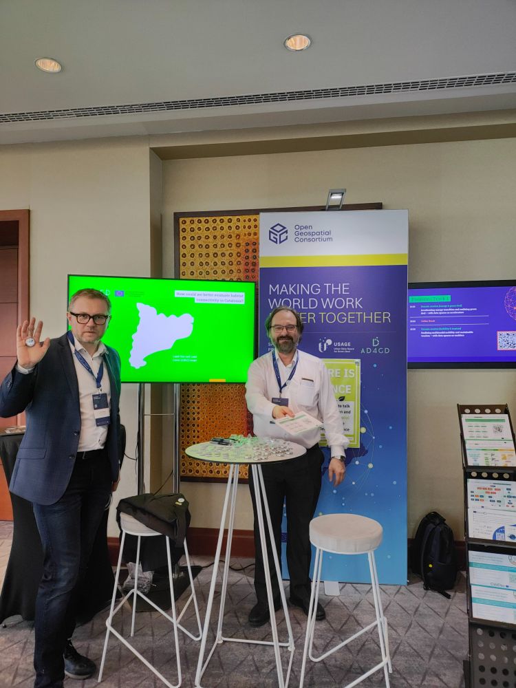
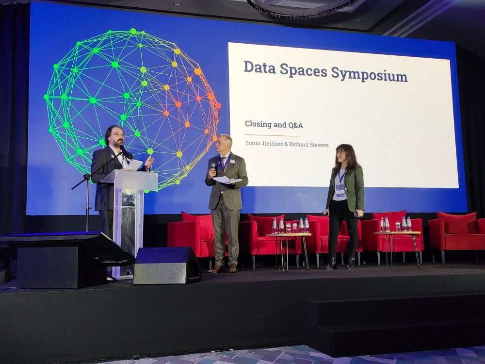
We are so PROUD! 💘📢 Our researcher
@joanma747.bsky.social took the stage at the #DataSpaces Symposium 2025 and showed how @ad4gd.eu is including both open & commercial #geospatial data into the #GreenDeal Data Space to make it an effective tool to tackle #climate challenges. Look! 🌍
@joanma747.bsky.social took the stage at the #DataSpaces Symposium 2025 and showed how @ad4gd.eu is including both open & commercial #geospatial data into the #GreenDeal Data Space to make it an effective tool to tackle #climate challenges. Look! 🌍

March 18, 2025 at 8:57 AM
We are so PROUD! 💘📢 Our researcher
@joanma747.bsky.social took the stage at the #DataSpaces Symposium 2025 and showed how @ad4gd.eu is including both open & commercial #geospatial data into the #GreenDeal Data Space to make it an effective tool to tackle #climate challenges. Look! 🌍
@joanma747.bsky.social took the stage at the #DataSpaces Symposium 2025 and showed how @ad4gd.eu is including both open & commercial #geospatial data into the #GreenDeal Data Space to make it an effective tool to tackle #climate challenges. Look! 🌍
El MiraMon també es suma!

February 24, 2025 at 9:29 AM
El MiraMon també es suma!
Reposted by MiraMon
I'm the first one to get here. The room is ready for the 30 year anniversary of the @miramon.cat

December 19, 2024 at 4:29 PM
I'm the first one to get here. The room is ready for the 30 year anniversary of the @miramon.cat
Reposted by MiraMon
Jaume Miranda explica com els sistemes d'informació geogràfica serveixen per prendre de decisions als parlaments de l'acte del @MiraMon.cat 30 anys

December 19, 2024 at 5:31 PM
Jaume Miranda explica com els sistemes d'informació geogràfica serveixen per prendre de decisions als parlaments de l'acte del @MiraMon.cat 30 anys
Reposted by MiraMon
"We need to work to move @miramon.cat to the place it deserves" says Joan Pino, director of @creaf.cat in the 30 anniversary event.
December 19, 2024 at 5:58 PM
"We need to work to move @miramon.cat to the place it deserves" says Joan Pino, director of @creaf.cat in the 30 anniversary event.
Reposted by MiraMon
The evening was supposed to be a tribute to Xavier Pons (@uabbarcelona.bsky.social) but it became also the recognition that both have been there for the beginning of the
@miramon.cat in @creaf.cat. Here some moments about it including a more private @grumets_UAB one at night.
@miramon.cat in @creaf.cat. Here some moments about it including a more private @grumets_UAB one at night.


December 21, 2024 at 1:30 PM
The evening was supposed to be a tribute to Xavier Pons (@uabbarcelona.bsky.social) but it became also the recognition that both have been there for the beginning of the
@miramon.cat in @creaf.cat. Here some moments about it including a more private @grumets_UAB one at night.
@miramon.cat in @creaf.cat. Here some moments about it including a more private @grumets_UAB one at night.
Reposted by MiraMon
THANK YOU from the bottom of our hearts!! 🩵🎉Yesterday we had a day full of emotions celebrating our 30 anniversary. Thank you to everyone who joined us on such a special day, sharing memories, hugs and good wishes for the future. We wish for many more years together!


December 20, 2024 at 1:33 PM
THANK YOU from the bottom of our hearts!! 🩵🎉Yesterday we had a day full of emotions celebrating our 30 anniversary. Thank you to everyone who joined us on such a special day, sharing memories, hugs and good wishes for the future. We wish for many more years together!
Reposted by MiraMon
I got my 30 years of @miramon.cat commemorative glass cup. Long life to MiraMon.

December 12, 2024 at 12:18 PM
I got my 30 years of @miramon.cat commemorative glass cup. Long life to MiraMon.
Segur que molts de vosaltres treballeu amb Sistemes d'Informació Geogràfica #SIG, com ara MiraMon. Però segur que no molts de vosaltres coneixeu la nostra història.
🧵Encetem un nou fil per apropar-vos l'exposició sobre els nostres 30 anys que estem exhibint a la Biblioteca de Ciències de la #UAB.
🧵Encetem un nou fil per apropar-vos l'exposició sobre els nostres 30 anys que estem exhibint a la Biblioteca de Ciències de la #UAB.


December 10, 2024 at 10:46 AM
Reserva't la data! 🎉Celebrem els 30 anys del MiraMon amb un acte central i un panell sobre el passat, present i futur dels #SIG i la teledetecció a Catalunya!
📅 19 de desembre, 17:30h
📍 Aula Magna, Casa de Convalescència UAB
🍾Aperitiu per a tots els assistents!
📅 19 de desembre, 17:30h
📍 Aula Magna, Casa de Convalescència UAB
🍾Aperitiu per a tots els assistents!

December 10, 2024 at 10:40 AM
Reserva't la data! 🎉Celebrem els 30 anys del MiraMon amb un acte central i un panell sobre el passat, present i futur dels #SIG i la teledetecció a Catalunya!
📅 19 de desembre, 17:30h
📍 Aula Magna, Casa de Convalescència UAB
🍾Aperitiu per a tots els assistents!
📅 19 de desembre, 17:30h
📍 Aula Magna, Casa de Convalescència UAB
🍾Aperitiu per a tots els assistents!
Reposted by MiraMon
This is the date of the celebration of the 30 years of @MiraMon_GIS: December 30th 2024. I was there from the day one discussing with Xavier and testing the first version. www.miramon.cat/ENG/MM_30any...

December 6, 2024 at 6:03 AM
This is the date of the celebration of the 30 years of @MiraMon_GIS: December 30th 2024. I was there from the day one discussing with Xavier and testing the first version. www.miramon.cat/ENG/MM_30any...
Reposted by MiraMon
And to "celebrate" we are going to release the version 10 that has integrated GDAL/OGR to read/open any popular format in the GIS world.
MiraMon is a GIS and Remote Sensing software that we started 30 year ago. So this month we are remembering the most significant progress we did in those years.
www.miramon.cat/Index_eng.htm
www.miramon.cat/Index_eng.htm

December 5, 2024 at 7:21 AM
And to "celebrate" we are going to release the version 10 that has integrated GDAL/OGR to read/open any popular format in the GIS world.