


Martin Vögele
@martinvoegele.bsky.social
Computational Biophysicist, Amateur Photographer, History+Language Nerd.
All views my own.
Website: https://martinvoegele.github.io/
All views my own.
Website: https://martinvoegele.github.io/
Fascinating project and very educational on the large scale!
That said, the routes on the map do not (always) seem to reflect the precise historical paths of the Roman roads. In the section I checked (between Mengen and Emerkingen), they appear to follow nearby modern roads instead.
That said, the routes on the map do not (always) seem to reflect the precise historical paths of the Roman roads. In the section I checked (between Mengen and Emerkingen), they appear to follow nearby modern roads instead.
November 9, 2025 at 1:04 PM
Fascinating project and very educational on the large scale!
That said, the routes on the map do not (always) seem to reflect the precise historical paths of the Roman roads. In the section I checked (between Mengen and Emerkingen), they appear to follow nearby modern roads instead.
That said, the routes on the map do not (always) seem to reflect the precise historical paths of the Roman roads. In the section I checked (between Mengen and Emerkingen), they appear to follow nearby modern roads instead.
Also "Servus" hab ich in Baden-Württemberg noch nirgendwo gehört. 🧐
October 31, 2025 at 10:12 AM
Also "Servus" hab ich in Baden-Württemberg noch nirgendwo gehört. 🧐
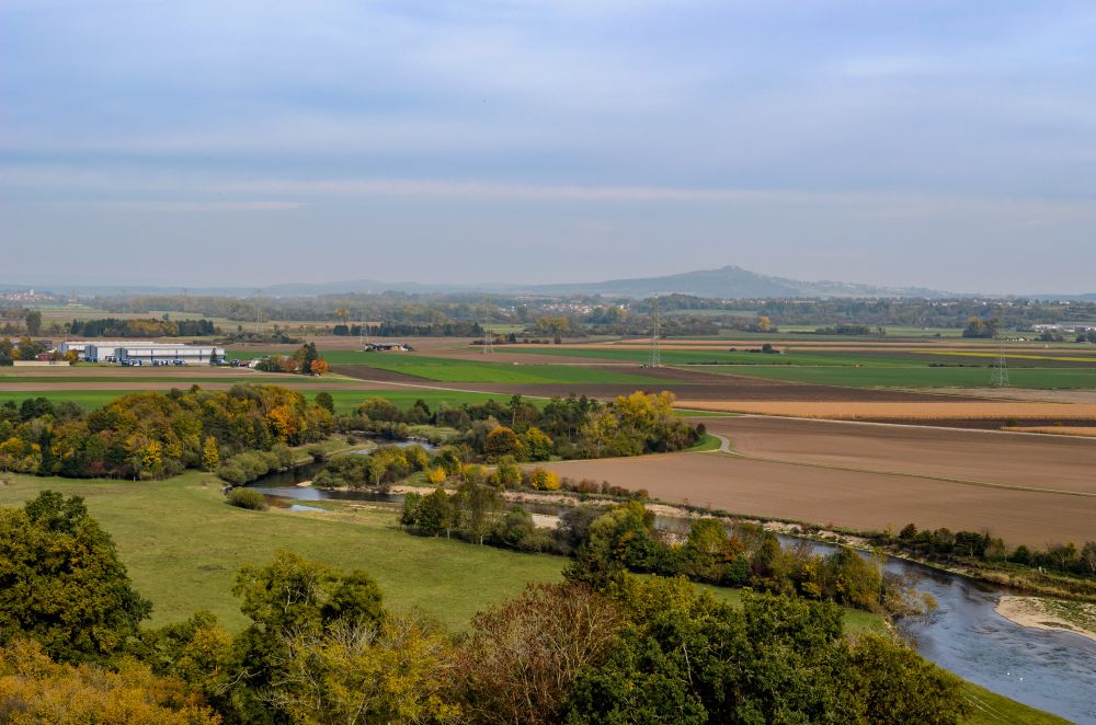
Its strategic position on a plateau, rising 40 meters above the Danube, offers sweeping views of the valley below.
October 27, 2025 at 10:23 AM
Its strategic position on a plateau, rising 40 meters above the Danube, offers sweeping views of the valley below.
I say "fennel-alaneen" as a German who first learned British English and then moved to the US. 🫠
October 23, 2025 at 12:07 PM
I say "fennel-alaneen" as a German who first learned British English and then moved to the US. 🫠