


Mark Meyer
@markmeyerwx.bsky.social
Meteorologist | Valpo Alum | TikTok/Youtube/Instagram/Threads: MeteorologistMarkMeyer |
Here’s my latest snowfall forecast for the winter storm impacting the Northeast today! Stay tuned for updates and follow my other socials as well! #winterstorm #snow #snowstorm #nyc

January 19, 2025 at 8:10 AM
Here’s my latest snowfall forecast for the winter storm impacting the Northeast today! Stay tuned for updates and follow my other socials as well! #winterstorm #snow #snowstorm #nyc
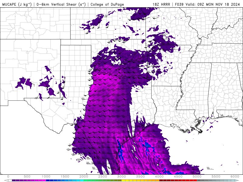
Getting concerned about a potent nocturnal QLCS tornado threat tomorrow night into Monday morning across West-Central Texas and possibly into Southwest OK. 500-1000 j/kg of sfc cape, 100-150 j/kg of 3cape, 50-60 knots of 0-6km shear, as well as 0-1km SRH of 300-400 m2/s2.


November 16, 2024 at 7:53 PM
Getting concerned about a potent nocturnal QLCS tornado threat tomorrow night into Monday morning across West-Central Texas and possibly into Southwest OK. 500-1000 j/kg of sfc cape, 100-150 j/kg of 3cape, 50-60 knots of 0-6km shear, as well as 0-1km SRH of 300-400 m2/s2.
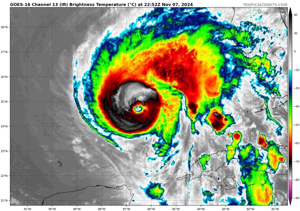
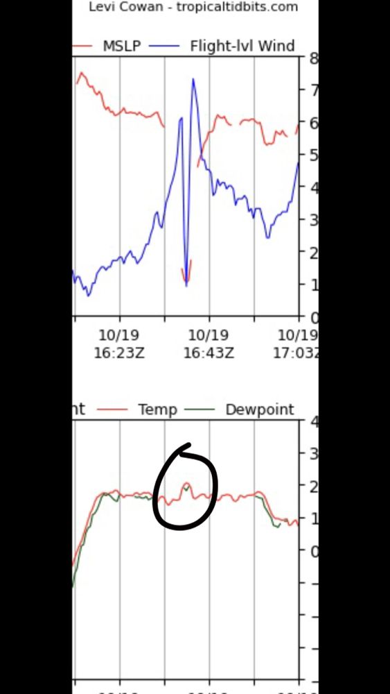
Safe to say #Rafael is stronger than a 90kt hurricane right now. Recon will be in there soon, but the eye is almost all cleared out on IR with it warming at a rapid pace.

November 7, 2024 at 11:10 PM
Safe to say #Rafael is stronger than a 90kt hurricane right now. Recon will be in there soon, but the eye is almost all cleared out on IR with it warming at a rapid pace.
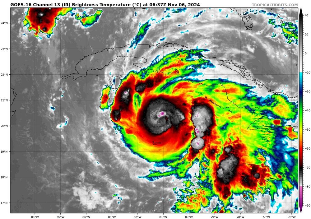
After what had transpired it’s kind of fitting we have another rapidly intensifying hurricane headed towards a land mass that wouldn’t have been as strong if it weren’t for record warm waters….but what do I know!
November 6, 2024 at 7:13 AM
After what had transpired it’s kind of fitting we have another rapidly intensifying hurricane headed towards a land mass that wouldn’t have been as strong if it weren’t for record warm waters….but what do I know!
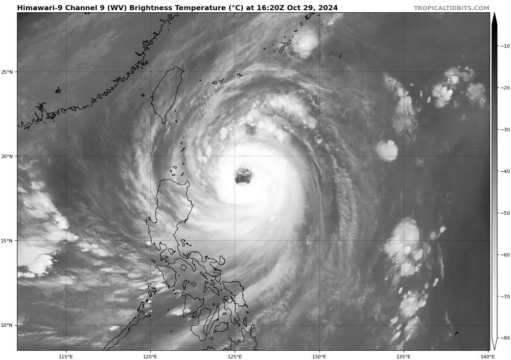
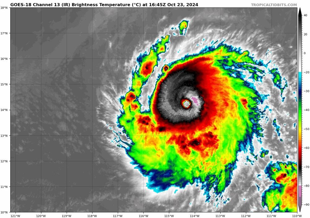
Kong-Rey has an absolutely massive eye. Winds now at 130 mph.
October 29, 2024 at 4:49 PM
Kong-Rey has an absolutely massive eye. Winds now at 130 mph.

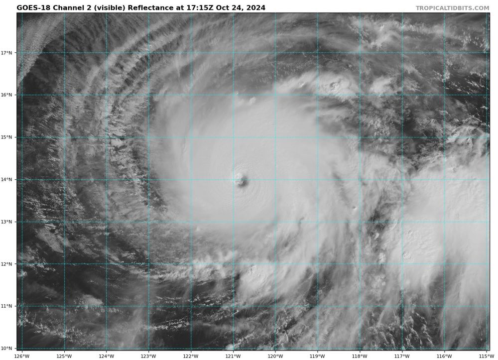


Going to have to watch the Caribbean and western Atlantic for tropical cyclone development the last few days of October into November. Strong MJO (rising motion), low (and lowering) wind shear, and above average SST’s will promote an unusually favorable pattern for (Strong?) tropical cyclone…(1/2)


October 22, 2024 at 6:39 PM
Going to have to watch the Caribbean and western Atlantic for tropical cyclone development the last few days of October into November. Strong MJO (rising motion), low (and lowering) wind shear, and above average SST’s will promote an unusually favorable pattern for (Strong?) tropical cyclone…(1/2)

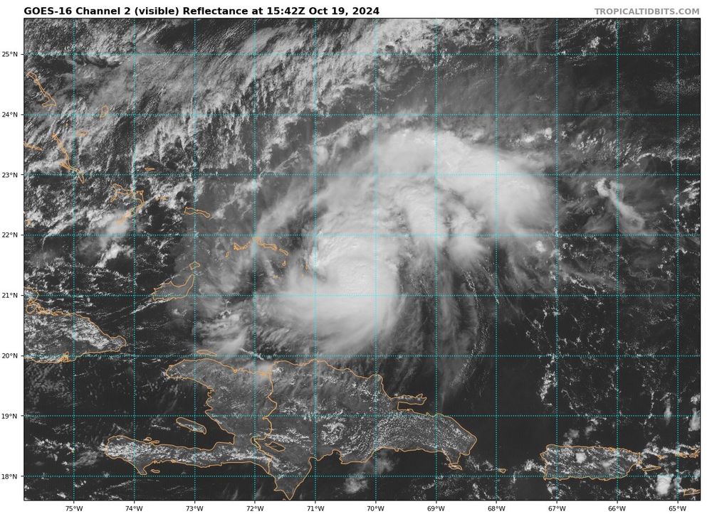
If you see this, post weather

October 18, 2024 at 3:40 PM
If you see this, post weather