


Mapping Segregation in Washington DC
@mappingdc.bsky.social
Since 2014 we've documented how racial covenants and serial displacement shaped the nation's capital. The city relies on our work, and we continue to press for digitizing the land records needed to complete the project.
As protest is suppressed -- Vigil for Peace encampment removed yesterday; Black Lives Matter Plaza removed earlier this year -- I think about this essay a colleague, Bryan Jenkins, and I wrote for the DC Office of Planning a few years ago: planning.dc.gov/node/1681486
The History of Resistance at Lafayette Square and the Black Lives Matter Movement, Washington, DC
In the wake of George Floyd’s death in Minneapolis, Minnesota, massive protests erupted. As with other key protests in the history of the BLM movement the city of the injustice became a key site and n...
planning.dc.gov
September 8, 2025 at 12:31 PM
As protest is suppressed -- Vigil for Peace encampment removed yesterday; Black Lives Matter Plaza removed earlier this year -- I think about this essay a colleague, Bryan Jenkins, and I wrote for the DC Office of Planning a few years ago: planning.dc.gov/node/1681486
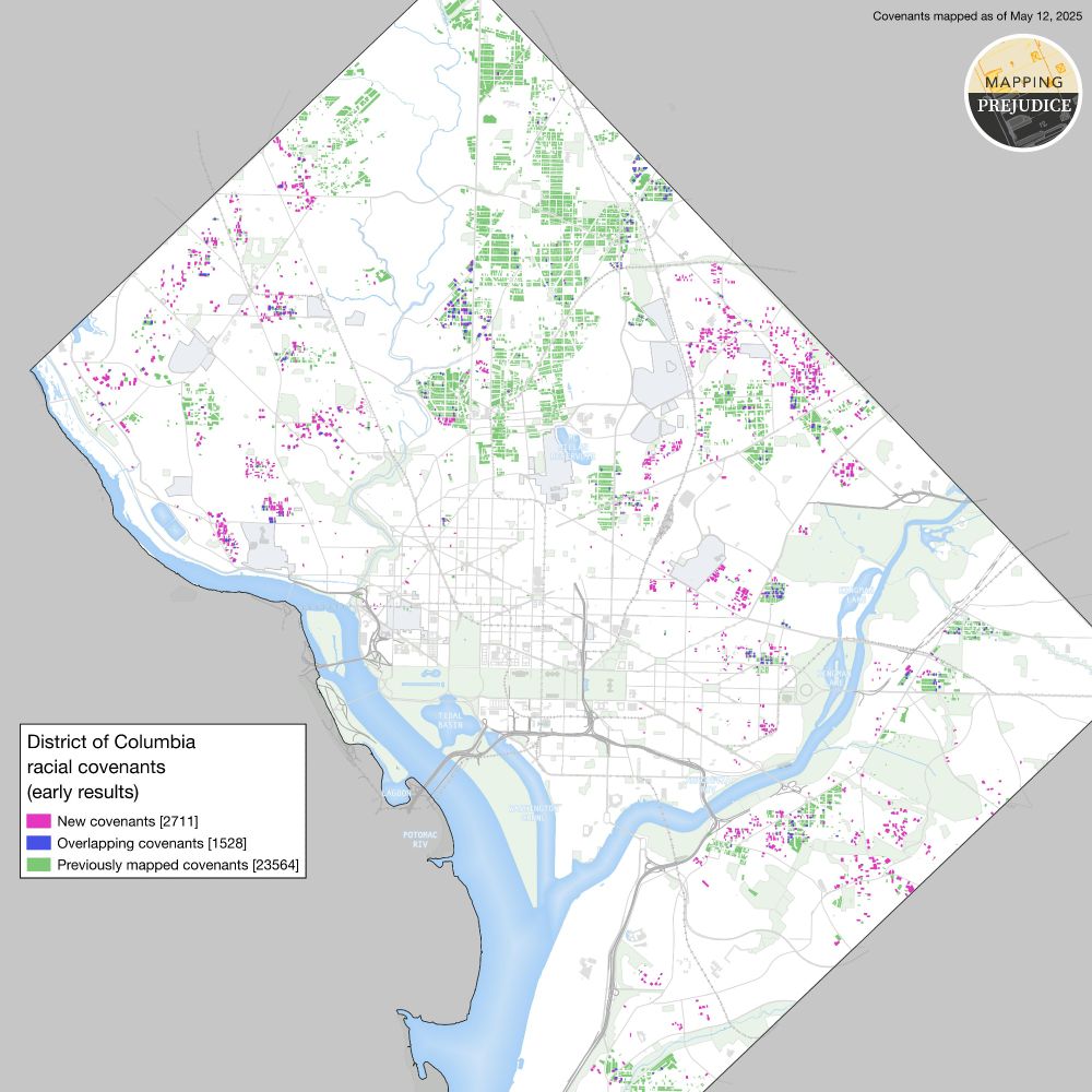
We're close to 20% done with the research! Check out this map showing our progress.
May 17, 2025 at 2:47 AM
We're close to 20% done with the research! Check out this map showing our progress.
SAVE RECORDS AT NARA!
Brian Sheffey of the International African American Museum is urging residents of the DC area to go to the National Archives and scan African American records to ensure they remain accessible. Email cfh@iaamuseum.org with the subject line Volunteer Community Digitizer.
Brian Sheffey of the International African American Museum is urging residents of the DC area to go to the National Archives and scan African American records to ensure they remain accessible. Email cfh@iaamuseum.org with the subject line Volunteer Community Digitizer.
February 23, 2025 at 1:18 AM
SAVE RECORDS AT NARA!
Brian Sheffey of the International African American Museum is urging residents of the DC area to go to the National Archives and scan African American records to ensure they remain accessible. Email cfh@iaamuseum.org with the subject line Volunteer Community Digitizer.
Brian Sheffey of the International African American Museum is urging residents of the DC area to go to the National Archives and scan African American records to ensure they remain accessible. Email cfh@iaamuseum.org with the subject line Volunteer Community Digitizer.
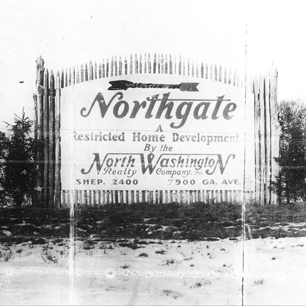
Mapping Segregation in Washington DC needs your help to finish the map. See mappingsegregationdc.org
Mapping Segregation DC
≈
mappingsegregationdc.org
February 19, 2025 at 1:38 AM
Mapping Segregation in Washington DC needs your help to finish the map. See mappingsegregationdc.org
Thank you to all who are working on this and recruiting others!
If you've already contacted your congresspeople & need something constructive to do, consider helping document the history some people are desperate to whitewash.
Mapping Segregation in DC (@mappingdc.bsky.social) needs volunteers to transcribe race restrictions on properties in DC.
1/3
Mapping Segregation in DC (@mappingdc.bsky.social) needs volunteers to transcribe race restrictions on properties in DC.
1/3
February 9, 2025 at 9:03 PM
Thank you to all who are working on this and recruiting others!
Reposted by Mapping Segregation in Washington DC
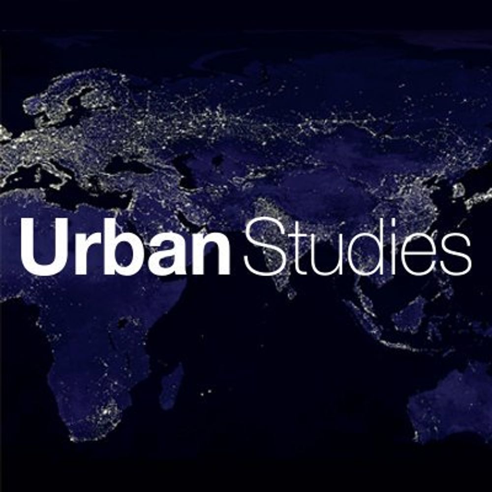
Editors' Featured Articles: Making power visible: Business improvement districts and #CreativePlacemaking in Washington, DC by Susanna F. Schaller, Aaron Howe, Coy McKinney and Sarah Shoenfeld
https://buff.ly/4164evC
#EditorsPicks #FreeAccess #placemaking #UrbanGovernance
https://buff.ly/4164evC
#EditorsPicks #FreeAccess #placemaking #UrbanGovernance
February 7, 2025 at 10:00 AM
Editors' Featured Articles: Making power visible: Business improvement districts and #CreativePlacemaking in Washington, DC by Susanna F. Schaller, Aaron Howe, Coy McKinney and Sarah Shoenfeld
https://buff.ly/4164evC
#EditorsPicks #FreeAccess #placemaking #UrbanGovernance
https://buff.ly/4164evC
#EditorsPicks #FreeAccess #placemaking #UrbanGovernance
We need your help mapping the racially restrictive covenants that once covered much of the nation's capital. Join an upcoming session with our partners at the University of Minnesota to learn more and get started! mappingprejudice.umn.edu/take-action/...
Volunteer | Mapping PrejudiceUniversity Libraries
mappingprejudice.umn.edu
November 22, 2024 at 4:09 PM
We need your help mapping the racially restrictive covenants that once covered much of the nation's capital. Join an upcoming session with our partners at the University of Minnesota to learn more and get started! mappingprejudice.umn.edu/take-action/...