


@lobeliaearth.bsky.social
Data insights for climate action. Provider of climate-ready data, extreme event predictors, and user-centered applications. Created by IsardSAT.
https://www.lobelia.earth/
https://www.lobelia.earth/
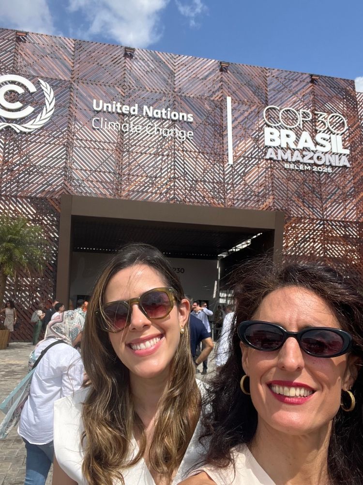
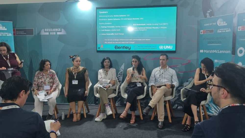
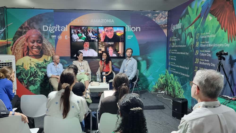
We are back home in Barcelona with food for thought from the exchanges with stakeholders from diverse industries, all with a common interest in building resilience to the impact of climate change in their regions and sectors.
Obrigado Brasil for these fruitful weeks, see you next time!
Obrigado Brasil for these fruitful weeks, see you next time!

November 21, 2025 at 10:02 AM
We are back home in Barcelona with food for thought from the exchanges with stakeholders from diverse industries, all with a common interest in building resilience to the impact of climate change in their regions and sectors.
Obrigado Brasil for these fruitful weeks, see you next time!
Obrigado Brasil for these fruitful weeks, see you next time!

Bas Mijling, from @knmi.nl, lead scientist of the Retina algorith, explains here how it works:
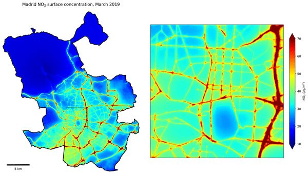
High-resolution mapping of urban NO2 concentrations using Retina v2: a case study on data assimilation of surface and satellite observations in Madrid
Abstract. Urban air pollution poses a significant health risk, with over half the global population living in cities where air quality often exceeds World Health Organization (WHO) guidelines. A comprehensive understanding of local pollution levels is essential for addressing this issue. Recent advancements in low-cost sensors and satellite instruments offer cost-efficient complements to reference stations but integrating these diverse data sources in useful monitoring tools is not straightforward. This study presents the updated Retina v2 algorithm, which generates high-resolution urban air pollution maps by assimilating heterogeneous measurements into a portable urban dispersion model. Tested for NO2 concentrations in Madrid during March 2019, it shows improved speed and accuracy over its predecessor, with the ability to incorporate satellite data. Retina v2 balances performance with modest computational demands, delivering similar or better results compared to complex dispersion models and machine learning approaches requiring extensive datasets. Using only TROPOMI satellite data, citywide NO2 simulations show an RMSE of 19.3 µg m−3, with better results when hourly in-situ measurements were included. Relying on data of a single ground station can introduce biases, which can be mitigated by incorporating satellite data or multiple ground stations. Including more stations improves accuracy, with 24 stations yielding a correlation of 0.90 and an RMSE of 13.0 µg m−3. The benefit of TROPOMI diminishes when data from five or more ground stations is available, but it remains valuable for many cities which have limited monitoring networks.
gmd.copernicus.org
October 28, 2025 at 9:31 AM
Bas Mijling, from @knmi.nl, lead scientist of the Retina algorith, explains here how it works:
Helena's work shows that warmer winters, now more frequent, are having a dramatic impact in preventing deep cascading most of the years and suggests a clear trend under global warming.
The article is available here:
The article is available here:
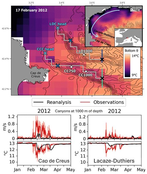
Capturing dense shelf water cascading with a high-resolution ocean reanalysis
Abstract. Dense shelf water cascading (DSWC) is an oceanographic process that occurs when dense shelf water overflows over the shelf edge downslope toward the deep sea. Monitored in the northwestern Mediterranean by moorings since 1993 in the Lacaze-Duthiers Canyon and since 2005 in the Cap de Creus Canyon, numerical modeling with reanalysis extends this timeline further into the past. This study investigates a regional reanalysis (1987–2021) validated against mooring observations at 750–1000 m depth. The reanalysis successfully reproduces observed intense DSWC (IDSWC) events from 1999, 2000, 2005, 2006, 2012, 2013, and 2018 while identifying one previously unreported event in 1987 and detecting no IDSWC between 1988 and 1998. The reanalysis effectively matches 84 % of observed IDSWC days within the same week and 56 % on the exact date. Instead of assimilating IDSWC events from mooring observations to resolve the cascading process, the model relies solely on the seawater density on the shelf and revealed the seawater properties along the canyon that caused IDSWC. This work highlights the importance of high-resolution reanalyses in investigating the impacts of mesoscale processes on larger scales in the deep ocean.
os.copernicus.org
October 21, 2025 at 9:15 AM
Helena's work shows that warmer winters, now more frequent, are having a dramatic impact in preventing deep cascading most of the years and suggests a clear trend under global warming.
The article is available here:
The article is available here:
🌍 We just started an EU-funded project, GreenEOº, also putting satellite data & AI to work for better local decision making & environmental protection by creating open applications to monitor top-down emissions, air quality, & ecosystem health.
@meteofrance.com | @inrae-france.bsky.social
@meteofrance.com | @inrae-france.bsky.social
April 25, 2025 at 12:46 PM
🌍 We just started an EU-funded project, GreenEOº, also putting satellite data & AI to work for better local decision making & environmental protection by creating open applications to monitor top-down emissions, air quality, & ecosystem health.
@meteofrance.com | @inrae-france.bsky.social
@meteofrance.com | @inrae-france.bsky.social