


Lichenstone Geo
@lichenstone.bsky.social
Robbie Austrums
#Geoscience - #GIS - #Archaeology
Anomaly GeoSurvey Software for #Geophysics
Worcester UK - www.lichenstone.com
#Geoscience - #GIS - #Archaeology
Anomaly GeoSurvey Software for #Geophysics
Worcester UK - www.lichenstone.com
Sad to see this beautiful #Worcester #canal -side weeping willow brought down by #stormdarragh. Still a lot of trunk remaining so I'll hope to see regrowth this spring.


December 8, 2024 at 2:53 PM
Sad to see this beautiful #Worcester #canal -side weeping willow brought down by #stormdarragh. Still a lot of trunk remaining so I'll hope to see regrowth this spring.
In London for @geolsoc.bsky.social NSGG Recent Advances in #Archaeology #Geophysics. Essential conference preparation in progress.

December 2, 2024 at 8:00 PM
In London for @geolsoc.bsky.social NSGG Recent Advances in #Archaeology #Geophysics. Essential conference preparation in progress.
You forgot to include a legend...

November 26, 2024 at 3:39 PM
You forgot to include a legend...
I missed the 'Continue Thread' button 🙄 Still new to this place 🙂

November 26, 2024 at 12:40 PM
I missed the 'Continue Thread' button 🙄 Still new to this place 🙂
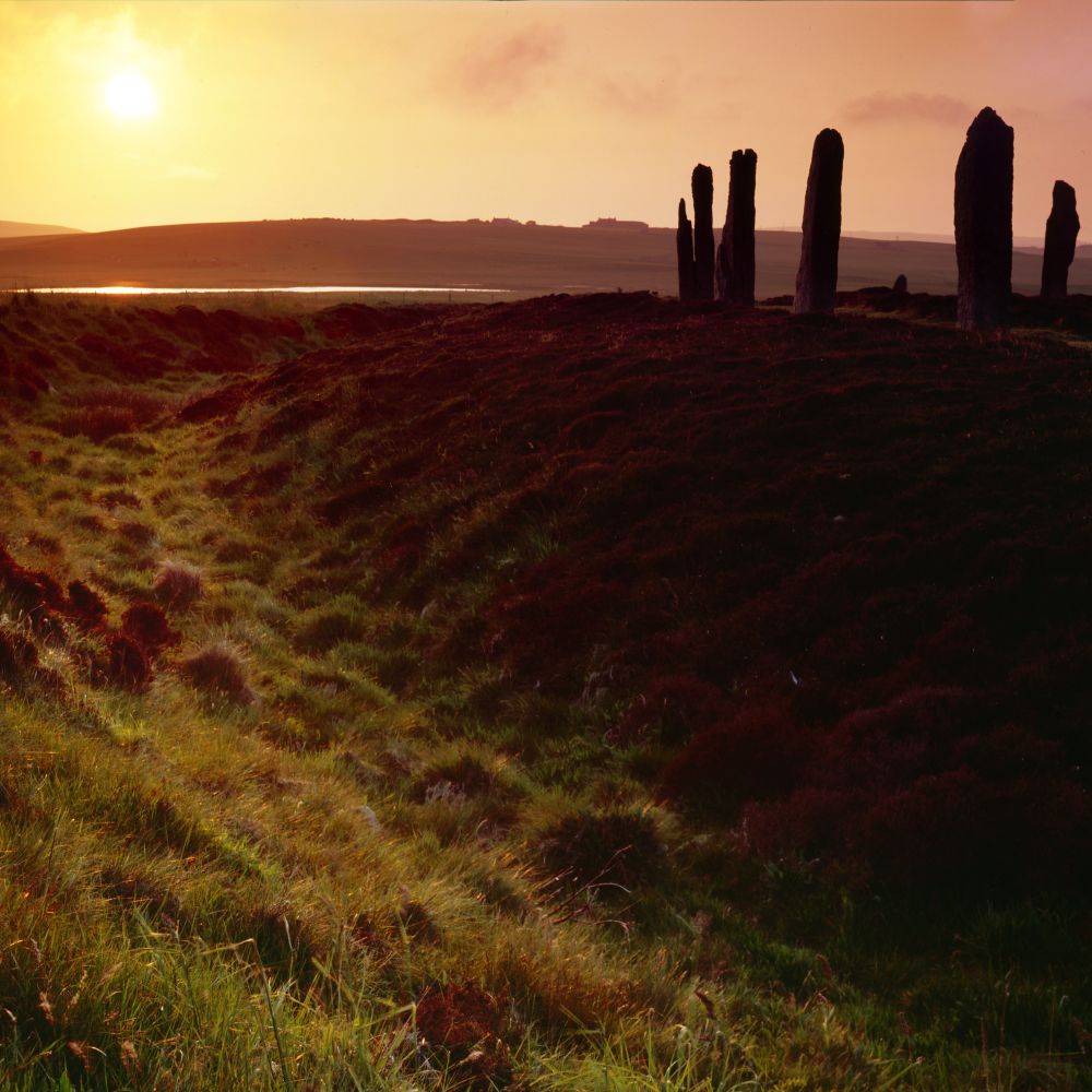
Ring of Brodgar, Orkney

November 25, 2024 at 12:11 AM
Ring of Brodgar, Orkney
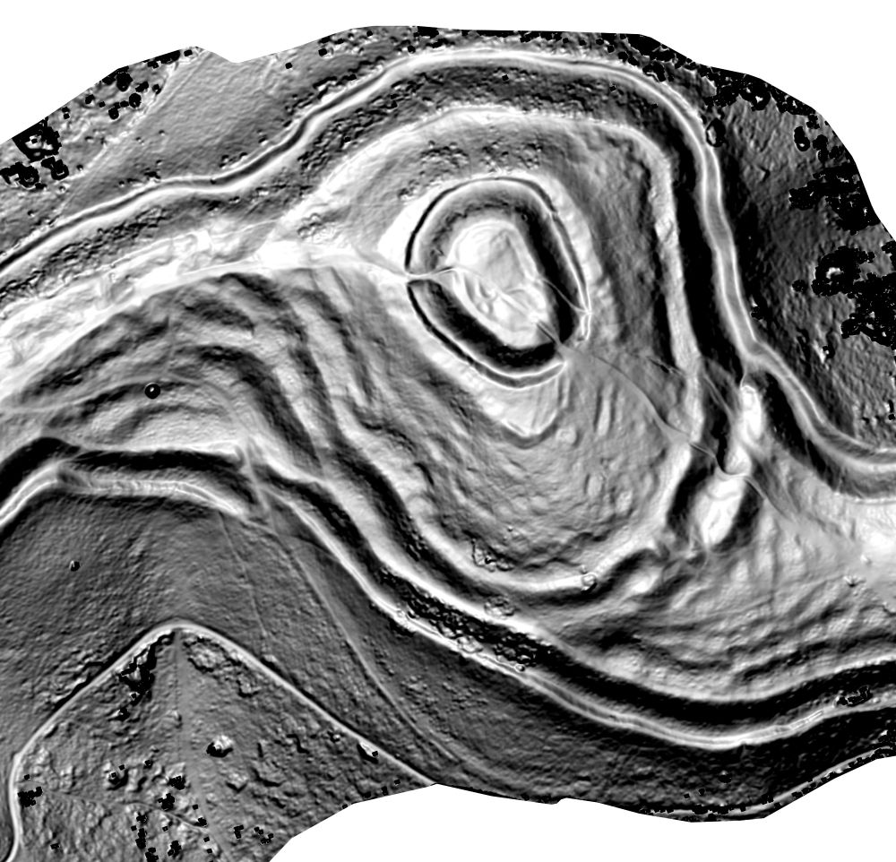
Visualizing terrain curvature can reveal and characterize subtle #archaeology features on steep ground.
This is a drone #photogrammetry survey of British Camp #hillfort on the #Malvern Hills. Red is convexity, blue is concavity, greyscale is steepness. Created using #QGIS and other #osgeo tools.
This is a drone #photogrammetry survey of British Camp #hillfort on the #Malvern Hills. Red is convexity, blue is concavity, greyscale is steepness. Created using #QGIS and other #osgeo tools.


November 21, 2024 at 6:53 PM
Visualizing terrain curvature can reveal and characterize subtle #archaeology features on steep ground.
This is a drone #photogrammetry survey of British Camp #hillfort on the #Malvern Hills. Red is convexity, blue is concavity, greyscale is steepness. Created using #QGIS and other #osgeo tools.
This is a drone #photogrammetry survey of British Camp #hillfort on the #Malvern Hills. Red is convexity, blue is concavity, greyscale is steepness. Created using #QGIS and other #osgeo tools.
Before and after comparison

November 21, 2024 at 12:53 PM
Before and after comparison
Here's a little experiment on using data science to accentuate subtle colour differences between archaeological features.
Decorrelation stretch is a statistical method that aims to identify and remove covariance between colour components, increasing the visual separation of different deposits.
Decorrelation stretch is a statistical method that aims to identify and remove covariance between colour components, increasing the visual separation of different deposits.

November 21, 2024 at 12:10 PM
Here's a little experiment on using data science to accentuate subtle colour differences between archaeological features.
Decorrelation stretch is a statistical method that aims to identify and remove covariance between colour components, increasing the visual separation of different deposits.
Decorrelation stretch is a statistical method that aims to identify and remove covariance between colour components, increasing the visual separation of different deposits.