


Just Maps
@justelexmaps.bsky.social
I make political and demographic maps from countries around the world. Caveat: I am an amateur.
Map of white ancestry in Venezuela by department.

March 28, 2025 at 10:47 PM
Map of white ancestry in Venezuela by department.
Most Afro-Colombians live along the Pacific Coast. The Choco department is over 70% Black, which is the highest percentage of any department in South America outside Suriname.
The island department of San Andres y Providencia (not shown) is 56% Black.
The island department of San Andres y Providencia (not shown) is 56% Black.

March 28, 2025 at 10:46 PM
Most Afro-Colombians live along the Pacific Coast. The Choco department is over 70% Black, which is the highest percentage of any department in South America outside Suriname.
The island department of San Andres y Providencia (not shown) is 56% Black.
The island department of San Andres y Providencia (not shown) is 56% Black.
Apropos of nothing, the 1991 Ukrainian independence referendum. Every oblast and region voted yes, including the parts Russia has invaded and claimed. #SlavaUkraini

March 1, 2025 at 2:50 PM
Apropos of nothing, the 1991 Ukrainian independence referendum. Every oblast and region voted yes, including the parts Russia has invaded and claimed. #SlavaUkraini
Happy #BlackHistoryMonth2025 (1/2)!
From 1873-75, there were 7 Black Congressmen:
Rep. Joseph Rainey (SC-1)
Rep. Alonzo Ransier (SC-2)
Rep. Robert Elliott (SC-3)
Rep. Richard Cain (SC-At Large)
Rep. Josiah Walls (FL-At Large)
Rep. John Lynch (MS-6)
Rep. James Rapier (AL-2)
From 1873-75, there were 7 Black Congressmen:
Rep. Joseph Rainey (SC-1)
Rep. Alonzo Ransier (SC-2)
Rep. Robert Elliott (SC-3)
Rep. Richard Cain (SC-At Large)
Rep. Josiah Walls (FL-At Large)
Rep. John Lynch (MS-6)
Rep. James Rapier (AL-2)


February 12, 2025 at 3:02 AM
Happy #BlackHistoryMonth2025 (1/2)!
From 1873-75, there were 7 Black Congressmen:
Rep. Joseph Rainey (SC-1)
Rep. Alonzo Ransier (SC-2)
Rep. Robert Elliott (SC-3)
Rep. Richard Cain (SC-At Large)
Rep. Josiah Walls (FL-At Large)
Rep. John Lynch (MS-6)
Rep. James Rapier (AL-2)
From 1873-75, there were 7 Black Congressmen:
Rep. Joseph Rainey (SC-1)
Rep. Alonzo Ransier (SC-2)
Rep. Robert Elliott (SC-3)
Rep. Richard Cain (SC-At Large)
Rep. Josiah Walls (FL-At Large)
Rep. John Lynch (MS-6)
Rep. James Rapier (AL-2)
East Anglia follows the pattern of the rest of Southern England where urban areas have plurality or majority populations that are religiously unaffiliated, with rural areas predominantly Christian. (11/11)

January 5, 2025 at 6:25 PM
East Anglia follows the pattern of the rest of Southern England where urban areas have plurality or majority populations that are religiously unaffiliated, with rural areas predominantly Christian. (11/11)
Most of London's constituencies have a Christian plurality or majority except for several cosmopolitan constituencies in Hackey/Islington/Camden (unaffiliated), and some Tower Hamlets/Redbridge/Newham constituencies (Muslim). (10/11)

January 5, 2025 at 6:24 PM
Most of London's constituencies have a Christian plurality or majority except for several cosmopolitan constituencies in Hackey/Islington/Camden (unaffiliated), and some Tower Hamlets/Redbridge/Newham constituencies (Muslim). (10/11)
The South Wales valleys (even not particularly urban areas) have pluralities or majorities of people who are nonreligious. I'm not sure the historic reason for this. #Wales #Geography #Maps #Datavis #Cymru (9/11)

January 5, 2025 at 6:24 PM
The South Wales valleys (even not particularly urban areas) have pluralities or majorities of people who are nonreligious. I'm not sure the historic reason for this. #Wales #Geography #Maps #Datavis #Cymru (9/11)
The urban areas of Yorkshire are predominantly nonreligious. Two Bradford constituencies and Dewsbury are predominantly Muslim. (8/11)

January 5, 2025 at 6:23 PM
The urban areas of Yorkshire are predominantly nonreligious. Two Bradford constituencies and Dewsbury are predominantly Muslim. (8/11)
The East Midlands has much religious diversity. Leicester is a multicultural city with the only Hindu-plurality constituency (Leicester East; notably the only Tory gain in 2024). Nottingham and its environs have people without any religious affiliation. (7/11)

January 5, 2025 at 6:22 PM
The East Midlands has much religious diversity. Leicester is a multicultural city with the only Hindu-plurality constituency (Leicester East; notably the only Tory gain in 2024). Nottingham and its environs have people without any religious affiliation. (7/11)
Christians are the largest religious group in all but 2 constituencies in the North East and Cumbria. (6/11)

January 5, 2025 at 6:22 PM
Christians are the largest religious group in all but 2 constituencies in the North East and Cumbria. (6/11)
The North West is probably the most Catholic part of England and Wales and exceptions include some constituencies in Manchester, and Blackburn (the former constituency of Foreign Secretary Jack Straw and the place the Beatles said had four thousand holes). (5/11)


January 5, 2025 at 6:21 PM
The North West is probably the most Catholic part of England and Wales and exceptions include some constituencies in Manchester, and Blackburn (the former constituency of Foreign Secretary Jack Straw and the place the Beatles said had four thousand holes). (5/11)
Christians are the largest group in each South East constituency except for those in metro Portsmouth, Southampton, and Brighton/Hove/Worthing. I was surprised that they were the biggest group in Oxford. #Oxford #Maps #Datavis #Geography (4/11)

January 5, 2025 at 6:20 PM
Christians are the largest group in each South East constituency except for those in metro Portsmouth, Southampton, and Brighton/Hove/Worthing. I was surprised that they were the biggest group in Oxford. #Oxford #Maps #Datavis #Geography (4/11)
People not affiliated with any religion are the plurality or majority of most of the South West's urban areas (Bristol, Bath, Exeter, Plymouth), and... Cornwall. Cornwall has a history of nonconformist Protestant Christianity and I wonder how they identify themselves. (3/11)

January 5, 2025 at 6:19 PM
People not affiliated with any religion are the plurality or majority of most of the South West's urban areas (Bristol, Bath, Exeter, Plymouth), and... Cornwall. Cornwall has a history of nonconformist Protestant Christianity and I wonder how they identify themselves. (3/11)
Christians are the largest religious group in all of the West Midlands constituencies save for five constituencies in Birmingham which are plurality or majority Muslim. (2/11) #geography #datavis #maps

January 5, 2025 at 6:19 PM
Christians are the largest religious group in all of the West Midlands constituencies save for five constituencies in Birmingham which are plurality or majority Muslim. (2/11) #geography #datavis #maps
Map of the largest religious group in each constituency in England and Wales as of the 2021 census. (1/11) #ukpol #geography #maps #datavis

January 5, 2025 at 6:18 PM
Map of the largest religious group in each constituency in England and Wales as of the 2021 census. (1/11) #ukpol #geography #maps #datavis
After learning about a 95% Asian precinct (Edison 78) that voted for Trump, I was curious about what the Asian vote did in the rest of Middlesex County, NJ.
It turns out was an outlier per the graph. 75/85 majority Asian precincts in Middlesex County voted for Harris.
It turns out was an outlier per the graph. 75/85 majority Asian precincts in Middlesex County voted for Harris.

December 28, 2024 at 2:05 AM
After learning about a 95% Asian precinct (Edison 78) that voted for Trump, I was curious about what the Asian vote did in the rest of Middlesex County, NJ.
It turns out was an outlier per the graph. 75/85 majority Asian precincts in Middlesex County voted for Harris.
It turns out was an outlier per the graph. 75/85 majority Asian precincts in Middlesex County voted for Harris.
Map of the best performing Republican from 2000 onwards. Donald Trump, due to his overwhelming strength in rural counties, is the best performing 21st century Republican in most of America's land area. #Geography #Maps #Election2024 #Datavis

December 27, 2024 at 5:08 AM
Map of the best performing Republican from 2000 onwards. Donald Trump, due to his overwhelming strength in rural counties, is the best performing 21st century Republican in most of America's land area. #Geography #Maps #Election2024 #Datavis
What I never quite understood is why John Kerry did better than Al Gore in this group of eastern Kentucky counties. Do those counties still have a lot of active coal mines? Maybe old union voters were okay with Kerry but not "Earth in the Balance" Al Gore? #Kentucky #Datavis #Maps #Geography

December 25, 2024 at 4:45 PM
What I never quite understood is why John Kerry did better than Al Gore in this group of eastern Kentucky counties. Do those counties still have a lot of active coal mines? Maybe old union voters were okay with Kerry but not "Earth in the Balance" Al Gore? #Kentucky #Datavis #Maps #Geography
Followup to the earlier map: I added in Gore's 2000 performance and he basically took over all but a handful of the Kerry counties. This map also corrects an error; Tompkins County, NY (where Cornell is) actually swung slightly to Harris, making her the best performer. #Election2024 #Maps #Geography

December 25, 2024 at 4:44 PM
Followup to the earlier map: I added in Gore's 2000 performance and he basically took over all but a handful of the Kerry counties. This map also corrects an error; Tompkins County, NY (where Cornell is) actually swung slightly to Harris, making her the best performer. #Election2024 #Maps #Geography
Map of the best-performing Democrat in every county since 2004. Harris was the best performing Democrat in a swathe of Colorado, Washington, and western North Carolina counties.
#Election2024 #Geography #Maps #Datavis
#Election2024 #Geography #Maps #Datavis

December 24, 2024 at 3:53 PM
Map of the best-performing Democrat in every county since 2004. Harris was the best performing Democrat in a swathe of Colorado, Washington, and western North Carolina counties.
#Election2024 #Geography #Maps #Datavis
#Election2024 #Geography #Maps #Datavis
Comparison of John Kerry and Kamala Harris's performances in the West. (5/5)


December 23, 2024 at 7:41 PM
Comparison of John Kerry and Kamala Harris's performances in the West. (5/5)
Comparison of John Kerry and Kamala Harris's performances in the Midwest. (4/5)


December 23, 2024 at 7:41 PM
Comparison of John Kerry and Kamala Harris's performances in the Midwest. (4/5)
Comparison of John Kerry and Kamala Harris's performances in the South. (3/5)


December 23, 2024 at 7:40 PM
Comparison of John Kerry and Kamala Harris's performances in the South. (3/5)
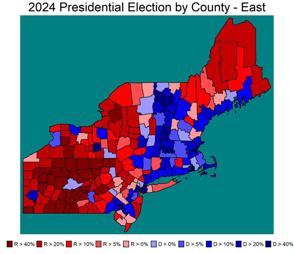
Compared to John Kerry, Kamala Harris did better in central Jersey, SEPA and especially central Pennsylvania, where Kerry did better in northern New England, western PA, and metropolitan New York. (2/5)


December 23, 2024 at 7:39 PM
Compared to John Kerry, Kamala Harris did better in central Jersey, SEPA and especially central Pennsylvania, where Kerry did better in northern New England, western PA, and metropolitan New York. (2/5)
Comparison of the 2004 and 2024 elections which were the last times the Democratic candidate lost the popular vote. Harris did about 1% better than John Kerry. (1/5)


December 23, 2024 at 7:38 PM
Comparison of the 2004 and 2024 elections which were the last times the Democratic candidate lost the popular vote. Harris did about 1% better than John Kerry. (1/5)