


Greg Fiske
@gfiske.bsky.social
Putting science on the map at Woodwell Climate Research Center | Cartographer | Analyst | Senior Research Associate | Fly fisher | located in Woods Hole, MA, USA
Spent a rainy but productive day on Capitol Hill in Washington D.C. with our Government Relations and @permafrostpathways.bsky.social teams. The importance of using maps to communicate our science was a key topic of discussion. The map tie also received several compliments :)


September 11, 2025 at 1:49 AM
Spent a rainy but productive day on Capitol Hill in Washington D.C. with our Government Relations and @permafrostpathways.bsky.social teams. The importance of using maps to communicate our science was a key topic of discussion. The map tie also received several compliments :)
Returned to my desk this week to find that the kind folks at Google Earth Outreach have uploaded the entire latest version of the ArcticDEM mosaic (v4.1) to the GEE archive.
developers.google.com/earth-engine...
Presently cleaning ~17tb from my hard drive :)
developers.google.com/earth-engine...
Presently cleaning ~17tb from my hard drive :)

September 4, 2025 at 5:11 PM
Returned to my desk this week to find that the kind folks at Google Earth Outreach have uploaded the entire latest version of the ArcticDEM mosaic (v4.1) to the GEE archive.
developers.google.com/earth-engine...
Presently cleaning ~17tb from my hard drive :)
developers.google.com/earth-engine...
Presently cleaning ~17tb from my hard drive :)
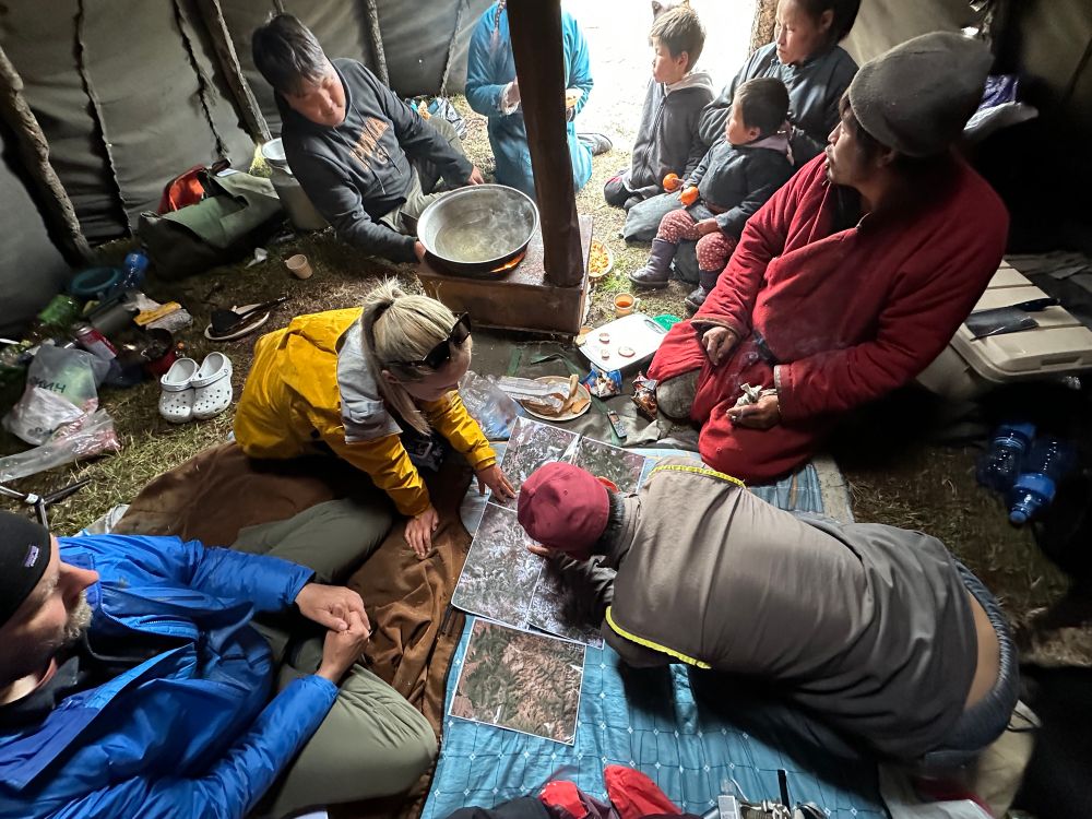
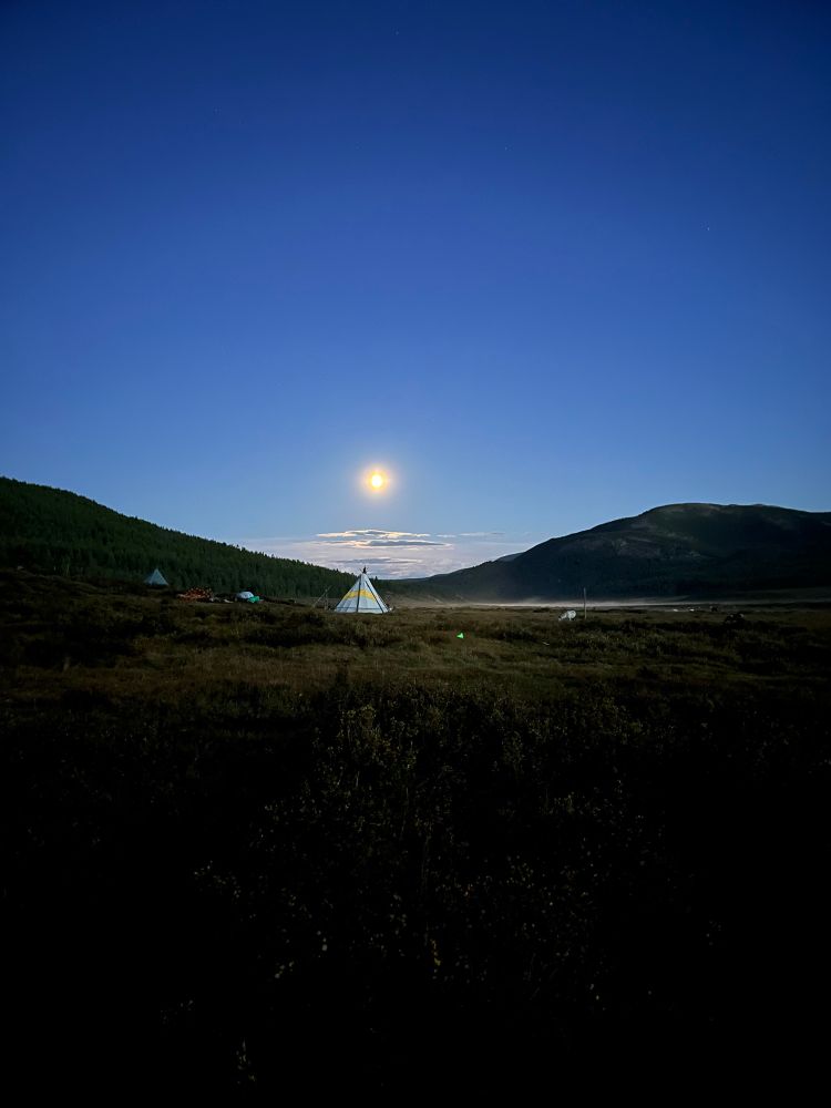
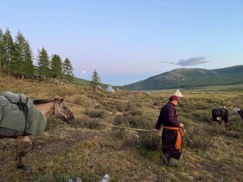
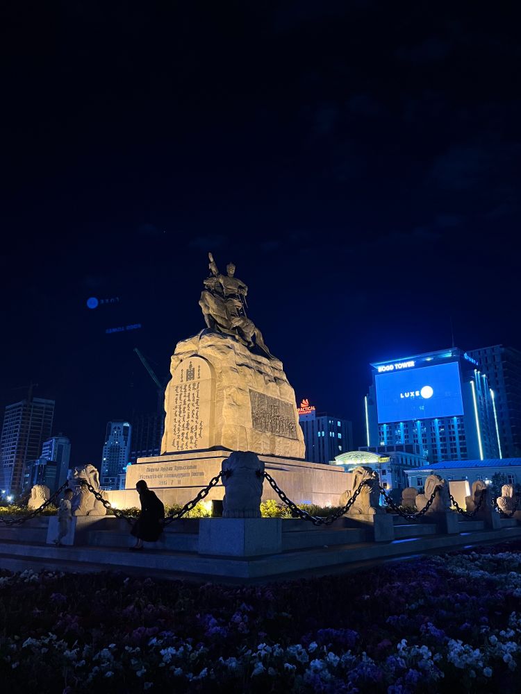
A 17km horseback trek brought us to the Dukha reindeer herders' autumn camp in the West Taiga this week. We're here to co-create maps, sharing the story of their nomadic life and how they're navigating climate change and land use changes.
Drone 📸: IG @l.s_ragchaa
@permafrostpathways.bsky.social
Drone 📸: IG @l.s_ragchaa
@permafrostpathways.bsky.social


August 14, 2025 at 11:26 AM
A 17km horseback trek brought us to the Dukha reindeer herders' autumn camp in the West Taiga this week. We're here to co-create maps, sharing the story of their nomadic life and how they're navigating climate change and land use changes.
Drone 📸: IG @l.s_ragchaa
@permafrostpathways.bsky.social
Drone 📸: IG @l.s_ragchaa
@permafrostpathways.bsky.social
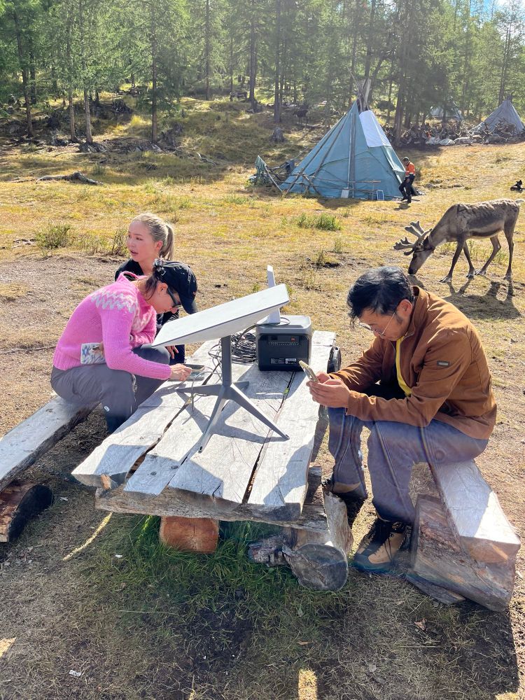
And we’re already hard at work discussing map information.

August 9, 2025 at 2:02 AM
And we’re already hard at work discussing map information.
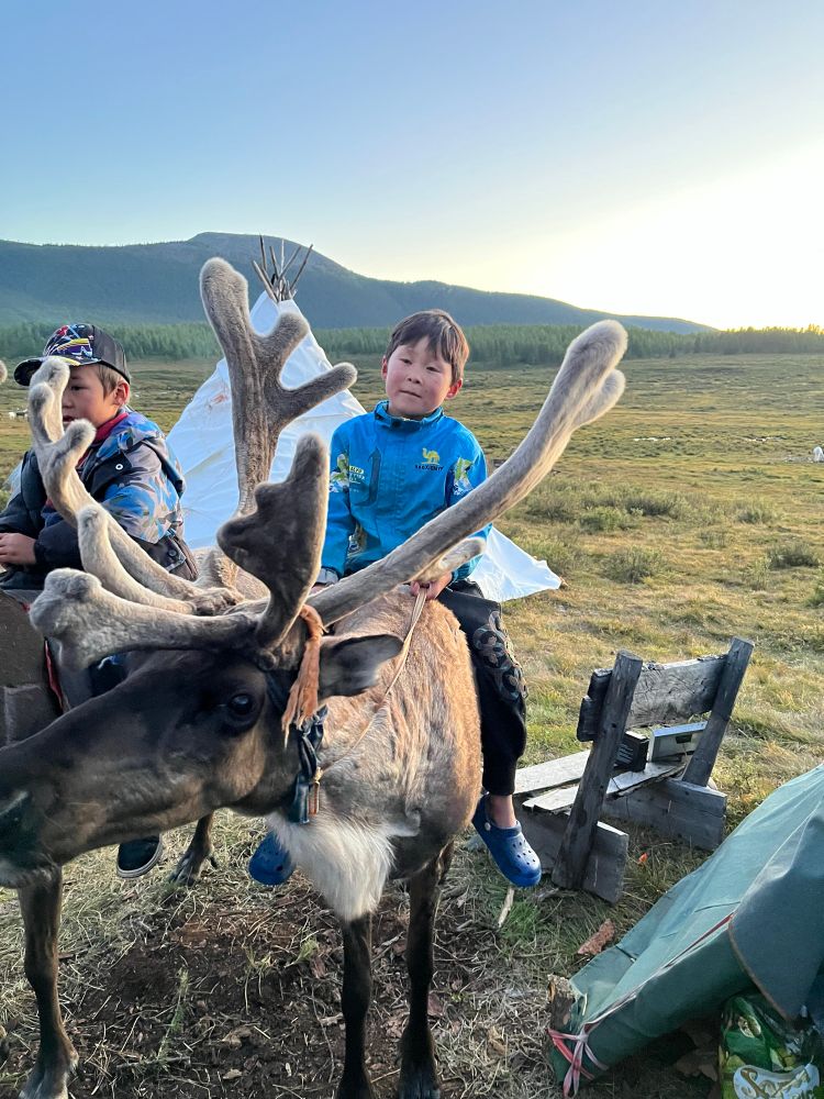
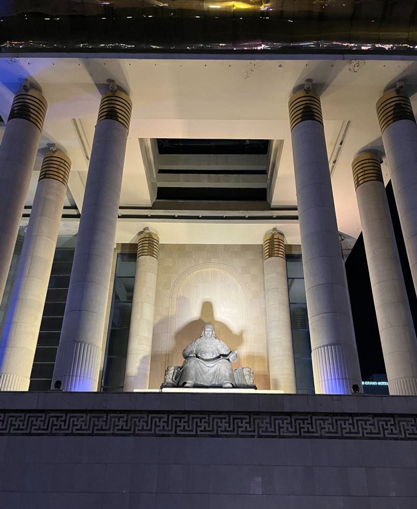
After many days of travel: inc four flights, 8 hours of 4x4 off roading, and a half day (and into the night) on horseback, we’ve reached the Dukha reindeer camp on the east taiga of Mongolia, just 10 miles from the Russian border. And they have starlink! 🙂
August 8, 2025 at 2:50 AM
After many days of travel: inc four flights, 8 hours of 4x4 off roading, and a half day (and into the night) on horseback, we’ve reached the Dukha reindeer camp on the east taiga of Mongolia, just 10 miles from the Russian border. And they have starlink! 🙂
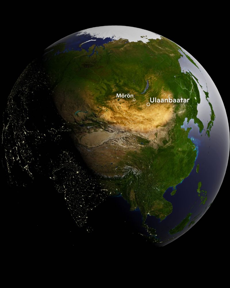
Excited to be visiting a new (to me) part of the permafrost region this month, with friend/colleague Marina Tonkopeeva of the International Centre for Reindeer husbandry, new collaborators from the Dukha indigenous community, and local science experts. I wonder what maps will come of this trip?!

July 31, 2025 at 4:21 PM
Excited to be visiting a new (to me) part of the permafrost region this month, with friend/colleague Marina Tonkopeeva of the International Centre for Reindeer husbandry, new collaborators from the Dukha indigenous community, and local science experts. I wonder what maps will come of this trip?!

July 17, 2025 at 3:52 PM
Great week at #EsriUC2025 with the @woodwellclimate.bsky.social team! Our @permafrostpathways.bsky.social booth was a hit, making many new connections… and Woodwell maps were everywhere, from the map gallery, plenary, to a main hall mural.


July 17, 2025 at 3:34 PM
Great week at #EsriUC2025 with the @woodwellclimate.bsky.social team! Our @permafrostpathways.bsky.social booth was a hit, making many new connections… and Woodwell maps were everywhere, from the map gallery, plenary, to a main hall mural.
Unpacking the Recent Heat Wave with an animation of NOAA's Real-Time Mesoscale Analysis (RTMA) data 🗺️
Stay cool this summer folks!
Stay cool this summer folks!
June 27, 2025 at 4:11 PM
Unpacking the Recent Heat Wave with an animation of NOAA's Real-Time Mesoscale Analysis (RTMA) data 🗺️
Stay cool this summer folks!
Stay cool this summer folks!
Taking a quick peek at firesmoke.ca/data/ ... things are heating up.
June 4, 2025 at 1:48 PM
Taking a quick peek at firesmoke.ca/data/ ... things are heating up.
Excited to be the Mountainfilm 2025 mural artist in Telluride! My mural, "Cartographies of Arctic Change" (a massive 26.5' x 36'!), visualizes our Arctic research. It's going up now on Telco Coffee, a wall previously graced by JR, Gregg Deal, Banksy, and more. Come see it in Telluride!


May 13, 2025 at 7:54 PM
Excited to be the Mountainfilm 2025 mural artist in Telluride! My mural, "Cartographies of Arctic Change" (a massive 26.5' x 36'!), visualizes our Arctic research. It's going up now on Telco Coffee, a wall previously graced by JR, Gregg Deal, Banksy, and more. Come see it in Telluride!
This well-loved print on our map table @woodwellclimate.bsky.social is a Venn diagram I created long ago to visualize the synergy btw maps and science.
Ultimately, the relationship is iterative: robust maps fuel better scientific inquiry, which in turn allows us to create even more insightful maps.
Ultimately, the relationship is iterative: robust maps fuel better scientific inquiry, which in turn allows us to create even more insightful maps.

May 8, 2025 at 6:48 PM
This well-loved print on our map table @woodwellclimate.bsky.social is a Venn diagram I created long ago to visualize the synergy btw maps and science.
Ultimately, the relationship is iterative: robust maps fuel better scientific inquiry, which in turn allows us to create even more insightful maps.
Ultimately, the relationship is iterative: robust maps fuel better scientific inquiry, which in turn allows us to create even more insightful maps.
A rainy weekend day in New England is a perfect time to visit The Map Center with @cmshintani.bsky.social. Thank you Andrew @mapcenter.com for the fabulous tour!


April 12, 2025 at 11:05 PM
A rainy weekend day in New England is a perfect time to visit The Map Center with @cmshintani.bsky.social. Thank you Andrew @mapcenter.com for the fabulous tour!
Make a difference this summer -- Join @cmshintani.bsky.social and me for an internship at @woodwellclimate.bsky.social and contribute to critical research on climate change.
Apply now: bit.ly/4l5D93W
Apply now: bit.ly/4l5D93W

March 25, 2025 at 7:01 PM
Make a difference this summer -- Join @cmshintani.bsky.social and me for an internship at @woodwellclimate.bsky.social and contribute to critical research on climate change.
Apply now: bit.ly/4l5D93W
Apply now: bit.ly/4l5D93W
Had a great chat today with the legendary Conrad Anker about maps. 🗺️
His perspective on exploration, storytelling, and how maps can shape our understanding of the world was inspiring.
📸 by R. Max Holmes
His perspective on exploration, storytelling, and how maps can shape our understanding of the world was inspiring.
📸 by R. Max Holmes

March 3, 2025 at 11:53 PM
Had a great chat today with the legendary Conrad Anker about maps. 🗺️
His perspective on exploration, storytelling, and how maps can shape our understanding of the world was inspiring.
📸 by R. Max Holmes
His perspective on exploration, storytelling, and how maps can shape our understanding of the world was inspiring.
📸 by R. Max Holmes
Thank you to Jack Dangermond for highlighting 3 of our @woodwellclimate.bsky.social #maps on the big stage here in DC this morning

February 24, 2025 at 3:09 PM
Thank you to Jack Dangermond for highlighting 3 of our @woodwellclimate.bsky.social #maps on the big stage here in DC this morning
A quick peek at the Santa Ana winds over the last few days.
Data: NOAA NWS RTMA
Data: NOAA NWS RTMA
January 10, 2025 at 4:21 PM
A quick peek at the Santa Ana winds over the last few days.
Data: NOAA NWS RTMA
Data: NOAA NWS RTMA
CONUS 2024 daily maximum temperature anomaly 🥵

January 8, 2025 at 8:58 PM
CONUS 2024 daily maximum temperature anomaly 🥵
A Collaborative and Scalable Geospatial Data Set for Arctic Retrogressive Thaw Slumps with Data Standards
www.nature.com/articles/s41...
www.nature.com/articles/s41...

January 6, 2025 at 4:15 PM
A Collaborative and Scalable Geospatial Data Set for Arctic Retrogressive Thaw Slumps with Data Standards
www.nature.com/articles/s41...
www.nature.com/articles/s41...
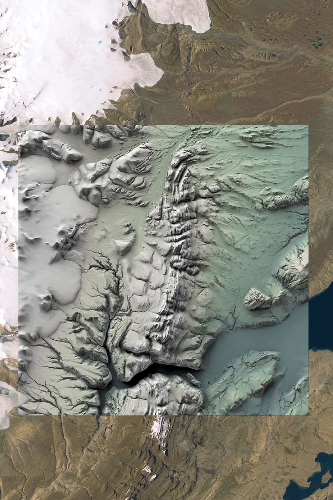
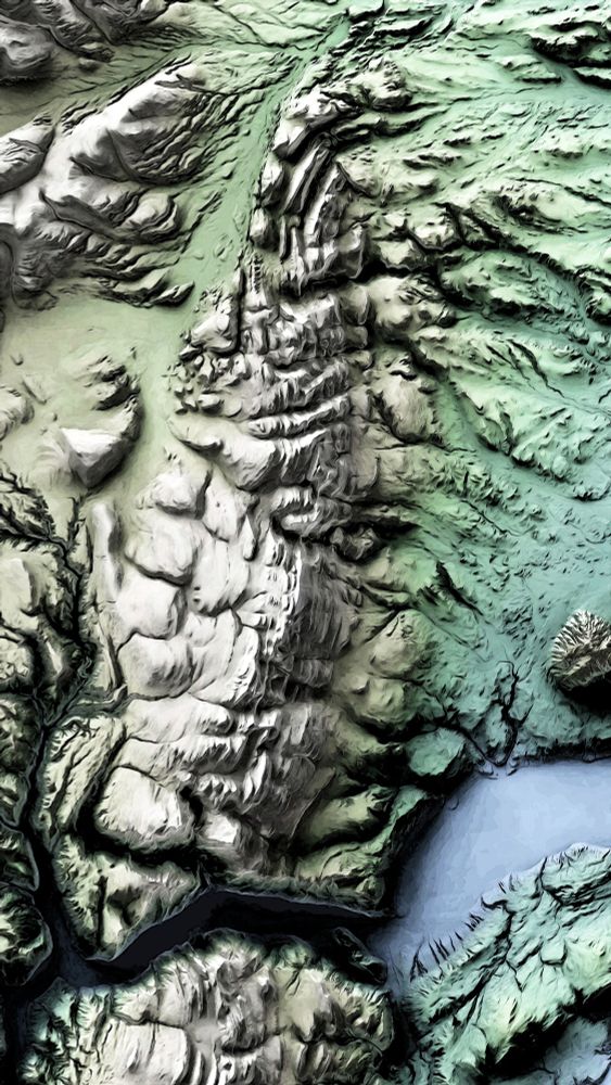
Just a regular reminder: the ArcticDEM is one of the most beautiful spatial datasets out there. I've been working on a large tile set for our #arctic abrupt thaw mapping activities recently and I can't help but stop and take a peek as the data rolls in.
December 30, 2024 at 4:55 PM
Just a regular reminder: the ArcticDEM is one of the most beautiful spatial datasets out there. I've been working on a large tile set for our #arctic abrupt thaw mapping activities recently and I can't help but stop and take a peek as the data rolls in.
Arctic Indigenous mapmakers are reclaiming the past, shaping their future.
A new story by Jess Howard @permafrostpathways.bsky.social highlighting our collaborative mapping efforts with Esri and native Alaskan communities.
permafrost.woodwellclimate.org/arctic-indig...
A new story by Jess Howard @permafrostpathways.bsky.social highlighting our collaborative mapping efforts with Esri and native Alaskan communities.
permafrost.woodwellclimate.org/arctic-indig...

December 5, 2024 at 3:24 PM
Arctic Indigenous mapmakers are reclaiming the past, shaping their future.
A new story by Jess Howard @permafrostpathways.bsky.social highlighting our collaborative mapping efforts with Esri and native Alaskan communities.
permafrost.woodwellclimate.org/arctic-indig...
A new story by Jess Howard @permafrostpathways.bsky.social highlighting our collaborative mapping efforts with Esri and native Alaskan communities.
permafrost.woodwellclimate.org/arctic-indig...
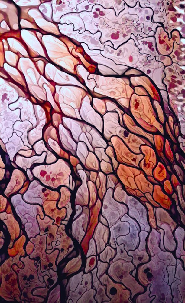
In this case, the data takes all the credit... it's beautiful. I also added a very minor Poster Edge filter in PS. Here's a link and a blender screenshot.
www.northeastoceandata.org/data-download/
www.northeastoceandata.org/data-download/

December 3, 2024 at 6:10 PM
In this case, the data takes all the credit... it's beautiful. I also added a very minor Poster Edge filter in PS. Here's a link and a blender screenshot.
www.northeastoceandata.org/data-download/
www.northeastoceandata.org/data-download/
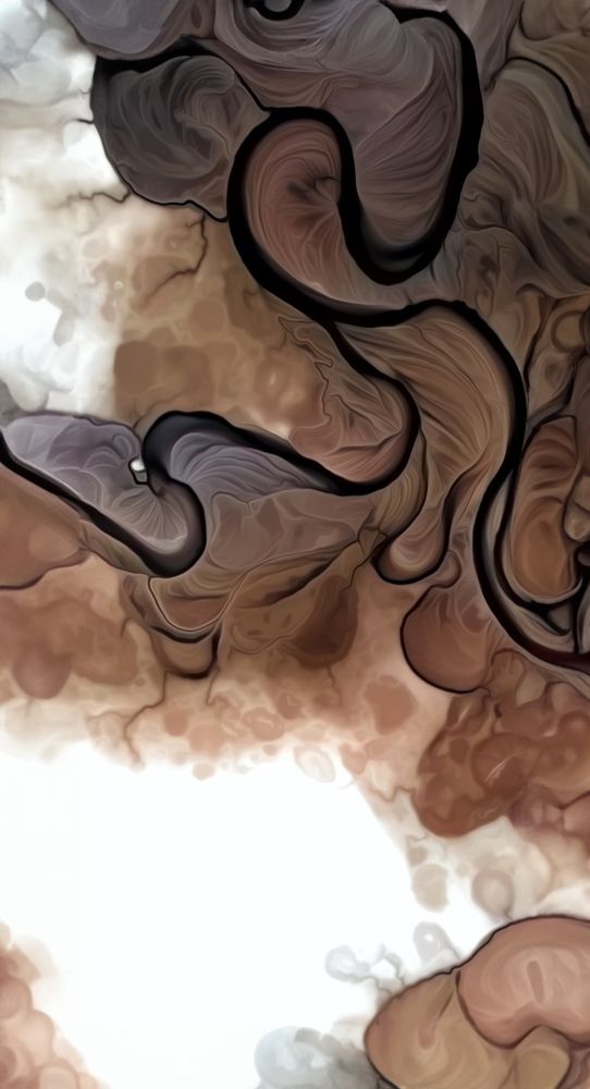
#30DayMapChallenge · Day 28 · The blue planet.
A collaborative map between @cmshintani.bsky.social and I showing the bathymetry around Cape Cod Massachusetts, home to @woodwellclimate.bsky.social.
Annotation was done in Adobe Illustrator while the bathymetric surface was rendered in Blender.
A collaborative map between @cmshintani.bsky.social and I showing the bathymetry around Cape Cod Massachusetts, home to @woodwellclimate.bsky.social.
Annotation was done in Adobe Illustrator while the bathymetric surface was rendered in Blender.


November 28, 2024 at 2:18 PM
#30DayMapChallenge · Day 28 · The blue planet.
A collaborative map between @cmshintani.bsky.social and I showing the bathymetry around Cape Cod Massachusetts, home to @woodwellclimate.bsky.social.
Annotation was done in Adobe Illustrator while the bathymetric surface was rendered in Blender.
A collaborative map between @cmshintani.bsky.social and I showing the bathymetry around Cape Cod Massachusetts, home to @woodwellclimate.bsky.social.
Annotation was done in Adobe Illustrator while the bathymetric surface was rendered in Blender.
The Science on the Fly project is celebrating 5 years of community science this month with free giveaways. This week is a drawing for a handmade mug by my longtime friend and colleague, Anya Suslova, and one of my river maps printed on glass. Enter to win:
scienceonthefly.org/5yeargiveaways
scienceonthefly.org/5yeargiveaways

November 27, 2024 at 2:45 PM
The Science on the Fly project is celebrating 5 years of community science this month with free giveaways. This week is a drawing for a handmade mug by my longtime friend and colleague, Anya Suslova, and one of my river maps printed on glass. Enter to win:
scienceonthefly.org/5yeargiveaways
scienceonthefly.org/5yeargiveaways
Coded up a quick animation showing recent Sea Surface Temperatures for #30DayMapChallenge Day 25, Heat.
Data: NOAA coral reef watch coralreefwatch.noaa.gov/product/5km/
🥵
Data: NOAA coral reef watch coralreefwatch.noaa.gov/product/5km/
🥵
November 25, 2024 at 9:09 PM
Coded up a quick animation showing recent Sea Surface Temperatures for #30DayMapChallenge Day 25, Heat.
Data: NOAA coral reef watch coralreefwatch.noaa.gov/product/5km/
🥵
Data: NOAA coral reef watch coralreefwatch.noaa.gov/product/5km/
🥵