


Geograph Great Britain & Ireland
@geograph-gbi.bsky.social
Record and share your places!
We collect geographically interesting photos of UK and Ireland.
Aiming for at least one per 1km OS grid square
Moderated, classroom-ready, reusable, geo-located
8 million photos so far
http://www.geograph.org.uk/
We collect geographically interesting photos of UK and Ireland.
Aiming for at least one per 1km OS grid square
Moderated, classroom-ready, reusable, geo-located
8 million photos so far
http://www.geograph.org.uk/
Pinned


To introduce ourselves here, we are a website collecting geographically interesting photos of Britain and Ireland, all geolocated and CC licensed for reuse. Still some grid squares with no photos, others with many, recording different details and changes over seasons and years. www.geograph.org.uk
Reposted by Geograph Great Britain & Ireland

An ancient landscape of early copper mines & Romano-British roundhouses 🛖⛰️
Cwm Dyli below Yr Wyddfa/Snowdon, Gwynedd
📷 My own, Sunday
Cwm Dyli below Yr Wyddfa/Snowdon, Gwynedd
📷 My own, Sunday

October 21, 2025 at 6:33 AM
An ancient landscape of early copper mines & Romano-British roundhouses 🛖⛰️
Cwm Dyli below Yr Wyddfa/Snowdon, Gwynedd
📷 My own, Sunday
Cwm Dyli below Yr Wyddfa/Snowdon, Gwynedd
📷 My own, Sunday
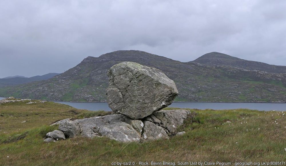
Three of twenty new squares added this week in the Outer Hebrides. Great to see more wild areas getting recorded
www.geograph.org.uk/search.php?i...
www.geograph.org.uk/profile/3729
www.geograph.org.uk/search.php?i...
www.geograph.org.uk/profile/3729


July 5, 2025 at 2:10 PM
Three of twenty new squares added this week in the Outer Hebrides. Great to see more wild areas getting recorded
www.geograph.org.uk/search.php?i...
www.geograph.org.uk/profile/3729
www.geograph.org.uk/search.php?i...
www.geograph.org.uk/profile/3729
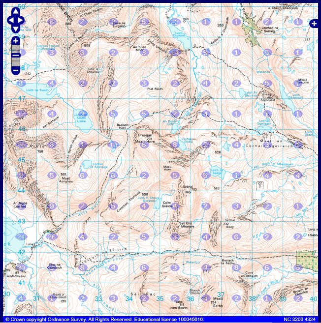
Another 10km square completed, NG91 in northwest Scotland. Still other gaps to fill by those who get into the wilds www.geograph.org.uk/search.php?i...

June 18, 2025 at 11:40 AM
Another 10km square completed, NG91 in northwest Scotland. Still other gaps to fill by those who get into the wilds www.geograph.org.uk/search.php?i...
Another milestone* reached, with 8 million photos now available on the site, all geolocated and CC-licensed from Great Britain and Ireland. A great record of our diverse islands. More photos always welcome!
*statistical milestone, we have tens of thousands of photos of actual milestones
*statistical milestone, we have tens of thousands of photos of actual milestones


May 2, 2025 at 2:55 PM
Another milestone* reached, with 8 million photos now available on the site, all geolocated and CC-licensed from Great Britain and Ireland. A great record of our diverse islands. More photos always welcome!
*statistical milestone, we have tens of thousands of photos of actual milestones
*statistical milestone, we have tens of thousands of photos of actual milestones
Another 10km square completed, NN16, south of Fort William
www.geograph.org.uk/mapper/?lat=...
www.geograph.org.uk/mapper/?lat=...


April 20, 2025 at 10:49 PM
Another 10km square completed, NN16, south of Fort William
www.geograph.org.uk/mapper/?lat=...
www.geograph.org.uk/mapper/?lat=...
Another 10km square completed, NC34 in northwest Scotland. Great to see remote areas getting more coverage. www.geograph.org.uk/mapper/?lat=...


April 15, 2025 at 1:15 PM
Another 10km square completed, NC34 in northwest Scotland. Great to see remote areas getting more coverage. www.geograph.org.uk/mapper/?lat=...
Eroding cliffs at Sewerby. Image number 8,000,000 for the site and an excellent record of change, and geography in action
www.geograph.org.uk/photo/8000000
www.geograph.org.uk/photo/8000000

March 20, 2025 at 8:15 AM
Eroding cliffs at Sewerby. Image number 8,000,000 for the site and an excellent record of change, and geography in action
www.geograph.org.uk/photo/8000000
www.geograph.org.uk/photo/8000000
Our first photo, submitted 20 years ago today. Now over 7,950,000 photos of Britain and Ireland on the site - where will our eight millionth be?
www.geograph.org.uk/photo/4
www.geograph.org.uk/photo/4

March 6, 2025 at 10:57 AM
Our first photo, submitted 20 years ago today. Now over 7,950,000 photos of Britain and Ireland on the site - where will our eight millionth be?
www.geograph.org.uk/photo/4
www.geograph.org.uk/photo/4
Reposted by Geograph Great Britain & Ireland

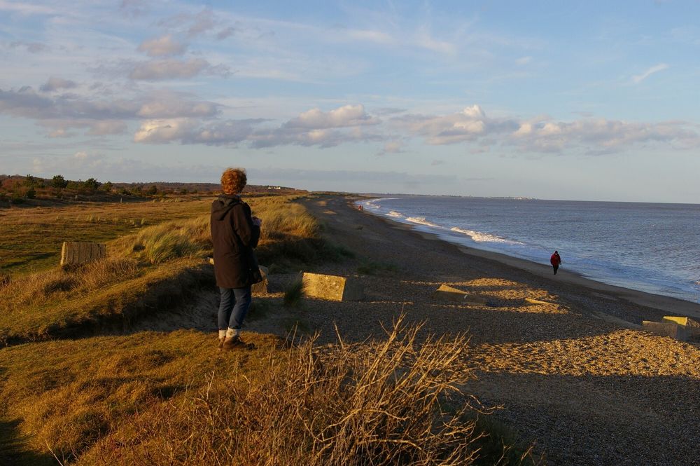
For the new month, here's a March image from one of my @geograph-gbi.bsky.social calendars, taken on this day five years ago: Looking North at Minsmere Haven.
www.geograph.org.uk/photo/7294441
www.geograph.org.uk/photo/7294441
March 1, 2025 at 9:26 AM
For the new month, here's a March image from one of my @geograph-gbi.bsky.social calendars, taken on this day five years ago: Looking North at Minsmere Haven.
www.geograph.org.uk/photo/7294441
www.geograph.org.uk/photo/7294441
Three recently submitted photos, typical of the winter so far. Over 10,000 photos submitted already this year, as we rapidly approach our 8 millionth photo in the archive


January 19, 2025 at 11:48 PM
Three recently submitted photos, typical of the winter so far. Over 10,000 photos submitted already this year, as we rapidly approach our 8 millionth photo in the archive
2024 in numbers:
268,748 photos submitted (bringing total to 7,915,829) by 622 contributors, covering 84,497 grid squares. Still more areas without photos in Ireland and the wilds of Scotland, and many more details and changes to record where we do have photos.
2025 will bring our 20th birthday!
268,748 photos submitted (bringing total to 7,915,829) by 622 contributors, covering 84,497 grid squares. Still more areas without photos in Ireland and the wilds of Scotland, and many more details and changes to record where we do have photos.
2025 will bring our 20th birthday!


January 1, 2025 at 4:58 PM
2024 in numbers:
268,748 photos submitted (bringing total to 7,915,829) by 622 contributors, covering 84,497 grid squares. Still more areas without photos in Ireland and the wilds of Scotland, and many more details and changes to record where we do have photos.
2025 will bring our 20th birthday!
268,748 photos submitted (bringing total to 7,915,829) by 622 contributors, covering 84,497 grid squares. Still more areas without photos in Ireland and the wilds of Scotland, and many more details and changes to record where we do have photos.
2025 will bring our 20th birthday!
Reposted by Geograph Great Britain & Ireland
Walking round the local vineyards. This one was first planted in 2017. It still seems odd to see them in the English landscape.

December 27, 2024 at 1:52 PM
Walking round the local vineyards. This one was first planted in 2017. It still seems odd to see them in the English landscape.
Photos quickly go from relatively mundane to important records of times past. We try to collect such photos and tell the story of our amazingly diverse islands, from pubs to seafronts to mountaintops and everything in between. All contributions welcome
Afternoon everyone. We’ve reached the surreal point in time where Google Street View has become a historical reference point…
Straker Street at Jarrow was once home to at least 3 pubs, with the Allison Arms being one of them. It’s shown below on Google 4 years before its demolition in 2012.
Straker Street at Jarrow was once home to at least 3 pubs, with the Allison Arms being one of them. It’s shown below on Google 4 years before its demolition in 2012.


December 22, 2024 at 9:40 PM
Photos quickly go from relatively mundane to important records of times past. We try to collect such photos and tell the story of our amazingly diverse islands, from pubs to seafronts to mountaintops and everything in between. All contributions welcome
Another 10km square completed, NB03 on Lewis with a photo of a ruined shieling www.geograph.org.uk/photo/7933626


December 9, 2024 at 2:51 PM
Another 10km square completed, NB03 on Lewis with a photo of a ruined shieling www.geograph.org.uk/photo/7933626
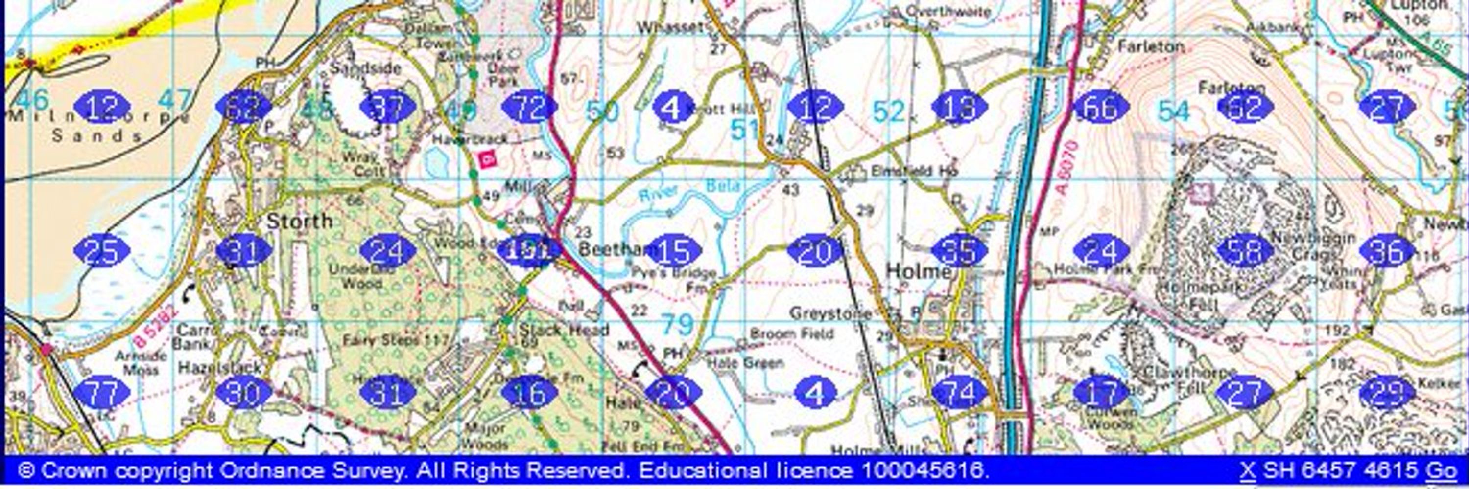
Where don't we have photos? In England and Wales it is mostly mudflats, islets and MOD land, in Scotland there are still gaps - good targets if you want to get somewhere rarely visited. 3359 squares left out of 244,324. Lots of areas still without photos in Ireland. www.geograph.org.uk/mapper/


December 7, 2024 at 11:51 AM
Where don't we have photos? In England and Wales it is mostly mudflats, islets and MOD land, in Scotland there are still gaps - good targets if you want to get somewhere rarely visited. 3359 squares left out of 244,324. Lots of areas still without photos in Ireland. www.geograph.org.uk/mapper/
Things change, even landscapes we think of as fixed. Recording how things are, and what they become is important
Beautiful light this morning, on my way to check how the path work is going. Pine regeneration climbing up the hill 🙂

December 2, 2024 at 9:20 PM
Things change, even landscapes we think of as fixed. Recording how things are, and what they become is important
We get about 5000 photos submitted each week, these are selection of some of the recently taken ones.


November 27, 2024 at 12:43 PM
We get about 5000 photos submitted each week, these are selection of some of the recently taken ones.
Reposted by Geograph Great Britain & Ireland

After several subzero days and a low of -11C, the Dee and the Lui are icing over nicely at Mar Lodge Estate. It is, however, VERY low water as it hasn't rained in earnest for a month!


November 20, 2024 at 12:59 PM
After several subzero days and a low of -11C, the Dee and the Lui are icing over nicely at Mar Lodge Estate. It is, however, VERY low water as it hasn't rained in earnest for a month!
Reposted by Geograph Great Britain & Ireland

Roe deer and autumn trees in Weald Country Park, Essex


November 20, 2024 at 5:37 AM
Roe deer and autumn trees in Weald Country Park, Essex
The website has been running for almost 20 years, and has many archive photos uploaded from before that. Some things stay much the same, others come and go. We're building an archive of all of it, and having fun exploring our islands along the way


November 19, 2024 at 5:32 PM
The website has been running for almost 20 years, and has many archive photos uploaded from before that. Some things stay much the same, others come and go. We're building an archive of all of it, and having fun exploring our islands along the way
To introduce ourselves here, we are a website collecting geographically interesting photos of Britain and Ireland, all geolocated and CC licensed for reuse. Still some grid squares with no photos, others with many, recording different details and changes over seasons and years. www.geograph.org.uk
November 18, 2024 at 9:34 PM
To introduce ourselves here, we are a website collecting geographically interesting photos of Britain and Ireland, all geolocated and CC licensed for reuse. Still some grid squares with no photos, others with many, recording different details and changes over seasons and years. www.geograph.org.uk