


GCarbin
@gcarbin.bsky.social
Retired NWS meteorologist (formerly WSO Charlotte, NC, WFO Wilmington, NC, and NWS Storm and Weather Prediction Centers). Now living in central Vermont and always watching the sky. I still use the handy Python pickax for data mining from time to time.
I first wrote and cron’d the script that makes these @NWSSPC upper air maps in November 1998. It’s been running and making the twice-daily UA maps for the past 27 years at this URL: www.spc.noaa.gov/obswx/maps/. That’s over 138,000 maps online and it’s still going!
November 10, 2025 at 9:18 PM
I first wrote and cron’d the script that makes these @NWSSPC upper air maps in November 1998. It’s been running and making the twice-daily UA maps for the past 27 years at this URL: www.spc.noaa.gov/obswx/maps/. That’s over 138,000 maps online and it’s still going!


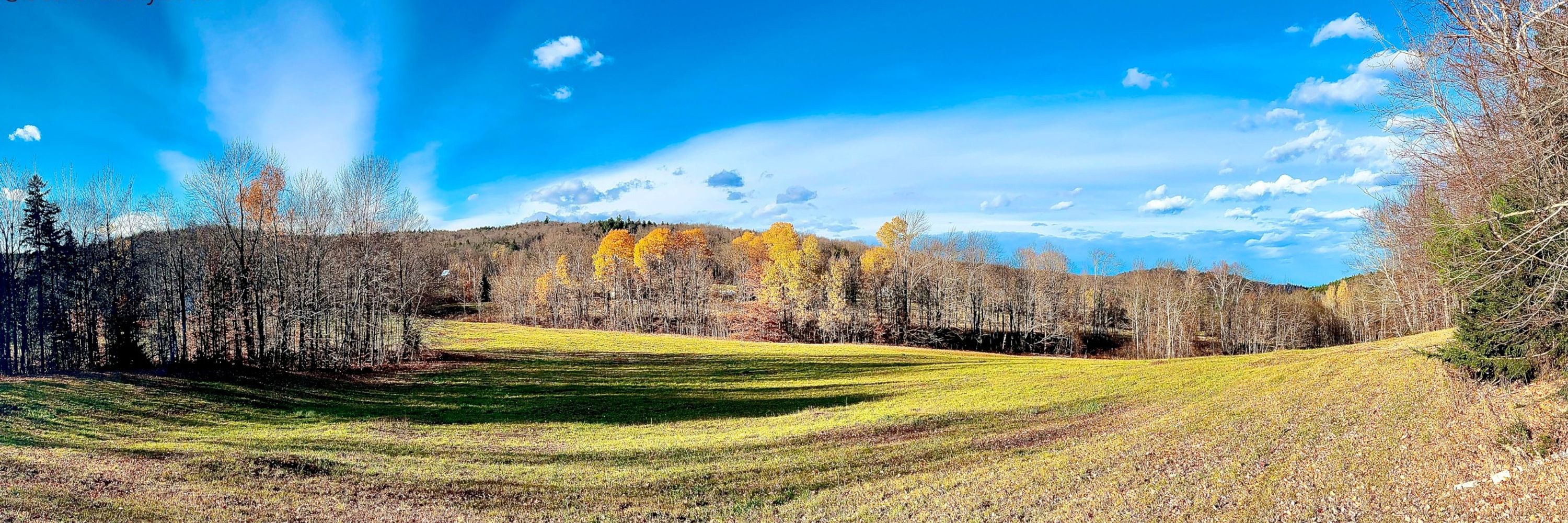
Beautiful #foliage nearing peak in spots on #VTwx I-91 north, and east along US Route 2 into #NHwx today. Some trees were vibrant red & golden yellow in the bright sunshine. Many areas should have (or develop) fantastic color through the end of the month but some rain would also be welcome.

September 19, 2025 at 2:04 AM


Population estimate for exposure to Extreme NWS HeatRisk at some point over the next 7 days. At least 94 million potentially exposed. Impacts likely in most health systems, heat-sensitive industries, and infrastructure. Stay hydrated, avoid direct sun, check on the elderly and pets! #HeatWave2025

June 21, 2025 at 12:43 PM
Population estimate for exposure to Extreme NWS HeatRisk at some point over the next 7 days. At least 94 million potentially exposed. Impacts likely in most health systems, heat-sensitive industries, and infrastructure. Stay hydrated, avoid direct sun, check on the elderly and pets! #HeatWave2025
Over the past 9 years, only 2021 has exceeded 2025 for running average CONUS temperature for the first 19 days of #meteorological summer. (CONUS area temperature grids from NWS URMA data 2017-2025).

June 20, 2025 at 9:08 PM
Over the past 9 years, only 2021 has exceeded 2025 for running average CONUS temperature for the first 19 days of #meteorological summer. (CONUS area temperature grids from NWS URMA data 2017-2025).
Here's a look at the population in Extreme NWS #Heat Risk over the next week compared to nearly the same time last year. HeatRisk is available here: www.wpc.ncep.noaa.gov/heatrisk/ #HeatWave2025


June 20, 2025 at 3:47 PM
Here's a look at the population in Extreme NWS #Heat Risk over the next week compared to nearly the same time last year. HeatRisk is available here: www.wpc.ncep.noaa.gov/heatrisk/ #HeatWave2025


May 2025 is going to be in the top 10 (top 5?) wettest Mays on record for parts of central #Vermont. It appears May 1984 was quite a soaking with local observations in the 10-12 inch range. The weekend system will likely get some spots into the 8-10 inch rainfall for the month. Yikes! #VTwx

May 20, 2025 at 4:28 PM