


FloodMapper
@floodmapper.bsky.social
Flood Route Planning - https://www.flood-mapper.com
FloodNav - York Update
york.floodmapper.co.uk
After a 3.6m peak the river is slowing falling. Staying high until Friday 12th.
For pedestrian access to the city from the South, use the road routes.
- Terry Ave. and New Walk flooded.
- Mlnm Br. open, incl. via Hosp. Flds. Rd.
york.floodmapper.co.uk
After a 3.6m peak the river is slowing falling. Staying high until Friday 12th.
For pedestrian access to the city from the South, use the road routes.
- Terry Ave. and New Walk flooded.
- Mlnm Br. open, incl. via Hosp. Flds. Rd.

December 11, 2025 at 9:05 AM
FloodNav - York Update
york.floodmapper.co.uk
After a 3.6m peak the river is slowing falling. Staying high until Friday 12th.
For pedestrian access to the city from the South, use the road routes.
- Terry Ave. and New Walk flooded.
- Mlnm Br. open, incl. via Hosp. Flds. Rd.
york.floodmapper.co.uk
After a 3.6m peak the river is slowing falling. Staying high until Friday 12th.
For pedestrian access to the city from the South, use the road routes.
- Terry Ave. and New Walk flooded.
- Mlnm Br. open, incl. via Hosp. Flds. Rd.
FloodNav - York Update
york.floodmapper.co.uk
Viking recorder holding steady at around 3.1m. Peaked for now.
Tue: level should fall
Weds: expect rise in response to rainfall in upper catchment.
Thur: 3.75-4.00m
York open for business as normal.
Will update as more info available.
york.floodmapper.co.uk
Viking recorder holding steady at around 3.1m. Peaked for now.
Tue: level should fall
Weds: expect rise in response to rainfall in upper catchment.
Thur: 3.75-4.00m
York open for business as normal.
Will update as more info available.

December 8, 2025 at 11:23 PM
FloodNav - York Update
york.floodmapper.co.uk
Viking recorder holding steady at around 3.1m. Peaked for now.
Tue: level should fall
Weds: expect rise in response to rainfall in upper catchment.
Thur: 3.75-4.00m
York open for business as normal.
Will update as more info available.
york.floodmapper.co.uk
Viking recorder holding steady at around 3.1m. Peaked for now.
Tue: level should fall
Weds: expect rise in response to rainfall in upper catchment.
Thur: 3.75-4.00m
York open for business as normal.
Will update as more info available.
York FloodNav Update
Https://york.floodmapper.co.uk
River Ouse is at 2.8m and rising.
We are expecting a peak at somewhere 3 - 3.2m
New Walk is currently flooded, so recommend access to the city centre via Terry Avenue from Fulford.
Millennium bridge access remaining open from both sides.
Https://york.floodmapper.co.uk
River Ouse is at 2.8m and rising.
We are expecting a peak at somewhere 3 - 3.2m
New Walk is currently flooded, so recommend access to the city centre via Terry Avenue from Fulford.
Millennium bridge access remaining open from both sides.

December 7, 2025 at 12:51 PM
York FloodNav Update
Https://york.floodmapper.co.uk
River Ouse is at 2.8m and rising.
We are expecting a peak at somewhere 3 - 3.2m
New Walk is currently flooded, so recommend access to the city centre via Terry Avenue from Fulford.
Millennium bridge access remaining open from both sides.
Https://york.floodmapper.co.uk
River Ouse is at 2.8m and rising.
We are expecting a peak at somewhere 3 - 3.2m
New Walk is currently flooded, so recommend access to the city centre via Terry Avenue from Fulford.
Millennium bridge access remaining open from both sides.
FloodNav – York Update
york.floodmapper.co.uk
The Viking Recorder at 2.85m and rising.
The EA forecasting ~3.49m.
Current Impacts
- Cstl Mills, Kgs & Qns St. flooded
- New Walk flooded between Fulford and the blue bridge.
- Terry Ave flooding later
Access across Mlnm. Bridge remaining open
york.floodmapper.co.uk
The Viking Recorder at 2.85m and rising.
The EA forecasting ~3.49m.
Current Impacts
- Cstl Mills, Kgs & Qns St. flooded
- New Walk flooded between Fulford and the blue bridge.
- Terry Ave flooding later
Access across Mlnm. Bridge remaining open

December 2, 2025 at 8:24 AM
FloodNav – York Update
york.floodmapper.co.uk
The Viking Recorder at 2.85m and rising.
The EA forecasting ~3.49m.
Current Impacts
- Cstl Mills, Kgs & Qns St. flooded
- New Walk flooded between Fulford and the blue bridge.
- Terry Ave flooding later
Access across Mlnm. Bridge remaining open
york.floodmapper.co.uk
The Viking Recorder at 2.85m and rising.
The EA forecasting ~3.49m.
Current Impacts
- Cstl Mills, Kgs & Qns St. flooded
- New Walk flooded between Fulford and the blue bridge.
- Terry Ave flooding later
Access across Mlnm. Bridge remaining open
FloodNav – York Update
york.floodmapper.co.uk
Viking Recorder 2.09m and rising rapidly.
EA forecast ~3.91m, seems a little high.
Impacts:
- Cst. Mills.
- Kgs & Qns St. (~midnight).
- New Walk (tonight)
- Rowntree Park closed
- Terry Ave. (morn)
- Mlnm. Br. remaining open
Further updates tomorrow.
york.floodmapper.co.uk
Viking Recorder 2.09m and rising rapidly.
EA forecast ~3.91m, seems a little high.
Impacts:
- Cst. Mills.
- Kgs & Qns St. (~midnight).
- New Walk (tonight)
- Rowntree Park closed
- Terry Ave. (morn)
- Mlnm. Br. remaining open
Further updates tomorrow.

December 1, 2025 at 9:51 PM
FloodNav – York Update
york.floodmapper.co.uk
Viking Recorder 2.09m and rising rapidly.
EA forecast ~3.91m, seems a little high.
Impacts:
- Cst. Mills.
- Kgs & Qns St. (~midnight).
- New Walk (tonight)
- Rowntree Park closed
- Terry Ave. (morn)
- Mlnm. Br. remaining open
Further updates tomorrow.
york.floodmapper.co.uk
Viking Recorder 2.09m and rising rapidly.
EA forecast ~3.91m, seems a little high.
Impacts:
- Cst. Mills.
- Kgs & Qns St. (~midnight).
- New Walk (tonight)
- Rowntree Park closed
- Terry Ave. (morn)
- Mlnm. Br. remaining open
Further updates tomorrow.
FloodNav - York Update
york.floodmapper.co.uk
River Ouse at 3.11m and rising. Forecast at 3.7 overnight.
Current Impacts:
- Castle Mills
- S. Esp., Kgs and Qns Staith
- New Walk
Expected to Flood:
- Terry Ave.
The crossing at Millennium bridge is expected to stay open from both directions.
york.floodmapper.co.uk
River Ouse at 3.11m and rising. Forecast at 3.7 overnight.
Current Impacts:
- Castle Mills
- S. Esp., Kgs and Qns Staith
- New Walk
Expected to Flood:
- Terry Ave.
The crossing at Millennium bridge is expected to stay open from both directions.

November 15, 2025 at 9:57 AM
FloodNav - York Update
york.floodmapper.co.uk
River Ouse at 3.11m and rising. Forecast at 3.7 overnight.
Current Impacts:
- Castle Mills
- S. Esp., Kgs and Qns Staith
- New Walk
Expected to Flood:
- Terry Ave.
The crossing at Millennium bridge is expected to stay open from both directions.
york.floodmapper.co.uk
River Ouse at 3.11m and rising. Forecast at 3.7 overnight.
Current Impacts:
- Castle Mills
- S. Esp., Kgs and Qns Staith
- New Walk
Expected to Flood:
- Terry Ave.
The crossing at Millennium bridge is expected to stay open from both directions.
FloodNav – York Update
🌊 york.floodmapper.co.uk
River Ouse at 1.94m and rising. The EA forecast is for 2.94m.
Impacts:
- Castle Mills Path (flooded already)
- Kgs/Qns Sh. & S. Espl - 5:30pm
- New Walk - 6:30pm
- Fulford Ings - 6:30pm.
Millennium Bridge remaining open
🌊 york.floodmapper.co.uk
River Ouse at 1.94m and rising. The EA forecast is for 2.94m.
Impacts:
- Castle Mills Path (flooded already)
- Kgs/Qns Sh. & S. Espl - 5:30pm
- New Walk - 6:30pm
- Fulford Ings - 6:30pm.
Millennium Bridge remaining open

October 4, 2025 at 1:19 PM
FloodNav – York Update
🌊 york.floodmapper.co.uk
River Ouse at 1.94m and rising. The EA forecast is for 2.94m.
Impacts:
- Castle Mills Path (flooded already)
- Kgs/Qns Sh. & S. Espl - 5:30pm
- New Walk - 6:30pm
- Fulford Ings - 6:30pm.
Millennium Bridge remaining open
🌊 york.floodmapper.co.uk
River Ouse at 1.94m and rising. The EA forecast is for 2.94m.
Impacts:
- Castle Mills Path (flooded already)
- Kgs/Qns Sh. & S. Espl - 5:30pm
- New Walk - 6:30pm
- Fulford Ings - 6:30pm.
Millennium Bridge remaining open
FloodNav – York Update
🌊 york.floodmapper.co.uk
River Ouse at 1.27m and rising. The EA forecast is slowly being revised down but is still up at 3.49m.
We're predicting a similar level to 2 wks ago: ~3.0m
Expecting Mil. Br. crossing to stay open both sides, including access from Hosp Flds Rd.
🌊 york.floodmapper.co.uk
River Ouse at 1.27m and rising. The EA forecast is slowly being revised down but is still up at 3.49m.
We're predicting a similar level to 2 wks ago: ~3.0m
Expecting Mil. Br. crossing to stay open both sides, including access from Hosp Flds Rd.

October 4, 2025 at 7:32 AM
FloodNav – York Update
🌊 york.floodmapper.co.uk
River Ouse at 1.27m and rising. The EA forecast is slowly being revised down but is still up at 3.49m.
We're predicting a similar level to 2 wks ago: ~3.0m
Expecting Mil. Br. crossing to stay open both sides, including access from Hosp Flds Rd.
🌊 york.floodmapper.co.uk
River Ouse at 1.27m and rising. The EA forecast is slowly being revised down but is still up at 3.49m.
We're predicting a similar level to 2 wks ago: ~3.0m
Expecting Mil. Br. crossing to stay open both sides, including access from Hosp Flds Rd.
FloodNav – York Update
🌊 york.floodmapper.co.uk
River Ouse Peaked today at 3.15m. Currently at 2.91m and falling slowly.
New Walk remains flooded overnight (as will S. Esplanade and Kgs/Qns Staith). Use Terry Avenue if you are heading to/from the City Centre.
Millennium Bridge access is open.
🌊 york.floodmapper.co.uk
River Ouse Peaked today at 3.15m. Currently at 2.91m and falling slowly.
New Walk remains flooded overnight (as will S. Esplanade and Kgs/Qns Staith). Use Terry Avenue if you are heading to/from the City Centre.
Millennium Bridge access is open.

September 22, 2025 at 6:08 PM
FloodNav – York Update
🌊 york.floodmapper.co.uk
River Ouse Peaked today at 3.15m. Currently at 2.91m and falling slowly.
New Walk remains flooded overnight (as will S. Esplanade and Kgs/Qns Staith). Use Terry Avenue if you are heading to/from the City Centre.
Millennium Bridge access is open.
🌊 york.floodmapper.co.uk
River Ouse Peaked today at 3.15m. Currently at 2.91m and falling slowly.
New Walk remains flooded overnight (as will S. Esplanade and Kgs/Qns Staith). Use Terry Avenue if you are heading to/from the City Centre.
Millennium Bridge access is open.
1/2 FloodNav – York Update
🌊 york.floodmapper.co.uk
Ouse @ 2.82m and rising. EA forecast 3.5m, we think 3.2m
Already flooded
Castle Mills
Q/K Staith
S. Esplanade
N. Walk
Fulford Ings
Terry avenue floods >3.1m and Rowntree Park may close.
Peak overnight Sunday, Monday morning commute impacted.
🌊 york.floodmapper.co.uk
Ouse @ 2.82m and rising. EA forecast 3.5m, we think 3.2m
Already flooded
Castle Mills
Q/K Staith
S. Esplanade
N. Walk
Fulford Ings
Terry avenue floods >3.1m and Rowntree Park may close.
Peak overnight Sunday, Monday morning commute impacted.

September 21, 2025 at 6:56 PM
1/2 FloodNav – York Update
🌊 york.floodmapper.co.uk
Ouse @ 2.82m and rising. EA forecast 3.5m, we think 3.2m
Already flooded
Castle Mills
Q/K Staith
S. Esplanade
N. Walk
Fulford Ings
Terry avenue floods >3.1m and Rowntree Park may close.
Peak overnight Sunday, Monday morning commute impacted.
🌊 york.floodmapper.co.uk
Ouse @ 2.82m and rising. EA forecast 3.5m, we think 3.2m
Already flooded
Castle Mills
Q/K Staith
S. Esplanade
N. Walk
Fulford Ings
Terry avenue floods >3.1m and Rowntree Park may close.
Peak overnight Sunday, Monday morning commute impacted.
Reposted by FloodMapper
Flood Warning for River Ouse at York - riverside properties

Flood Warning for River Ouse at York - riverside properties
Rising river levels caused by heavy rainfall is expected to cause flooding this evening, Sunday 21/09/2025. Areas most at risk include properties on King's Staith in York and riverside areas through York from Lendal Bridge to Millennium Bridge. We are closing flood gates in York and the Foss Barrier is in operation. Activate any property flood protection products you may have.
This message will be updated by 03:00 AM on 22/09/2025, or as the situation changes.
www.floodmapper.co.uk
September 21, 2025 at 6:10 PM
Flood Warning for River Ouse at York - riverside properties
FloodNav – York Update
🌊 york.floodmapper.co.uk
Ouse at 1.61m and rising.
EA forecast: 3.94m
FloodNav prediction: 2.5–3.0m.
⚠️ Impacts expected:
Castle Mills (flooded now)
Kgs/Qns Sth. ~12PM
New Walk (Mil. → Blue Br) ~1:30PM
Mil. Br. crossing to stay open, including Hospital Flds Rd access.
🌊 york.floodmapper.co.uk
Ouse at 1.61m and rising.
EA forecast: 3.94m
FloodNav prediction: 2.5–3.0m.
⚠️ Impacts expected:
Castle Mills (flooded now)
Kgs/Qns Sth. ~12PM
New Walk (Mil. → Blue Br) ~1:30PM
Mil. Br. crossing to stay open, including Hospital Flds Rd access.

September 21, 2025 at 7:03 AM
FloodNav – York Update
🌊 york.floodmapper.co.uk
Ouse at 1.61m and rising.
EA forecast: 3.94m
FloodNav prediction: 2.5–3.0m.
⚠️ Impacts expected:
Castle Mills (flooded now)
Kgs/Qns Sth. ~12PM
New Walk (Mil. → Blue Br) ~1:30PM
Mil. Br. crossing to stay open, including Hospital Flds Rd access.
🌊 york.floodmapper.co.uk
Ouse at 1.61m and rising.
EA forecast: 3.94m
FloodNav prediction: 2.5–3.0m.
⚠️ Impacts expected:
Castle Mills (flooded now)
Kgs/Qns Sth. ~12PM
New Walk (Mil. → Blue Br) ~1:30PM
Mil. Br. crossing to stay open, including Hospital Flds Rd access.
FloodNav – York Update
🌊 york.floodmapper.co.uk
River at 0.79m and rising. EA predict 4.53m – we think that’s unrealistic.
With the extra rain, we expect 2.5–3.0m late Sunday/Monday.
This is enough to flood Kings/Queens Staith, S. Esplanade and onto New Walk in parts.
More updates to follow.
🌊 york.floodmapper.co.uk
River at 0.79m and rising. EA predict 4.53m – we think that’s unrealistic.
With the extra rain, we expect 2.5–3.0m late Sunday/Monday.
This is enough to flood Kings/Queens Staith, S. Esplanade and onto New Walk in parts.
More updates to follow.

September 20, 2025 at 9:06 PM
FloodNav – York Update
🌊 york.floodmapper.co.uk
River at 0.79m and rising. EA predict 4.53m – we think that’s unrealistic.
With the extra rain, we expect 2.5–3.0m late Sunday/Monday.
This is enough to flood Kings/Queens Staith, S. Esplanade and onto New Walk in parts.
More updates to follow.
🌊 york.floodmapper.co.uk
River at 0.79m and rising. EA predict 4.53m – we think that’s unrealistic.
With the extra rain, we expect 2.5–3.0m late Sunday/Monday.
This is enough to flood Kings/Queens Staith, S. Esplanade and onto New Walk in parts.
More updates to follow.
FloodNav – York Update
🌊 york.floodmapper.co.uk
River currently around 1.3m. EA forecast rise to 2.5m, but we think 2.2-2.3m is more realistic.
Flooding Expected:
- Castle Mills
- Qns Sth. & S. Esplanade
- New walk (if higher forecast holds)
Millennium Bridge & Terry Ave clear.
🌊 york.floodmapper.co.uk
River currently around 1.3m. EA forecast rise to 2.5m, but we think 2.2-2.3m is more realistic.
Flooding Expected:
- Castle Mills
- Qns Sth. & S. Esplanade
- New walk (if higher forecast holds)
Millennium Bridge & Terry Ave clear.

September 16, 2025 at 7:27 AM
FloodNav – York Update
🌊 york.floodmapper.co.uk
River currently around 1.3m. EA forecast rise to 2.5m, but we think 2.2-2.3m is more realistic.
Flooding Expected:
- Castle Mills
- Qns Sth. & S. Esplanade
- New walk (if higher forecast holds)
Millennium Bridge & Terry Ave clear.
🌊 york.floodmapper.co.uk
River currently around 1.3m. EA forecast rise to 2.5m, but we think 2.2-2.3m is more realistic.
Flooding Expected:
- Castle Mills
- Qns Sth. & S. Esplanade
- New walk (if higher forecast holds)
Millennium Bridge & Terry Ave clear.
FloodNav - York Update
🌊 york.floodmapper.co.uk
Upstream stations are steady/slightly rising, so levels will persist for a while but no further impact is expected.
Flooding:
Kings/Queens Staith
South Esplanade
New Walk
✅ Millennium Bridge & Terry Ave to City Centre are clear.
🌊 york.floodmapper.co.uk
Upstream stations are steady/slightly rising, so levels will persist for a while but no further impact is expected.
Flooding:
Kings/Queens Staith
South Esplanade
New Walk
✅ Millennium Bridge & Terry Ave to City Centre are clear.

January 28, 2025 at 11:32 PM
FloodNav - York Update
🌊 york.floodmapper.co.uk
Upstream stations are steady/slightly rising, so levels will persist for a while but no further impact is expected.
Flooding:
Kings/Queens Staith
South Esplanade
New Walk
✅ Millennium Bridge & Terry Ave to City Centre are clear.
🌊 york.floodmapper.co.uk
Upstream stations are steady/slightly rising, so levels will persist for a while but no further impact is expected.
Flooding:
Kings/Queens Staith
South Esplanade
New Walk
✅ Millennium Bridge & Terry Ave to City Centre are clear.
Reposted by FloodMapper
Upper Mole fairly high and not falling much now after Friday rain from edge of Storm Eowyn; two bouts of rain over next 24 hrs (windy too) could see >20mm which would cause overtopping to flood plain, and perhaps flood alert if rain comes in at top end of forecast range. Let's see.

January 26, 2025 at 9:02 AM
Upper Mole fairly high and not falling much now after Friday rain from edge of Storm Eowyn; two bouts of rain over next 24 hrs (windy too) could see >20mm which would cause overtopping to flood plain, and perhaps flood alert if rain comes in at top end of forecast range. Let's see.
FloodNav - York Update
york.floodmapper.co.uk
Snowmelt is raising river levels; EA predicts 3.62m.
Impacts expected:
- Castle Mills (imminent)
- South Esplanade, Kings & Queens Staith (4pm)
- New Walk (from 4:45pm)
- Terry Avenue (after 10pm)
Millennium Bridge staying clear
york.floodmapper.co.uk
Snowmelt is raising river levels; EA predicts 3.62m.
Impacts expected:
- Castle Mills (imminent)
- South Esplanade, Kings & Queens Staith (4pm)
- New Walk (from 4:45pm)
- Terry Avenue (after 10pm)
Millennium Bridge staying clear

January 14, 2025 at 12:21 PM
FloodNav - York Update
york.floodmapper.co.uk
Snowmelt is raising river levels; EA predicts 3.62m.
Impacts expected:
- Castle Mills (imminent)
- South Esplanade, Kings & Queens Staith (4pm)
- New Walk (from 4:45pm)
- Terry Avenue (after 10pm)
Millennium Bridge staying clear
york.floodmapper.co.uk
Snowmelt is raising river levels; EA predicts 3.62m.
Impacts expected:
- Castle Mills (imminent)
- South Esplanade, Kings & Queens Staith (4pm)
- New Walk (from 4:45pm)
- Terry Avenue (after 10pm)
Millennium Bridge staying clear
FloodNav - York Update
york.floodmapper.co.uk
Temperature is now picking up, leading to a rise in the river levels upstream in response to the snow from last week melting (e.g. Bainbridge - www.floodmapper.co.uk/stations/bai...).
Expecting the river to begin to rise, with a peak later in the week.
york.floodmapper.co.uk
Temperature is now picking up, leading to a rise in the river levels upstream in response to the snow from last week melting (e.g. Bainbridge - www.floodmapper.co.uk/stations/bai...).
Expecting the river to begin to rise, with a peak later in the week.
Is York flooded? View York's FloodNav
Is York flooded? View Find out on FloodNav! In York our live flood map includes areas and paths on the River Ouse such as Germany Beck, Rowntree Gardens, and Millennium Fields. Including key access po...
york.floodmapper.co.uk
January 13, 2025 at 11:38 AM
FloodNav - York Update
york.floodmapper.co.uk
Temperature is now picking up, leading to a rise in the river levels upstream in response to the snow from last week melting (e.g. Bainbridge - www.floodmapper.co.uk/stations/bai...).
Expecting the river to begin to rise, with a peak later in the week.
york.floodmapper.co.uk
Temperature is now picking up, leading to a rise in the river levels upstream in response to the snow from last week melting (e.g. Bainbridge - www.floodmapper.co.uk/stations/bai...).
Expecting the river to begin to rise, with a peak later in the week.
FloodNav - Welney Update.
welney.floodmapper.co.uk
Causeway now has around 14cm of water on the road.
Conditions are very cold and icy. Seek alternative route.
welney.floodmapper.co.uk
Causeway now has around 14cm of water on the road.
Conditions are very cold and icy. Seek alternative route.

January 9, 2025 at 6:21 PM
FloodNav - Welney Update.
welney.floodmapper.co.uk
Causeway now has around 14cm of water on the road.
Conditions are very cold and icy. Seek alternative route.
welney.floodmapper.co.uk
Causeway now has around 14cm of water on the road.
Conditions are very cold and icy. Seek alternative route.
FloodNav - York Update
york.floodmapper.co.uk
River at 2.89m, higher than forecasts but unlikely to rise further. Castle Mills, Kings Staith, Queens Staith, New Walk, and Rowntree Gardens (south of Millennium Bridge) flooded. Millennium Bridge access unaffected.
york.floodmapper.co.uk
River at 2.89m, higher than forecasts but unlikely to rise further. Castle Mills, Kings Staith, Queens Staith, New Walk, and Rowntree Gardens (south of Millennium Bridge) flooded. Millennium Bridge access unaffected.

January 7, 2025 at 7:21 AM
FloodNav - York Update
york.floodmapper.co.uk
River at 2.89m, higher than forecasts but unlikely to rise further. Castle Mills, Kings Staith, Queens Staith, New Walk, and Rowntree Gardens (south of Millennium Bridge) flooded. Millennium Bridge access unaffected.
york.floodmapper.co.uk
River at 2.89m, higher than forecasts but unlikely to rise further. Castle Mills, Kings Staith, Queens Staith, New Walk, and Rowntree Gardens (south of Millennium Bridge) flooded. Millennium Bridge access unaffected.
FloodNav - York Update
york.floodmapper.co.uk
Snowmelt pushing levels higher than our forecast, now peaking at ~2.70m (EA agrees). New Walk, Queens Staith, Kings Staith, and South Esplanade are flooded. Sewage discharging near New Walk—use Terry Ave tomorrow until cleaned!
york.floodmapper.co.uk
Snowmelt pushing levels higher than our forecast, now peaking at ~2.70m (EA agrees). New Walk, Queens Staith, Kings Staith, and South Esplanade are flooded. Sewage discharging near New Walk—use Terry Ave tomorrow until cleaned!

January 6, 2025 at 9:38 PM
FloodNav - York Update
york.floodmapper.co.uk
Snowmelt pushing levels higher than our forecast, now peaking at ~2.70m (EA agrees). New Walk, Queens Staith, Kings Staith, and South Esplanade are flooded. Sewage discharging near New Walk—use Terry Ave tomorrow until cleaned!
york.floodmapper.co.uk
Snowmelt pushing levels higher than our forecast, now peaking at ~2.70m (EA agrees). New Walk, Queens Staith, Kings Staith, and South Esplanade are flooded. Sewage discharging near New Walk—use Terry Ave tomorrow until cleaned!
FloodNav - Brockham Update
brockham.floodmapper.co.uk
Water has peaked and is slowly receding. Bridge over the River Mole should now be clear.
brockham.floodmapper.co.uk
Water has peaked and is slowly receding. Bridge over the River Mole should now be clear.

January 6, 2025 at 10:56 AM
FloodNav - Brockham Update
brockham.floodmapper.co.uk
Water has peaked and is slowly receding. Bridge over the River Mole should now be clear.
brockham.floodmapper.co.uk
Water has peaked and is slowly receding. Bridge over the River Mole should now be clear.
FloodNav - York Update
york.floodmapper.co.uk
Snowmelt is causing a slow rise on the Ouse. Expecting 2.3-2.5m, falling overnight
Flooding likely at New Walk (>2.35m), South Esplanade, and King's Staith (>2.23m)
If New Walk floods - then avoid due to sewage discharge nearby; use Terry Avenue.
york.floodmapper.co.uk
Snowmelt is causing a slow rise on the Ouse. Expecting 2.3-2.5m, falling overnight
Flooding likely at New Walk (>2.35m), South Esplanade, and King's Staith (>2.23m)
If New Walk floods - then avoid due to sewage discharge nearby; use Terry Avenue.

January 6, 2025 at 10:48 AM
FloodNav - York Update
york.floodmapper.co.uk
Snowmelt is causing a slow rise on the Ouse. Expecting 2.3-2.5m, falling overnight
Flooding likely at New Walk (>2.35m), South Esplanade, and King's Staith (>2.23m)
If New Walk floods - then avoid due to sewage discharge nearby; use Terry Avenue.
york.floodmapper.co.uk
Snowmelt is causing a slow rise on the Ouse. Expecting 2.3-2.5m, falling overnight
Flooding likely at New Walk (>2.35m), South Esplanade, and King's Staith (>2.23m)
If New Walk floods - then avoid due to sewage discharge nearby; use Terry Avenue.
Reposted by FloodMapper
Mill / Lee Street Horley looks to have partial flooding from River Mole across the road. Any pics if safe to do so welcome to verify models. Visit Flood Mapper link here to keep an eye on this. Nearby Lonesome Ln reportedly flooded by Burstow Stream. horley.floodmapper.co.uk/map/MillLnLe...

January 5, 2025 at 4:24 PM
Mill / Lee Street Horley looks to have partial flooding from River Mole across the road. Any pics if safe to do so welcome to verify models. Visit Flood Mapper link here to keep an eye on this. Nearby Lonesome Ln reportedly flooded by Burstow Stream. horley.floodmapper.co.uk/map/MillLnLe...
Reposted by FloodMapper
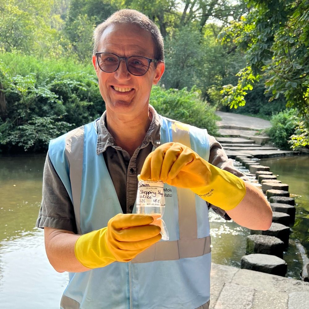
🚨 Reminder: River Mole River Watch with partners @Floodmapper now has live flood info for Horley, Brockham & Cobham—monitoring river levels at vulnerable spots like low bridges tracks and paths. Share timestamped flood photos to help ground-truth data. 🌧️ horley.floodmapper.co.uk


January 5, 2025 at 10:46 AM
🚨 Reminder: River Mole River Watch with partners @Floodmapper now has live flood info for Horley, Brockham & Cobham—monitoring river levels at vulnerable spots like low bridges tracks and paths. Share timestamped flood photos to help ground-truth data. 🌧️ horley.floodmapper.co.uk