


Eva Richter
@evarichter.bsky.social
Data Investigator at Global Witness
interested in climate journalism, creative exploration, craft projects, climbing rock
interested in climate journalism, creative exploration, craft projects, climbing rock
BirdNET also has an app that lets you classify bird sounds with your phone. Easiest way to get started. If you want to set up your own Raspberry Pi, I'd recommend looking at this repo: github.com/Nachtzuster/...
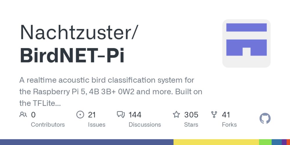
GitHub - Nachtzuster/BirdNET-Pi: A realtime acoustic bird classification system for the Raspberry Pi 5, 4B 3B+ 0W2 and more. Built on the TFLite version of BirdNET.
A realtime acoustic bird classification system for the Raspberry Pi 5, 4B 3B+ 0W2 and more. Built on the TFLite version of BirdNET. - Nachtzuster/BirdNET-Pi
github.com
May 27, 2025 at 12:44 PM
BirdNET also has an app that lets you classify bird sounds with your phone. Easiest way to get started. If you want to set up your own Raspberry Pi, I'd recommend looking at this repo: github.com/Nachtzuster/...
This was such an interesting read, especially the part about the shrinking of the atmosphere. I would be interested to know how launching satellites is regulated - can any company just start launching them given enough funding?
March 13, 2025 at 3:47 PM
This was such an interesting read, especially the part about the shrinking of the atmosphere. I would be interested to know how launching satellites is regulated - can any company just start launching them given enough funding?
Both are fine, one is American English, the other is British English
March 9, 2025 at 8:13 PM
Both are fine, one is American English, the other is British English
Yes, you're right, it will be interesting to see how this will develop throughout the year.
February 25, 2025 at 10:26 AM
Yes, you're right, it will be interesting to see how this will develop throughout the year.
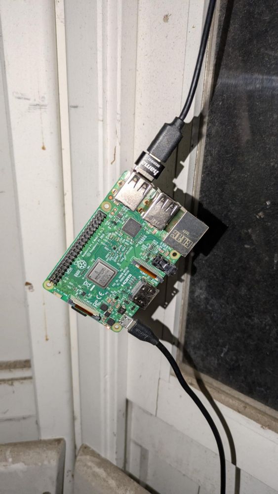
This is the Raspberry Pi setup. It's attached to a microphone on the outside that records bird sounds (and only that!). The sounds are classified using BirdNet (birdnet.cornell.edu), a popular bird classification machine learning model.
February 25, 2025 at 1:01 AM
This is the Raspberry Pi setup. It's attached to a microphone on the outside that records bird sounds (and only that!). The sounds are classified using BirdNet (birdnet.cornell.edu), a popular bird classification machine learning model.
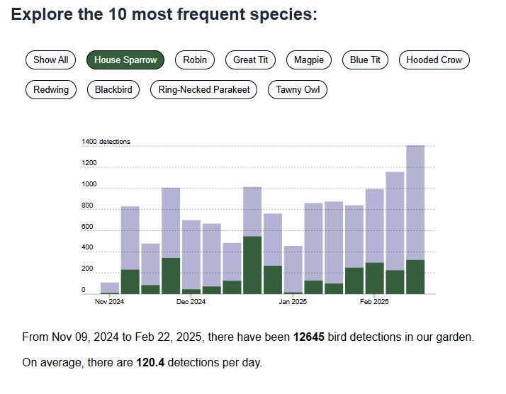
Since I'm working on my #datavisualization skills, I made a few charts to visualize this data.
The house sparrow clearly takes the win for the noisiest bird.
The house sparrow clearly takes the win for the noisiest bird.
February 25, 2025 at 1:01 AM
Since I'm working on my #datavisualization skills, I made a few charts to visualize this data.
The house sparrow clearly takes the win for the noisiest bird.
The house sparrow clearly takes the win for the noisiest bird.
I used the Google Earth Engine Python API to obtain images from NASA's Landsat 9 mission and mapped shortwave infrared light as red, near-infrared light as green and green light as blue. If you are interested in the code or have feedback, let me know. (Note: this is a personal project).
February 6, 2025 at 12:13 AM
I used the Google Earth Engine Python API to obtain images from NASA's Landsat 9 mission and mapped shortwave infrared light as red, near-infrared light as green and green light as blue. If you are interested in the code or have feedback, let me know. (Note: this is a personal project).
I used a combination of spectral bands that highlight burned areas and changes in soil moisture.
The red spots in the 2025 image are areas affected by the recent wildfires. The cyan-colored spots in the 2024 image are peaks covered by snow in the Tehachapi mountains.
The red spots in the 2025 image are areas affected by the recent wildfires. The cyan-colored spots in the 2024 image are peaks covered by snow in the Tehachapi mountains.
February 6, 2025 at 12:13 AM
I used a combination of spectral bands that highlight burned areas and changes in soil moisture.
The red spots in the 2025 image are areas affected by the recent wildfires. The cyan-colored spots in the 2024 image are peaks covered by snow in the Tehachapi mountains.
The red spots in the 2025 image are areas affected by the recent wildfires. The cyan-colored spots in the 2024 image are peaks covered by snow in the Tehachapi mountains.
"ChatGPT, please summarize this 4955-word deep research report in a single paragraph"
February 4, 2025 at 1:53 AM
"ChatGPT, please summarize this 4955-word deep research report in a single paragraph"