


DTU Cryosphere group
@dtucryo.bsky.social
The Cryosphere Research Group at DTU Space 🌍❄️ | Geodesy & Earth Observation Department |


Also check out our news side for more Cryo Group news: www.space.dtu.dk/english/rese...
www.space.dtu.dk
October 20, 2025 at 8:37 AM
Also check out our news side for more Cryo Group news: www.space.dtu.dk/english/rese...
As part of #AMAP’s collaborative process, the first draft of the Arctic Land Ice chapter for the upcoming 2026 Assessment Report is now being circulated to national representatives across Arctic nations. Their input will help ensure that key datasets and perspectives are represented across borders.
October 6, 2025 at 7:36 AM
As part of #AMAP’s collaborative process, the first draft of the Arctic Land Ice chapter for the upcoming 2026 Assessment Report is now being circulated to national representatives across Arctic nations. Their input will help ensure that key datasets and perspectives are represented across borders.
Thanks to all the curious and engaged young GIS users who joined and to #UngeGISBrugere for organizing this inspiring event! 🚀🛰️
October 1, 2025 at 8:50 AM
Thanks to all the curious and engaged young GIS users who joined and to #UngeGISBrugere for organizing this inspiring event! 🚀🛰️
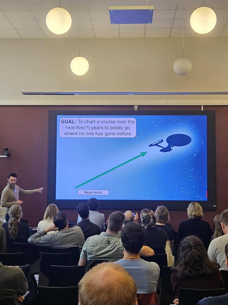
Poster Session
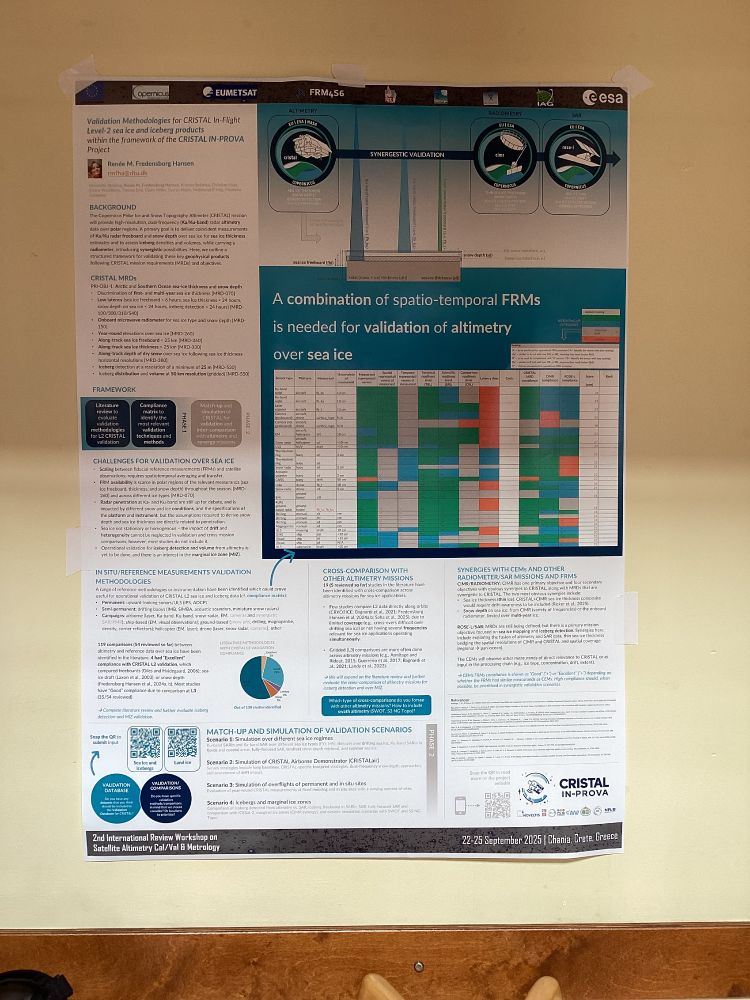
SP-43: Validation Methodologies for CRISTAL In-Flight Level-2 sea ice and iceberg products within the framework of the CRISTAL IN-PROVA Project 🛰️🛩️❄️🧊
Suggestions for validation scenarios or data to support #CRISTAL and synergies with CEMs? ➡️Submit here: forms.office.com/e/KkVhdzTwth
SP-43: Validation Methodologies for CRISTAL In-Flight Level-2 sea ice and iceberg products within the framework of the CRISTAL IN-PROVA Project 🛰️🛩️❄️🧊
Suggestions for validation scenarios or data to support #CRISTAL and synergies with CEMs? ➡️Submit here: forms.office.com/e/KkVhdzTwth
September 29, 2025 at 7:58 AM
Poster Session
SP-43: Validation Methodologies for CRISTAL In-Flight Level-2 sea ice and iceberg products within the framework of the CRISTAL IN-PROVA Project 🛰️🛩️❄️🧊
Suggestions for validation scenarios or data to support #CRISTAL and synergies with CEMs? ➡️Submit here: forms.office.com/e/KkVhdzTwth
SP-43: Validation Methodologies for CRISTAL In-Flight Level-2 sea ice and iceberg products within the framework of the CRISTAL IN-PROVA Project 🛰️🛩️❄️🧊
Suggestions for validation scenarios or data to support #CRISTAL and synergies with CEMs? ➡️Submit here: forms.office.com/e/KkVhdzTwth
Presentation - Session 10: Cryosphere Altimetry Calibration/Validation II
S10-33: Dual-hemisphere Sea Ice Reference measurements from multiple data sources tailored for evaluation and product inter-comparison of satellite altimetry 🛩️❄️🧊 #CCI
Interested? essd.copernicus.org/preprints/es...
S10-33: Dual-hemisphere Sea Ice Reference measurements from multiple data sources tailored for evaluation and product inter-comparison of satellite altimetry 🛩️❄️🧊 #CCI
Interested? essd.copernicus.org/preprints/es...
Dual-hemisphere sea ice thickness reference measurements from multiple data sources for evaluation and product inter-comparison of satellite altimetry
Abstract. Sea ice altimetry currently remains the primary method for estimating sea ice thickness from space, however time-series of sea ice thickness estimates are of limited use without having been ...
essd.copernicus.org
September 29, 2025 at 7:58 AM
Presentation - Session 10: Cryosphere Altimetry Calibration/Validation II
S10-33: Dual-hemisphere Sea Ice Reference measurements from multiple data sources tailored for evaluation and product inter-comparison of satellite altimetry 🛩️❄️🧊 #CCI
Interested? essd.copernicus.org/preprints/es...
S10-33: Dual-hemisphere Sea Ice Reference measurements from multiple data sources tailored for evaluation and product inter-comparison of satellite altimetry 🛩️❄️🧊 #CCI
Interested? essd.copernicus.org/preprints/es...
Presentation - Session 9: Cryosphere Altimetry Calibration/Validation I
S9-14: Validation Methodologies for CRISTAL In-Flight Level-2 Land Ice Products – An Overview from the CRISTAL IN-PROVA Project 🛰️🛩️❄️ #IN-PROVA
Suggestions for #CRISTAL validation? Submit here ➡️ forms.office.com/e/LkSrJnPFTh
S9-14: Validation Methodologies for CRISTAL In-Flight Level-2 Land Ice Products – An Overview from the CRISTAL IN-PROVA Project 🛰️🛩️❄️ #IN-PROVA
Suggestions for #CRISTAL validation? Submit here ➡️ forms.office.com/e/LkSrJnPFTh

September 29, 2025 at 7:58 AM
Presentation - Session 9: Cryosphere Altimetry Calibration/Validation I
S9-14: Validation Methodologies for CRISTAL In-Flight Level-2 Land Ice Products – An Overview from the CRISTAL IN-PROVA Project 🛰️🛩️❄️ #IN-PROVA
Suggestions for #CRISTAL validation? Submit here ➡️ forms.office.com/e/LkSrJnPFTh
S9-14: Validation Methodologies for CRISTAL In-Flight Level-2 Land Ice Products – An Overview from the CRISTAL IN-PROVA Project 🛰️🛩️❄️ #IN-PROVA
Suggestions for #CRISTAL validation? Submit here ➡️ forms.office.com/e/LkSrJnPFTh
Presentation - Session 9: Cryosphere Altimetry Calibration/Validation I
S9-19: Advancing Land Ice Altimetry with Sentinel-3: Performance Assessment and Error Budget Characterization 🛰️❄️ #S3MPC
S9-19: Advancing Land Ice Altimetry with Sentinel-3: Performance Assessment and Error Budget Characterization 🛰️❄️ #S3MPC

September 29, 2025 at 7:58 AM
Presentation - Session 9: Cryosphere Altimetry Calibration/Validation I
S9-19: Advancing Land Ice Altimetry with Sentinel-3: Performance Assessment and Error Budget Characterization 🛰️❄️ #S3MPC
S9-19: Advancing Land Ice Altimetry with Sentinel-3: Performance Assessment and Error Budget Characterization 🛰️❄️ #S3MPC
Presentation - Session 9: Cryosphere Altimetry Calibration/Validation I
S9-28: Operational Fiducial Reference Measurements over Sea Ice in support of Sentinel-3 validation (ESA St3TART-FO project) 🛰️🛩️❄️🧊 #St3TART-FO
S9-28: Operational Fiducial Reference Measurements over Sea Ice in support of Sentinel-3 validation (ESA St3TART-FO project) 🛰️🛩️❄️🧊 #St3TART-FO

September 29, 2025 at 7:58 AM
Presentation - Session 9: Cryosphere Altimetry Calibration/Validation I
S9-28: Operational Fiducial Reference Measurements over Sea Ice in support of Sentinel-3 validation (ESA St3TART-FO project) 🛰️🛩️❄️🧊 #St3TART-FO
S9-28: Operational Fiducial Reference Measurements over Sea Ice in support of Sentinel-3 validation (ESA St3TART-FO project) 🛰️🛩️❄️🧊 #St3TART-FO
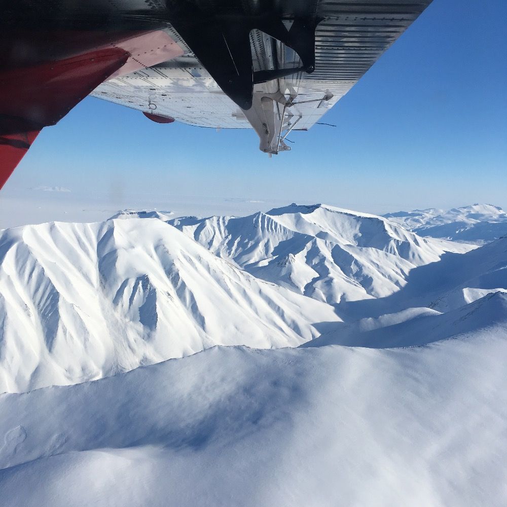
The goal is to test #CRISTALair, the new airborne demonstrator procured by ESA to support the upcoming #Copernicus #CRISTAL mission. #CRISTAL will deliver key observations of sea-ice thickness, snow depth, and land-ice elevation changes, supporting climate research and sea-level rise monitoring🛰


September 22, 2025 at 11:35 AM
The goal is to test #CRISTALair, the new airborne demonstrator procured by ESA to support the upcoming #Copernicus #CRISTAL mission. #CRISTAL will deliver key observations of sea-ice thickness, snow depth, and land-ice elevation changes, supporting climate research and sea-level rise monitoring🛰
🪵 High-res optical data makes it possible to map driftwood accumulations along Alaskan & NW Canadian rivers and coasts, helping quantify this overlooked carbon sink.
doi.org/10.1038/s415...
doi.org/10.1038/s415...

Large driftwood accumulations along arctic coastlines and rivers - Scientific Reports
Scientific Reports - Large driftwood accumulations along arctic coastlines and rivers
doi.org
September 16, 2025 at 12:22 PM
🪵 High-res optical data makes it possible to map driftwood accumulations along Alaskan & NW Canadian rivers and coasts, helping quantify this overlooked carbon sink.
doi.org/10.1038/s415...
doi.org/10.1038/s415...
🫧 UAV remote sensing images help upscale methane emissions in a subarctic Finnish bog, bridging the gap between local-scale in-situ observations and km-scale landscapes.
doi.org/10.1111/gcb....
doi.org/10.1111/gcb....

Seasonality in Diffusive Methane Emissions Differs Between Bog Microforms
This study shows that small-scale landscape features within a boreal bog strongly influence seasonal patterns of methane emissions. By combining ground-based measurements with high-resolution drone m...
doi.org
September 16, 2025 at 12:22 PM
🫧 UAV remote sensing images help upscale methane emissions in a subarctic Finnish bog, bridging the gap between local-scale in-situ observations and km-scale landscapes.
doi.org/10.1111/gcb....
doi.org/10.1111/gcb....