


Neil
@cneilb.bsky.social
Husband, Father and Grandfather. Lover of all things weather. I am a passionate supporter of football and an occasional writer for Beyond90. I used to pop up on TV now and then but am now happily retired.
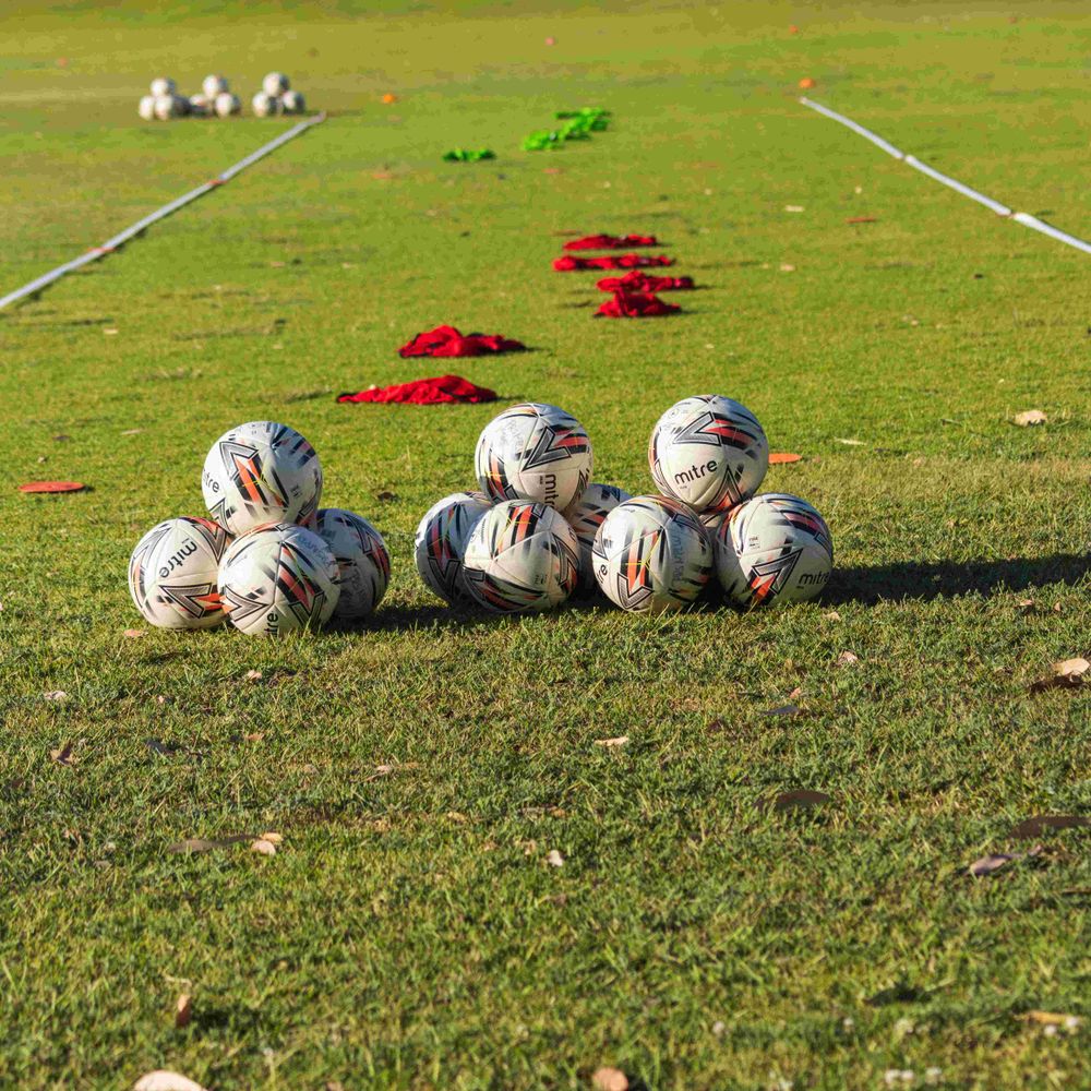
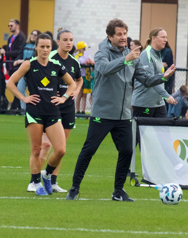
The @the-matildas.bsky.social had an open training session at the Sam Kerr centre yesterday, and I was able to capture a few images of them going through their paces under the watchful eye of coaches Joe Montemurro and Emily Husband. #matildas


July 2, 2025 at 4:11 AM
The @the-matildas.bsky.social had an open training session at the Sam Kerr centre yesterday, and I was able to capture a few images of them going through their paces under the watchful eye of coaches Joe Montemurro and Emily Husband. #matildas
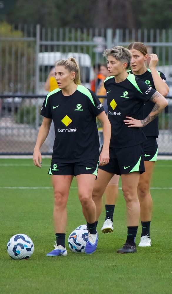
I’ve been fortunate to be given media accreditation for the @the-matildas.bsky.social games against #Slovenia and #Panama in #Perth over the next week or so. Here are a few images I took at today’s press event. @beyond90au.bsky.social


June 25, 2025 at 1:35 PM
I’ve been fortunate to be given media accreditation for the @the-matildas.bsky.social games against #Slovenia and #Panama in #Perth over the next week or so. Here are a few images I took at today’s press event. @beyond90au.bsky.social
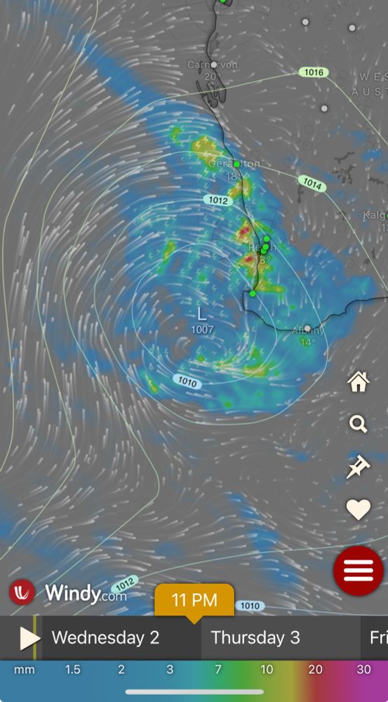
The latest run of the ECMWF model via Windy.com and it’s looking promising for some much needed rain for southern WA. #perth #perthweather
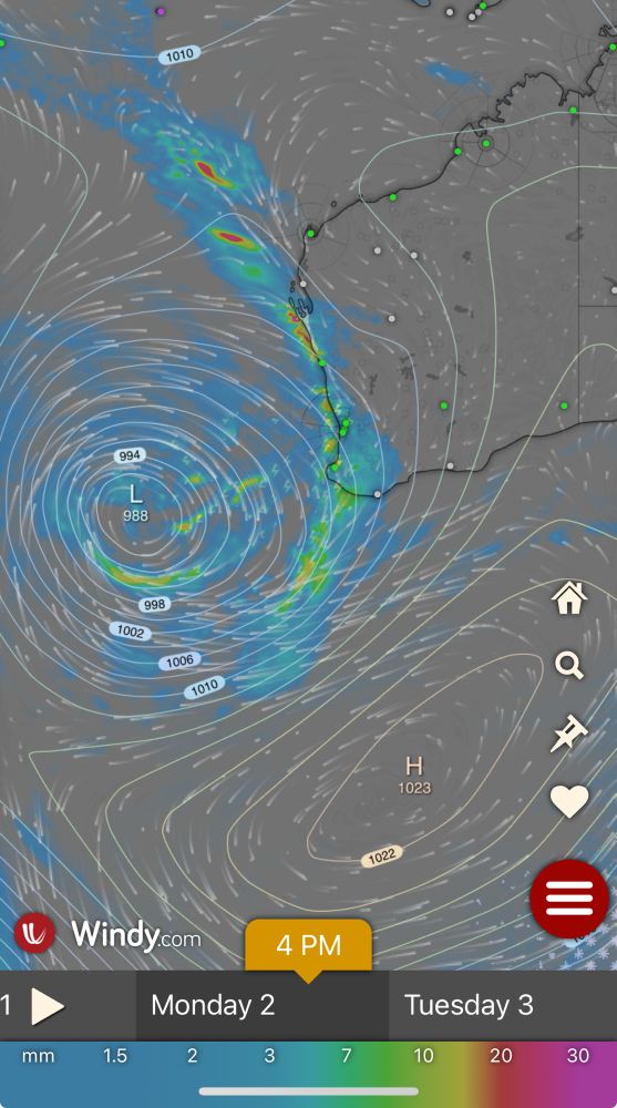
June 1, 2025 at 1:03 AM
The latest run of the ECMWF model via Windy.com and it’s looking promising for some much needed rain for southern WA. #perth #perthweather
🧪
The computer model predictions for landfall for Tropical Cyclone Albert aren't great for Thursday. Brisbane is in the firing line for the ECMWF, ACCESS and GFS models. Still a long way out but authorities will be worried. #TCAlbert #TropicalCyclone #QLDWeather #Brisbane
The computer model predictions for landfall for Tropical Cyclone Albert aren't great for Thursday. Brisbane is in the firing line for the ECMWF, ACCESS and GFS models. Still a long way out but authorities will be worried. #TCAlbert #TropicalCyclone #QLDWeather #Brisbane


March 2, 2025 at 5:29 AM
🧪
The computer model predictions for landfall for Tropical Cyclone Albert aren't great for Thursday. Brisbane is in the firing line for the ECMWF, ACCESS and GFS models. Still a long way out but authorities will be worried. #TCAlbert #TropicalCyclone #QLDWeather #Brisbane
The computer model predictions for landfall for Tropical Cyclone Albert aren't great for Thursday. Brisbane is in the firing line for the ECMWF, ACCESS and GFS models. Still a long way out but authorities will be worried. #TCAlbert #TropicalCyclone #QLDWeather #Brisbane
Satellite & radar imagery for Severe Tropical Cyclone Zelia. According to the BoM it's now a category 5 ( highest rating) with estimated maximum wind gusts of 285km/hr. The system is expected to cross the coast between De Grey & Karratha during Friday afternoon or evening. #TCZelia #TropicalCyclone


February 13, 2025 at 10:44 AM
Satellite & radar imagery for Severe Tropical Cyclone Zelia. According to the BoM it's now a category 5 ( highest rating) with estimated maximum wind gusts of 285km/hr. The system is expected to cross the coast between De Grey & Karratha during Friday afternoon or evening. #TCZelia #TropicalCyclone
Tropical low (18U) looks like it will be tricky to forecast as the models are in major disagreement about where it will go. Access - C has it close to #Geraldton by Saturday but the EC has it much further east. #weather #tropicallow #perthnews


February 10, 2025 at 3:17 AM
Tropical low (18U) looks like it will be tricky to forecast as the models are in major disagreement about where it will go. Access - C has it close to #Geraldton by Saturday but the EC has it much further east. #weather #tropicallow #perthnews
Tropical cyclone Sean has formed. At 8 am it was a Cat 1 system with mean speeds of 85km/hr and gusting to 120km/hr. It was estimated to be 275 km WNW of Port Hedland and 150km NNW of Karratha moving WSW at 13km/hr. www.bom.gov.au/cgi-bin/wrap... #TCSean #Cyclone #Weather

January 19, 2025 at 2:25 AM
Tropical cyclone Sean has formed. At 8 am it was a Cat 1 system with mean speeds of 85km/hr and gusting to 120km/hr. It was estimated to be 275 km WNW of Port Hedland and 150km NNW of Karratha moving WSW at 13km/hr. www.bom.gov.au/cgi-bin/wrap... #TCSean #Cyclone #Weather
Here's the latest track map for a potential tropical cyclone off the Pilbara coast of Western Australia. If correct, the potential impacts will be relatively minor - image via Bureau of Meteorology. #Tropicalcyclone #weather #westernaustralia #wa
www.bom.gov.au/products/IDW...
www.bom.gov.au/products/IDW...

January 18, 2025 at 1:51 AM
Here's the latest track map for a potential tropical cyclone off the Pilbara coast of Western Australia. If correct, the potential impacts will be relatively minor - image via Bureau of Meteorology. #Tropicalcyclone #weather #westernaustralia #wa
www.bom.gov.au/products/IDW...
www.bom.gov.au/products/IDW...
There's a chance of a Tropical Cyclone forming off the WA coast this weekend. The latest models suggest a circulation by Sunday off the Pilbara coast. If it is named it will be called Sean. #Tropicalcyclone #WestAustralia

January 17, 2025 at 3:16 AM
There's a chance of a Tropical Cyclone forming off the WA coast this weekend. The latest models suggest a circulation by Sunday off the Pilbara coast. If it is named it will be called Sean. #Tropicalcyclone #WestAustralia