


ClimateEngine.org
@climateengine.org
On-demand insights from #Climate and #EarthObservations for non-commercial | ClimateEngine.org | App & API built on #EarthEngine | Initiative between @driscience.bsky.social and @ucmerced.bsky.social
Reposted by ClimateEngine.org

📈 New from ClimateEngine.org: Vegetation Production Reports!
Developed with partners at the BLM and USDA-ARS, these reports bring satellite-based rangeland data directly into grazing and resource management workflows. Bridging the gap between data and decision-making. 🛰️🌾
#RemoteSensing #Geospatial
Developed with partners at the BLM and USDA-ARS, these reports bring satellite-based rangeland data directly into grazing and resource management workflows. Bridging the gap between data and decision-making. 🛰️🌾
#RemoteSensing #Geospatial

December 16, 2025 at 11:05 PM
📈 New from ClimateEngine.org: Vegetation Production Reports!
Developed with partners at the BLM and USDA-ARS, these reports bring satellite-based rangeland data directly into grazing and resource management workflows. Bridging the gap between data and decision-making. 🛰️🌾
#RemoteSensing #Geospatial
Developed with partners at the BLM and USDA-ARS, these reports bring satellite-based rangeland data directly into grazing and resource management workflows. Bridging the gap between data and decision-making. 🛰️🌾
#RemoteSensing #Geospatial
Reposted by ClimateEngine.org
NOAA's National Integrated Drought Information System has supported and leveraged @climateengine.org from the very beginning — thank you NOAA!
We'll be posting many more updates on the ClimateEngine.org bsky account, so be sure and follow ➕
We'll be posting many more updates on the ClimateEngine.org bsky account, so be sure and follow ➕
Did you know @noaa.gov uses the Climate Engine API to power many Current Conditions maps on Drought.gov?
Since 2021, NOAA has used Climate Engine daily to generate GeoTIFFs for precip, temp anomalies, SPI, SPEI, EDDI, and more—openly shared via public cloud buckets.
Learn more: shorturl.at/J1X5q
Since 2021, NOAA has used Climate Engine daily to generate GeoTIFFs for precip, temp anomalies, SPI, SPEI, EDDI, and more—openly shared via public cloud buckets.
Learn more: shorturl.at/J1X5q

December 12, 2025 at 6:39 PM
NOAA's National Integrated Drought Information System has supported and leveraged @climateengine.org from the very beginning — thank you NOAA!
We'll be posting many more updates on the ClimateEngine.org bsky account, so be sure and follow ➕
We'll be posting many more updates on the ClimateEngine.org bsky account, so be sure and follow ➕
Did you know @noaa.gov uses the Climate Engine API to power many Current Conditions maps on Drought.gov?
Since 2021, NOAA has used Climate Engine daily to generate GeoTIFFs for precip, temp anomalies, SPI, SPEI, EDDI, and more—openly shared via public cloud buckets.
Learn more: shorturl.at/J1X5q
Since 2021, NOAA has used Climate Engine daily to generate GeoTIFFs for precip, temp anomalies, SPI, SPEI, EDDI, and more—openly shared via public cloud buckets.
Learn more: shorturl.at/J1X5q
December 12, 2025 at 6:36 PM
Did you know @noaa.gov uses the Climate Engine API to power many Current Conditions maps on Drought.gov?
Since 2021, NOAA has used Climate Engine daily to generate GeoTIFFs for precip, temp anomalies, SPI, SPEI, EDDI, and more—openly shared via public cloud buckets.
Learn more: shorturl.at/J1X5q
Since 2021, NOAA has used Climate Engine daily to generate GeoTIFFs for precip, temp anomalies, SPI, SPEI, EDDI, and more—openly shared via public cloud buckets.
Learn more: shorturl.at/J1X5q
Reposted by ClimateEngine.org
Testing, testing, is this thing on 🎤
@climateengine.org is live on Substack! ✍️
Read our first article, which surveys the free and public tools that Climate Engine provides, supporting access to 90+ #EarthObservations time-series datasets for analysis.
substack.com/home/post/p-...
#EarthEngine
@climateengine.org is live on Substack! ✍️
Read our first article, which surveys the free and public tools that Climate Engine provides, supporting access to 90+ #EarthObservations time-series datasets for analysis.
substack.com/home/post/p-...
#EarthEngine

Data at Your Fingertips: Everything You Need to Know To Get Started With Climate Engine
On-Demand Insights from Climate and Earth Observations Data
substack.com
December 8, 2025 at 6:09 PM
Testing, testing, is this thing on 🎤
@climateengine.org is live on Substack! ✍️
Read our first article, which surveys the free and public tools that Climate Engine provides, supporting access to 90+ #EarthObservations time-series datasets for analysis.
substack.com/home/post/p-...
#EarthEngine
@climateengine.org is live on Substack! ✍️
Read our first article, which surveys the free and public tools that Climate Engine provides, supporting access to 90+ #EarthObservations time-series datasets for analysis.
substack.com/home/post/p-...
#EarthEngine
Reposted by ClimateEngine.org
New masking options:
💧 Map Landsat NDVI trends only in riparian areas.
🌲 Track USFS Tree Canopy Cover over NLCD forest classes.
➕ Apply up to 2 masks (union or intersection).
Docs: support.climateengine.org/article/198-...
What will you try?
#RemoteSensing #EarthEngine #ClimateEngine
💧 Map Landsat NDVI trends only in riparian areas.
🌲 Track USFS Tree Canopy Cover over NLCD forest classes.
➕ Apply up to 2 masks (union or intersection).
Docs: support.climateengine.org/article/198-...
What will you try?
#RemoteSensing #EarthEngine #ClimateEngine
November 20, 2025 at 11:22 PM
New masking options:
💧 Map Landsat NDVI trends only in riparian areas.
🌲 Track USFS Tree Canopy Cover over NLCD forest classes.
➕ Apply up to 2 masks (union or intersection).
Docs: support.climateengine.org/article/198-...
What will you try?
#RemoteSensing #EarthEngine #ClimateEngine
💧 Map Landsat NDVI trends only in riparian areas.
🌲 Track USFS Tree Canopy Cover over NLCD forest classes.
➕ Apply up to 2 masks (union or intersection).
Docs: support.climateengine.org/article/198-...
What will you try?
#RemoteSensing #EarthEngine #ClimateEngine
Reposted by ClimateEngine.org
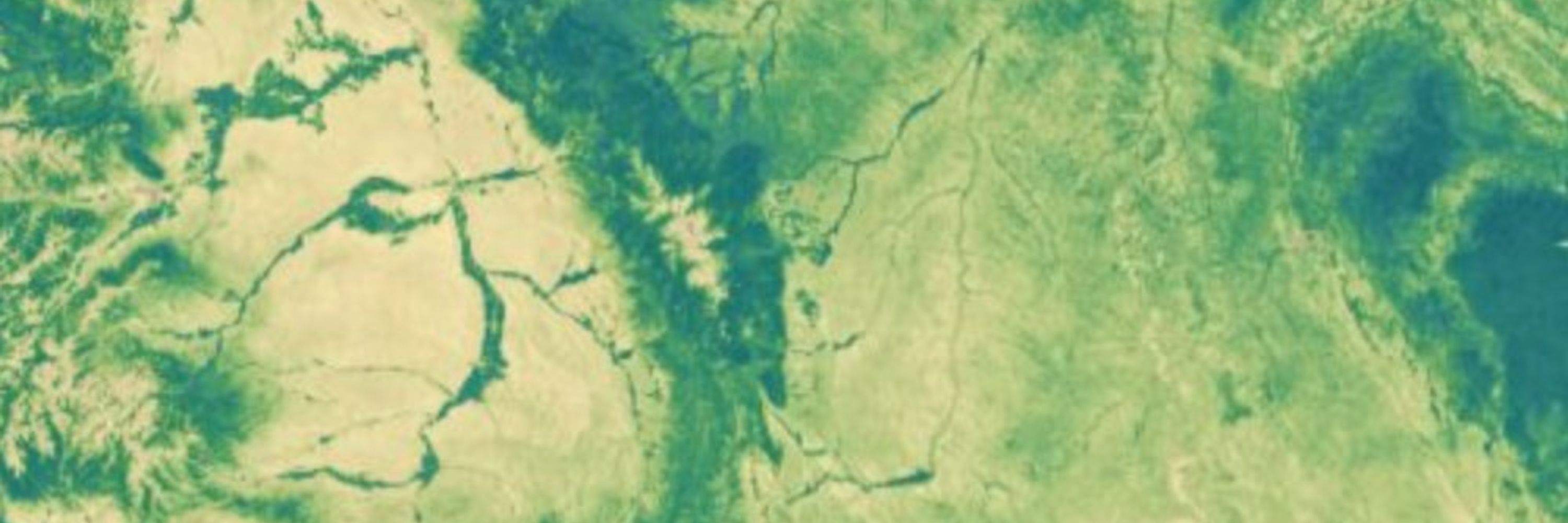
🎯 Focus your maps with categorical data! 🎯
New in Climate Engine: categorical masks to focus maps by land ownership, landcover, valley bottoms, and more.
In the demo video, see Landsat NDVI trends (1985–2025) across riparian areas at Maggie Creek, Nevada.
🌎 Try it at app.climateengine.org
New in Climate Engine: categorical masks to focus maps by land ownership, landcover, valley bottoms, and more.
In the demo video, see Landsat NDVI trends (1985–2025) across riparian areas at Maggie Creek, Nevada.
🌎 Try it at app.climateengine.org
November 20, 2025 at 11:22 PM
🎯 Focus your maps with categorical data! 🎯
New in Climate Engine: categorical masks to focus maps by land ownership, landcover, valley bottoms, and more.
In the demo video, see Landsat NDVI trends (1985–2025) across riparian areas at Maggie Creek, Nevada.
🌎 Try it at app.climateengine.org
New in Climate Engine: categorical masks to focus maps by land ownership, landcover, valley bottoms, and more.
In the demo video, see Landsat NDVI trends (1985–2025) across riparian areas at Maggie Creek, Nevada.
🌎 Try it at app.climateengine.org
Reposted by ClimateEngine.org
🗺️ New raster overlays in Climate Engine! 🗺️
You can now add contextual overlays to your CE maps:
🌍 Landcover (NLCD, ESA WorldCover),
🏛️ Land ownership (Surface Management Agency)
💧 Wetlands (NWI, VBET)
What layers do you want to see added to Climate Engine?
#EarthObservations #Climate #Geospatial
You can now add contextual overlays to your CE maps:
🌍 Landcover (NLCD, ESA WorldCover),
🏛️ Land ownership (Surface Management Agency)
💧 Wetlands (NWI, VBET)
What layers do you want to see added to Climate Engine?
#EarthObservations #Climate #Geospatial
November 10, 2025 at 2:22 PM
🗺️ New raster overlays in Climate Engine! 🗺️
You can now add contextual overlays to your CE maps:
🌍 Landcover (NLCD, ESA WorldCover),
🏛️ Land ownership (Surface Management Agency)
💧 Wetlands (NWI, VBET)
What layers do you want to see added to Climate Engine?
#EarthObservations #Climate #Geospatial
You can now add contextual overlays to your CE maps:
🌍 Landcover (NLCD, ESA WorldCover),
🏛️ Land ownership (Surface Management Agency)
💧 Wetlands (NWI, VBET)
What layers do you want to see added to Climate Engine?
#EarthObservations #Climate #Geospatial
Reposted by ClimateEngine.org
🗺️ Climate Engine is looking sharper than ever with new basemaps!
You can now add high-res aerial imagery and topographic layers beneath your computed maps to explore fine-scale landscape detail.
Check out the demo and try it at app.climateengine.org
🌎
#EarthEngine #RemoteSensing #Geospatial
You can now add high-res aerial imagery and topographic layers beneath your computed maps to explore fine-scale landscape detail.
Check out the demo and try it at app.climateengine.org
🌎
#EarthEngine #RemoteSensing #Geospatial
November 7, 2025 at 5:39 PM
🗺️ Climate Engine is looking sharper than ever with new basemaps!
You can now add high-res aerial imagery and topographic layers beneath your computed maps to explore fine-scale landscape detail.
Check out the demo and try it at app.climateengine.org
🌎
#EarthEngine #RemoteSensing #Geospatial
You can now add high-res aerial imagery and topographic layers beneath your computed maps to explore fine-scale landscape detail.
Check out the demo and try it at app.climateengine.org
🌎
#EarthEngine #RemoteSensing #Geospatial
Reposted by ClimateEngine.org
🧑💻 Check out my more extensive post on LinkedIn and stay tuned for more details — including how to call the tools through the @climateengineorg.bsky.social API — in the coming days
www.linkedin.com/feed/update/...
If you're using the tools, I'd love to hear from you!
www.linkedin.com/feed/update/...
If you're using the tools, I'd love to hear from you!

Eric Jensen on LinkedIn: Generating Climate Engine Reports for Custom Areas of Interest
🚨 New Climate Engine data tools! 🚨
This week we're excited to introduce new Climate Engine reports that can be produced for any location in CONUS! This tool…
www.linkedin.com
January 31, 2025 at 3:39 PM
🧑💻 Check out my more extensive post on LinkedIn and stay tuned for more details — including how to call the tools through the @climateengineorg.bsky.social API — in the coming days
www.linkedin.com/feed/update/...
If you're using the tools, I'd love to hear from you!
www.linkedin.com/feed/update/...
If you're using the tools, I'd love to hear from you!
Reposted by ClimateEngine.org
To help to support users, we've published a tutorial video that demonstrates using a 'Priority Region', 'Shapefile Upload', or 'Drawn Polygon' for your AOI for lands administered by BLM, NPS, USFS, USFWS, BIA, DOD, or all lands.
📺 See the video www.youtube.com/watch?v=b4yj...
📺 See the video www.youtube.com/watch?v=b4yj...

Generating Climate Engine Reports for Custom Areas of Interest
YouTube video by Climate Engine Org
www.youtube.com
January 31, 2025 at 3:39 PM
To help to support users, we've published a tutorial video that demonstrates using a 'Priority Region', 'Shapefile Upload', or 'Drawn Polygon' for your AOI for lands administered by BLM, NPS, USFS, USFWS, BIA, DOD, or all lands.
📺 See the video www.youtube.com/watch?v=b4yj...
📺 See the video www.youtube.com/watch?v=b4yj...
Reposted by ClimateEngine.org
🚨 New Climate Engine data tools! 🚨
This week we're excited to introduce @climateengineorg.bsky.social reports for anywhere in CONUS. Created for resource managers, policymakers, and others, the reports aid in reporting, monitoring, and adaptive management.
🛠️ Use the tools reports.climateengine.org
This week we're excited to introduce @climateengineorg.bsky.social reports for anywhere in CONUS. Created for resource managers, policymakers, and others, the reports aid in reporting, monitoring, and adaptive management.
🛠️ Use the tools reports.climateengine.org


January 31, 2025 at 3:39 PM
🚨 New Climate Engine data tools! 🚨
This week we're excited to introduce @climateengineorg.bsky.social reports for anywhere in CONUS. Created for resource managers, policymakers, and others, the reports aid in reporting, monitoring, and adaptive management.
🛠️ Use the tools reports.climateengine.org
This week we're excited to introduce @climateengineorg.bsky.social reports for anywhere in CONUS. Created for resource managers, policymakers, and others, the reports aid in reporting, monitoring, and adaptive management.
🛠️ Use the tools reports.climateengine.org
Our team at @DRIScience is honored to be recognized as one of the inaugural recipients of the #GeoForGood23 Impact Awards! 🛰️
Thank you to Google Earth Outreach for highlighting the work of the exemplary partners selected 🙏
medium.com/google-earth...
Thank you to Google Earth Outreach for highlighting the work of the exemplary partners selected 🙏
medium.com/google-earth...

Announcing Geo for Good Impact Awards: Recognizing our community
By Devaja Shah, Program Manager, Google Earth Outreach
medium.com
October 13, 2023 at 7:46 PM
Our team at @DRIScience is honored to be recognized as one of the inaugural recipients of the #GeoForGood23 Impact Awards! 🛰️
Thank you to Google Earth Outreach for highlighting the work of the exemplary partners selected 🙏
medium.com/google-earth...
Thank you to Google Earth Outreach for highlighting the work of the exemplary partners selected 🙏
medium.com/google-earth...
Reposted by ClimateEngine.org
Fantastic to see the USGS Historical Imagery mosaic produced by USDA-NRCS Working Lands for Wildlife in the #EarthEngine Community Catalog!
gee-community-catalog.org/projects/his...
I had the privilege of working on the project in 2020-2021 — tremendous opportunities in conservation and beyond.
gee-community-catalog.org/projects/his...
I had the privilege of working on the project in 2020-2021 — tremendous opportunities in conservation and beyond.

September 27, 2023 at 3:42 PM
Fantastic to see the USGS Historical Imagery mosaic produced by USDA-NRCS Working Lands for Wildlife in the #EarthEngine Community Catalog!
gee-community-catalog.org/projects/his...
I had the privilege of working on the project in 2020-2021 — tremendous opportunities in conservation and beyond.
gee-community-catalog.org/projects/his...
I had the privilege of working on the project in 2020-2021 — tremendous opportunities in conservation and beyond.
We're excited to share that we're adding dozens of our #EarthEngine assets to the EE Community Catalog!
The first batch includes USGS VIIRS and MODIS Evapotranspiration, CEMS Fire Danger Indices, the North American Drought Monitor, and more 🛰️
Catalog changelog: gee-community-catalog.org/changelog/
The first batch includes USGS VIIRS and MODIS Evapotranspiration, CEMS Fire Danger Indices, the North American Drought Monitor, and more 🛰️
Catalog changelog: gee-community-catalog.org/changelog/

September 27, 2023 at 3:25 PM
We're excited to share that we're adding dozens of our #EarthEngine assets to the EE Community Catalog!
The first batch includes USGS VIIRS and MODIS Evapotranspiration, CEMS Fire Danger Indices, the North American Drought Monitor, and more 🛰️
Catalog changelog: gee-community-catalog.org/changelog/
The first batch includes USGS VIIRS and MODIS Evapotranspiration, CEMS Fire Danger Indices, the North American Drought Monitor, and more 🛰️
Catalog changelog: gee-community-catalog.org/changelog/