


Bryon
@bryonw.bsky.social
Engineer & Planner who plans and engineers human transport - trails, paths, sidewalks, bike lanes. Tennis junky, gardner, and ceaseless chess learner. DMV area.
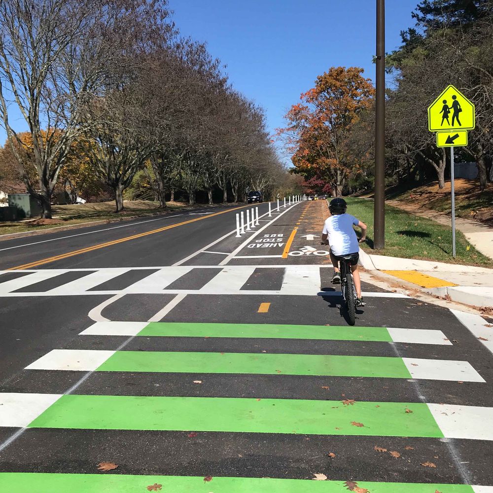
Yep. That’s by design. To keep speeds down. Assuming this picture is from the CCT looking north, then yeah that’s a speedhump and a 10’ wide car lane (12’ of asphalt technically) with a buffered shared use path next to it. South of the CCT this path becomes a bike only cycletrack down to Dorset.
November 23, 2025 at 5:31 PM
Yep. That’s by design. To keep speeds down. Assuming this picture is from the CCT looking north, then yeah that’s a speedhump and a 10’ wide car lane (12’ of asphalt technically) with a buffered shared use path next to it. South of the CCT this path becomes a bike only cycletrack down to Dorset.
This is actually the new southbound car lane. The new 2-way shared use path is on the left side of the photo. It’s just not marked and signed yet.
November 23, 2025 at 3:23 PM
This is actually the new southbound car lane. The new 2-way shared use path is on the left side of the photo. It’s just not marked and signed yet.
The “may” is history. At least with regard to regulatory (black and white) signs. New MUTCD signs are clearer but wordier. Something like, bikes are allowed to have whole damn lane. Or some such.
July 19, 2025 at 1:16 AM
The “may” is history. At least with regard to regulatory (black and white) signs. New MUTCD signs are clearer but wordier. Something like, bikes are allowed to have whole damn lane. Or some such.
I like it. Definitely worth the experiment. Not wholly different than a nearside bike signal. I wonder metric is going to be used to determine success since pedestrian crash data is quite “noisy” at the hyper local level.
July 13, 2025 at 2:03 PM
I like it. Definitely worth the experiment. Not wholly different than a nearside bike signal. I wonder metric is going to be used to determine success since pedestrian crash data is quite “noisy” at the hyper local level.
Next year, the new east end of this trail will be all the way down to Calvert Street!
April 28, 2025 at 2:13 AM
Next year, the new east end of this trail will be all the way down to Calvert Street!