
•VALID FROM NOW-00:00 SUNDAY 22 JUNE•
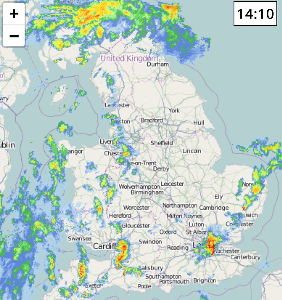
Thunderstorms are likely to develop in N England today, Further storms possible elsewhere such as Wales, Norfolk, Midlands, Cornwall and pretty much anywhere.
#weatheruk #thunderstorms
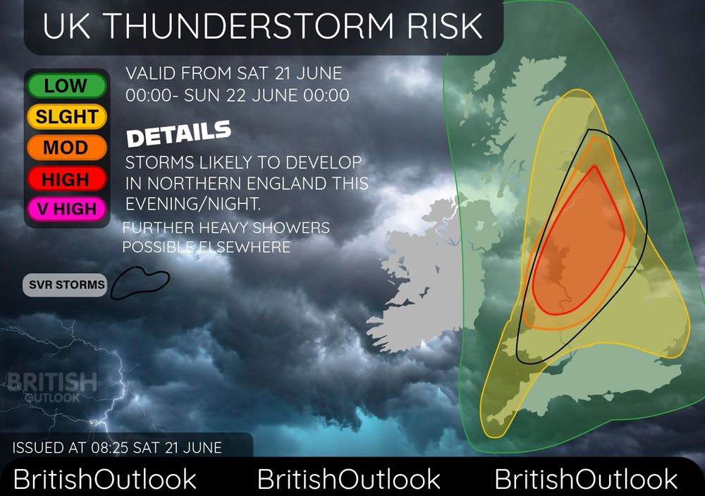
•VALID FROM NOW-00:00 SUNDAY 22 JUNE•
Thunderstorms are likely to develop in N England today, Further storms possible elsewhere such as Wales, Norfolk, Midlands, Cornwall and pretty much anywhere.
#weatheruk #thunderstorms
An Amber warning has been issued in SE England tonight from 8pm to 5am tomorrow morning. Some disruption is likely within this area, with flooding likely, power cuts and potential damage to buildings.
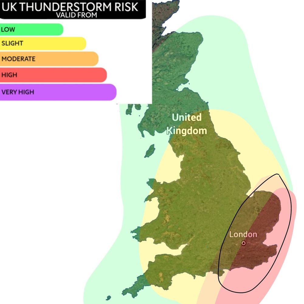
An Amber warning has been issued in SE England tonight from 8pm to 5am tomorrow morning. Some disruption is likely within this area, with flooding likely, power cuts and potential damage to buildings.
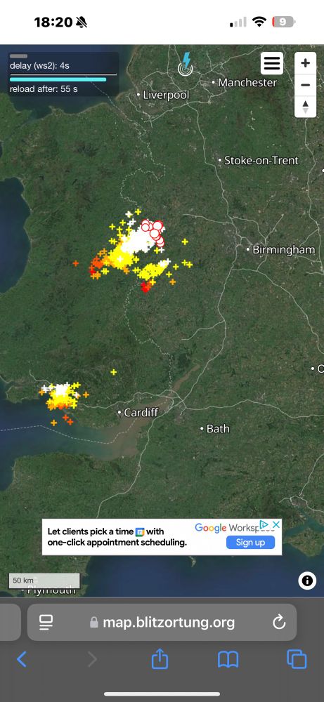
30°c possible in London, temperatures will likely significantly drop to more near average after the next couple days.
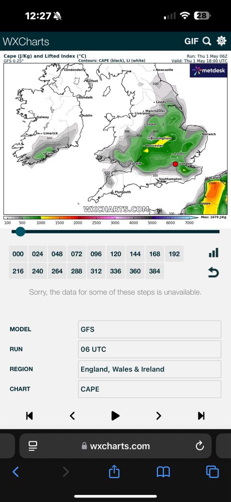
30°c possible in London, temperatures will likely significantly drop to more near average after the next couple days.
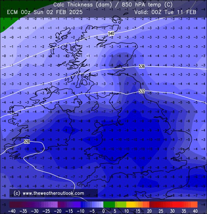
#uksnow
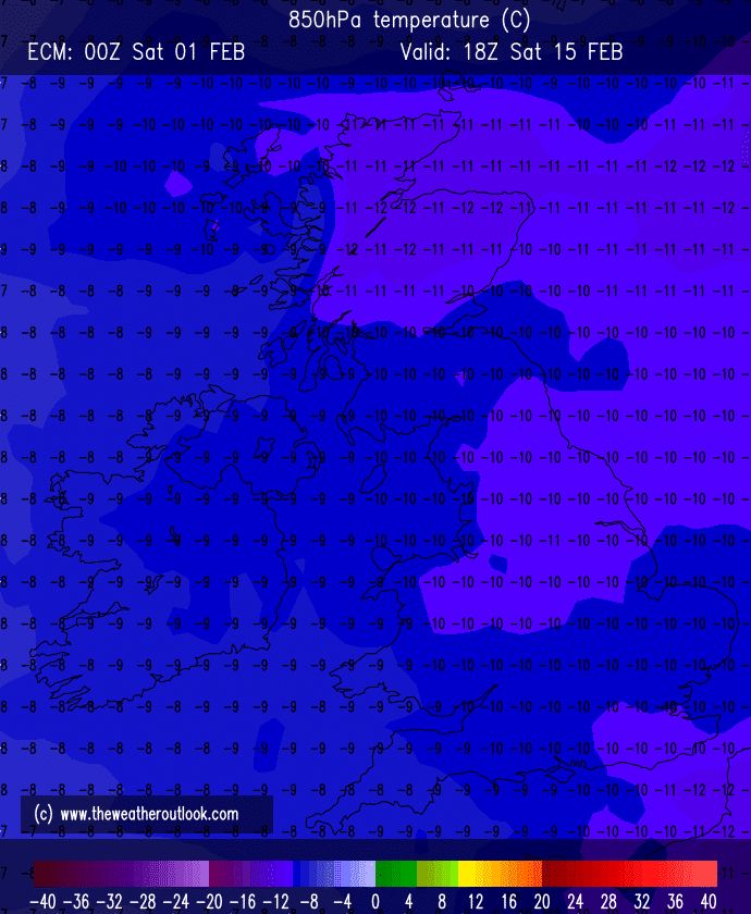
#uksnow
Make sure to post any pictures
Make sure to post any pictures
Scattered thunderstorms along with strong gusts are likely in the South and parts of E Ireland, particularly late morning-afternoon
A tornado possible in the SW
#thunderstorm
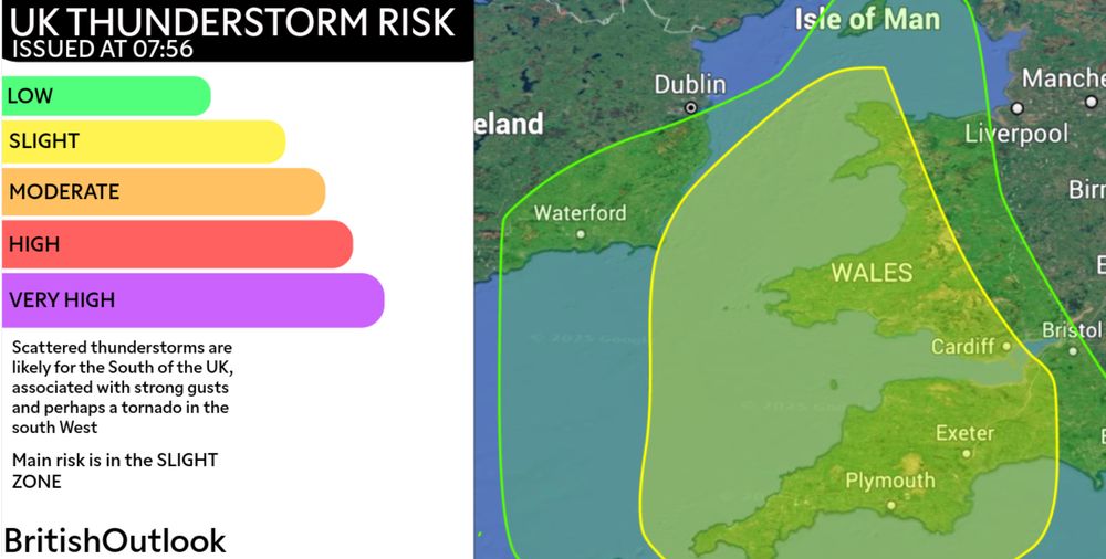
Scattered thunderstorms along with strong gusts are likely in the South and parts of E Ireland, particularly late morning-afternoon
A tornado possible in the SW
#thunderstorm
Issued at 07:56 26th Jan 2025
Scattered thunderstorms will be associated with strong gusts for many in the South, there will be a small risk of a tornado in the SW and some small hail possible
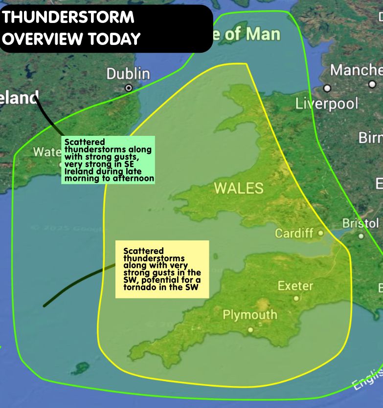
Issued at 07:56 26th Jan 2025
Scattered thunderstorms will be associated with strong gusts for many in the South, there will be a small risk of a tornado in the SW and some small hail possible
Small accumulations possible widespread throughout this evening, perhaps quite a few cm locally, especially over higher elevations
Glasgow will have a mix of rain/snow/sleet, temporary accumulations possible in this area
#snow
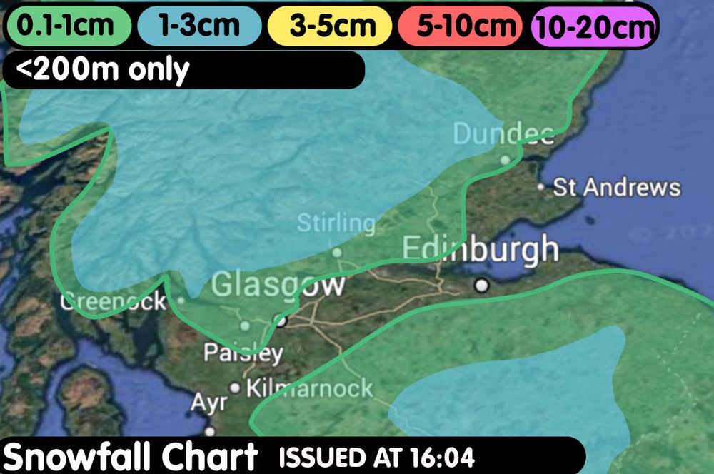
Small accumulations possible widespread throughout this evening, perhaps quite a few cm locally, especially over higher elevations
Glasgow will have a mix of rain/snow/sleet, temporary accumulations possible in this area
#snow
The Red wind warning for Scotland is now in force, 80-90mph gusts for many with up to 100mph possible
Make sure to take caution and listen to the Met Office’s advice.
#weather #stormeowyn
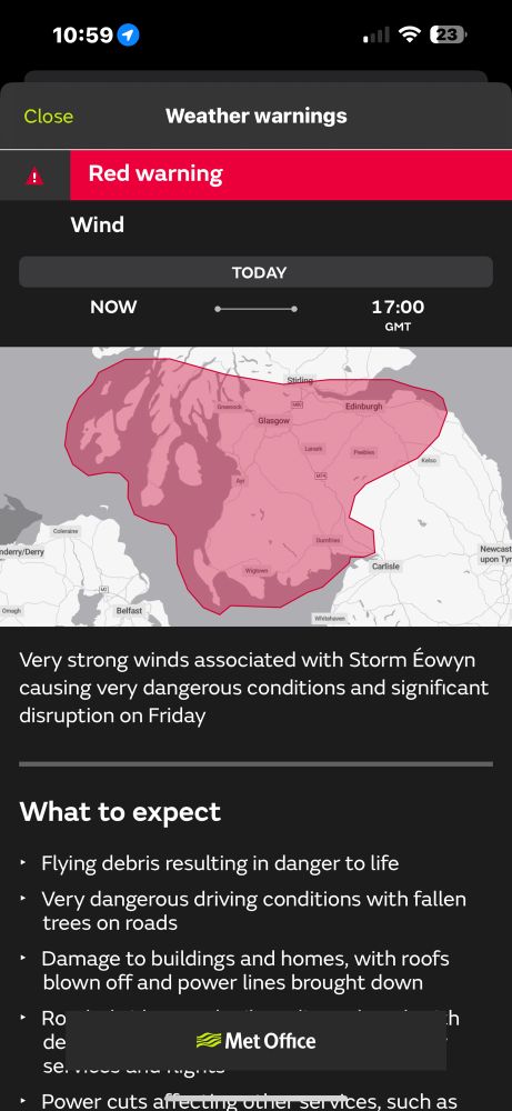
The Red wind warning for Scotland is now in force, 80-90mph gusts for many with up to 100mph possible
Make sure to take caution and listen to the Met Office’s advice.
#weather #stormeowyn
#stormeowyn
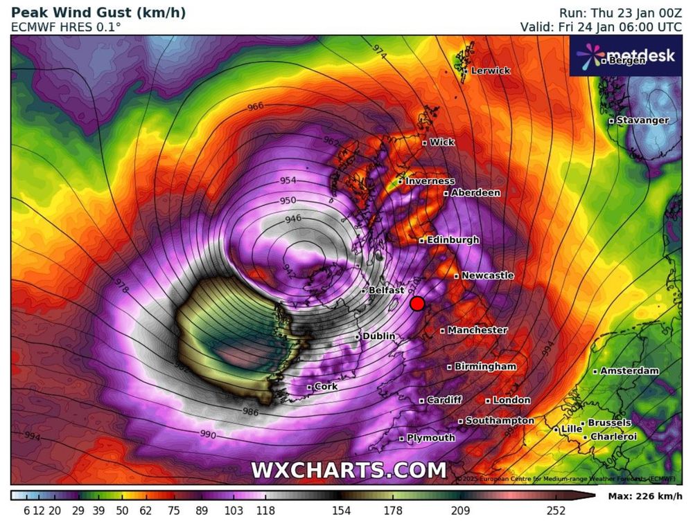
#stormeowyn
VALID FROM NOW-00:00 FRI
Scattered thunderstorms affecting Wales and Southern England, along with gusty winds, some hail possible.
A wind outlook will be issued later as severe winds are likely..
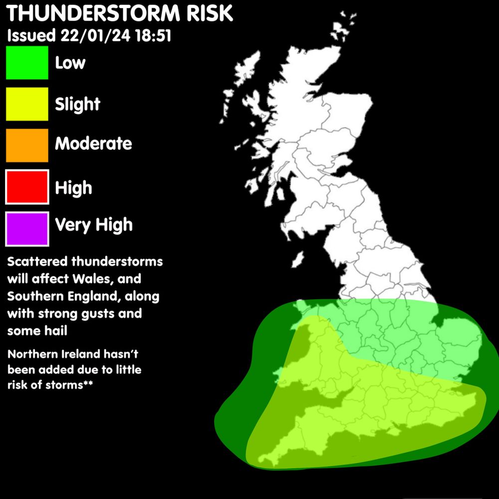
VALID FROM NOW-00:00 FRI
Scattered thunderstorms affecting Wales and Southern England, along with gusty winds, some hail possible.
A wind outlook will be issued later as severe winds are likely..
Increase in temperature for many, especially in Scotland. Still remaining chilly for many
**Based from UKV model**
Max of 10oc in England
Max of 10oc Wales
Max of 13oc Scotland
Max of 13oc Northern Ireland
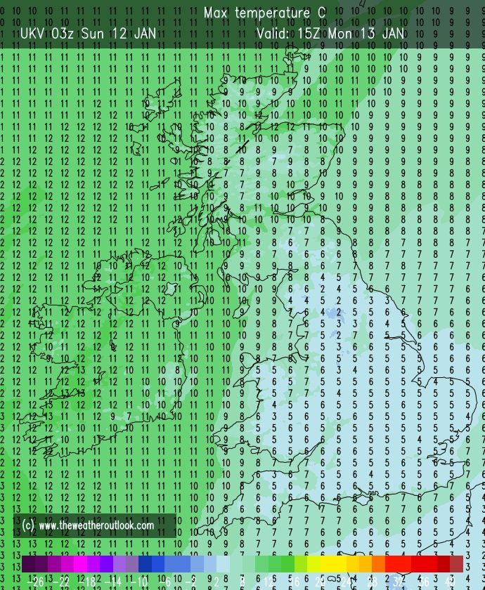
Increase in temperature for many, especially in Scotland. Still remaining chilly for many
**Based from UKV model**
Max of 10oc in England
Max of 10oc Wales
Max of 13oc Scotland
Max of 13oc Northern Ireland
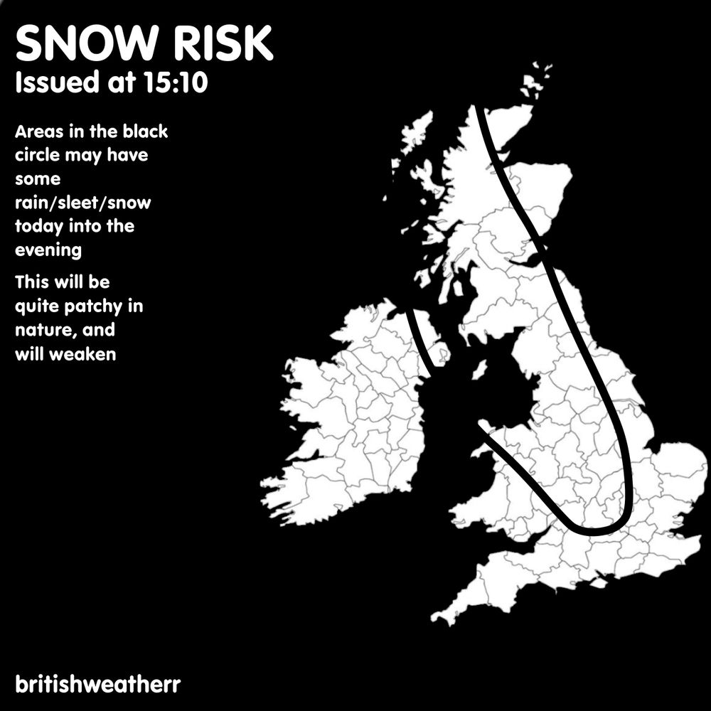
Widespread very low risk of snow, with a high-end low risk affecting W Scotland, NW England.
Potential for a moderate to be issued later if the chances increase
#uksnow
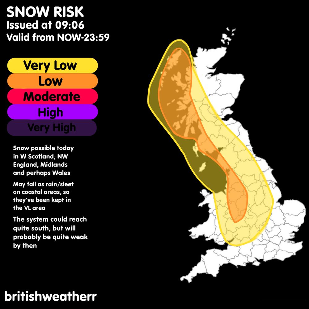
Widespread very low risk of snow, with a high-end low risk affecting W Scotland, NW England.
Potential for a moderate to be issued later if the chances increase
#uksnow
Rain/snow in the south today will freeze overnight in places where temperatures are below freezing.
Small chance of some more rain or wintry weather in the morning but it will fizzle out without any significant impacts.
#uksnow
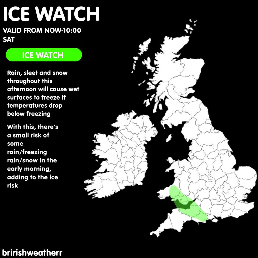
Rain/snow in the south today will freeze overnight in places where temperatures are below freezing.
Small chance of some more rain or wintry weather in the morning but it will fizzle out without any significant impacts.
#uksnow
Very low risk of snowfall in the SW, sWales, and Ireland.
Low risk of snowfall south of Ireland
It reminds uncertain how far the snow will get before fizzling out
#uksnow
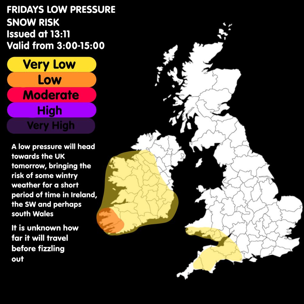
Very low risk of snowfall in the SW, sWales, and Ireland.
Low risk of snowfall south of Ireland
It reminds uncertain how far the snow will get before fizzling out
#uksnow
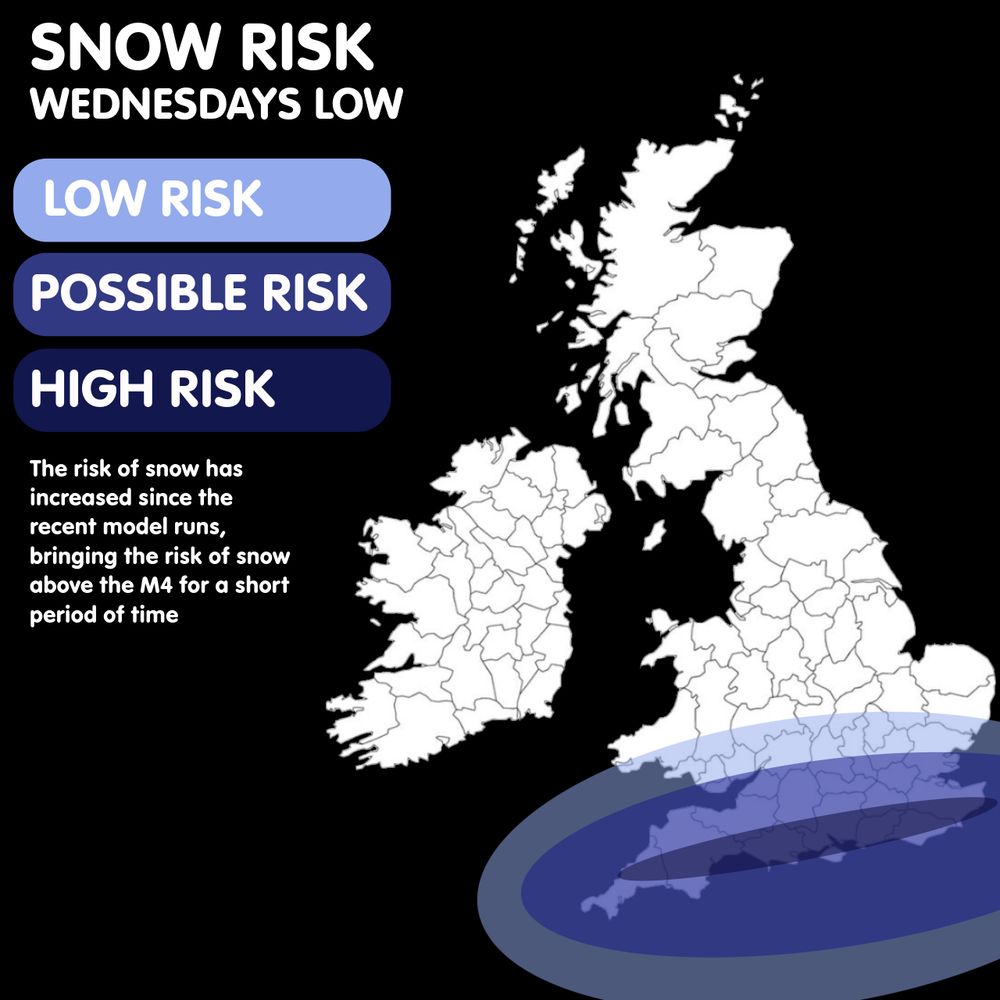
A High risk option has been added, affecting the far Sourh, particularly in the Warning Area.
Snow risk is now above the M4 for a short period of time.
Warning area likely won’t be extended as impacts are less likely out of the warning.
#uksnow #snow
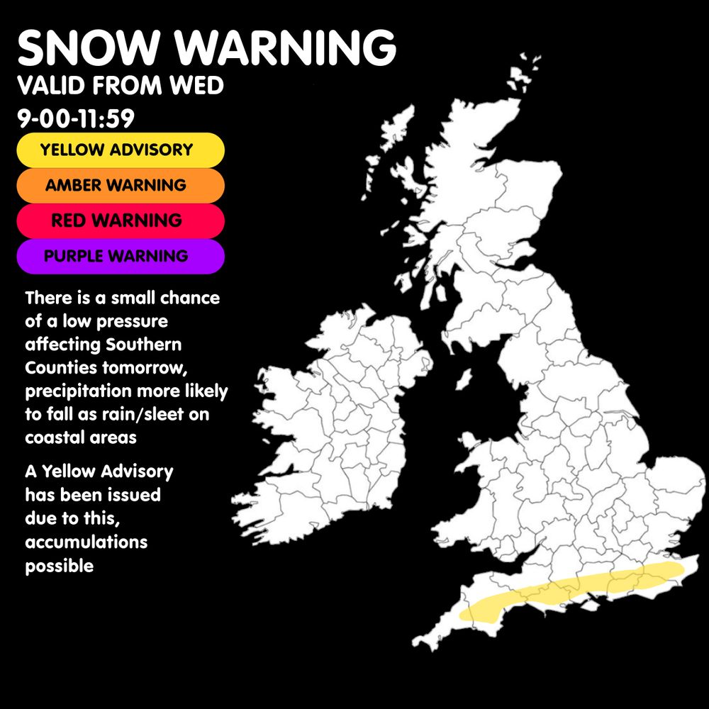
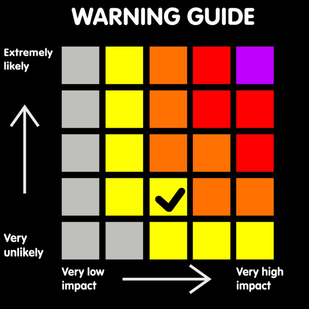
I have issued a Yellow Snow Warning due to potential snow tomorrow, the track of the low remains uncertain, but a small risk of snow affecting the S is possible.
Mostly rain on coastal areas, snow may be mixed in. Snow in-land areas, especially on hills.

I have issued a Yellow Snow Warning due to potential snow tomorrow, the track of the low remains uncertain, but a small risk of snow affecting the S is possible.
Mostly rain on coastal areas, snow may be mixed in. Snow in-land areas, especially on hills.
A shift south with the risk compared to yesterday, the possible risk is southern areas with a very low risk added up to the M4 area due to uncertainty.
#uksnow

A shift south with the risk compared to yesterday, the possible risk is southern areas with a very low risk added up to the M4 area due to uncertainty.
#uksnow
It remains uncertain on the exact areas that will see snow as the system could track more North or South, so this will likely be updated tomorrow.
Greatest chance of snowfall below the M4, but small risk of some as far as s Wales

It remains uncertain on the exact areas that will see snow as the system could track more North or South, so this will likely be updated tomorrow.
Greatest chance of snowfall below the M4, but small risk of some as far as s Wales
Main risk of Freezing Rain will be throughout Saturday evening and night.
Freeing rain is still possible out of highlighted areas, but highlighted areas are at highest risk.
Please ensure you look through the Met Offices Warning for more details.

Main risk of Freezing Rain will be throughout Saturday evening and night.
Freeing rain is still possible out of highlighted areas, but highlighted areas are at highest risk.
Please ensure you look through the Met Offices Warning for more details.
Valid from 18:00-00:00
Main risk of rainfall is in the SW and Wales, nothing significant expected

Valid from 18:00-00:00
Main risk of rainfall is in the SW and Wales, nothing significant expected
Rain likely, windy for some, especially near coastal areas.
Snow continuing over the highlands and higher elevations, clearing throughout the afternoon and evening.


Rain likely, windy for some, especially near coastal areas.
Snow continuing over the highlands and higher elevations, clearing throughout the afternoon and evening.

