


Rusty
@bizarmadillo.bsky.social
Adventurer, explorer, maker of things.
Thru-hiking the Long Trail backwards in 2025
🥾 🏕 🏔 🌵 🎸 🎧 🌊 🔬 🌻
Thru-hiking the Long Trail backwards in 2025
🥾 🏕 🏔 🌵 🎸 🎧 🌊 🔬 🌻
Day 14 on the Long Trail
17.3 miles, +4345' -5136'
cooley glen to sucker brook
fast trail first half of day, last half overgrown with lots of blowdowns
boyce mountain
many minor peaks
pleiad lake
hiking with tanker
biggest mileage so far
17.3 miles, +4345' -5136'
cooley glen to sucker brook
fast trail first half of day, last half overgrown with lots of blowdowns
boyce mountain
many minor peaks
pleiad lake
hiking with tanker
biggest mileage so far


September 25, 2025 at 11:44 PM
Day 14 on the Long Trail
17.3 miles, +4345' -5136'
cooley glen to sucker brook
fast trail first half of day, last half overgrown with lots of blowdowns
boyce mountain
many minor peaks
pleiad lake
hiking with tanker
biggest mileage so far
17.3 miles, +4345' -5136'
cooley glen to sucker brook
fast trail first half of day, last half overgrown with lots of blowdowns
boyce mountain
many minor peaks
pleiad lake
hiking with tanker
biggest mileage so far
Day 13 on the Long Trail
15.4 miles, +3811' -3928'
theron dean to cooley glen
two 4k'ers before noon. mostly easy ridge running and one big rocky descent
mt ellen
mt abraham
lincoln gap
1 day hiker keeps giving me celery
finally meet another sobo hiker "tanker"
15.4 miles, +3811' -3928'
theron dean to cooley glen
two 4k'ers before noon. mostly easy ridge running and one big rocky descent
mt ellen
mt abraham
lincoln gap
1 day hiker keeps giving me celery
finally meet another sobo hiker "tanker"


September 25, 2025 at 5:37 PM
Day 13 on the Long Trail
15.4 miles, +3811' -3928'
theron dean to cooley glen
two 4k'ers before noon. mostly easy ridge running and one big rocky descent
mt ellen
mt abraham
lincoln gap
1 day hiker keeps giving me celery
finally meet another sobo hiker "tanker"
15.4 miles, +3811' -3928'
theron dean to cooley glen
two 4k'ers before noon. mostly easy ridge running and one big rocky descent
mt ellen
mt abraham
lincoln gap
1 day hiker keeps giving me celery
finally meet another sobo hiker "tanker"
Day 12 on the Long Trail
13.0 miles +3636' -3130'
montclair glen to theron dean
tough, rocky and slow trail with some views
mt ethan allen
burnt rock mountain
molly stark mountain
appalachian gap
stark mountain
13.0 miles +3636' -3130'
montclair glen to theron dean
tough, rocky and slow trail with some views
mt ethan allen
burnt rock mountain
molly stark mountain
appalachian gap
stark mountain


September 25, 2025 at 12:23 AM
Day 12 on the Long Trail
13.0 miles +3636' -3130'
montclair glen to theron dean
tough, rocky and slow trail with some views
mt ethan allen
burnt rock mountain
molly stark mountain
appalachian gap
stark mountain
13.0 miles +3636' -3130'
montclair glen to theron dean
tough, rocky and slow trail with some views
mt ethan allen
burnt rock mountain
molly stark mountain
appalachian gap
stark mountain
Day 11 on the Long Trail
10.9 miles +4183' -1781'
Rt 2 to Montclair Glen
Back on trail around 11:00. Long climb over one of the steepest sections of the trail. Pushed hard to make the summit and then the shelter by dark.
Camels Hump peak
epic views
having the summit all to myself
10.9 miles +4183' -1781'
Rt 2 to Montclair Glen
Back on trail around 11:00. Long climb over one of the steepest sections of the trail. Pushed hard to make the summit and then the shelter by dark.
Camels Hump peak
epic views
having the summit all to myself


September 20, 2025 at 10:21 PM
Day 11 on the Long Trail
10.9 miles +4183' -1781'
Rt 2 to Montclair Glen
Back on trail around 11:00. Long climb over one of the steepest sections of the trail. Pushed hard to make the summit and then the shelter by dark.
Camels Hump peak
epic views
having the summit all to myself
10.9 miles +4183' -1781'
Rt 2 to Montclair Glen
Back on trail around 11:00. Long climb over one of the steepest sections of the trail. Pushed hard to make the summit and then the shelter by dark.
Camels Hump peak
epic views
having the summit all to myself
Day 10 on the Long Trail
zero day
Waterbury, Vermont
sleeping in
breakfast included
lunch at Blackback Pub
paid my respects at the B&J flavor graveyard
laundry and resupply
endless law & order reruns
zero day
Waterbury, Vermont
sleeping in
breakfast included
lunch at Blackback Pub
paid my respects at the B&J flavor graveyard
laundry and resupply
endless law & order reruns


September 20, 2025 at 9:47 PM
Day 10 on the Long Trail
zero day
Waterbury, Vermont
sleeping in
breakfast included
lunch at Blackback Pub
paid my respects at the B&J flavor graveyard
laundry and resupply
endless law & order reruns
zero day
Waterbury, Vermont
sleeping in
breakfast included
lunch at Blackback Pub
paid my respects at the B&J flavor graveyard
laundry and resupply
endless law & order reruns
Day 9 on the Long Trail
6.7 miles +724' -2538'
Buchanan to Rt 2
Town day! Mostly downhill easy trail to the highway. Got lucky and met a nobo hiker at the trailhead and caught a ride into town. Trail magic!
6.7 miles +724' -2538'
Buchanan to Rt 2
Town day! Mostly downhill easy trail to the highway. Got lucky and met a nobo hiker at the trailhead and caught a ride into town. Trail magic!


September 20, 2025 at 8:59 PM
Day 9 on the Long Trail
6.7 miles +724' -2538'
Buchanan to Rt 2
Town day! Mostly downhill easy trail to the highway. Got lucky and met a nobo hiker at the trailhead and caught a ride into town. Trail magic!
6.7 miles +724' -2538'
Buchanan to Rt 2
Town day! Mostly downhill easy trail to the highway. Got lucky and met a nobo hiker at the trailhead and caught a ride into town. Trail magic!
Day 8 on the Long Trail
14.8 miles +3783' -5296'
Taft Lodge to Buchanan
difficult technical climbing up to the summit but easy trails along the ridge wet ladders and more technical descents getting down
long downhill miles to finish the day
Mount Mansfield, highest peak in Vermont
14.8 miles +3783' -5296'
Taft Lodge to Buchanan
difficult technical climbing up to the summit but easy trails along the ridge wet ladders and more technical descents getting down
long downhill miles to finish the day
Mount Mansfield, highest peak in Vermont


September 10, 2025 at 11:58 AM
Day 8 on the Long Trail
14.8 miles +3783' -5296'
Taft Lodge to Buchanan
difficult technical climbing up to the summit but easy trails along the ridge wet ladders and more technical descents getting down
long downhill miles to finish the day
Mount Mansfield, highest peak in Vermont
14.8 miles +3783' -5296'
Taft Lodge to Buchanan
difficult technical climbing up to the summit but easy trails along the ridge wet ladders and more technical descents getting down
long downhill miles to finish the day
Mount Mansfield, highest peak in Vermont
Day 7 on the Long Trail
3.1 miles +2142' -34'
Smugglers Notch to Taft Lodge
the rain comes
waiting out the weather in the lodge for better conditions and views at the summit
catching up on food
catching up on sleep
catching up with other hikers doing the same
3.1 miles +2142' -34'
Smugglers Notch to Taft Lodge
the rain comes
waiting out the weather in the lodge for better conditions and views at the summit
catching up on food
catching up on sleep
catching up with other hikers doing the same


September 10, 2025 at 3:18 AM
Day 7 on the Long Trail
3.1 miles +2142' -34'
Smugglers Notch to Taft Lodge
the rain comes
waiting out the weather in the lodge for better conditions and views at the summit
catching up on food
catching up on sleep
catching up with other hikers doing the same
3.1 miles +2142' -34'
Smugglers Notch to Taft Lodge
the rain comes
waiting out the weather in the lodge for better conditions and views at the summit
catching up on food
catching up on sleep
catching up with other hikers doing the same
Day 6 on the Long Trail
13.2 miles +3931' -3877'
Bear Hollow to Smuggler's Notch
tough, steep technical trail made harder by multiple blowdowns and approaching storms
Whiteface Mountain
Madonna Peak
wandering thru a snowless deserted ski resort in summer
13.2 miles +3931' -3877'
Bear Hollow to Smuggler's Notch
tough, steep technical trail made harder by multiple blowdowns and approaching storms
Whiteface Mountain
Madonna Peak
wandering thru a snowless deserted ski resort in summer


September 10, 2025 at 2:08 AM
Day 6 on the Long Trail
13.2 miles +3931' -3877'
Bear Hollow to Smuggler's Notch
tough, steep technical trail made harder by multiple blowdowns and approaching storms
Whiteface Mountain
Madonna Peak
wandering thru a snowless deserted ski resort in summer
13.2 miles +3931' -3877'
Bear Hollow to Smuggler's Notch
tough, steep technical trail made harder by multiple blowdowns and approaching storms
Whiteface Mountain
Madonna Peak
wandering thru a snowless deserted ski resort in summer
Day 5 on the Long Trail
8.6 miles +1439' -1522'
Round Top to Bear Hollow
town day! short jaunt downhill to Johnson for recharge and resupply at Jenna's Coffee Shop and Johnson Hardware & Rental. three miles up logging road to camp
1 grilled cheese
1 peach toast with burrata
8.6 miles +1439' -1522'
Round Top to Bear Hollow
town day! short jaunt downhill to Johnson for recharge and resupply at Jenna's Coffee Shop and Johnson Hardware & Rental. three miles up logging road to camp
1 grilled cheese
1 peach toast with burrata


September 9, 2025 at 3:11 PM
Day 5 on the Long Trail
8.6 miles +1439' -1522'
Round Top to Bear Hollow
town day! short jaunt downhill to Johnson for recharge and resupply at Jenna's Coffee Shop and Johnson Hardware & Rental. three miles up logging road to camp
1 grilled cheese
1 peach toast with burrata
8.6 miles +1439' -1522'
Round Top to Bear Hollow
town day! short jaunt downhill to Johnson for recharge and resupply at Jenna's Coffee Shop and Johnson Hardware & Rental. three miles up logging road to camp
1 grilled cheese
1 peach toast with burrata
Day 4 on the Long Trail
16 miles +4336' -4238'
Spruce Ledge to Round Top
Butternut and Laraway peaks
rolled into camp just in time for a nice sunset
2 perrigrines
1 toad
fish
16 miles +4336' -4238'
Spruce Ledge to Round Top
Butternut and Laraway peaks
rolled into camp just in time for a nice sunset
2 perrigrines
1 toad
fish


September 9, 2025 at 2:19 PM
Day 4 on the Long Trail
16 miles +4336' -4238'
Spruce Ledge to Round Top
Butternut and Laraway peaks
rolled into camp just in time for a nice sunset
2 perrigrines
1 toad
fish
16 miles +4336' -4238'
Spruce Ledge to Round Top
Butternut and Laraway peaks
rolled into camp just in time for a nice sunset
2 perrigrines
1 toad
fish
Day 3 on the Long Trail
14.8 miles
Hazens Notch to Spruce Ledge
tough trail in the morning with several minor peaks, easier in the afternoon to finally cover some miles
Haystack Mountain
Tillotson Peak
Belvedere Mountain
Devils Gulch
3 beaver ponds
1 cluster of chicken-looking things
tiny frogs
14.8 miles
Hazens Notch to Spruce Ledge
tough trail in the morning with several minor peaks, easier in the afternoon to finally cover some miles
Haystack Mountain
Tillotson Peak
Belvedere Mountain
Devils Gulch
3 beaver ponds
1 cluster of chicken-looking things
tiny frogs


September 9, 2025 at 3:53 AM
Day 3 on the Long Trail
14.8 miles
Hazens Notch to Spruce Ledge
tough trail in the morning with several minor peaks, easier in the afternoon to finally cover some miles
Haystack Mountain
Tillotson Peak
Belvedere Mountain
Devils Gulch
3 beaver ponds
1 cluster of chicken-looking things
tiny frogs
14.8 miles
Hazens Notch to Spruce Ledge
tough trail in the morning with several minor peaks, easier in the afternoon to finally cover some miles
Haystack Mountain
Tillotson Peak
Belvedere Mountain
Devils Gulch
3 beaver ponds
1 cluster of chicken-looking things
tiny frogs
Day 2 on the Long Trail
9.4 miles
Laura Woodward to Hazens Notch
rugged, steep, slow trails
first big summit, Jay Peak
1 perrigrine
1 owl
1 toad
9.4 miles
Laura Woodward to Hazens Notch
rugged, steep, slow trails
first big summit, Jay Peak
1 perrigrine
1 owl
1 toad


September 9, 2025 at 1:54 AM
Day 2 on the Long Trail
9.4 miles
Laura Woodward to Hazens Notch
rugged, steep, slow trails
first big summit, Jay Peak
1 perrigrine
1 owl
1 toad
9.4 miles
Laura Woodward to Hazens Notch
rugged, steep, slow trails
first big summit, Jay Peak
1 perrigrine
1 owl
1 toad
Day 1 on the Long Trail
8.7 miles
Journeys End to Laura Woodward
rugged, wet and slippery
sweltering humidity
1 snek
1 rabbit
too many moose poops to count
off to a good start
8.7 miles
Journeys End to Laura Woodward
rugged, wet and slippery
sweltering humidity
1 snek
1 rabbit
too many moose poops to count
off to a good start


September 9, 2025 at 12:02 AM
Day 1 on the Long Trail
8.7 miles
Journeys End to Laura Woodward
rugged, wet and slippery
sweltering humidity
1 snek
1 rabbit
too many moose poops to count
off to a good start
8.7 miles
Journeys End to Laura Woodward
rugged, wet and slippery
sweltering humidity
1 snek
1 rabbit
too many moose poops to count
off to a good start
views from burlington today. i'll bet there's some trails around here...

August 31, 2025 at 12:51 AM
views from burlington today. i'll bet there's some trails around here...
if you train your gear to pack itself, it's a real timesaver. pro tip.
August 30, 2025 at 12:35 AM
if you train your gear to pack itself, it's a real timesaver. pro tip.
san jacinto wilderness day 3
little tahquitz valley, pct, south ridge and devils slide trails 7.2 mi +1055' -2543' elevation 4hr 35min
max elev 8,823ft tahquitz peak
little tahquitz valley, pct, south ridge and devils slide trails 7.2 mi +1055' -2543' elevation 4hr 35min
max elev 8,823ft tahquitz peak


August 22, 2025 at 6:08 PM
san jacinto wilderness day 3
little tahquitz valley, pct, south ridge and devils slide trails 7.2 mi +1055' -2543' elevation 4hr 35min
max elev 8,823ft tahquitz peak
little tahquitz valley, pct, south ridge and devils slide trails 7.2 mi +1055' -2543' elevation 4hr 35min
max elev 8,823ft tahquitz peak
san jacinto wilderness day 2
pct, deer spring, peak and wellman cienega trails 15.6 mi loop, 3,851' gross elevation 11hr 30min
10,551' max elev (~300ft below the summit)
camping again in tahquitz meadow
pct, deer spring, peak and wellman cienega trails 15.6 mi loop, 3,851' gross elevation 11hr 30min
10,551' max elev (~300ft below the summit)
camping again in tahquitz meadow


August 20, 2025 at 6:18 PM
san jacinto wilderness day 2
pct, deer spring, peak and wellman cienega trails 15.6 mi loop, 3,851' gross elevation 11hr 30min
10,551' max elev (~300ft below the summit)
camping again in tahquitz meadow
pct, deer spring, peak and wellman cienega trails 15.6 mi loop, 3,851' gross elevation 11hr 30min
10,551' max elev (~300ft below the summit)
camping again in tahquitz meadow
three day two night shakedown hike san jacinto wilderness
camping in tahquitz meadow 7950' elev
day 1 devils slide trail to camp 3.4 mi, 1,600 ft net elevation 2hr 14min
camping in tahquitz meadow 7950' elev
day 1 devils slide trail to camp 3.4 mi, 1,600 ft net elevation 2hr 14min


August 19, 2025 at 7:00 AM
three day two night shakedown hike san jacinto wilderness
camping in tahquitz meadow 7950' elev
day 1 devils slide trail to camp 3.4 mi, 1,600 ft net elevation 2hr 14min
camping in tahquitz meadow 7950' elev
day 1 devils slide trail to camp 3.4 mi, 1,600 ft net elevation 2hr 14min
sunset on the PCT. nice views, but will he make camp before dark??

August 18, 2025 at 3:22 AM
sunset on the PCT. nice views, but will he make camp before dark??
who doesn't love a good footbridge?

August 15, 2025 at 4:24 AM
who doesn't love a good footbridge?
exploring the local park from a different side turns the familiar into a whole new adventure

August 13, 2025 at 5:12 PM
exploring the local park from a different side turns the familiar into a whole new adventure
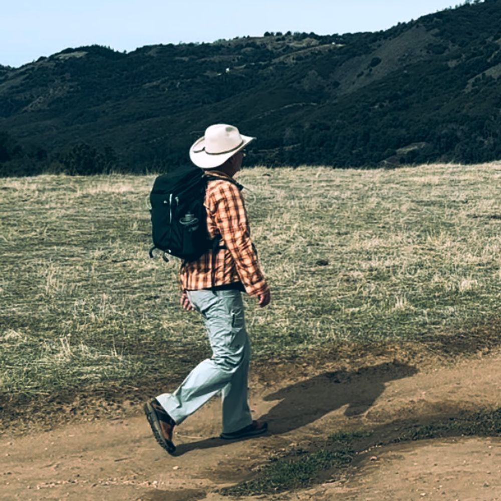
seemed like a good day for a walk down by the coast

August 11, 2025 at 3:32 AM
seemed like a good day for a walk down by the coast
made a detachable hip-belt pouch for my new backpack. it's smaller than the one that came with the pack, but mine works one handed


August 11, 2025 at 1:59 AM
made a detachable hip-belt pouch for my new backpack. it's smaller than the one that came with the pack, but mine works one handed
sunset hike in the city... beats the heat and the crowds

August 6, 2025 at 5:50 AM
sunset hike in the city... beats the heat and the crowds