


Dr. Bede Ffinian Rowe Davies
@bedeffinian.bsky.social
Post Doctoral Researcher at Nantes University 🇫🇷 Using Novel and Traditional Observational and Analysis Tools 🛰️ 🎣to assess Anthropogenic Impacts on Marine Environments 🐠 Surfing, stats and cycling. He/him
www.BedeFfinianRoweDavies.com
www.BedeFfinianRoweDavies.com
We also found some general latitudinal patterns in intertidal seagrass, with the proportion of the intertidal area covered by seagrass increasing as you go south, and not only that, the cover/density of that seagrass tends to increase the further south you go.

November 4, 2025 at 12:17 PM
We also found some general latitudinal patterns in intertidal seagrass, with the proportion of the intertidal area covered by seagrass increasing as you go south, and not only that, the cover/density of that seagrass tends to increase the further south you go.
From this total area we found hotspots of intertidal seagrass across the whole of Europe, with three notable hotspots coming out as the biggest in the North Frisian Wadden Sea (Germany), Arcachon Bay (France) and Ria Formosa (Portugal).

November 4, 2025 at 12:17 PM
From this total area we found hotspots of intertidal seagrass across the whole of Europe, with three notable hotspots coming out as the biggest in the North Frisian Wadden Sea (Germany), Arcachon Bay (France) and Ria Formosa (Portugal).
Then using a cloud-computing approach we classified the over 15,100 km ² of intertidal area in Europe, finding an area larger than both Paris and Lisbon combined appeared to be seagrass at over 50 % cover (212 +/- 18.8 km ²)

November 4, 2025 at 12:17 PM
Then using a cloud-computing approach we classified the over 15,100 km ² of intertidal area in Europe, finding an area larger than both Paris and Lisbon combined appeared to be seagrass at over 50 % cover (212 +/- 18.8 km ²)
By updating the ICE CREAMS model, we improved its accuracy from 82 % in previous work to 91 % by decreased its’ false positive rate on over 60,000 independent and openly accessible validation data.

November 4, 2025 at 12:17 PM
By updating the ICE CREAMS model, we improved its accuracy from 82 % in previous work to 91 % by decreased its’ false positive rate on over 60,000 independent and openly accessible validation data.
5) lead a Call-to-Action for the availability of data following the FAIR principles to improve future iterations of this European scale map.
Through this work we feel we successfully achieved all of the first four aims and hope that this paper will achieve the fifth: a Call-to-Action!
Through this work we feel we successfully achieved all of the first four aims and hope that this paper will achieve the fifth: a Call-to-Action!
November 4, 2025 at 12:17 PM
5) lead a Call-to-Action for the availability of data following the FAIR principles to improve future iterations of this European scale map.
Through this work we feel we successfully achieved all of the first four aims and hope that this paper will achieve the fifth: a Call-to-Action!
Through this work we feel we successfully achieved all of the first four aims and hope that this paper will achieve the fifth: a Call-to-Action!
2) use ICE CREAMS to create a contemporary map of Intertidal Seagrass for Europe
3) provide a robust and scalable methodology to allow others to map intertidal seagrass at large scales
4) provide an open-access and hopefully easy to use tool to view this map
3) provide a robust and scalable methodology to allow others to map intertidal seagrass at large scales
4) provide an open-access and hopefully easy to use tool to view this map

November 4, 2025 at 12:17 PM
2) use ICE CREAMS to create a contemporary map of Intertidal Seagrass for Europe
3) provide a robust and scalable methodology to allow others to map intertidal seagrass at large scales
4) provide an open-access and hopefully easy to use tool to view this map
3) provide a robust and scalable methodology to allow others to map intertidal seagrass at large scales
4) provide an open-access and hopefully easy to use tool to view this map
We aimed to do this by using products or data that were openly available and consistent across Europe from the Copernicus Sentinel-2 imagery, the Google Earth Engine cloud-computing used to sort this imagery, the ICE CREAMS model used to classify the imagery even down to the outputs themselves.

November 4, 2025 at 12:17 PM
We aimed to do this by using products or data that were openly available and consistent across Europe from the Copernicus Sentinel-2 imagery, the Google Earth Engine cloud-computing used to sort this imagery, the ICE CREAMS model used to classify the imagery even down to the outputs themselves.
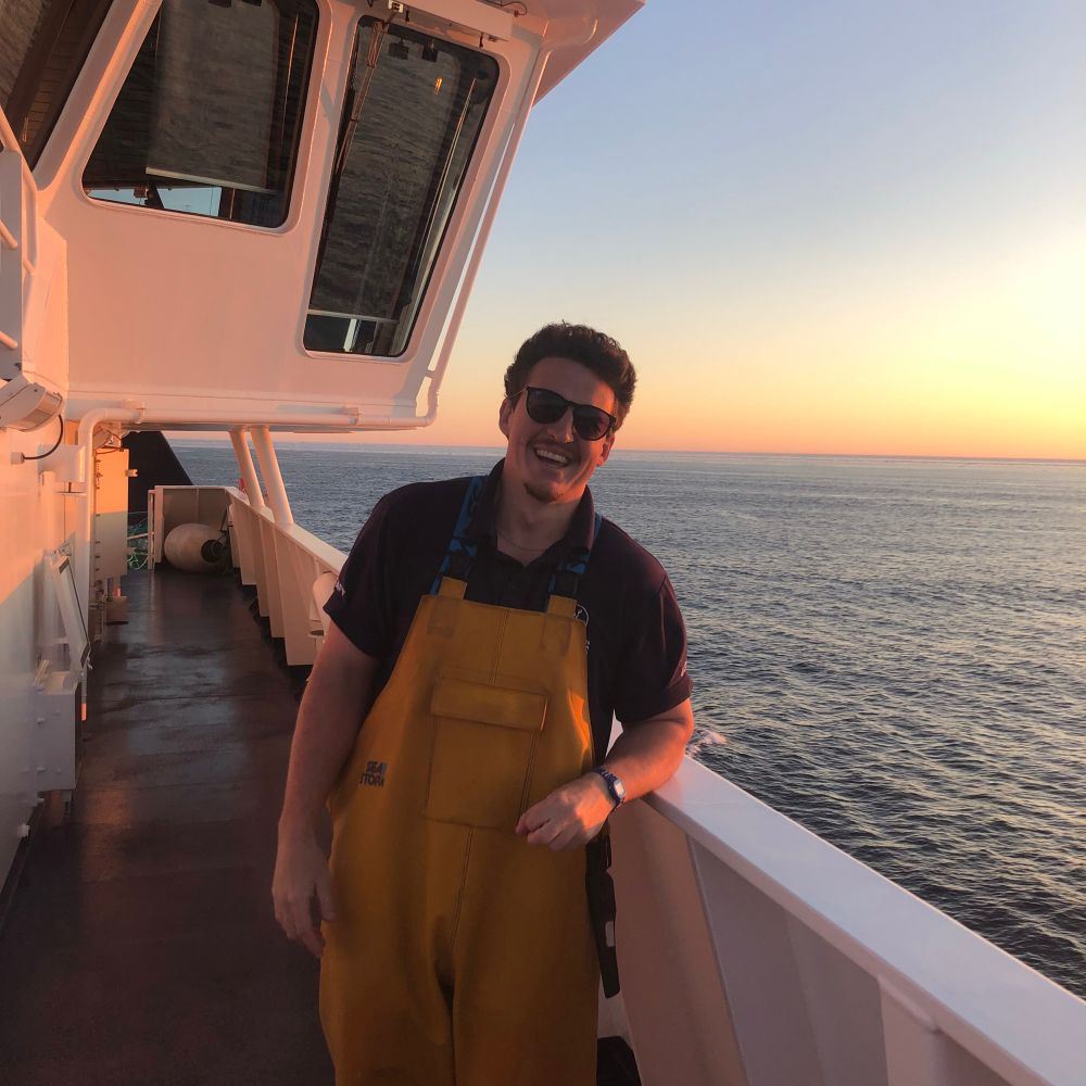
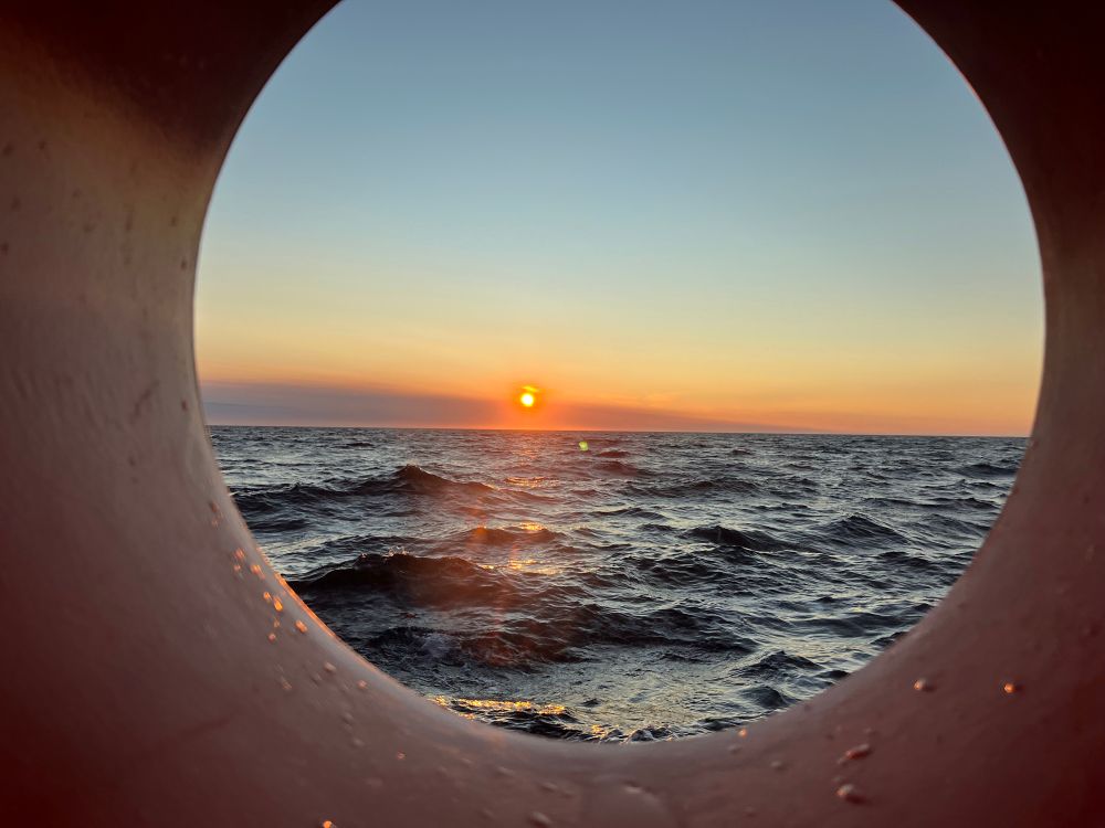
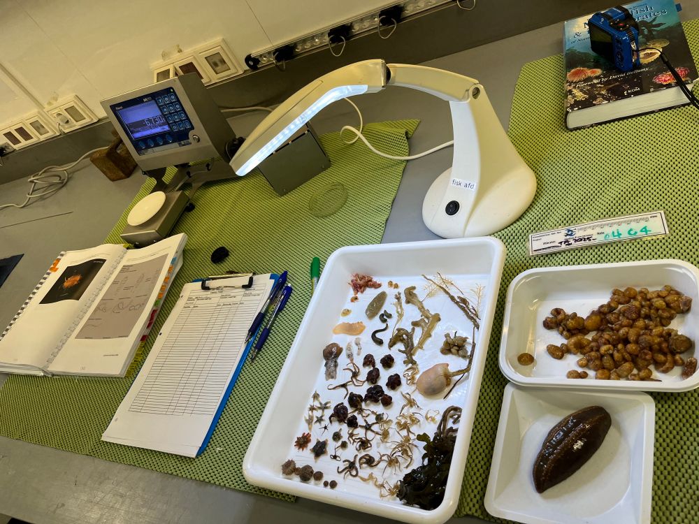
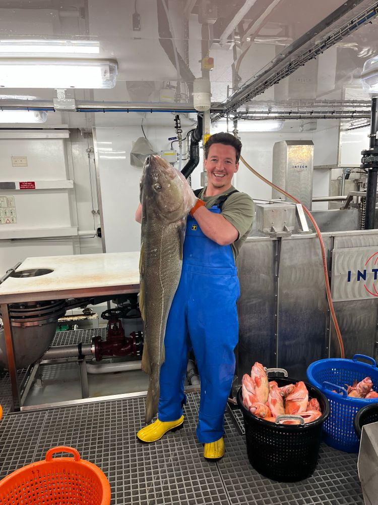
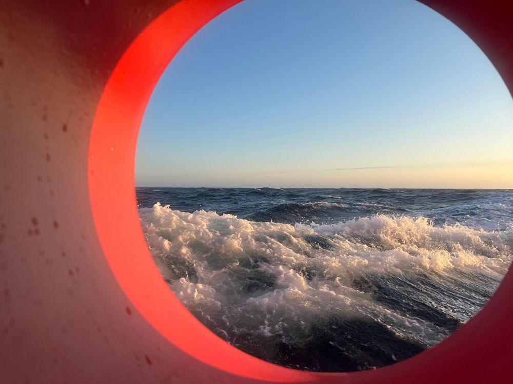
Have spent an amazing time these last few weeks as Benthic Taxonomist on the RV Tarajoq as part of their annual surveys of the Greenlandic 🇬🇱 Shrimp and Cod! It is always such a privilege and always reminds me how much I love being at sea
July 22, 2025 at 2:50 PM
Have spent an amazing time these last few weeks as Benthic Taxonomist on the RV Tarajoq as part of their annual surveys of the Greenlandic 🇬🇱 Shrimp and Cod! It is always such a privilege and always reminds me how much I love being at sea
Counting Walruses from space? #BIOSPACE25 @esa.int using commercially available Very High resolution satellite data with citizen science and validation with in situ drone data

February 13, 2025 at 10:43 AM
Counting Walruses from space? #BIOSPACE25 @esa.int using commercially available Very High resolution satellite data with citizen science and validation with in situ drone data
Genetics from space?? #BIOSPACE25 @esa.int Genetics, of course, not possible to be sampled from Satellite observations 🛰️ but habitats can be defined and mapped

February 13, 2025 at 10:22 AM
Genetics from space?? #BIOSPACE25 @esa.int Genetics, of course, not possible to be sampled from Satellite observations 🛰️ but habitats can be defined and mapped
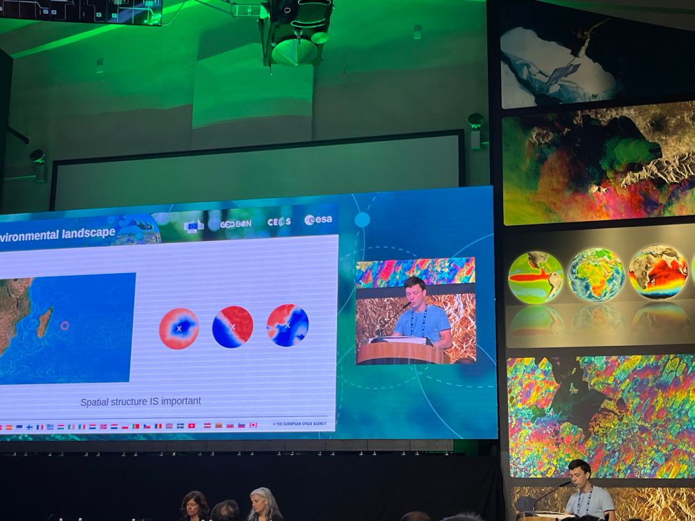
Now moving into the open ocean for modelling but considering local structure #BIOSPACE25 @esa.int work from the same lab (MARBEC @umontpellier.bsky.social) using image Convulutional neural networks to model fish 🐟 distributions
February 13, 2025 at 10:02 AM
Now moving into the open ocean for modelling but considering local structure #BIOSPACE25 @esa.int work from the same lab (MARBEC @umontpellier.bsky.social) using image Convulutional neural networks to model fish 🐟 distributions
Now we move onto Habitat Suitability and Species Distribution Modelling #BIOSPACE25 @esa.int here work at MARBEC lab using Neural Network transfer learning to predict abundance of Fish Species

February 13, 2025 at 9:53 AM
Now we move onto Habitat Suitability and Species Distribution Modelling #BIOSPACE25 @esa.int here work at MARBEC lab using Neural Network transfer learning to predict abundance of Fish Species
How depressing: 250 companies causing 73% of Ecosystem Damage globally #BIOSPACE25 @esa.int

February 13, 2025 at 8:26 AM
How depressing: 250 companies causing 73% of Ecosystem Damage globally #BIOSPACE25 @esa.int
Todays keynotes discussing Earth Observation for sustainability #BIOSPACE25 @esa.int Nature Positive and Economics of Conservation

February 13, 2025 at 8:04 AM
Todays keynotes discussing Earth Observation for sustainability #BIOSPACE25 @esa.int Nature Positive and Economics of Conservation
Victoire Martinez setting up the workshop on Marine Biodiversity from space #BIOSPACE25 @esa.int what are the specific needs to fulfil our science and policy needs

February 12, 2025 at 2:07 PM
Victoire Martinez setting up the workshop on Marine Biodiversity from space #BIOSPACE25 @esa.int what are the specific needs to fulfil our science and policy needs
The final talk of the Coastal Ecosystem is coming back to Seagrasses in the intertidal area, but specifically impacts of Marine and Terrestrial Heatwaves #BIOSPACE25 @esa.int using combinations of experimental assessments of seagrass with Satellite Remote Sensing 🛰️

February 12, 2025 at 12:33 PM
The final talk of the Coastal Ecosystem is coming back to Seagrasses in the intertidal area, but specifically impacts of Marine and Terrestrial Heatwaves #BIOSPACE25 @esa.int using combinations of experimental assessments of seagrass with Satellite Remote Sensing 🛰️
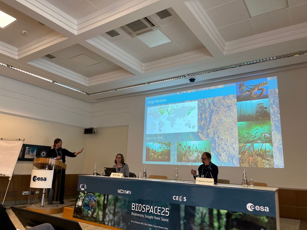
The Coastal Ecosystem session is moving a little bit further from the coast now: but not too far! #BIOSPACE25 @esa.int the first kelp forest assessment across British Columbia, Canada
February 12, 2025 at 12:12 PM
The Coastal Ecosystem session is moving a little bit further from the coast now: but not too far! #BIOSPACE25 @esa.int the first kelp forest assessment across British Columbia, Canada
Time to ‘get our feet wet’ in the Marine Ecosystem session #BIOSPACE25 @esa.int here discussing plankton communities around Florida

February 12, 2025 at 9:21 AM
Time to ‘get our feet wet’ in the Marine Ecosystem session #BIOSPACE25 @esa.int here discussing plankton communities around Florida
Today’s keynote discusses how None Government Organisations and Civil Societies can aid and influence Government strategies, guidelines and even laws using informative Remote Sensing to maximise conservation #BIOSPACE25 @esa.int 🛰️

February 12, 2025 at 8:03 AM
Today’s keynote discusses how None Government Organisations and Civil Societies can aid and influence Government strategies, guidelines and even laws using informative Remote Sensing to maximise conservation #BIOSPACE25 @esa.int 🛰️
Now we move on to foundational models for modelling soil biodiversity in comparison to tabular data 📊 🛰️ #BIOSPACE25 @esa.int so quick summary is: foundational modelling performs worse than high quality tabular data but could be a good alternative when in situ data are lacking

February 11, 2025 at 12:20 PM
Now we move on to foundational models for modelling soil biodiversity in comparison to tabular data 📊 🛰️ #BIOSPACE25 @esa.int so quick summary is: foundational modelling performs worse than high quality tabular data but could be a good alternative when in situ data are lacking
The session continues looking at biodiversity monitoring across different realms: terrestrial, coastal and marine #BIOSPACE25 @esa.int

February 11, 2025 at 11:33 AM
The session continues looking at biodiversity monitoring across different realms: terrestrial, coastal and marine #BIOSPACE25 @esa.int
Now it’s on to habitat mapping with Earth Observation #BIOSPACE25 @esa.int Current available data are lacking for model training, testing and validation, but perhaps more importantly there is a lack of consistency in model protocols 🧪 📊 🛰️

February 11, 2025 at 10:25 AM
Now it’s on to habitat mapping with Earth Observation #BIOSPACE25 @esa.int Current available data are lacking for model training, testing and validation, but perhaps more importantly there is a lack of consistency in model protocols 🧪 📊 🛰️
Kicking off this morning is the discussion of what is coming next in Satellite 🛰️ #BIOSPACE25 @esa.int will any of the new satellites be a Swiss Army knife, one satellite fits all?! Spoilers: No

February 11, 2025 at 7:58 AM
Kicking off this morning is the discussion of what is coming next in Satellite 🛰️ #BIOSPACE25 @esa.int will any of the new satellites be a Swiss Army knife, one satellite fits all?! Spoilers: No
How will we know if the curve of biodiversity loss is bending back towards sustainable goals? #BIOSPACE25 @esa.int Monitor Monitor Monitor at spatial and temporal scales that are essential for policy makers 🛰️🧪

February 10, 2025 at 4:45 PM
How will we know if the curve of biodiversity loss is bending back towards sustainable goals? #BIOSPACE25 @esa.int Monitor Monitor Monitor at spatial and temporal scales that are essential for policy makers 🛰️🧪
Straight to the necessity of this research #BIOSPACE25 @esa.int can we better inform and collaborate with all researchers in the field of biodiversity monitoring?

February 10, 2025 at 1:21 PM
Straight to the necessity of this research #BIOSPACE25 @esa.int can we better inform and collaborate with all researchers in the field of biodiversity monitoring?