


@batisterm.bsky.social
Creator of Relief Maps, a 3D GPS app for mountain sports 📱
🦋 @reliefmaps.bsky.social
🏔️ https://reliefmaps.io
🦋 @reliefmaps.bsky.social
🏔️ https://reliefmaps.io
Reposted

We have all seen the news about the L.A. fires. Satellite imagery help us understand how huge those fires are😢 Our thoughts are with all those affected.
#losangeles #fires images are from @esa.int
#losangeles #fires images are from @esa.int
January 14, 2025 at 2:07 PM
We have all seen the news about the L.A. fires. Satellite imagery help us understand how huge those fires are😢 Our thoughts are with all those affected.
#losangeles #fires images are from @esa.int
#losangeles #fires images are from @esa.int
Reposted
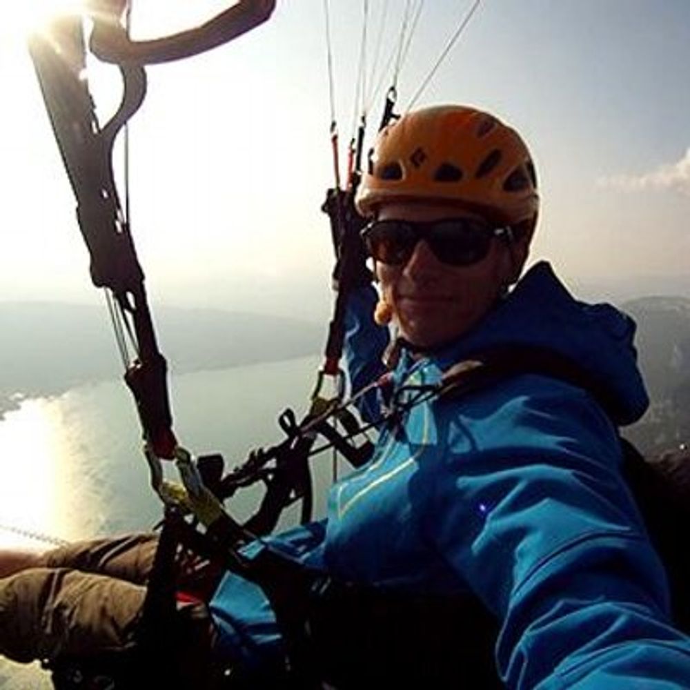
Backcountry skiing for Christmas is the best gift 🎁
Sharing good snow with my dad & bro. We use the app every time we go skiing and splitboarding, that's a good way to check what to improve!#reliefmaps #backcountryskiing #splitboarding
Sharing good snow with my dad & bro. We use the app every time we go skiing and splitboarding, that's a good way to check what to improve!#reliefmaps #backcountryskiing #splitboarding
December 29, 2024 at 11:32 AM
Backcountry skiing for Christmas is the best gift 🎁
Sharing good snow with my dad & bro. We use the app every time we go skiing and splitboarding, that's a good way to check what to improve!#reliefmaps #backcountryskiing #splitboarding
Sharing good snow with my dad & bro. We use the app every time we go skiing and splitboarding, that's a good way to check what to improve!#reliefmaps #backcountryskiing #splitboarding
Reposted

Quelle image du JWST!!
Uranus, ses anneaux, 14 de ces lunes, et des galaxies à perte de vue. On se rend vraiment compte de la profondeur de l'Univers!
Uranus, ses anneaux, 14 de ces lunes, et des galaxies à perte de vue. On se rend vraiment compte de la profondeur de l'Univers!
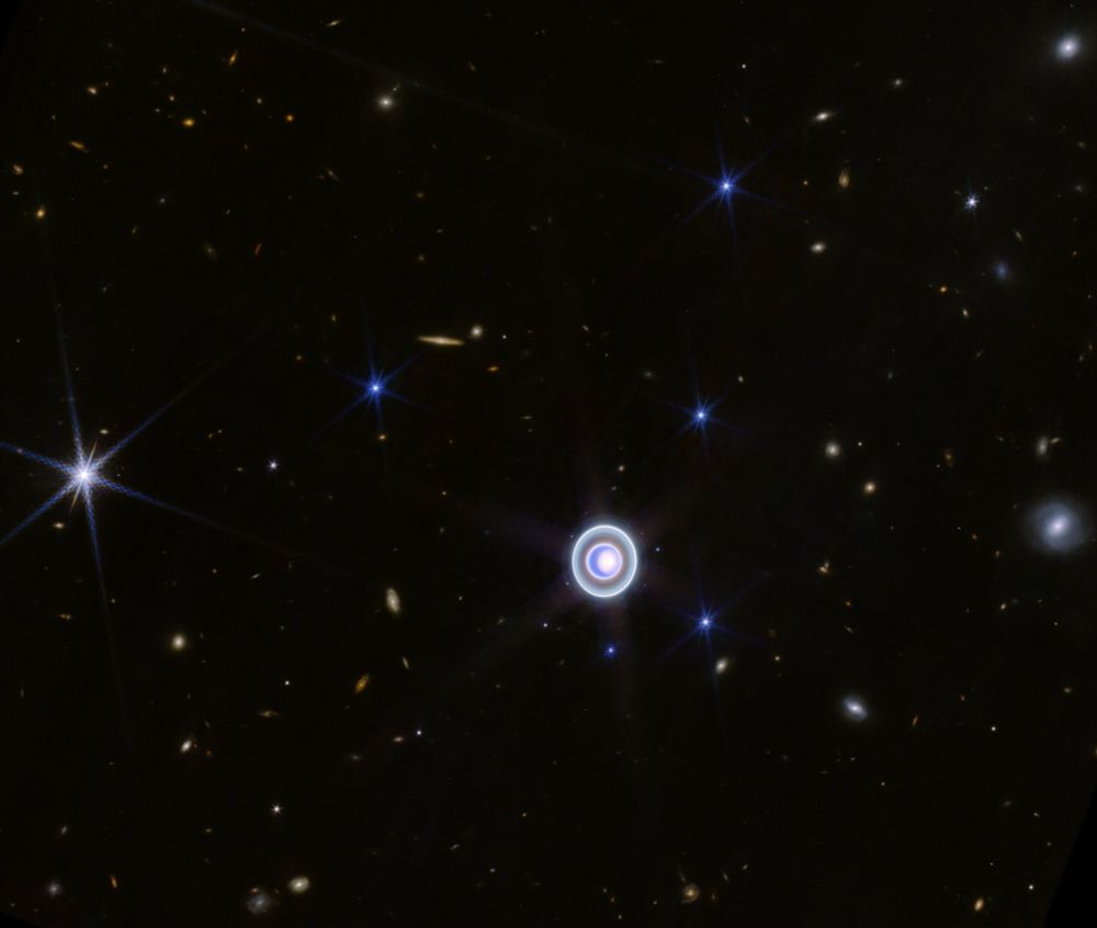
December 28, 2024 at 10:53 AM
Quelle image du JWST!!
Uranus, ses anneaux, 14 de ces lunes, et des galaxies à perte de vue. On se rend vraiment compte de la profondeur de l'Univers!
Uranus, ses anneaux, 14 de ces lunes, et des galaxies à perte de vue. On se rend vraiment compte de la profondeur de l'Univers!
Reposted
The new orientation layer is really good to highlight areas you want to avoid while skiing in the backcountry #reliefmaps #3DMaps #backcountry #ski
November 18, 2024 at 11:17 AM
The new orientation layer is really good to highlight areas you want to avoid while skiing in the backcountry #reliefmaps #3DMaps #backcountry #ski
Reposted
Hey Bluesky, we are thrilled to join this community. We are Relief Maps a 3D GPS app for mountain sports ! 🙌


November 18, 2024 at 10:53 AM
Hey Bluesky, we are thrilled to join this community. We are Relief Maps a 3D GPS app for mountain sports ! 🙌