


@argounesfab.bsky.social
jeudi 6 novembre, 19h30, à la Librairie l’Atelier, 2bis Rue du Jourdain. Présentation de l'Ouvrage "Méridiens, mesurer, partager, dominer le Monde", chez @cnrseditions.bsky.social Découvrons comment les méridiens furent successivement en marge ou au centre, un axe ou un bout du monde.

November 2, 2025 at 12:32 PM
jeudi 6 novembre, 19h30, à la Librairie l’Atelier, 2bis Rue du Jourdain. Présentation de l'Ouvrage "Méridiens, mesurer, partager, dominer le Monde", chez @cnrseditions.bsky.social Découvrons comment les méridiens furent successivement en marge ou au centre, un axe ou un bout du monde.
Très heureux de faire partie du lancement du très beau premier numéro de « Livraisons », magazine vidéo mensuel d' @aoc-media.bsky.social avec « Méridiens. Mesurer, partager, dominer le Monde » chez @cnrseditions.bsky.social


September 12, 2025 at 7:19 AM
Très heureux de faire partie du lancement du très beau premier numéro de « Livraisons », magazine vidéo mensuel d' @aoc-media.bsky.social avec « Méridiens. Mesurer, partager, dominer le Monde » chez @cnrseditions.bsky.social
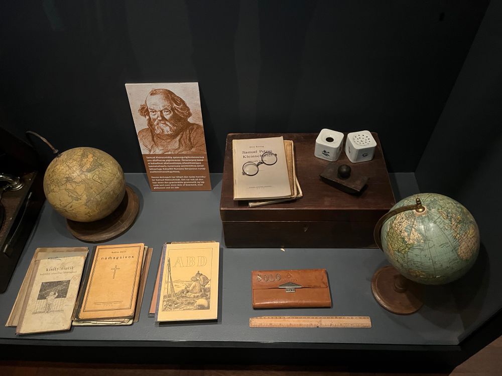
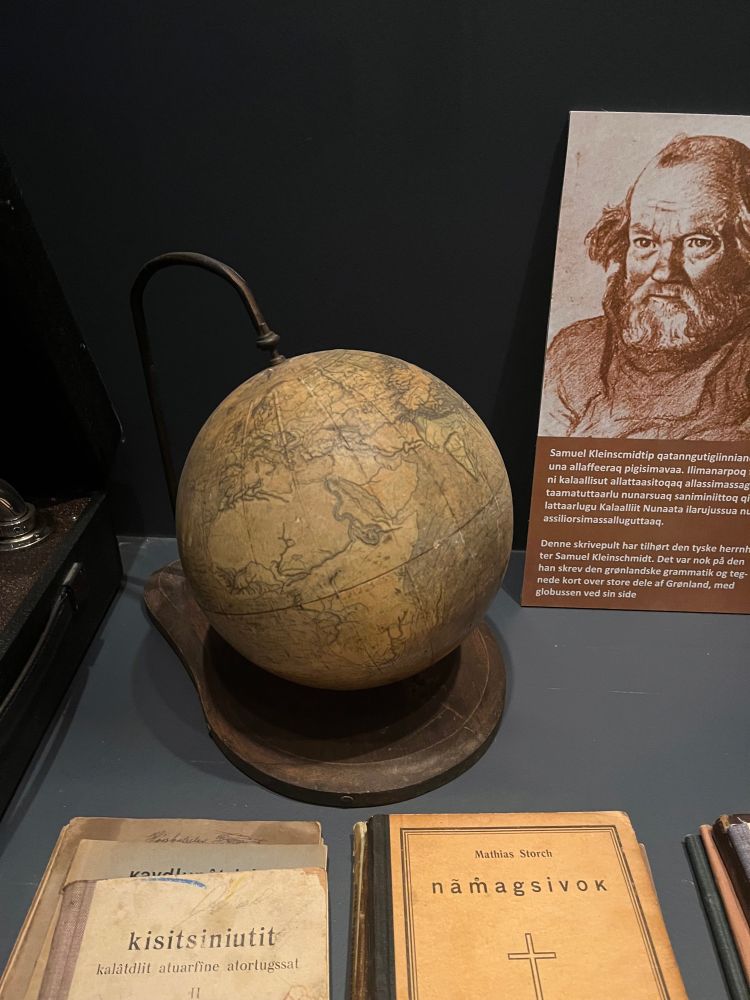
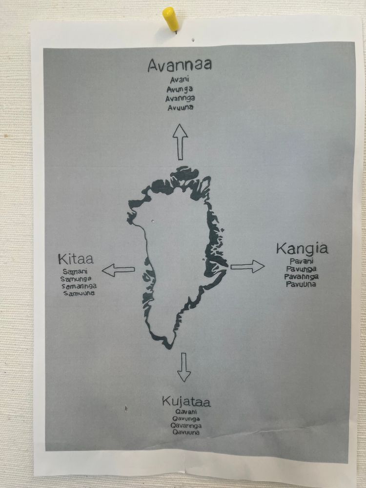
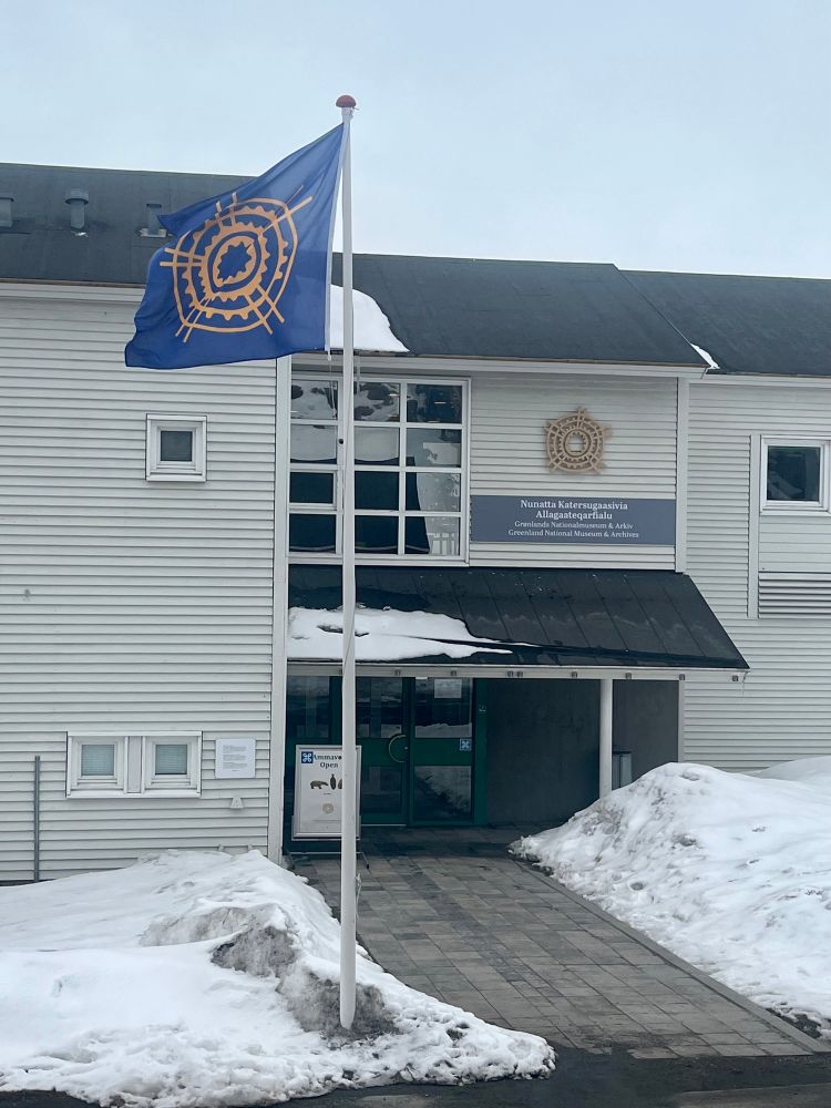
Une très belle rencontre avec les équipes du Musée national et des archives nationales du Groenland, pour parler médiations et visites scolaires au Groenland…. et aussi points cardinaux. De belles perspectives pour la géographie et son apprentissage.
@singaravelou.bsky.social
@singaravelou.bsky.social
May 7, 2025 at 3:20 PM
Une très belle rencontre avec les équipes du Musée national et des archives nationales du Groenland, pour parler médiations et visites scolaires au Groenland…. et aussi points cardinaux. De belles perspectives pour la géographie et son apprentissage.
@singaravelou.bsky.social
@singaravelou.bsky.social
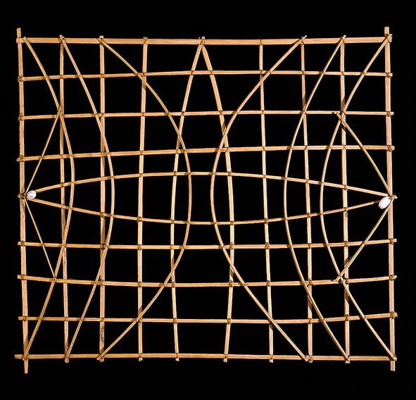
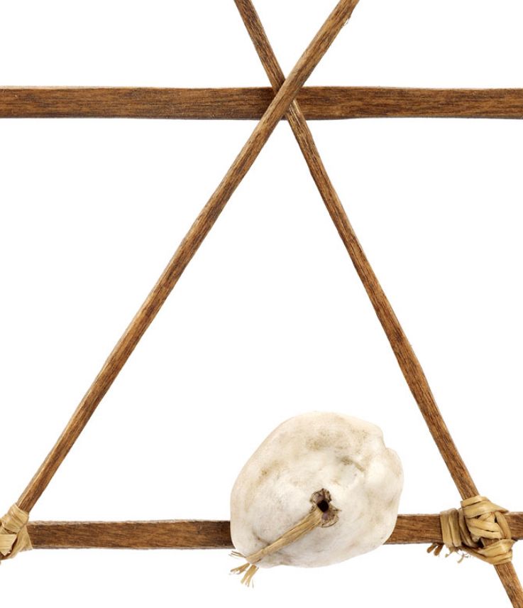
Comme les cartes Ammassalik, les stick charts de Micronésie témoignent d’une cartographie façonnée à partir de ressources locales et de connaissances partagées du territoire. Utilisées sur les Îles Marshall, ces cartes en bois et fibres de cocotier modélisent vagues, courants et positions des îles.
May 7, 2025 at 3:04 PM
Comme les cartes Ammassalik, les stick charts de Micronésie témoignent d’une cartographie façonnée à partir de ressources locales et de connaissances partagées du territoire. Utilisées sur les Îles Marshall, ces cartes en bois et fibres de cocotier modélisent vagues, courants et positions des îles.
1/3
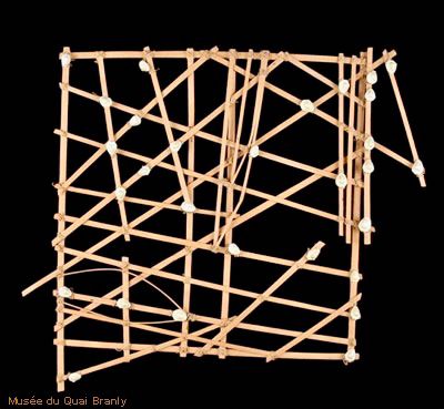
Voici un patrimoine exceptionnel qui sort
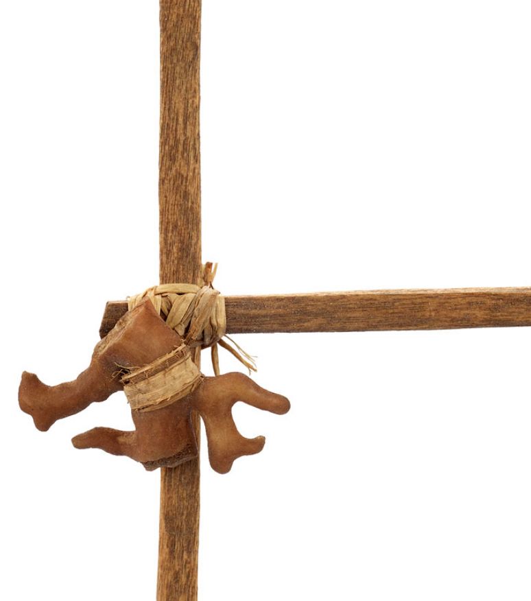
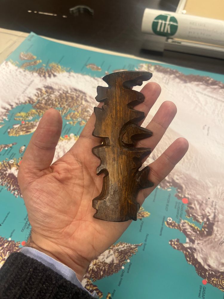
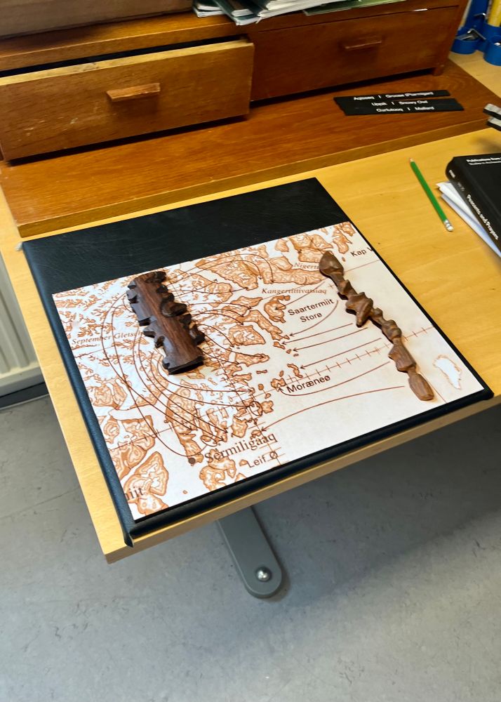
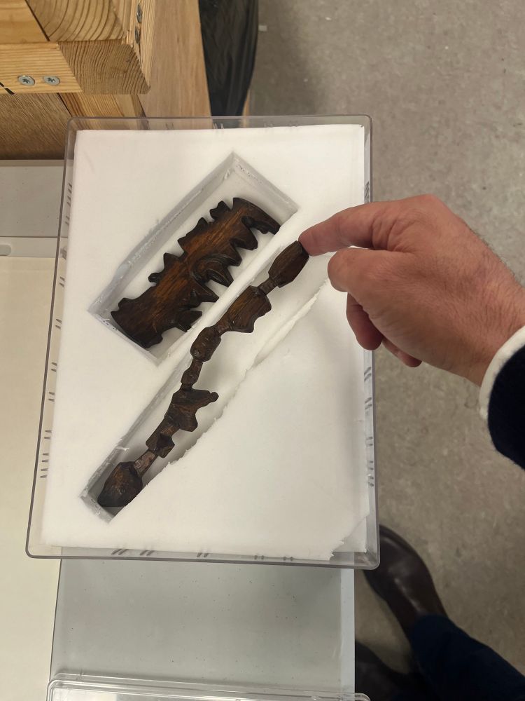
des réserves du Nationalmusuem and Archieve of Greenland pour notre exposition. Sculptées dans le bois par Kunit fra Umivik dans les années 1880, ces cartes tactiles représentent avec précision les côtes de l'est du Groenland.
Voici un patrimoine exceptionnel qui sort
des réserves du Nationalmusuem and Archieve of Greenland pour notre exposition. Sculptées dans le bois par Kunit fra Umivik dans les années 1880, ces cartes tactiles représentent avec précision les côtes de l'est du Groenland.
May 7, 2025 at 2:48 PM
1/3
Voici un patrimoine exceptionnel qui sort
des réserves du Nationalmusuem and Archieve of Greenland pour notre exposition. Sculptées dans le bois par Kunit fra Umivik dans les années 1880, ces cartes tactiles représentent avec précision les côtes de l'est du Groenland.
Voici un patrimoine exceptionnel qui sort
des réserves du Nationalmusuem and Archieve of Greenland pour notre exposition. Sculptées dans le bois par Kunit fra Umivik dans les années 1880, ces cartes tactiles représentent avec précision les côtes de l'est du Groenland.
Exceptional heritage from the National Museum & Archives of Greenland. Sculpted by Kunit fra Umivik in
the 1880s, these Ammassalik tactile maps of East Greenland blend , Inuit memory, and storytelling.
transmitted through touch.
#Ammassalik #Cartography #Greenland with Pierre Singaravélou
the 1880s, these Ammassalik tactile maps of East Greenland blend , Inuit memory, and storytelling.
transmitted through touch.
#Ammassalik #Cartography #Greenland with Pierre Singaravélou
May 7, 2025 at 2:45 PM
Exceptional heritage from the National Museum & Archives of Greenland. Sculpted by Kunit fra Umivik in
the 1880s, these Ammassalik tactile maps of East Greenland blend , Inuit memory, and storytelling.
transmitted through touch.
#Ammassalik #Cartography #Greenland with Pierre Singaravélou
the 1880s, these Ammassalik tactile maps of East Greenland blend , Inuit memory, and storytelling.
transmitted through touch.
#Ammassalik #Cartography #Greenland with Pierre Singaravélou
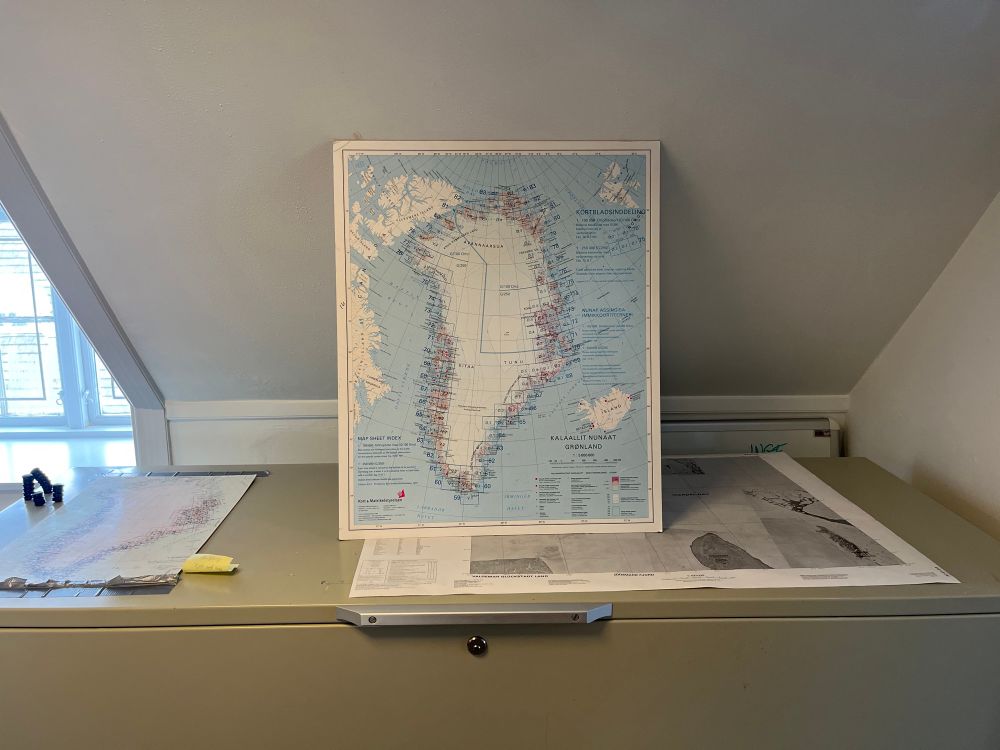
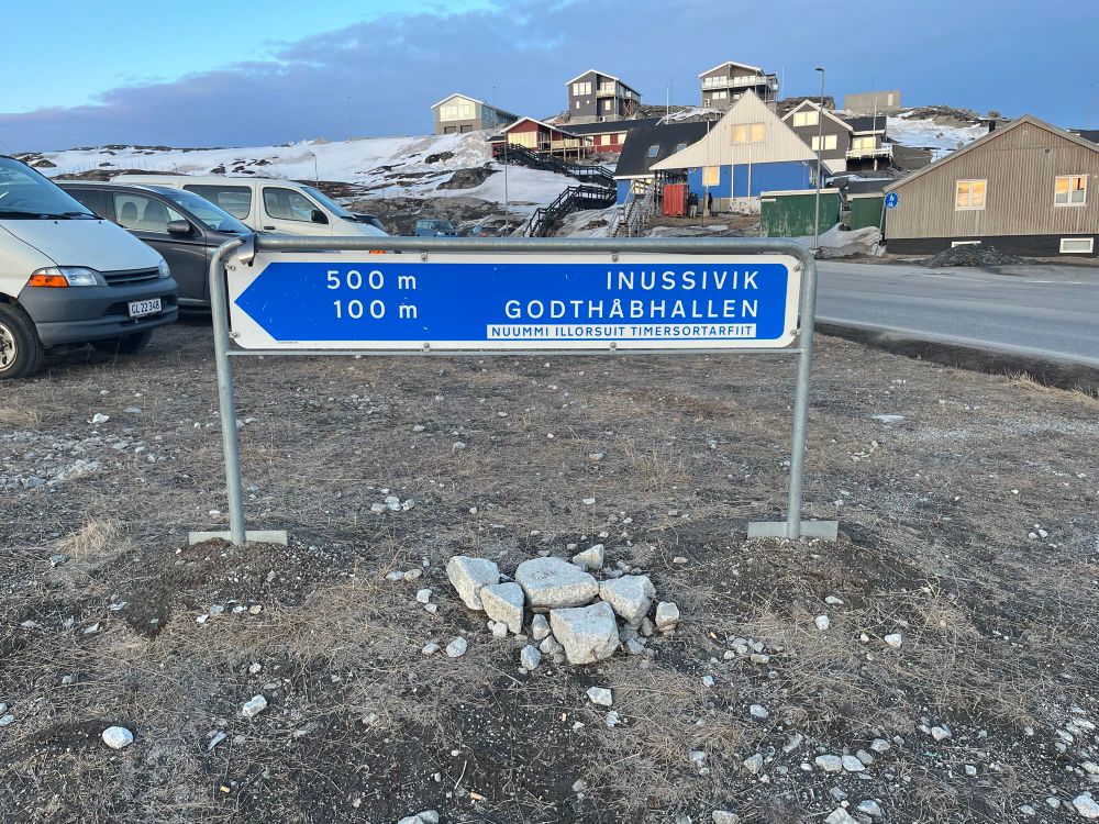
In Greenland, roads lead nowhere.
Each town or village is like an island on land. The absence of intercity roads is a geographic constraint: deep fords, steep mountains, and glaciers make continuous infrastructure nearly impossible. Access is by sea or air.
Each town or village is like an island on land. The absence of intercity roads is a geographic constraint: deep fords, steep mountains, and glaciers make continuous infrastructure nearly impossible. Access is by sea or air.
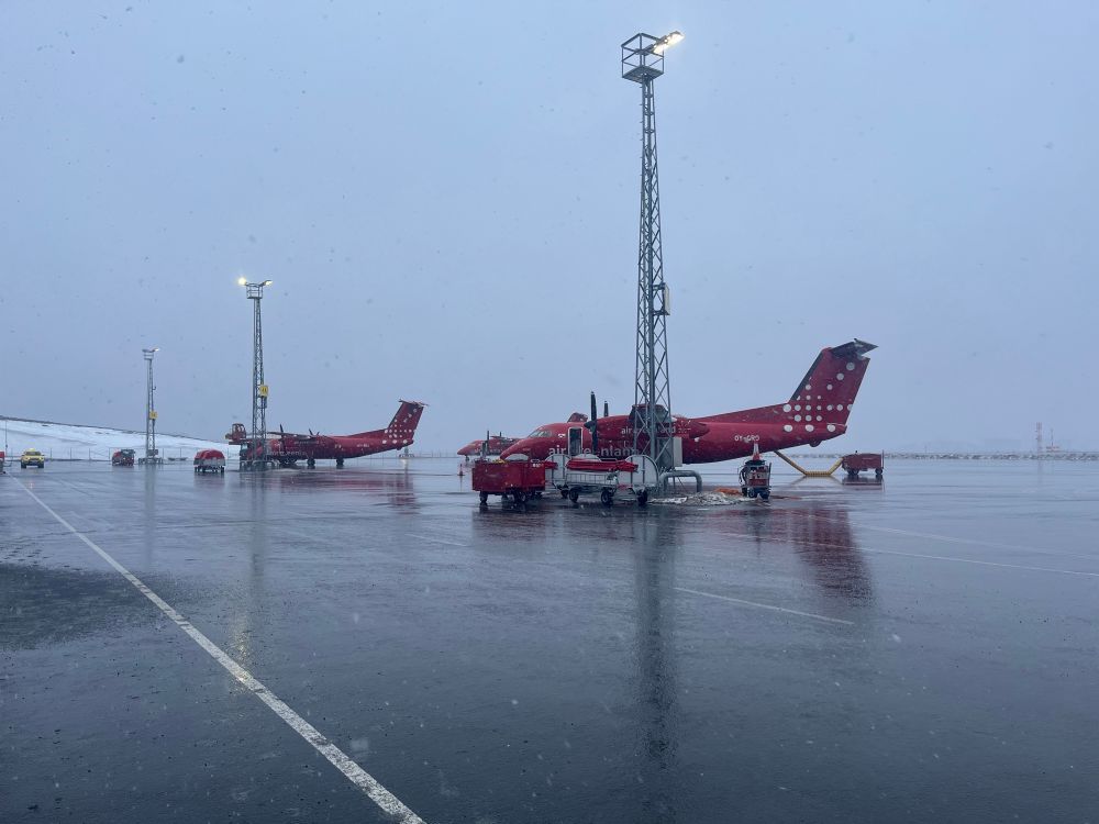
May 7, 2025 at 2:40 PM
In Greenland, roads lead nowhere.
Each town or village is like an island on land. The absence of intercity roads is a geographic constraint: deep fords, steep mountains, and glaciers make continuous infrastructure nearly impossible. Access is by sea or air.
Each town or village is like an island on land. The absence of intercity roads is a geographic constraint: deep fords, steep mountains, and glaciers make continuous infrastructure nearly impossible. Access is by sea or air.