Adam Clark
banner
adamd-clark.bsky.social
Adam Clark
@adamd-clark.bsky.social
TAMU 26' | Meteorology | tamscams/tasc | Atmospheric Electricity Enthusiast | Photography |
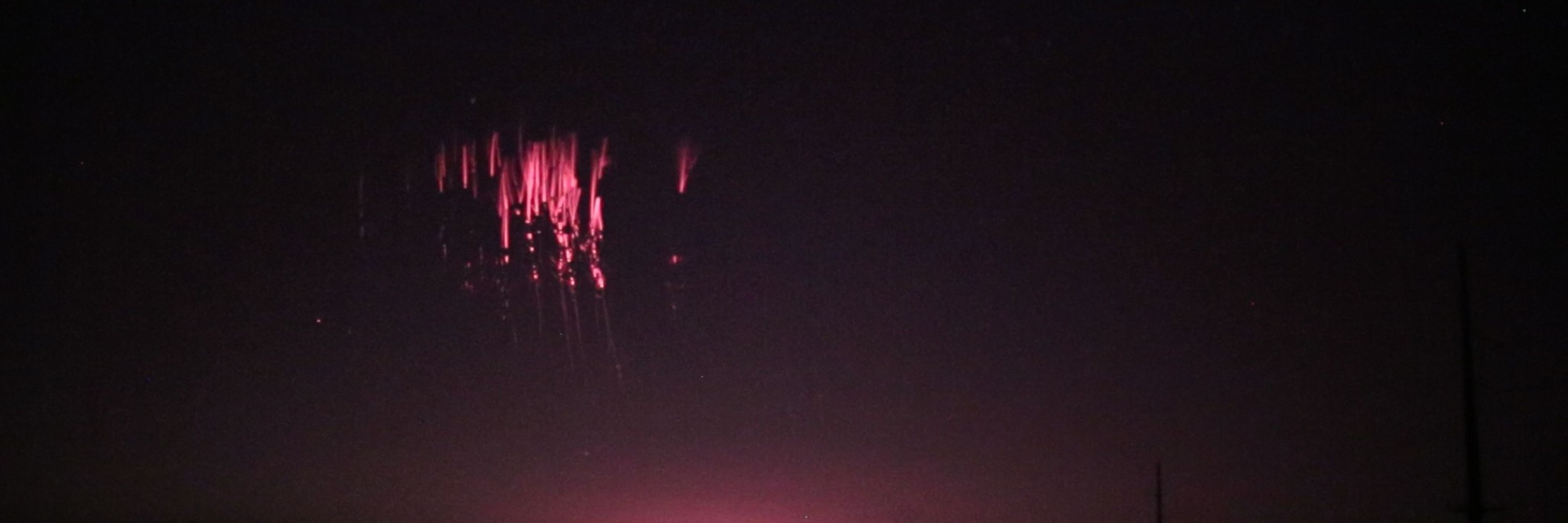
Went out for lightning a few days ago and got this nice flash. Still working on fixing my settings, but this was a huge success for me!
June 11, 2025 at 9:27 PM
This project took forever, but I'm glad I have it functional now. Well functional enough to generate 50 images before eating all of my RAM. Enjoy the shabby True-Color and pseudo-5 minute flash density.
April 16, 2025 at 1:44 AM
Let's see if this one actually plays..😵‍💫
April 6, 2025 at 4:05 AM
Just spent all day writing/borrowing code to create this loop for an MCS over the gulf. I believe the yellow and red points are from miscalculations from scan point to degrees lat/lon, but I see this as a win. Took my computer 24 minutes to make this though and files weighed ~7.3 gbs. Too much imo
April 6, 2025 at 4:03 AM
My dad sent me these pictures of big time ice accumulation on radio towers in Cedar Hill, Tx. Being downstream of a mesoscale β lake effect snow band is likely the culprit. Fascinating and uncommon imagery in north Texas.
February 20, 2025 at 4:38 PM
Had an awesome trip to Denver and learned some helpful lessons while there! Namely: Don't attempt to hike an 8000' mountain in the winter without spikes and winter clothes, especially if you're from Texas and have not gotten used to the altitude.
December 20, 2024 at 8:21 PM
The sun setting on an absolute beauty of a closed low over the Great Lakes. It's imagery like this that get me stoked for GOES-19 data to become more readily available.
November 21, 2024 at 8:38 PM
This is a shot in the dark, but does anyone know if the time from the GOES-R data from AWS is correct? Example time, image, and UCAR radar image closest in time. I'm using ABI-L2-CMIPC data as a proxy for longwave IR. If anyone has any experience with this data, your input is greatly appreciated!
November 20, 2024 at 3:42 AM
USAGI is weakening right now (probably undergoing an EWRC), but at it's peak, it was undoubtedly a Super Typhoon. Really wish they had some sort of reconnaissance, because that pressure could be much lower than the JTWC's estimated 915 mb.
November 13, 2024 at 9:40 PM
Starting to see the 00Z deterministic models (namely the GFS/ICON) favoring this northern area of low-level vorticity just off the coast of Haiti. While they suggest this wave will continue to be strung out, a further north launch point keeps it over waters for longer.
November 12, 2024 at 4:26 AM
That was meant to be a gif lol. The orange L is where I analyzed the MLC, red dashed (pen) is about where the EW is according to the NHC 12Z, red dashed (highlighted) is an extension of the ITCZ, and yellow arrows represent the sfc flow.
November 11, 2024 at 6:45 PM
I don't think there's enough attention on this disturbance south of Hispaniola. Notable SE and SW sfc winds, as well as an mid-level center over Isla Beata, DR. While it's still likely an open wave at this point, it'll be interesting to see how fast it can organize later this week.
November 11, 2024 at 6:37 PM