


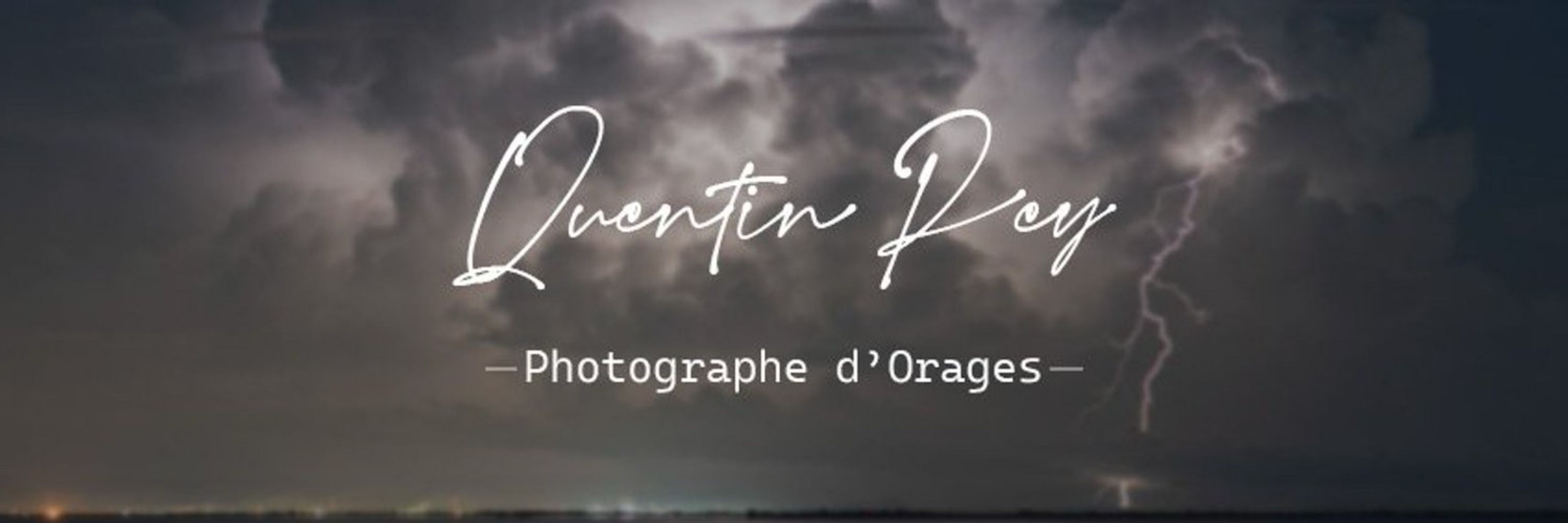

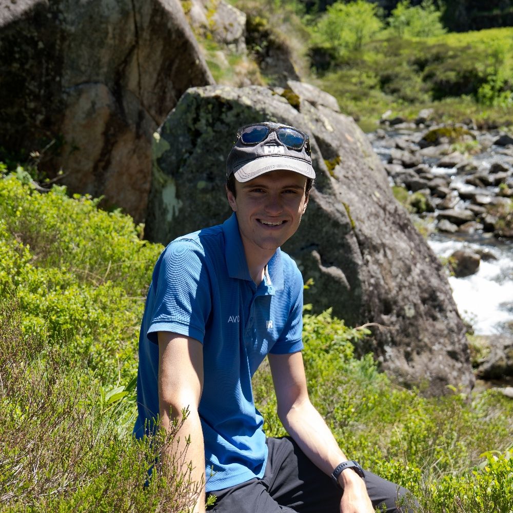
Quentin Rey Photography
@quentinrey.com
Storm Chase & Photography 📷⛈️🌪️
Severe Weather Enthusiast 🌩️
Nature, weather, climate 🌱⛅️🌍
Website : https://photo.quentinrey.com
--------
Adhérent @infoclimat.fr
Contributeur @visov1.bsky.social
Severe Weather Enthusiast 🌩️
Nature, weather, climate 🌱⛅️🌍
Website : https://photo.quentinrey.com
--------
Adhérent @infoclimat.fr
Contributeur @visov1.bsky.social
Pinned
Quentin Rey Photography
@quentinrey.com
· Jun 30

Soutenez Quentin Rey - Photographe d'Orages sur Tipeee
Tipeee est la platforme n°1 en Europe de financement participatif pour les Créateurs de contenus
fr.tipeee.com
Bonjour ! 👋
Je viens d'ouvrir une page Tipeee permettant à celle et ceux qui le veulent / peuvent de soutenir financièrement mon activité de photographe d'orage ! 📷
Toute participation sera la bienvenue ! ✨
Je vous remercie par avance ! 🙏
Orageusement votre,
Quentin
Je viens d'ouvrir une page Tipeee permettant à celle et ceux qui le veulent / peuvent de soutenir financièrement mon activité de photographe d'orage ! 📷
Toute participation sera la bienvenue ! ✨
Je vous remercie par avance ! 🙏
Orageusement votre,
Quentin
Reposted by Quentin Rey Photography
Photographier la foudre implique parfois de composer avec la pluie, une contrainte qui complique sérieusement la prise de vue. En témoignent ces deux clichés saisis lors de la nuit orageuse du 19 au 20 avril 2025 !


February 13, 2026 at 9:00 AM
Photographier la foudre implique parfois de composer avec la pluie, une contrainte qui complique sérieusement la prise de vue. En témoignent ces deux clichés saisis lors de la nuit orageuse du 19 au 20 avril 2025 !
Photographier la foudre implique parfois de composer avec la pluie, une contrainte qui complique sérieusement la prise de vue. En témoignent ces deux clichés saisis lors de la nuit orageuse du 19 au 20 avril 2025 !
February 13, 2026 at 9:00 AM
Photographier la foudre implique parfois de composer avec la pluie, une contrainte qui complique sérieusement la prise de vue. En témoignent ces deux clichés saisis lors de la nuit orageuse du 19 au 20 avril 2025 !
Reposted by Quentin Rey Photography

#DirectSE
🌬️Fin de la #VigilanceRouge sur l'Aude et les Pyrénées-Orientales
➡️On relève des rafales maximales globalement entre 140 et 160 km/h
⚠️🟠#VigilanceOrange toujours en cours sur ces départements, l'Hérault et la Corse.
🌬️Fin de la #VigilanceRouge sur l'Aude et les Pyrénées-Orientales
➡️On relève des rafales maximales globalement entre 140 et 160 km/h
⚠️🟠#VigilanceOrange toujours en cours sur ces départements, l'Hérault et la Corse.

February 12, 2026 at 1:09 PM
#DirectSE
🌬️Fin de la #VigilanceRouge sur l'Aude et les Pyrénées-Orientales
➡️On relève des rafales maximales globalement entre 140 et 160 km/h
⚠️🟠#VigilanceOrange toujours en cours sur ces départements, l'Hérault et la Corse.
🌬️Fin de la #VigilanceRouge sur l'Aude et les Pyrénées-Orientales
➡️On relève des rafales maximales globalement entre 140 et 160 km/h
⚠️🟠#VigilanceOrange toujours en cours sur ces départements, l'Hérault et la Corse.
Reposted by Quentin Rey Photography
Le vent moyen 10 min a également était remarquable dépassant les 100km/h sur la station de Lézignan, proche de la tempête Klaus.
Clairement une tempête remarquable avec de très nombreux dégâts dans l'Aude et les Pyrénées-Orientales.
Clairement une tempête remarquable avec de très nombreux dégâts dans l'Aude et les Pyrénées-Orientales.
#DirectSE
🌬️Fin de la #VigilanceRouge sur l'Aude et les Pyrénées-Orientales
➡️On relève des rafales maximales globalement entre 140 et 160 km/h
⚠️🟠#VigilanceOrange toujours en cours sur ces départements, l'Hérault et la Corse.
🌬️Fin de la #VigilanceRouge sur l'Aude et les Pyrénées-Orientales
➡️On relève des rafales maximales globalement entre 140 et 160 km/h
⚠️🟠#VigilanceOrange toujours en cours sur ces départements, l'Hérault et la Corse.
February 12, 2026 at 1:58 PM
Le vent moyen 10 min a également était remarquable dépassant les 100km/h sur la station de Lézignan, proche de la tempête Klaus.
Clairement une tempête remarquable avec de très nombreux dégâts dans l'Aude et les Pyrénées-Orientales.
Clairement une tempête remarquable avec de très nombreux dégâts dans l'Aude et les Pyrénées-Orientales.
Reposted by Quentin Rey Photography

Vigilance ROUGE avalanches sur la Haute Tarentaise, en Savoie.
C'est seulement la troisième fois en 25 ans que ce niveau de vigilance est atteint pour le paramètre avalanches.
> 15 et 16 janvier 2013 en Aspe Ossau et Haute Bigorre.
> 8 et 9 janvier 2018 en Haute Maurienne.
C'est seulement la troisième fois en 25 ans que ce niveau de vigilance est atteint pour le paramètre avalanches.
> 15 et 16 janvier 2013 en Aspe Ossau et Haute Bigorre.
> 8 et 9 janvier 2018 en Haute Maurienne.

February 11, 2026 at 8:11 PM
Vigilance ROUGE avalanches sur la Haute Tarentaise, en Savoie.
C'est seulement la troisième fois en 25 ans que ce niveau de vigilance est atteint pour le paramètre avalanches.
> 15 et 16 janvier 2013 en Aspe Ossau et Haute Bigorre.
> 8 et 9 janvier 2018 en Haute Maurienne.
C'est seulement la troisième fois en 25 ans que ce niveau de vigilance est atteint pour le paramètre avalanches.
> 15 et 16 janvier 2013 en Aspe Ossau et Haute Bigorre.
> 8 et 9 janvier 2018 en Haute Maurienne.
Reposted by Quentin Rey Photography
🔴 Savoie : Vigilance rouge avalanches ce jeudi dès 6h.
⚠️ De très grandes avalanches pourraient se produire et atteindre des routes, des infrastructures, voire des habitations.
➡️ Soyez vigilants, restez informés : vigilance.meteofrance.fr/fr
⚠️ De très grandes avalanches pourraient se produire et atteindre des routes, des infrastructures, voire des habitations.
➡️ Soyez vigilants, restez informés : vigilance.meteofrance.fr/fr

February 11, 2026 at 8:24 PM
🔴 Savoie : Vigilance rouge avalanches ce jeudi dès 6h.
⚠️ De très grandes avalanches pourraient se produire et atteindre des routes, des infrastructures, voire des habitations.
➡️ Soyez vigilants, restez informés : vigilance.meteofrance.fr/fr
⚠️ De très grandes avalanches pourraient se produire et atteindre des routes, des infrastructures, voire des habitations.
➡️ Soyez vigilants, restez informés : vigilance.meteofrance.fr/fr
🔴 Et hop, vigilance rouge avalanche pour la Savoie ! ❄️
Pensée à nos secours et toutes les personnes sur le pont pour gérer ces événements !
On va faire de la veille et du suivi ave l'association @visov1.bsky.social concernant ces différents phénomènes et suivi sur les forums @infoclimat.fr !
Pensée à nos secours et toutes les personnes sur le pont pour gérer ces événements !
On va faire de la veille et du suivi ave l'association @visov1.bsky.social concernant ces différents phénomènes et suivi sur les forums @infoclimat.fr !
Et de 3, la Savoie passe en vigilance rouge pour une situation avalancheuse remarquable, "et même exceptionnelle jeudi sur la Haute-Tarentaise et près du Mont-Blanc" sic @meteofrance.com

February 11, 2026 at 7:17 PM
🔴 Et hop, vigilance rouge avalanche pour la Savoie ! ❄️
Pensée à nos secours et toutes les personnes sur le pont pour gérer ces événements !
On va faire de la veille et du suivi ave l'association @visov1.bsky.social concernant ces différents phénomènes et suivi sur les forums @infoclimat.fr !
Pensée à nos secours et toutes les personnes sur le pont pour gérer ces événements !
On va faire de la veille et du suivi ave l'association @visov1.bsky.social concernant ces différents phénomènes et suivi sur les forums @infoclimat.fr !
Reposted by Quentin Rey Photography

A high-resolution look at Tropical Cyclone Gezani's eye from yesterday before the storm made landfall in eastern Madagascar.

February 11, 2026 at 3:19 PM
A high-resolution look at Tropical Cyclone Gezani's eye from yesterday before the storm made landfall in eastern Madagascar.
🔴🍃💦
Vigilance Rouge pour Vent pour : Aude
Vigilance Rouge Crues pour : Gironde, Lot-et-Garonne
Restez informé/es : vigilance.meteofrance.fr
Vigilance Rouge pour Vent pour : Aude
Vigilance Rouge Crues pour : Gironde, Lot-et-Garonne
Restez informé/es : vigilance.meteofrance.fr

February 11, 2026 at 3:10 PM
🔴🍃💦
Vigilance Rouge pour Vent pour : Aude
Vigilance Rouge Crues pour : Gironde, Lot-et-Garonne
Restez informé/es : vigilance.meteofrance.fr
Vigilance Rouge pour Vent pour : Aude
Vigilance Rouge Crues pour : Gironde, Lot-et-Garonne
Restez informé/es : vigilance.meteofrance.fr
Reposted by Quentin Rey Photography

Le dynamisme d'altitude de la #tempêteNils fonce plein pot depuis l'atlantique rattrapant l'air doux de basse couche d'origine subtropicale. Dès ce soir fortes pluies et orages possibles depuis l'ouest avec localement convection sévère possible. Nils occasionnera de sérieuses intempéries.
February 11, 2026 at 2:59 PM
Le dynamisme d'altitude de la #tempêteNils fonce plein pot depuis l'atlantique rattrapant l'air doux de basse couche d'origine subtropicale. Dès ce soir fortes pluies et orages possibles depuis l'ouest avec localement convection sévère possible. Nils occasionnera de sérieuses intempéries.
Reposted by Quentin Rey Photography
⚠️ Prudence, la tempête Nils touche le littoral atlantique de mercredi soir à jeudi, puis en journée de jeudi le pourtour méditerranéen et la Corse.
Rafales possibles :
➡️120 à 140 km/h sur le littoral aquitain et charentais
➡️130 à 150 km/h du Roussillon à l'Aude
👉 meteofrance.com/actualites-e...
Rafales possibles :
➡️120 à 140 km/h sur le littoral aquitain et charentais
➡️130 à 150 km/h du Roussillon à l'Aude
👉 meteofrance.com/actualites-e...

February 11, 2026 at 12:26 PM
⚠️ Prudence, la tempête Nils touche le littoral atlantique de mercredi soir à jeudi, puis en journée de jeudi le pourtour méditerranéen et la Corse.
Rafales possibles :
➡️120 à 140 km/h sur le littoral aquitain et charentais
➡️130 à 150 km/h du Roussillon à l'Aude
👉 meteofrance.com/actualites-e...
Rafales possibles :
➡️120 à 140 km/h sur le littoral aquitain et charentais
➡️130 à 150 km/h du Roussillon à l'Aude
👉 meteofrance.com/actualites-e...
🍃🟠🔴 La vigilance rouge vent n'est pas exclue sur l'Aude et les Pyrénées-Orientales, il faudra suivre l'actualisation du bulletin de vigilance @meteofrance.com à 16h !

La dépression Nils gagne par l'ouest cet après-midi. Son front froid va aborder dans quelques heures les côtes de l'Atlantique.
Dans ce flux d'ouest rapide, on observe l'effet de foehn marqué et les ondes orographiques sur les reliefs sous le vent du sud-est du pays.
Image sat Eumetsat
Dans ce flux d'ouest rapide, on observe l'effet de foehn marqué et les ondes orographiques sur les reliefs sous le vent du sud-est du pays.
Image sat Eumetsat
February 11, 2026 at 2:46 PM
🍃🟠🔴 La vigilance rouge vent n'est pas exclue sur l'Aude et les Pyrénées-Orientales, il faudra suivre l'actualisation du bulletin de vigilance @meteofrance.com à 16h !
Reposted by Quentin Rey Photography

🌧La séquence pluvieuse se poursuit, avec déjà de nombreuses crues de cours d'eau, comme ici avec la Garonne à Toulouse (31) (merci à Matthieu pour les photos), et le Célé à Bagnac-sur-Célé (46).
Les cumuls depuis lundi 7h atteignent :
121 mm au Falgoux (15)
93 mm à Pérols-sur-Vézère (19)
Les cumuls depuis lundi 7h atteignent :
121 mm au Falgoux (15)
93 mm à Pérols-sur-Vézère (19)


February 11, 2026 at 2:16 PM
🌧La séquence pluvieuse se poursuit, avec déjà de nombreuses crues de cours d'eau, comme ici avec la Garonne à Toulouse (31) (merci à Matthieu pour les photos), et le Célé à Bagnac-sur-Célé (46).
Les cumuls depuis lundi 7h atteignent :
121 mm au Falgoux (15)
93 mm à Pérols-sur-Vézère (19)
Les cumuls depuis lundi 7h atteignent :
121 mm au Falgoux (15)
93 mm à Pérols-sur-Vézère (19)
Reposted by Quentin Rey Photography

Sans surprise, les vigilances crues, pluie-inondation, vent et désormais avalanche progressent franchement en ce mercredi matin. La Garonne connait une belle crue, tandis que la tempête Nils qui arrive ce soir sur la cote Aquitaine promet d'être sévère notamment sur Aude et PO + reliefs héraultais.


February 11, 2026 at 9:19 AM
Sans surprise, les vigilances crues, pluie-inondation, vent et désormais avalanche progressent franchement en ce mercredi matin. La Garonne connait une belle crue, tandis que la tempête Nils qui arrive ce soir sur la cote Aquitaine promet d'être sévère notamment sur Aude et PO + reliefs héraultais.
Reposted by Quentin Rey Photography
Vigilance orange avalanches sur 12 massifs des Alpes, du Champsaur au Chablais.
Pic d'activité avalancheuse attendu jeudi. Situation à suivre tout particulièrement dans le massif du Mont Blanc où une activité avalancheuse exceptionnelle n'est pas exclue.
Pic d'activité avalancheuse attendu jeudi. Situation à suivre tout particulièrement dans le massif du Mont Blanc où une activité avalancheuse exceptionnelle n'est pas exclue.

February 11, 2026 at 10:03 AM
Vigilance orange avalanches sur 12 massifs des Alpes, du Champsaur au Chablais.
Pic d'activité avalancheuse attendu jeudi. Situation à suivre tout particulièrement dans le massif du Mont Blanc où une activité avalancheuse exceptionnelle n'est pas exclue.
Pic d'activité avalancheuse attendu jeudi. Situation à suivre tout particulièrement dans le massif du Mont Blanc où une activité avalancheuse exceptionnelle n'est pas exclue.
Reposted by Quentin Rey Photography
Depuis quelques jours, le mode "infra-horaire" des stations @meteofrance.com est disponible sur Infoclimat ! 😍
Pour cela, un "bouton magique" 🔴 a été ajouté sur les pages temps réel, à la fois pour les tableaux et les graphiques.
Pour cela, un "bouton magique" 🔴 a été ajouté sur les pages temps réel, à la fois pour les tableaux et les graphiques.

February 4, 2026 at 9:57 AM
Depuis quelques jours, le mode "infra-horaire" des stations @meteofrance.com est disponible sur Infoclimat ! 😍
Pour cela, un "bouton magique" 🔴 a été ajouté sur les pages temps réel, à la fois pour les tableaux et les graphiques.
Pour cela, un "bouton magique" 🔴 a été ajouté sur les pages temps réel, à la fois pour les tableaux et les graphiques.
Nouvelles photos ! 📷
Durant la nuit du 19 au 20 avril 2025, plusieurs orages se sont succédé. L'activité électrique était particulièrement esthétique, comme en témoigne cet éclair saisi quelques instants avant l'arrivée de la pluie ! ⛈️
Durant la nuit du 19 au 20 avril 2025, plusieurs orages se sont succédé. L'activité électrique était particulièrement esthétique, comme en témoigne cet éclair saisi quelques instants avant l'arrivée de la pluie ! ⛈️


February 4, 2026 at 9:17 AM
Nouvelles photos ! 📷
Durant la nuit du 19 au 20 avril 2025, plusieurs orages se sont succédé. L'activité électrique était particulièrement esthétique, comme en témoigne cet éclair saisi quelques instants avant l'arrivée de la pluie ! ⛈️
Durant la nuit du 19 au 20 avril 2025, plusieurs orages se sont succédé. L'activité électrique était particulièrement esthétique, comme en témoigne cet éclair saisi quelques instants avant l'arrivée de la pluie ! ⛈️
Reposted by Quentin Rey Photography
Voici un exemple de coup de foudre survenu dans la soirée du 19 avril 2025. Le plafond nuageux était bas, rendant difficile de distinguer clairement les impacts. J'ai profité de l'ambiance et ai tenté de photographier avant que la pluie n'atteigne ma position ! ⚡
#Photography #WxSky
#Photography #WxSky


January 29, 2026 at 9:21 AM
Voici un exemple de coup de foudre survenu dans la soirée du 19 avril 2025. Le plafond nuageux était bas, rendant difficile de distinguer clairement les impacts. J'ai profité de l'ambiance et ai tenté de photographier avant que la pluie n'atteigne ma position ! ⚡
#Photography #WxSky
#Photography #WxSky
January 29, 2026 at 9:21 AM
Voici un exemple de coup de foudre survenu dans la soirée du 19 avril 2025. Le plafond nuageux était bas, rendant difficile de distinguer clairement les impacts. J'ai profité de l'ambiance et ai tenté de photographier avant que la pluie n'atteigne ma position ! ⚡
#Photography #WxSky
#Photography #WxSky
Reposted by Quentin Rey Photography

📸 The first official images from @eumetsat.int's MTG-S1 satellite are in 👀
🔗 esa.int/Applications/Observing_the_Earth/Meteorological_missions/meteosat_third_generation/Europe_s_next-generation_weather_satellite_sends_back_first_images
@thalesaleniaspace.bsky.social
🔗 esa.int/Applications/Observing_the_Earth/Meteorological_missions/meteosat_third_generation/Europe_s_next-generation_weather_satellite_sends_back_first_images
@thalesaleniaspace.bsky.social


January 27, 2026 at 10:30 AM
📸 The first official images from @eumetsat.int's MTG-S1 satellite are in 👀
🔗 esa.int/Applications/Observing_the_Earth/Meteorological_missions/meteosat_third_generation/Europe_s_next-generation_weather_satellite_sends_back_first_images
@thalesaleniaspace.bsky.social
🔗 esa.int/Applications/Observing_the_Earth/Meteorological_missions/meteosat_third_generation/Europe_s_next-generation_weather_satellite_sends_back_first_images
@thalesaleniaspace.bsky.social
Un faucon crécerelle aperçu au détour d'une balade ! 🦅
J'ai essayé de l'approcher pour le prendre posé mais, évidemment, il m'a vu arriver de loin avec mon gros objectif 😂
J'ai essayé de l'approcher pour le prendre posé mais, évidemment, il m'a vu arriver de loin avec mon gros objectif 😂

January 26, 2026 at 4:39 PM
Un faucon crécerelle aperçu au détour d'une balade ! 🦅
J'ai essayé de l'approcher pour le prendre posé mais, évidemment, il m'a vu arriver de loin avec mon gros objectif 😂
J'ai essayé de l'approcher pour le prendre posé mais, évidemment, il m'a vu arriver de loin avec mon gros objectif 😂
Orage matinal ! Les modèles voyaient en effet un risque mais j'ai été pris de cours 😂 l'orage était lointain mais quel plaisir de retrouver ces ambiances ! ⚡️


January 24, 2026 at 10:14 AM
Orage matinal ! Les modèles voyaient en effet un risque mais j'ai été pris de cours 😂 l'orage était lointain mais quel plaisir de retrouver ces ambiances ! ⚡️
Soirée du 19 avril 2025, une ligne orageuse devait traverser la région. J'ai choisi le Pic-Saint-Loup comme point de vue. Le plafond nuageux bas compliquait les prises de vue, mais l'ambiance restait agréable avec ses jeux d'ombres et de lumières, marquant le début d'une magnifique nuit orageuse ! ⚡


January 22, 2026 at 10:40 AM
Soirée du 19 avril 2025, une ligne orageuse devait traverser la région. J'ai choisi le Pic-Saint-Loup comme point de vue. Le plafond nuageux bas compliquait les prises de vue, mais l'ambiance restait agréable avec ses jeux d'ombres et de lumières, marquant le début d'une magnifique nuit orageuse ! ⚡
Reposted by Quentin Rey Photography

This image shows Storm #Harry in the Mediterranean on 19 Jan as seen by Meteosat-12's FCI.
Its high-resolution data reveal cloud structures for monitoring and forecasting severe weather.
Access the imagery here: bit.ly/45nmKBz
Its high-resolution data reveal cloud structures for monitoring and forecasting severe weather.
Access the imagery here: bit.ly/45nmKBz

January 20, 2026 at 12:32 PM
This image shows Storm #Harry in the Mediterranean on 19 Jan as seen by Meteosat-12's FCI.
Its high-resolution data reveal cloud structures for monitoring and forecasting severe weather.
Access the imagery here: bit.ly/45nmKBz
Its high-resolution data reveal cloud structures for monitoring and forecasting severe weather.
Access the imagery here: bit.ly/45nmKBz
Lueurs d'Aurores !
Quelques lueurs visibles à l'horizon malgré les nuages, content d'être sorti pour le vivre plus que pour le photographier !
Hâte de voir les photos de celles et ceux qui avaient la vue dégagée ! Ca va être dantesque ! :D
Quelques lueurs visibles à l'horizon malgré les nuages, content d'être sorti pour le vivre plus que pour le photographier !
Hâte de voir les photos de celles et ceux qui avaient la vue dégagée ! Ca va être dantesque ! :D

January 19, 2026 at 10:57 PM
Lueurs d'Aurores !
Quelques lueurs visibles à l'horizon malgré les nuages, content d'être sorti pour le vivre plus que pour le photographier !
Hâte de voir les photos de celles et ceux qui avaient la vue dégagée ! Ca va être dantesque ! :D
Quelques lueurs visibles à l'horizon malgré les nuages, content d'être sorti pour le vivre plus que pour le photographier !
Hâte de voir les photos de celles et ceux qui avaient la vue dégagée ! Ca va être dantesque ! :D