


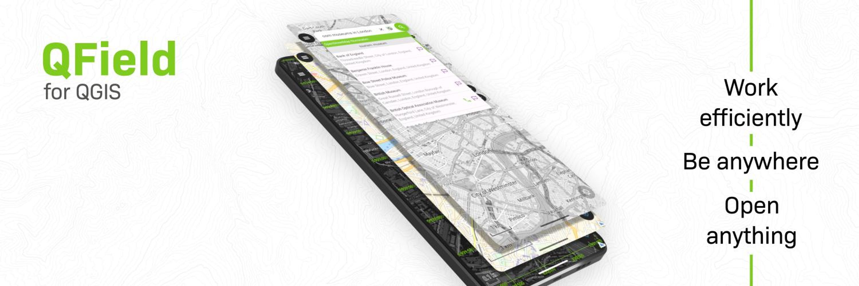

QField for QGIS
@qfield.org
I love to go out collecting spatial information, share it via
QFieldCloud and process it in the office with my best friend @qgis
QFieldCloud and process it in the office with my best friend @qgis
FOSS4G 2025 Auckland recap: QField is production infrastructure now.
The pattern across deployments: QGIS Desktop → QField (offline) → QFieldCloud → Enterprise APIs
Not "can this work?" anymore. It's "how do we optimize this workflow?"
#FOSS4G2025 #QField #OpenSourceGIS
buff.ly/Laf6wAt
The pattern across deployments: QGIS Desktop → QField (offline) → QFieldCloud → Enterprise APIs
Not "can this work?" anymore. It's "how do we optimize this workflow?"
#FOSS4G2025 #QField #OpenSourceGIS
buff.ly/Laf6wAt

January 7, 2026 at 6:16 AM
FOSS4G 2025 Auckland recap: QField is production infrastructure now.
The pattern across deployments: QGIS Desktop → QField (offline) → QFieldCloud → Enterprise APIs
Not "can this work?" anymore. It's "how do we optimize this workflow?"
#FOSS4G2025 #QField #OpenSourceGIS
buff.ly/Laf6wAt
The pattern across deployments: QGIS Desktop → QField (offline) → QFieldCloud → Enterprise APIs
Not "can this work?" anymore. It's "how do we optimize this workflow?"
#FOSS4G2025 #QField #OpenSourceGIS
buff.ly/Laf6wAt
New year, new feature! 🎉
Coming soon in QField 4.1
Coordinate geometry operations 📐
Distance/angle/elevation calculations, circle intersections, parameter-driven point addition.
Define via vector layers, cursor snapping, or direct GNSS input.
#QField
Coming soon in QField 4.1
Coordinate geometry operations 📐
Distance/angle/elevation calculations, circle intersections, parameter-driven point addition.
Define via vector layers, cursor snapping, or direct GNSS input.
#QField
January 6, 2026 at 7:59 AM
New year, new feature! 🎉
Coming soon in QField 4.1
Coordinate geometry operations 📐
Distance/angle/elevation calculations, circle intersections, parameter-driven point addition.
Define via vector layers, cursor snapping, or direct GNSS input.
#QField
Coming soon in QField 4.1
Coordinate geometry operations 📐
Distance/angle/elevation calculations, circle intersections, parameter-driven point addition.
Define via vector layers, cursor snapping, or direct GNSS input.
#QField
QField Advent Calendar - Day 24
🌟 Thank You!
To everyone who has supported QField over the years - our users, contributors, partners, and sponsors - thank you!
2025 was incredible, and we're already planning features for 2026 that will make it even better.
See you in the field!
🌟 Thank You!
To everyone who has supported QField over the years - our users, contributors, partners, and sponsors - thank you!
2025 was incredible, and we're already planning features for 2026 that will make it even better.
See you in the field!

December 24, 2025 at 6:16 AM
QField Advent Calendar - Day 24
🌟 Thank You!
To everyone who has supported QField over the years - our users, contributors, partners, and sponsors - thank you!
2025 was incredible, and we're already planning features for 2026 that will make it even better.
See you in the field!
🌟 Thank You!
To everyone who has supported QField over the years - our users, contributors, partners, and sponsors - thank you!
2025 was incredible, and we're already planning features for 2026 that will make it even better.
See you in the field!
QField Advent Calendar - Day 23
📍 Positioning Actions Pie Menu
A brand new positioning actions pie menu has arrived in QField 4.0. Simply tap the location marker on the map canvas to reveal it.
All your positioning controls in one convenient menu!
📍 Positioning Actions Pie Menu
A brand new positioning actions pie menu has arrived in QField 4.0. Simply tap the location marker on the map canvas to reveal it.
All your positioning controls in one convenient menu!
December 23, 2025 at 6:16 AM
QField Advent Calendar - Day 23
📍 Positioning Actions Pie Menu
A brand new positioning actions pie menu has arrived in QField 4.0. Simply tap the location marker on the map canvas to reveal it.
All your positioning controls in one convenient menu!
📍 Positioning Actions Pie Menu
A brand new positioning actions pie menu has arrived in QField 4.0. Simply tap the location marker on the map canvas to reveal it.
All your positioning controls in one convenient menu!
QField Advent Calendar - Day 22
🎯 Configurable Default Mode
QField 4.0 is an improved the experience for newcomers. You can now set the default mode (browse or digitize) that QField opens in for each project.
Configure it in QFieldSync's project properties panel.
🎯 Configurable Default Mode
QField 4.0 is an improved the experience for newcomers. You can now set the default mode (browse or digitize) that QField opens in for each project.
Configure it in QFieldSync's project properties panel.

December 22, 2025 at 6:16 AM
QField Advent Calendar - Day 22
🎯 Configurable Default Mode
QField 4.0 is an improved the experience for newcomers. You can now set the default mode (browse or digitize) that QField opens in for each project.
Configure it in QFieldSync's project properties panel.
🎯 Configurable Default Mode
QField 4.0 is an improved the experience for newcomers. You can now set the default mode (browse or digitize) that QField opens in for each project.
Configure it in QFieldSync's project properties panel.
QField Advent Calendar - Day 21
📖 Plugin API Documentation Site
We launched a new site to help QField plugin authors: api.qfield.org
Explore available properties and functions throughout QField. Everything plugin developers need to build amazing extensions!
📖 Plugin API Documentation Site
We launched a new site to help QField plugin authors: api.qfield.org
Explore available properties and functions throughout QField. Everything plugin developers need to build amazing extensions!

December 21, 2025 at 6:16 AM
QField Advent Calendar - Day 21
📖 Plugin API Documentation Site
We launched a new site to help QField plugin authors: api.qfield.org
Explore available properties and functions throughout QField. Everything plugin developers need to build amazing extensions!
📖 Plugin API Documentation Site
We launched a new site to help QField plugin authors: api.qfield.org
Explore available properties and functions throughout QField. Everything plugin developers need to build amazing extensions!
QField Advent Calendar - Day 20
✨ Virtual Layer Support
Virtual layers are a hidden gem in QGIS. This year we unlocked support for them in QFieldCloud - for everyone.
Free community account or paid subscription, virtual layers are now available to all!
✨ Virtual Layer Support
Virtual layers are a hidden gem in QGIS. This year we unlocked support for them in QFieldCloud - for everyone.
Free community account or paid subscription, virtual layers are now available to all!

December 20, 2025 at 6:16 AM
QField Advent Calendar - Day 20
✨ Virtual Layer Support
Virtual layers are a hidden gem in QGIS. This year we unlocked support for them in QFieldCloud - for everyone.
Free community account or paid subscription, virtual layers are now available to all!
✨ Virtual Layer Support
Virtual layers are a hidden gem in QGIS. This year we unlocked support for them in QFieldCloud - for everyone.
Free community account or paid subscription, virtual layers are now available to all!
QField Advent Calendar - Day 19
💬 QField Community Platform
The QField community keeps growing. This year we launched a dedicated community platform where members can connect and help each other.
Join the conversation - register and say hi!
buff.ly/SC82ucr
💬 QField Community Platform
The QField community keeps growing. This year we launched a dedicated community platform where members can connect and help each other.
Join the conversation - register and say hi!
buff.ly/SC82ucr

December 19, 2025 at 6:16 AM
QField Advent Calendar - Day 19
💬 QField Community Platform
The QField community keeps growing. This year we launched a dedicated community platform where members can connect and help each other.
Join the conversation - register and say hi!
buff.ly/SC82ucr
💬 QField Community Platform
The QField community keeps growing. This year we launched a dedicated community platform where members can connect and help each other.
Join the conversation - register and say hi!
buff.ly/SC82ucr
QField 4.0 “Aare” marks a major usability milestone, making mobile field mapping more accessible than ever. With a streamlined project creation wizard, improved cloud workflows, and a leaner, clearer user interface, QField 4.0 unlocks a great spatia...
buff.ly/KBQAhwv
buff.ly/KBQAhwv

December 18, 2025 at 12:15 PM
QField 4.0 “Aare” marks a major usability milestone, making mobile field mapping more accessible than ever. With a streamlined project creation wizard, improved cloud workflows, and a leaner, clearer user interface, QField 4.0 unlocks a great spatia...
buff.ly/KBQAhwv
buff.ly/KBQAhwv
QField Advent Calendar - Day 18
📋 Online Legend Support
QField's legend has always been a standout feature. Now in QField 4.0, it fetches and displays online legends from WMS and ArcGIS Map services.
Full context for your online layers, right in the app!
📋 Online Legend Support
QField's legend has always been a standout feature. Now in QField 4.0, it fetches and displays online legends from WMS and ArcGIS Map services.
Full context for your online layers, right in the app!

December 18, 2025 at 6:16 AM
QField Advent Calendar - Day 18
📋 Online Legend Support
QField's legend has always been a standout feature. Now in QField 4.0, it fetches and displays online legends from WMS and ArcGIS Map services.
Full context for your online layers, right in the app!
📋 Online Legend Support
QField's legend has always been a standout feature. Now in QField 4.0, it fetches and displays online legends from WMS and ArcGIS Map services.
Full context for your online layers, right in the app!
QField Advent Calendar - Day 17
📚 Documentation Improvements
With QField's growth comes the need for better documentation. We've reorganized our docs site into clearer sections this year.
Finding the answers you need just got easier!
📚 Documentation Improvements
With QField's growth comes the need for better documentation. We've reorganized our docs site into clearer sections this year.
Finding the answers you need just got easier!

December 17, 2025 at 6:16 AM
QField Advent Calendar - Day 17
📚 Documentation Improvements
With QField's growth comes the need for better documentation. We've reorganized our docs site into clearer sections this year.
Finding the answers you need just got easier!
📚 Documentation Improvements
With QField's growth comes the need for better documentation. We've reorganized our docs site into clearer sections this year.
Finding the answers you need just got easier!
QField Advent Calendar - Day 16
🎨 Refined User Interface
QField 4.0 brought major UI refinements. The feature form's read mode has been completely redesigned for better readability and less visual clutter.
Cleaner, clearer, easier to scan in the field!
🎨 Refined User Interface
QField 4.0 brought major UI refinements. The feature form's read mode has been completely redesigned for better readability and less visual clutter.
Cleaner, clearer, easier to scan in the field!

December 16, 2025 at 6:16 AM
QField Advent Calendar - Day 16
🎨 Refined User Interface
QField 4.0 brought major UI refinements. The feature form's read mode has been completely redesigned for better readability and less visual clutter.
Cleaner, clearer, easier to scan in the field!
🎨 Refined User Interface
QField 4.0 brought major UI refinements. The feature form's read mode has been completely redesigned for better readability and less visual clutter.
Cleaner, clearer, easier to scan in the field!
QField Advent Calendar - Day 15
🎁 QField 4.0 Released!
QField 4.0 is out and packed with new features!
The new project creation wizard lets you build projects directly in QField and upload them instantly to QFieldCloud. QGIS know-how is no longer a barrier to getting started!
🎁 QField 4.0 Released!
QField 4.0 is out and packed with new features!
The new project creation wizard lets you build projects directly in QField and upload them instantly to QFieldCloud. QGIS know-how is no longer a barrier to getting started!

December 15, 2025 at 6:16 AM
QField Advent Calendar - Day 15
🎁 QField 4.0 Released!
QField 4.0 is out and packed with new features!
The new project creation wizard lets you build projects directly in QField and upload them instantly to QFieldCloud. QGIS know-how is no longer a barrier to getting started!
🎁 QField 4.0 Released!
QField 4.0 is out and packed with new features!
The new project creation wizard lets you build projects directly in QField and upload them instantly to QFieldCloud. QGIS know-how is no longer a barrier to getting started!
QField Advent Calendar - Day 14
📐 Forward Angle Snapping
Early this year we refined angle snapping by adding "forward snapping" while digitizing polygons and lines.
Create straight-angled buildings more easily in the field. No more wrestling with corners!
📐 Forward Angle Snapping
Early this year we refined angle snapping by adding "forward snapping" while digitizing polygons and lines.
Create straight-angled buildings more easily in the field. No more wrestling with corners!

December 14, 2025 at 6:16 AM
QField Advent Calendar - Day 14
📐 Forward Angle Snapping
Early this year we refined angle snapping by adding "forward snapping" while digitizing polygons and lines.
Create straight-angled buildings more easily in the field. No more wrestling with corners!
📐 Forward Angle Snapping
Early this year we refined angle snapping by adding "forward snapping" while digitizing polygons and lines.
Create straight-angled buildings more easily in the field. No more wrestling with corners!
QField Advent Calendar - Day 13
✏️ Improved Photo Annotation
We spent some time making photo annotation in QField super responsive.
If you previously experienced lag while annotating, give it another try - it's much smoother now!
✏️ Improved Photo Annotation
We spent some time making photo annotation in QField super responsive.
If you previously experienced lag while annotating, give it another try - it's much smoother now!

December 13, 2025 at 6:16 AM
QField Advent Calendar - Day 13
✏️ Improved Photo Annotation
We spent some time making photo annotation in QField super responsive.
If you previously experienced lag while annotating, give it another try - it's much smoother now!
✏️ Improved Photo Annotation
We spent some time making photo annotation in QField super responsive.
If you previously experienced lag while annotating, give it another try - it's much smoother now!
QField Advent Calendar - Day 12
☁️ QFieldCloud Storage Overhaul
A complete rewrite of QFieldCloud's file storage this year unlocked major improvements.
Faster speeds, resumable downloads for spotty connections, and support for files up to 20GB.
Spatial data can be big - we're ready for it!
☁️ QFieldCloud Storage Overhaul
A complete rewrite of QFieldCloud's file storage this year unlocked major improvements.
Faster speeds, resumable downloads for spotty connections, and support for files up to 20GB.
Spatial data can be big - we're ready for it!

December 12, 2025 at 6:16 AM
QField Advent Calendar - Day 12
☁️ QFieldCloud Storage Overhaul
A complete rewrite of QFieldCloud's file storage this year unlocked major improvements.
Faster speeds, resumable downloads for spotty connections, and support for files up to 20GB.
Spatial data can be big - we're ready for it!
☁️ QFieldCloud Storage Overhaul
A complete rewrite of QFieldCloud's file storage this year unlocked major improvements.
Faster speeds, resumable downloads for spotty connections, and support for files up to 20GB.
Spatial data can be big - we're ready for it!
🎉 Exciting Partnership
We're thrilled to welcome EBP to the QField partner network!
EBP brings world-class expertise in:
✓ GIS & IT Consulting
✓ UX/UI Design
✓ Software Development
✓ Data Science
✓ Project Management
#QField
We're thrilled to welcome EBP to the QField partner network!
EBP brings world-class expertise in:
✓ GIS & IT Consulting
✓ UX/UI Design
✓ Software Development
✓ Data Science
✓ Project Management
#QField

December 11, 2025 at 9:15 AM
🎉 Exciting Partnership
We're thrilled to welcome EBP to the QField partner network!
EBP brings world-class expertise in:
✓ GIS & IT Consulting
✓ UX/UI Design
✓ Software Development
✓ Data Science
✓ Project Management
#QField
We're thrilled to welcome EBP to the QField partner network!
EBP brings world-class expertise in:
✓ GIS & IT Consulting
✓ UX/UI Design
✓ Software Development
✓ Data Science
✓ Project Management
#QField
QField Advent Calendar - Day 11
📋 XLSForm Converter Plugin
This plugin converts XLSForm survey files (.xls, .xlsx, .ods) into fully formed QGIS projects ready to use in QField.
The plugin can even auto-upload to QFieldCloud via QFieldSync. Field-ready projects in minutes!
📋 XLSForm Converter Plugin
This plugin converts XLSForm survey files (.xls, .xlsx, .ods) into fully formed QGIS projects ready to use in QField.
The plugin can even auto-upload to QFieldCloud via QFieldSync. Field-ready projects in minutes!

December 11, 2025 at 6:16 AM
QField Advent Calendar - Day 11
📋 XLSForm Converter Plugin
This plugin converts XLSForm survey files (.xls, .xlsx, .ods) into fully formed QGIS projects ready to use in QField.
The plugin can even auto-upload to QFieldCloud via QFieldSync. Field-ready projects in minutes!
📋 XLSForm Converter Plugin
This plugin converts XLSForm survey files (.xls, .xlsx, .ods) into fully formed QGIS projects ready to use in QField.
The plugin can even auto-upload to QFieldCloud via QFieldSync. Field-ready projects in minutes!
QField Advent Calendar - Day 10
🔍 Feature Identification for Online Layers
QField can now identify features in online raster layers from WMS and ArcGIS Map services, as well as vector tile layers.
This works great with OpenStreetMap's breadcrumb vector tiles. Give it a try!
🔍 Feature Identification for Online Layers
QField can now identify features in online raster layers from WMS and ArcGIS Map services, as well as vector tile layers.
This works great with OpenStreetMap's breadcrumb vector tiles. Give it a try!

December 10, 2025 at 6:16 AM
QField Advent Calendar - Day 10
🔍 Feature Identification for Online Layers
QField can now identify features in online raster layers from WMS and ArcGIS Map services, as well as vector tile layers.
This works great with OpenStreetMap's breadcrumb vector tiles. Give it a try!
🔍 Feature Identification for Online Layers
QField can now identify features in online raster layers from WMS and ArcGIS Map services, as well as vector tile layers.
This works great with OpenStreetMap's breadcrumb vector tiles. Give it a try!
QField Advent Calendar - Day 9
💾 Tripled Cloud Storage!
We heard our QFieldCloud users loud and clear with regards to subscription storage.
We've tripled the storage capacity for the same monthly price.
Same invoice, more storage!
💾 Tripled Cloud Storage!
We heard our QFieldCloud users loud and clear with regards to subscription storage.
We've tripled the storage capacity for the same monthly price.
Same invoice, more storage!

December 9, 2025 at 6:16 AM
QField Advent Calendar - Day 9
💾 Tripled Cloud Storage!
We heard our QFieldCloud users loud and clear with regards to subscription storage.
We've tripled the storage capacity for the same monthly price.
Same invoice, more storage!
💾 Tripled Cloud Storage!
We heard our QFieldCloud users loud and clear with regards to subscription storage.
We've tripled the storage capacity for the same monthly price.
Same invoice, more storage!
QField Advent Calendar - Day 8
🔌 Plugin Framework Growth
It's now easier than ever to expand QField's capabilities through a curated list of plugins directly within the QField plugin manager.
Watch this space - this list of plugins will open up even further soon!
🔌 Plugin Framework Growth
It's now easier than ever to expand QField's capabilities through a curated list of plugins directly within the QField plugin manager.
Watch this space - this list of plugins will open up even further soon!

December 8, 2025 at 6:16 AM
QField Advent Calendar - Day 8
🔌 Plugin Framework Growth
It's now easier than ever to expand QField's capabilities through a curated list of plugins directly within the QField plugin manager.
Watch this space - this list of plugins will open up even further soon!
🔌 Plugin Framework Growth
It's now easier than ever to expand QField's capabilities through a curated list of plugins directly within the QField plugin manager.
Watch this space - this list of plugins will open up even further soon!
QField Advent Calendar - Day 7
📸 Customizable Photo Stamping
You can now customize what gets "stamped" on photos taken in QField. Field names, coordinates, timestamps or a logo.
Add information and branding and share photos straight from the field, no post-processing required.
📸 Customizable Photo Stamping
You can now customize what gets "stamped" on photos taken in QField. Field names, coordinates, timestamps or a logo.
Add information and branding and share photos straight from the field, no post-processing required.

December 7, 2025 at 6:16 AM
QField Advent Calendar - Day 7
📸 Customizable Photo Stamping
You can now customize what gets "stamped" on photos taken in QField. Field names, coordinates, timestamps or a logo.
Add information and branding and share photos straight from the field, no post-processing required.
📸 Customizable Photo Stamping
You can now customize what gets "stamped" on photos taken in QField. Field names, coordinates, timestamps or a logo.
Add information and branding and share photos straight from the field, no post-processing required.
QField Advent Calendar - Day 6
📥 On-Demand Attachment Downloads
On-demand image, video, and audio attachment downloads came to #QFieldCloud this year!
When turned on, QField will download a given attachment only when requested by a feature form.
📥 On-Demand Attachment Downloads
On-demand image, video, and audio attachment downloads came to #QFieldCloud this year!
When turned on, QField will download a given attachment only when requested by a feature form.

December 6, 2025 at 6:16 AM
QField Advent Calendar - Day 6
📥 On-Demand Attachment Downloads
On-demand image, video, and audio attachment downloads came to #QFieldCloud this year!
When turned on, QField will download a given attachment only when requested by a feature form.
📥 On-Demand Attachment Downloads
On-demand image, video, and audio attachment downloads came to #QFieldCloud this year!
When turned on, QField will download a given attachment only when requested by a feature form.
🔒 Granular Layer Permissions
With the QFieldSync plugin you can set up a granular set of permissions that covers all aspects of digitizing or editing for a given vector layer.
These permissions can be set as rules or through data-defined properties.
With the QFieldSync plugin you can set up a granular set of permissions that covers all aspects of digitizing or editing for a given vector layer.
These permissions can be set as rules or through data-defined properties.

December 5, 2025 at 6:16 AM
🔒 Granular Layer Permissions
With the QFieldSync plugin you can set up a granular set of permissions that covers all aspects of digitizing or editing for a given vector layer.
These permissions can be set as rules or through data-defined properties.
With the QFieldSync plugin you can set up a granular set of permissions that covers all aspects of digitizing or editing for a given vector layer.
These permissions can be set as rules or through data-defined properties.
QField Advent Calendar - Day 4
📝 Layer Notes in the Legend
QField's legend now shows a layer notes icon. When tapped, it displays embedded notes attached to map layers within your current project.
The notes are configurable in your QGIS project!
📝 Layer Notes in the Legend
QField's legend now shows a layer notes icon. When tapped, it displays embedded notes attached to map layers within your current project.
The notes are configurable in your QGIS project!

December 4, 2025 at 6:16 AM
QField Advent Calendar - Day 4
📝 Layer Notes in the Legend
QField's legend now shows a layer notes icon. When tapped, it displays embedded notes attached to map layers within your current project.
The notes are configurable in your QGIS project!
📝 Layer Notes in the Legend
QField's legend now shows a layer notes icon. When tapped, it displays embedded notes attached to map layers within your current project.
The notes are configurable in your QGIS project!